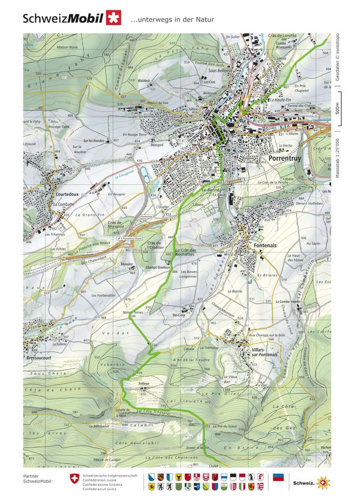
A few weeks later, I was back on the trail again. I took the train to Porrentruy and started out on the next section of the Chemin de Jura. This section would take me to St-Ursanne. It is a route that I have walked before. When I walked the Trans Swiss Trail in 2021, that trail started in Porrentruy, and the first stage took me to St-Ursanne. But that was in the depths of winter, with snow on the high ground. This time, it would be in Spring, and with expected a warm day.
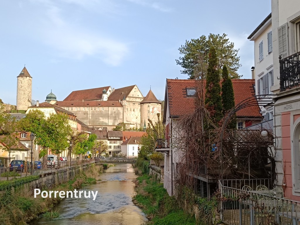
Porrentruy is at the centre of that odd-shaped piece of Switzerland that sticks out westwards into France. There is evidence of human settlement there since stone age times. But the first documented record of the town comes from the twelfth century, when it is recorded as Porrentru. There are conflicting accounts of how the town derived its name. One account is that it comes from Pons Ragentrudis, or Ragentrud’s Bridge. Ragentrud was the wife of one of the Frankish kings. Another reported origin of the name is that it combines the French words for a wild boar (porc) and a female pig (truie). The coat of arms of the town features a wild boar to this day. Some things are better left to legend.
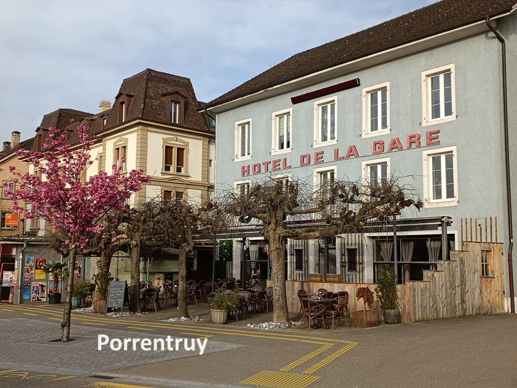
When Jura became a canton of Switzerland in the 1970s, Porrentruy had ambitions to become the seat of administration for the canton, but it lost out to Delémont. Porrentruy settled into second place within the canton, and remains a kind of sleepy backwater to this day. Indeed, when I arrived there, it seemed like nothing was stirring. There was a single patron quietly sipping coffee at the Hotel de la Gare. I was able to make my way up the middle of the Grand Rue without interruption from any motorised vehicle. And soon, I was out in the countryside. The route goes to the southern edge of the town and then turns southwest, with a forest on the left, and the town on the right.
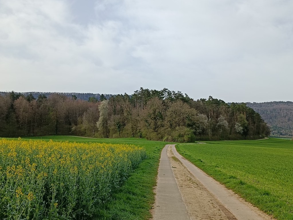
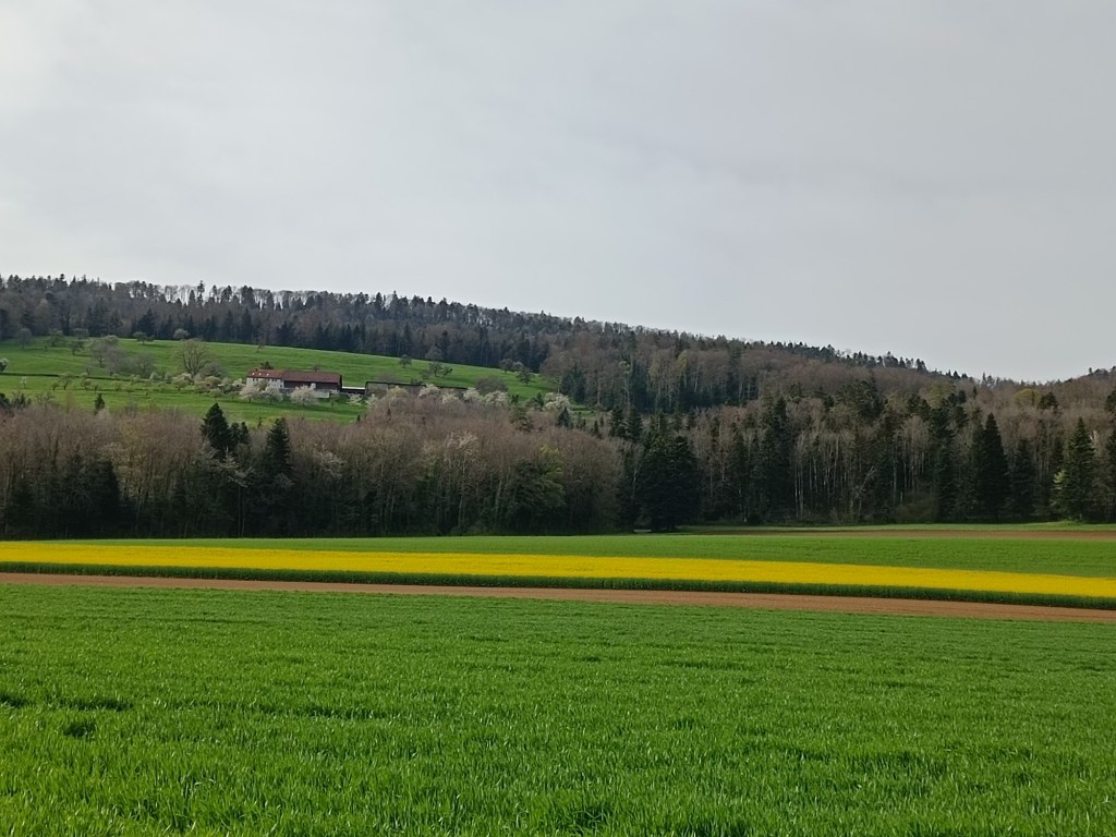
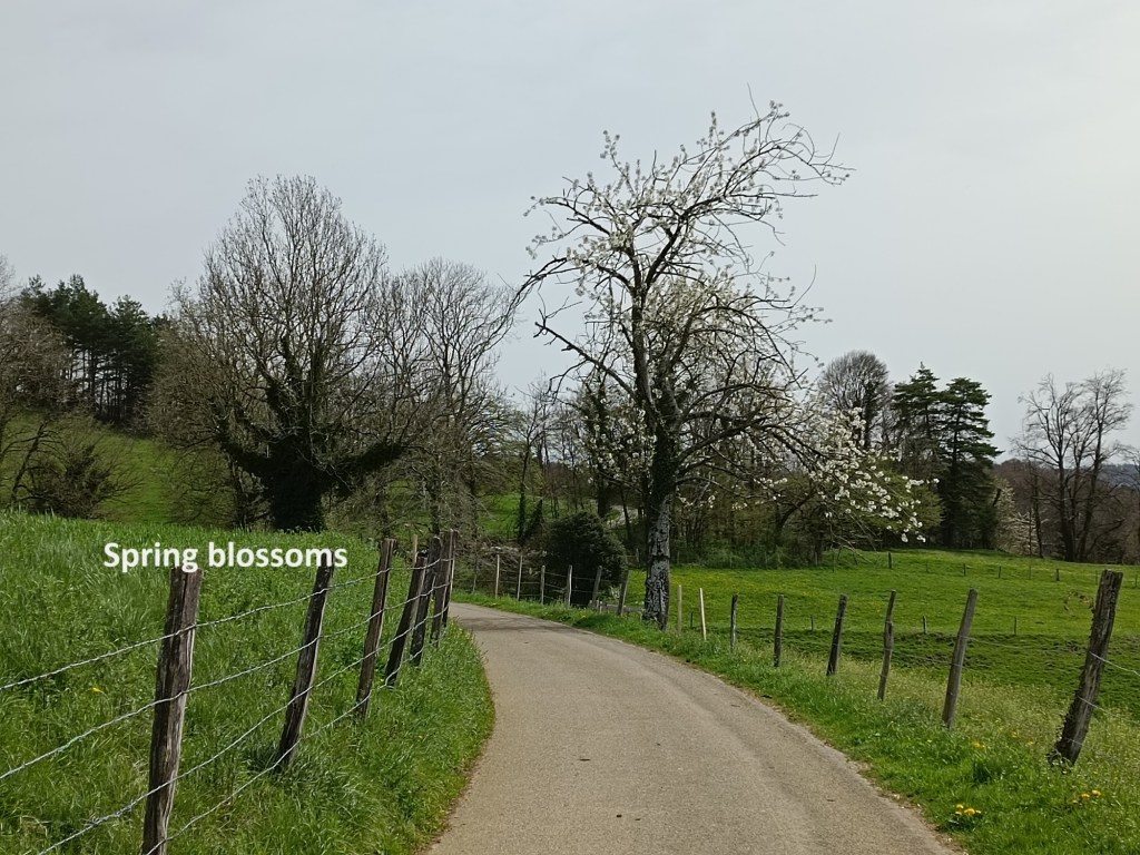
And then I was into fields. I passed fields of oil seed rape, just coming into flower, and not yet giving that bright yellow colour to the landscape that characterises late April or early May. There was forestry too, and it did not take too long before I was in the middle of the forest. The trail was going upward by then as well, and though the ascent was not steep, it was long. I must have missed a sign along the way, and took a loop of the road instead of a more direct way upwards through the forest. But overall, I followed the trail steadily to arrive into the open at Les Chainions. The last time that I was here, when walking the Trans Swiss Trail, Les Chainions was covered in snow. Even the trees were white. But on this day, with bright spring sunshine, everything was green.
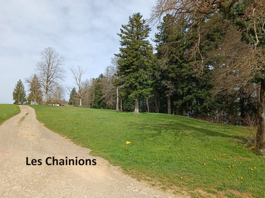
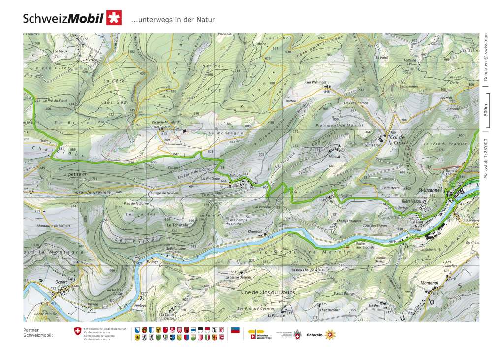
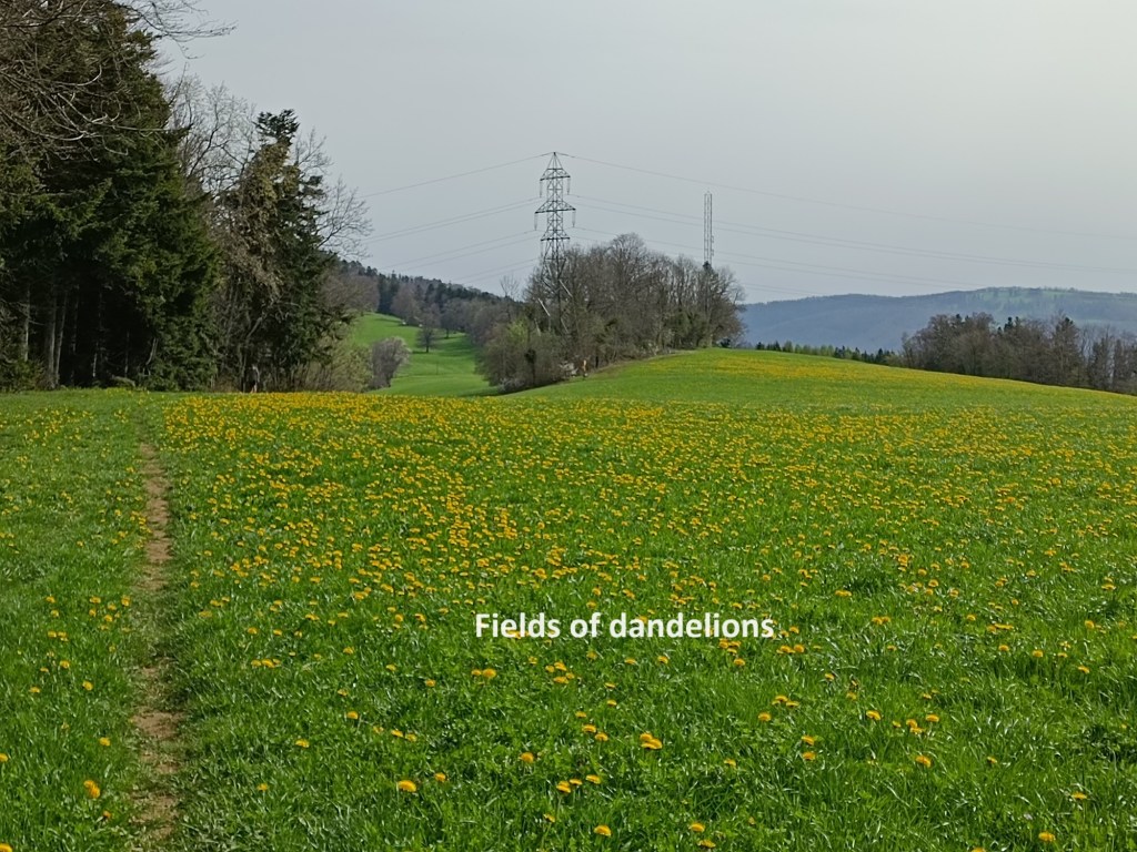
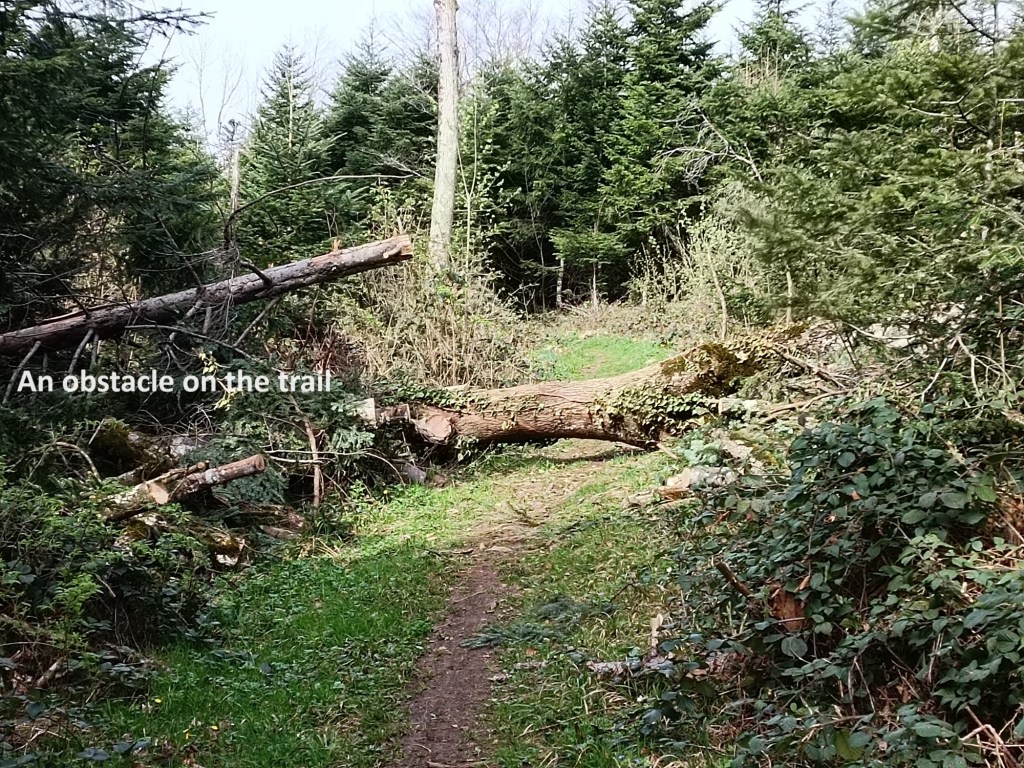
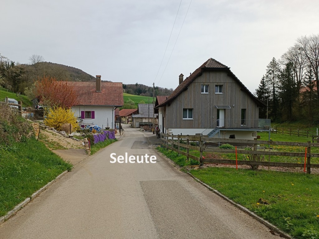
Les Chainions is the highest point on this part of the route at 884m. After that, I was going downhill. I was soon back into the forest along an easy trail, though with occasional obstacles. But apart from those occasional obstacles, it was easy going. The trail got steeper as I approached the tiny village of Seleute, but not so steep as to be difficult.
The pervious time that I came this way, when walking the Trans Swiss Trail, it was winter, and the bar in Seleute was closed. But now, it was Spring, and the bar was open. It was not busy, and it would have been churlish of me not to stop there, since they were clearly catering for Sunday clientele. Thus it was that I enjoyed a beer and a few minutes rest in Seleute.


Then I went on again. The trail rises slightly coming out from Seleute, but then begins the final descent towards St-Ursanne. At one point, I almost took a wrong turn, one that would have had me going up into the mountains again, but I realised my error quickly, and was soon back on the correct route. The trail goes through woodland and fields as it descends, and eventually comes out on the main road just a couple of hundred metres short of St-Ursanne itself.
The walk from Porrentruy to St-Ursanne is not a long one, but I had equipped myself with a guide to the town, one that outlined a walking route to see all the sights. St-Ursanne has its origins in the name of an Irish saint by the name of Ursicinus. The Celtic monasticism of the sixth century embraced a kind of hermit’s existence, and Ursicinus settled on the banks of the Doubs River to live that life. But hermits attract disciples, and within a few decades, a real monastery was founded. The community grew, and came under the jurisdiction of the Bishop of Basel. Despite damage in war, and in spite of political upheavals, the monastery has survived and is still there today. St-Ursanne is one of those places where the monastery and the town are inseparable.

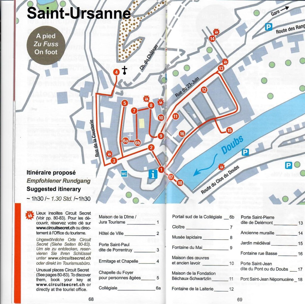

The first place in the walking guide that I came to was the Porte Saint-Paul. It was first mentioned in documents from 1296, but the current structure dates from 1664. The outer side of the tower displays the coats of arms of the town and one of the Prince-Bishops of Basel, Johann Konrad von Roggenbach.
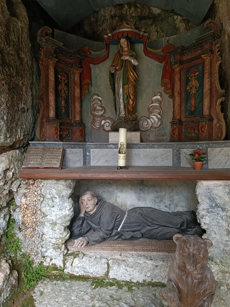
I did not go immediately inside the town, but instead made my way up a long steep series of steps to the hermitage grotto where St. Ursicinus is supposed to have lived. When I say it was long, the guidebook says that it is 190 steps. There is also a chapel just below the grotto, dating from 1621.
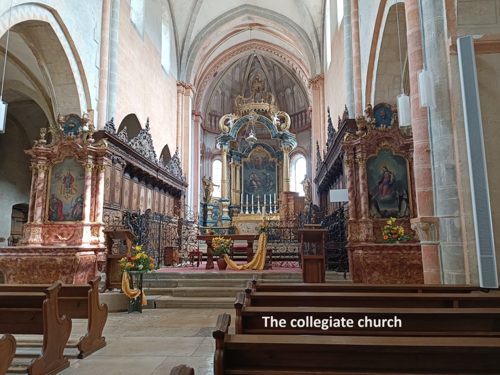
I continued following the guidebook, aiming to go to the Chapelle du Foyer, but it was closed due to construction work. I went on then to the Collegiate Church. The building dates back to the twelfth century, though it was only finished early in the following century. The current decoration is baroque in style, and dates from the late seventeenth century. There is also a crypt, which once held the remains of St. Ursicinus, but they are now under the main altar, and the crypt appears to be empty.
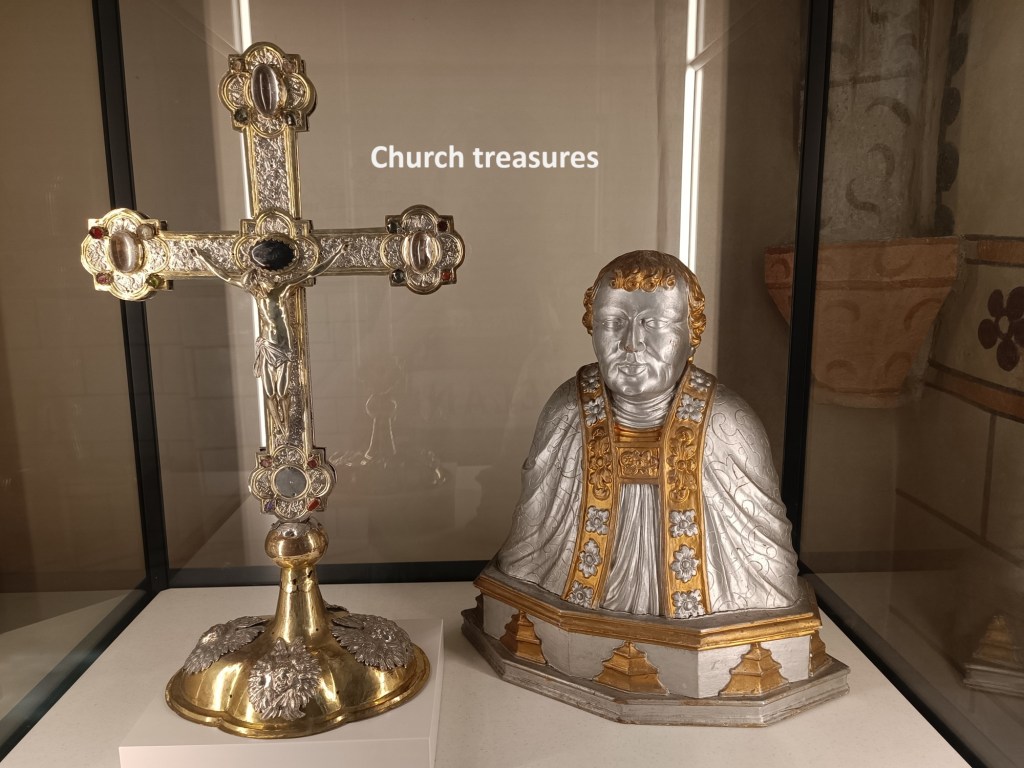
There are some church treasures on display. The cross was once mounted on a processional staff, but is now used as an altar cross. The bust is of an unknown person, but I would be willing to wager that the person was one of the Prince-Bishops of Basel.
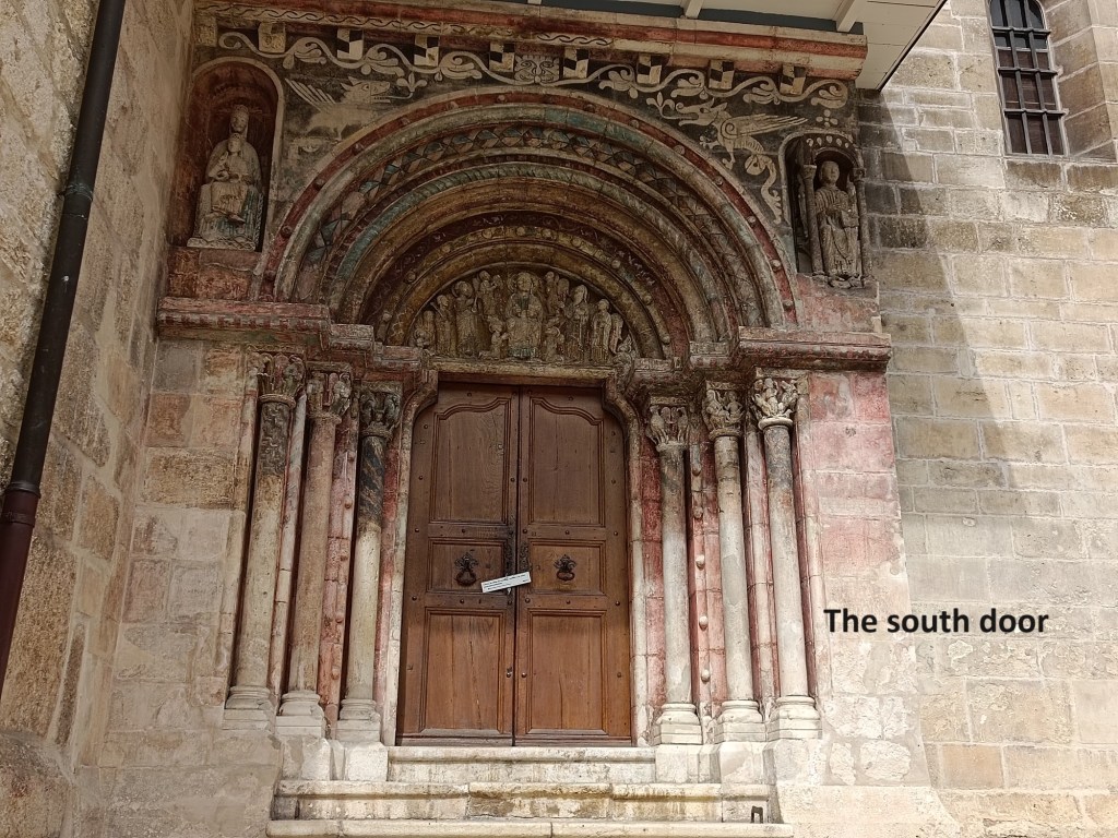
The south door of the church is Romanesque in style, and probably dates back to the construction of the church in the twelfth century. The arch features a representation of Christ on his throne, with St. Ursicinus on one side and an angel on the other. The capitals of the columns feature various biblical references, including the four evangelists.
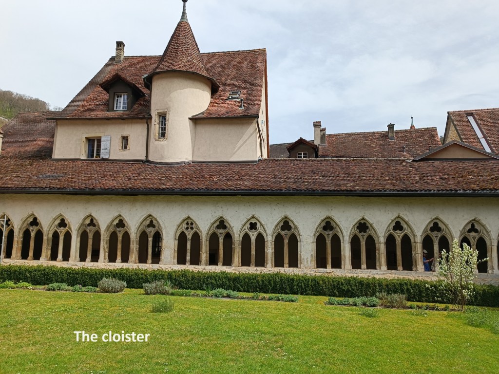
And then I went on to the Cloister. The layout of the current structure dates back to 1380. It was restored in 1551 and 1906.
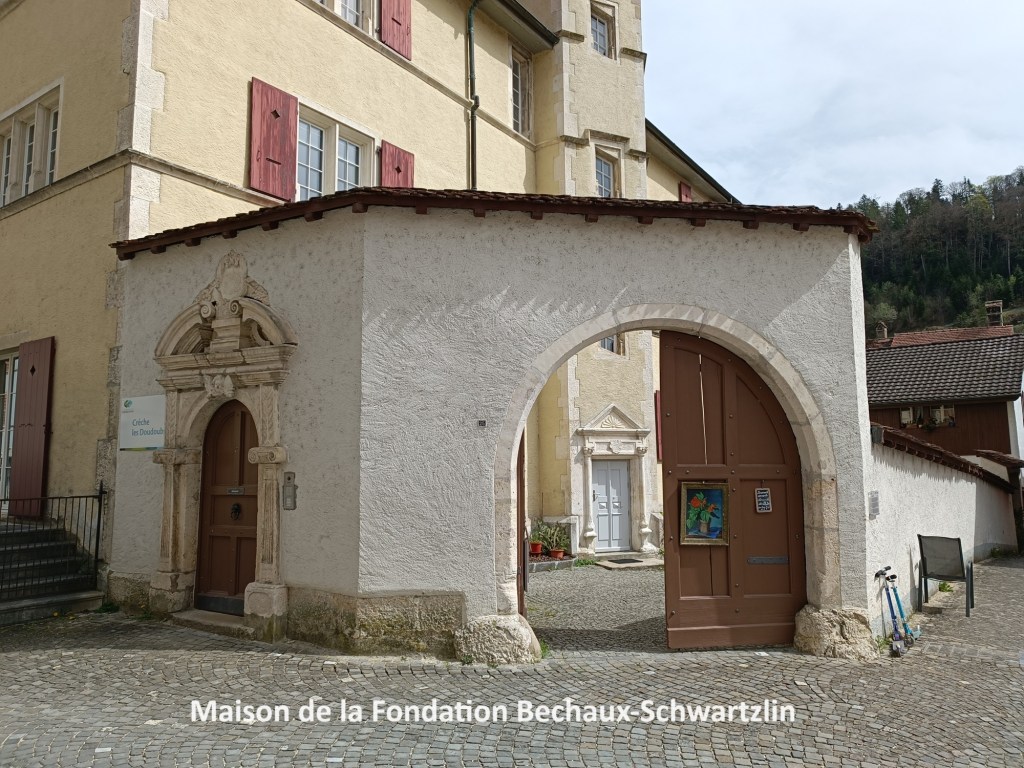
After the cloister, I came to the Maison de la foundation Béchaux-Schwartzlin. This house belonged to the richest canons associated with the nearby church. It was rebuilt in 1578 by Canon Ursanne Desiglans after a major fire in the town in 1558. The archway above the gate dates from 1620.
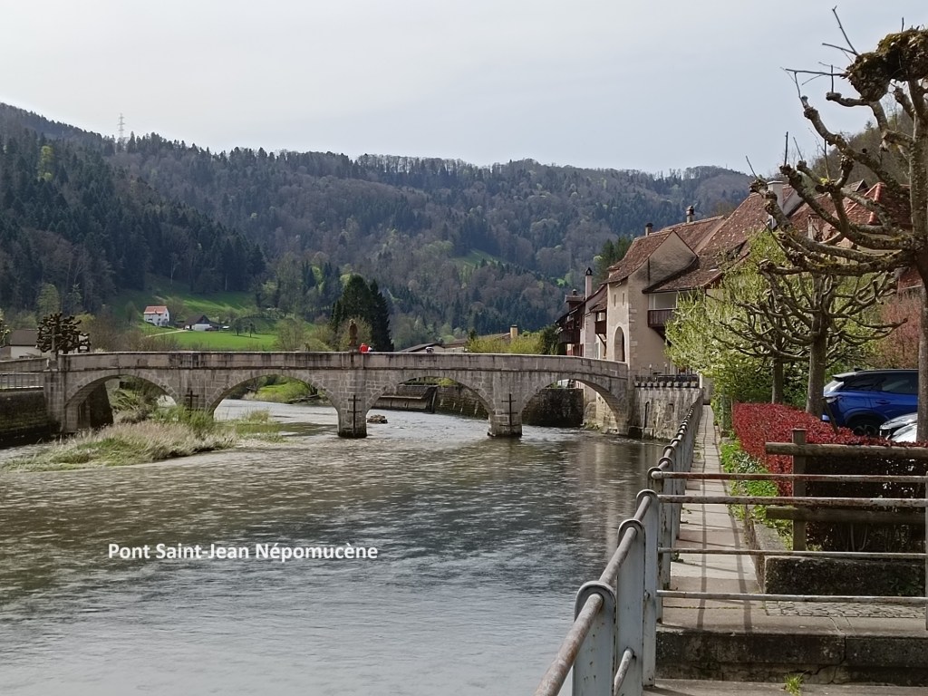
There are three fountains in the town, all of which are mentioned in the guidebook. However, all of them were dry and not running during my visit, so I left the main street and went over to the river. There, I had a good view of the Pont Saint-Jean Népomecène. The current bridge, with its four arches, was built in 1728. It replaced a wooden bridge that was built in the late seventeenth century. In the middle of the bridge is a statue of Saint-Jean Népomecène. The bridge was renovated in 2016. The statue that currently stands on the bridge is a replica of the original. The original is in a museum in the town since the replica took its place in 1973.
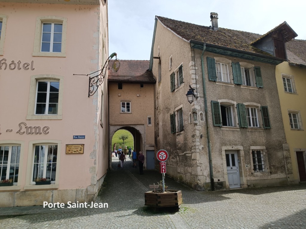
The access to the bridge from the town side of the river is by the Porte Saint-Jean. The current gate structure was built in the late seventeenth century.
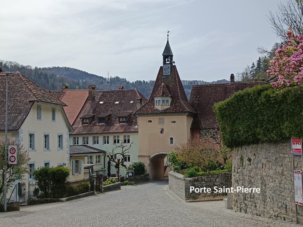
After all of that, and a further stroll through the centre of the town, I made my way out of town by the gate on the eastern side. Since the gate on the western side was named after Saint Paul, it made sense that the eastern gate would be named after Saint Peter. The current Porte Saint-Pierre was originally built in 1522, then remodelled in 1665, and most recently restored in 1949. Like the gate at the other end of town, this one carries the coat of arms of the Prince-Bishop Johann Konrad von Roggenbach. It also houses a clock that was built in 1713.
And after all that, it was time to make my way up the hill to the train station. I had not long to wait before taking the train back to Basel.
My total step count for the day was 36,432.