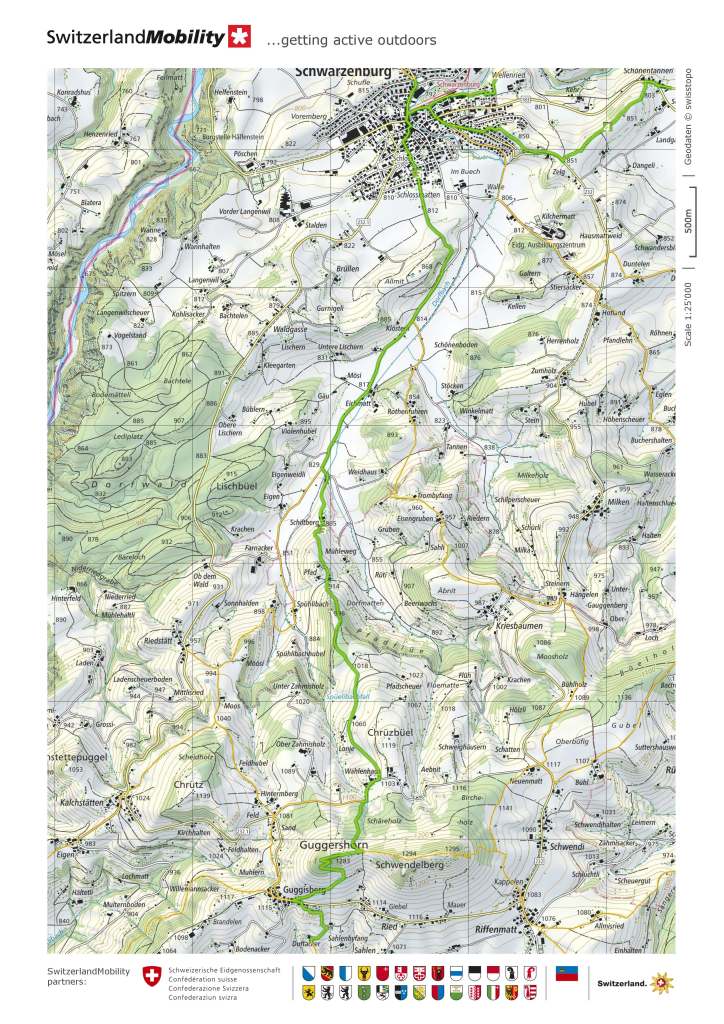
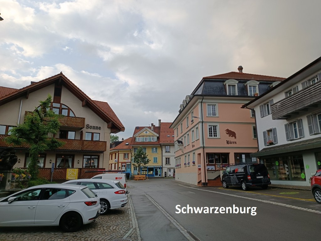
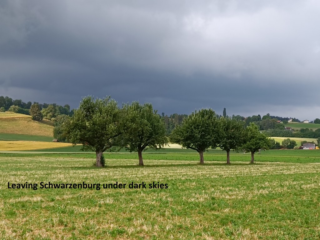
The night before I went back to Schwarzenburg, there was heavy rain all over Switzerland. But the forecast was good, and I was determined to get another stage of the Alpine Panorama Weg behind me. I made an early start and took the train. Schwarzenburg is the terminus of one of the commuter lines around Bern, and I was there not long after 7:30 in the morning. The ground was still wet from the overnight rain, and the sky looked very heavy, with lots of dark clouds still around.
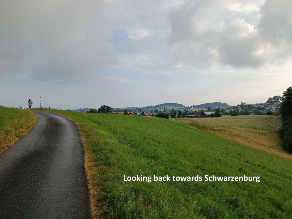

The trail follows a small road out of Schwarzenburg, going over a small hill that provides a last look back at the town. Then it goes down into the valley of the Dorfbach stream. The way through the valley is fairly flat, and the relaxed walk at this stage gave me a chance to survey the hills ahead, and to consider my way up them.
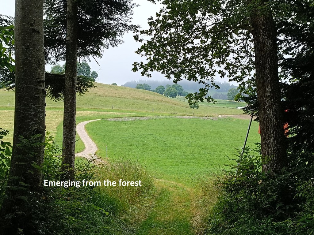
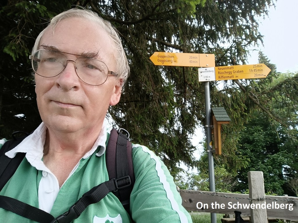
Eventually, the trail turns south. It goes up the hillside, past some farms and then into a forest. It was intermittently steep and relatively easy, though that didn’t matter very much as I was fresh with plenty of energy in the early morning. I emerged from the forest, going up past one more farm to come to the road at Wählenhaus. After a short distance along the road, I was then back into the forest, coming out just a few metres below Sattel. Sattel is between the Guggershorn and Schwendelberg peaks. I decided that before going on to Guggershorn, I would first go to the summit of Schwendelberg. There was still cloud on both peaks, so I did not expect to see much, but Schwendelberg is ten metres higher than its neighbour, so I couldn’t pass by without going there. Going up Schwendelberg, there was still mist on Guggershorn, but it was clear that the sun was trying hard to break through. There is a waymark point on the top of Schwendelberg, and I paused there briefly for a photo.
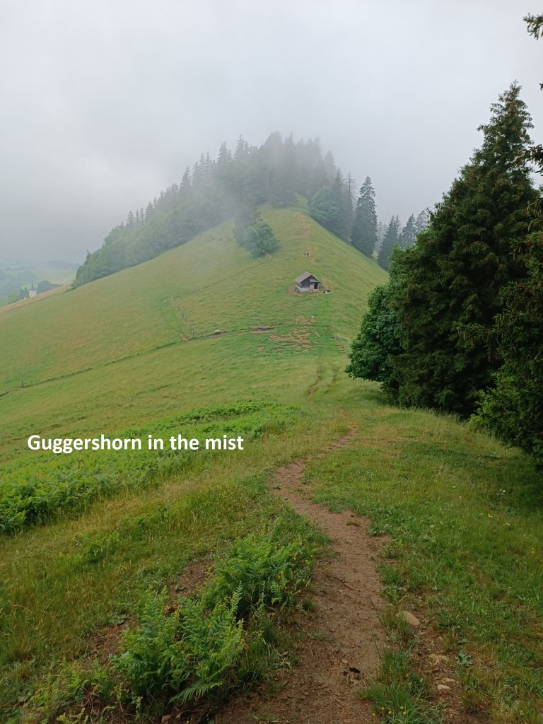

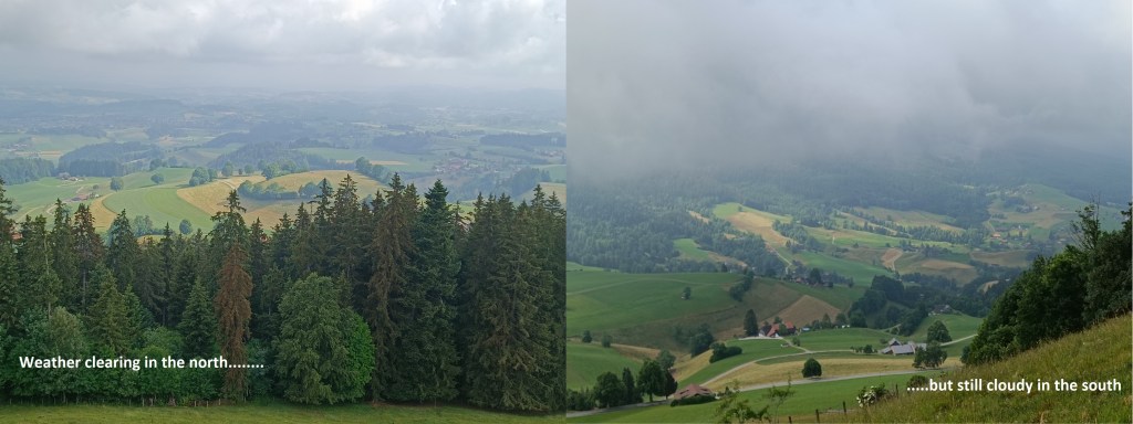
Coming back down to Sattel, it was clear that the sun was winning the battle with the clouds. As I went up the other side, there were relatively clear views to the north, but the mountains to the south were still hidden in cloud.
The route up Guggershorn is relatively easy. The summit is a huge lump of rock sticking out above the tree clad slopes. The final stage of getting to the top of that lump of rock is a staircase of about seventy steps. From there, I could see back to Schwendelberg, though the mountains to the south were still obscured. As I descended towards the village of Guggisberg, it looked like the sun had finally won its battle over the clouds, and there was even a hint of blue sky.
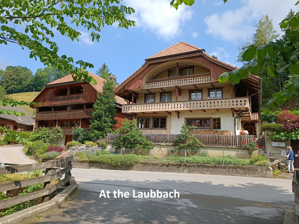
I didn’t go in into Guggisberg. The trail just touches the edge of the village and then turns away to continue on down into the valley below. It winds its way downward through fields and forestry, and along small lanes to reach the Laubbach stream. The stream itself is insignificant at this point, but there are some nicely decorated traditional Bernese houses close by. I had ascended 500m from Schwarzenburg to the summits of Schwendelberg and Guggershorn at 1296m and 1284m, but now at the Laubbach, at just 861m, I had lost almost all of that. Another ascent was ahead of me.


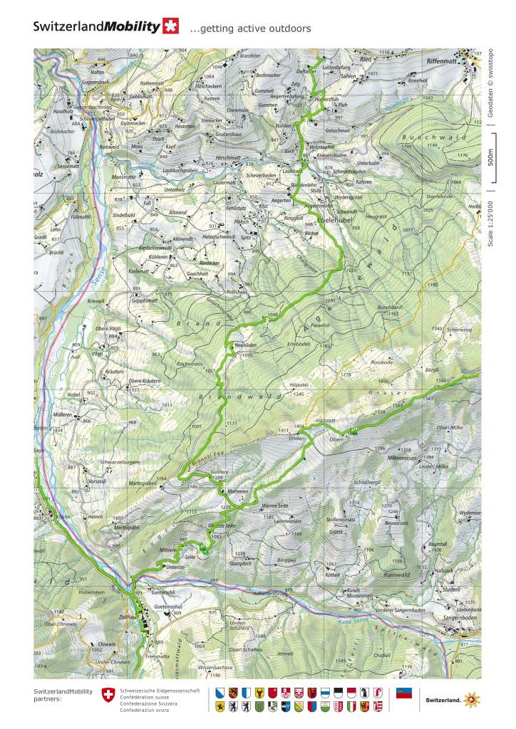
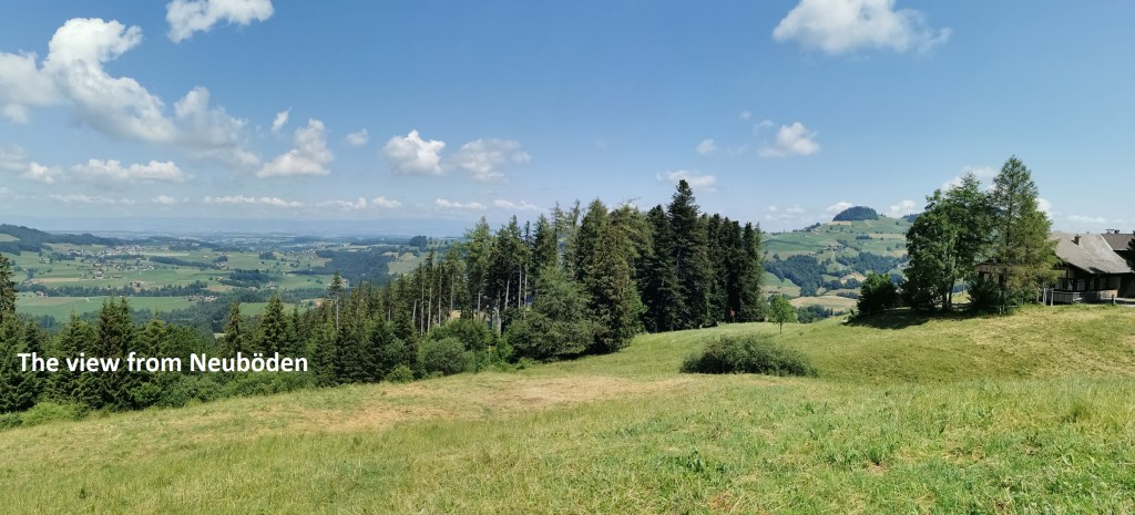
I went on up from the Laubbach stream, at first through fields and then through a forest. It was not too strenuous, and the route through the forest was for the most part on a wide track, almost a road. Eventually, though, the trail turned off that track to take a rougher and more direct way upwards among the trees. It came out into the open close to those at Neuböden. From there, there were fantastic views to the north. In the distance, with all of the Mittelland in between, a faint dark line on the horizon showed where the Jura mountains were. And close, but becoming more distant, I could see the Guggershorn through a gap in the trees.
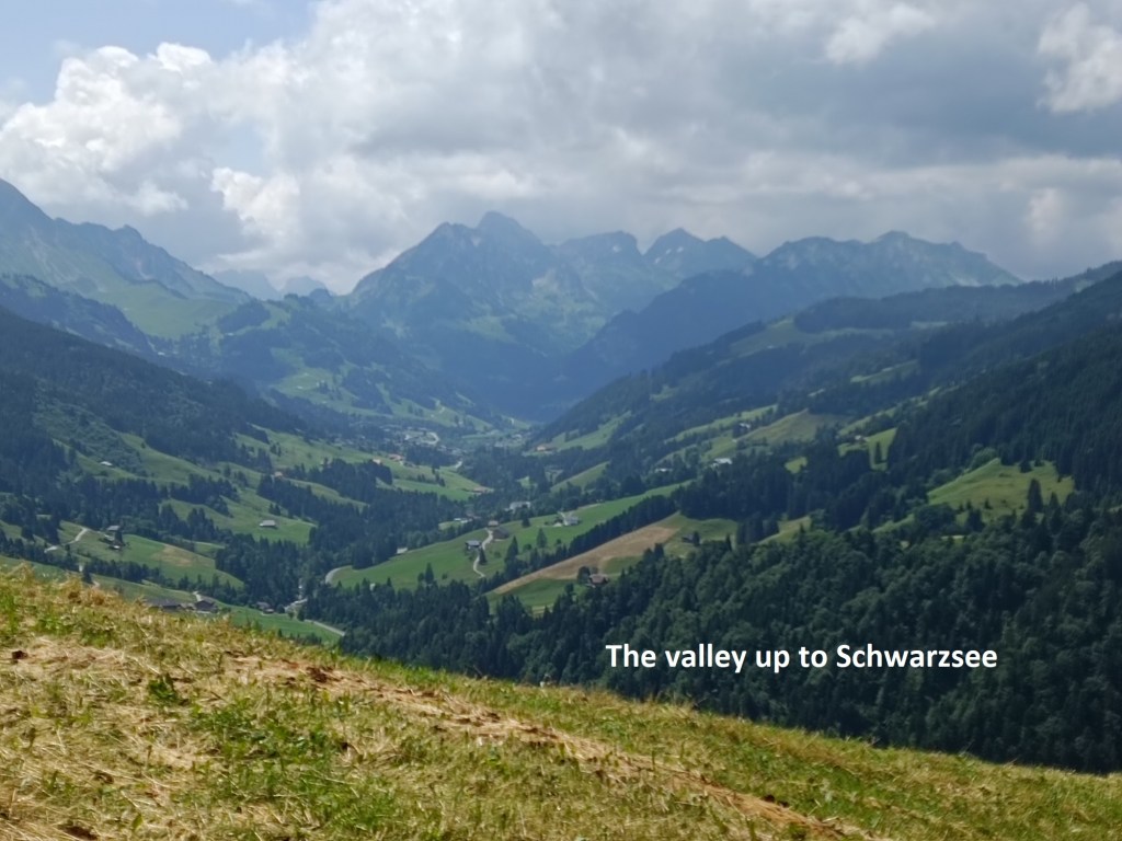
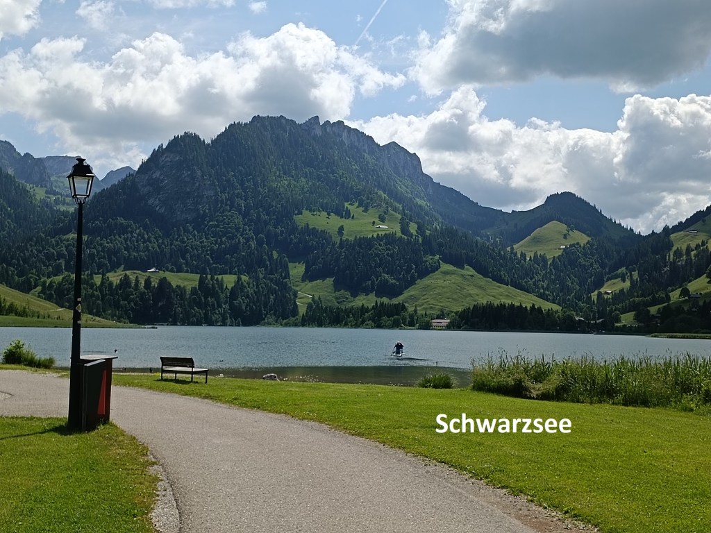
But my route was southwards, and in that direction, there was only upwards. Leaving Neuböden, I was very soon back into the forest. The direct route southward would go over the cliffs of Brönnti Egg, so the route wisely goes south-westwards before circling around to the south side of the mountain. The highest point was at 1209m, so I had ascended 350m from the Laubbach. I emerged from the forest to be greeted by a wonderful view of the valley going south towards Schwarzsee.

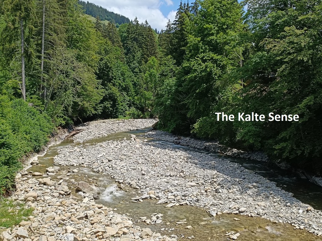
But first I had to descend into that valley. Initially, it was along a road, past the houses at Martenen. Then it went down through fields where a man was cutting the long grass with a mechanical mower. Then there was a short forest stretch and more fields after that. I met a man toiling his way upwards with what seemed like a massive pack on his back. We chatted for a minute or two, and he explained that he was going paragliding. I wished him well, and we went on our different ways. A little further, when passing a farm, I chatted with a farmer, both of us bemoaning the chaos of today’s world, and both of us saying how more people should get out and enjoy the natural beauty of Switzerland. Further along, as the trail meandered its way downwards, I met a couple who were looking for a particular lake, but on these steep slopes, I could see nowhere for a lake to be, and I was unable to help them. And then I was in the valley and crossing the Kalte Sense to get to Zollhaus.
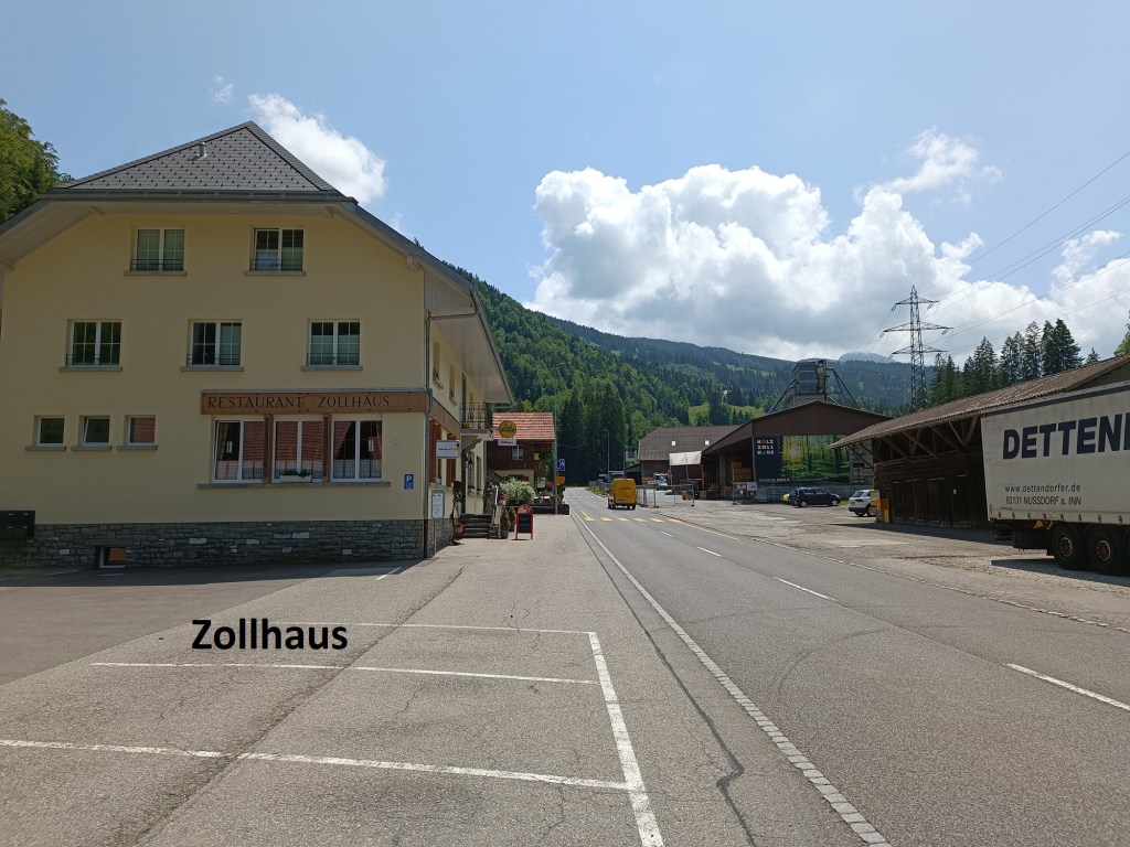
The Sense river marks much of the boundary between Bern and Fribourg cantons. Tow smaller streams combine at Zollhaus to form the Sense. The Kalte Sense comes down from the mountains of the Bernese Oberland, while the Warme Sense comes down from Schwarzsee. I really do not know if one is colder than the other. But crossing the Kalte Sense and reaching Zollhaus meant that I had left Bern canton, and now I was in Fribourg.
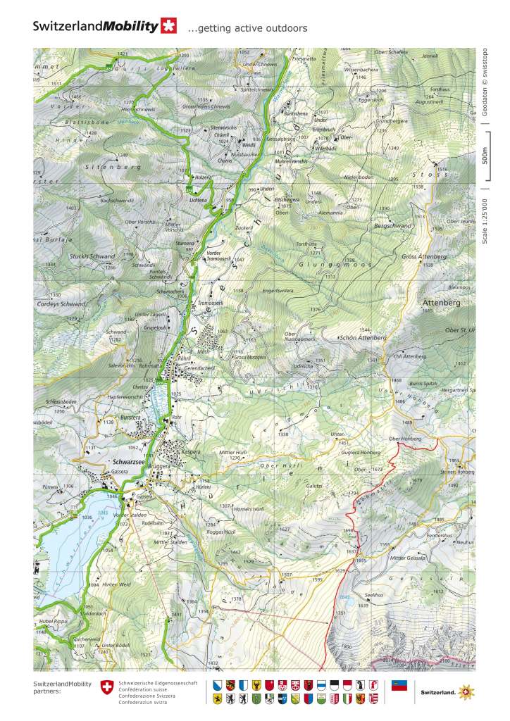
In Zollhaus, I was hoping to get a beer, and there is a restaurant in the village. Sadly, however, it was closed, and I went on. My route now was along the banks of the Warme Sense.
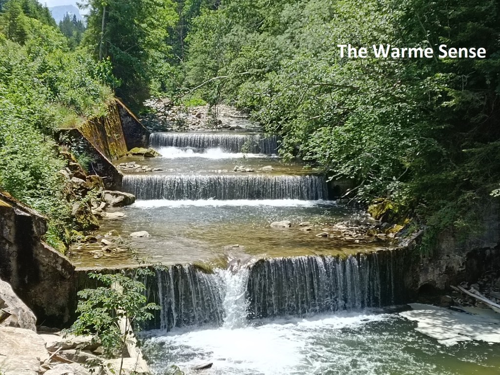
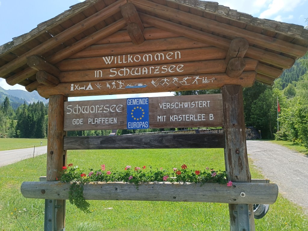
The route lies between the river and the road for the remainder of the journey, and the two are never far apart. I had the noise of traffic on one side, and flowing water on the other. It is not an interesting route, quite boring, in fact. It would go up and down as it followed the river, but always more up than down. It went on like that for what seemed ages, and I wondered was I ever going to get to Schwarzsee. But eventually, I got there. I passed the welcome sign close to the road, though I still had over a kilometre to go. The effort was worth it: when I got there, the mountains were looking beautiful in the afternoon sun. And in Schwarzsee, I was able to get a beer!
With reaching Schwarzsee, I had now walked 327km of the total 510km of the Alpine Panorama Weg. With less than 200km to go, it feels like I am getting close to the end. But it may be a little while before I can come back to this trail. Nevertheless, with six months of the year to go, and more than half the trail behind me, I am confident of reaching Geneva by December.
My total step count for the day was 46,953.