

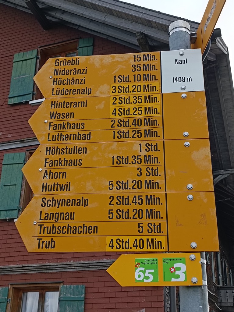
For the next stage of the trail, I would have to get back to Napf. I had known from the last stage that Napf has no public transport , and the nearest point of access was Mettlenalp, so that is where I would have to go. Mettlenalp has a bus service, but only at weekends, and the earliest bus on a Sunday gets that at 09:30. That is far from my ideal starting time; I like to be on the trail early. And the signposts from the last day said it would take an hour to get from Mettlenalp to Napf, since it involves about 350m of ascent.
Also, I wanted to walk more than one of the guidebook stages. One stage from Napf, according to the guidebook, would take me to Lüderenalp, where there is a bus service, but infrequent. I wanted to get to Emmenmatt, where there is a regular and frequent train service every day. It seemed I would just have to make the best of it and see what I could do.
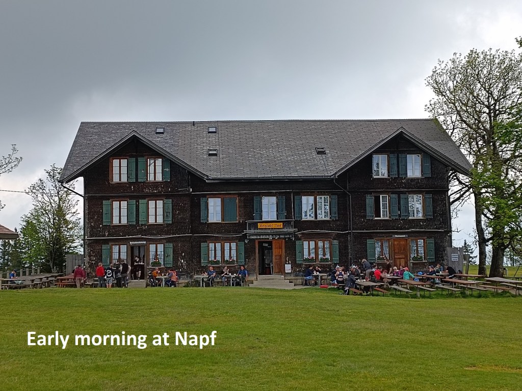
The train and bus connections worked, and I found myself on the bus to Mettlenalp on schedule. The previous day, the afternoon bus had arrived empty in Mettlenalp, and went down to the railway station full. Today, it was going full up to Mettlenalp, with lots of hikers eagerly looking forward to a day in the mountains. I was quickly off the bus and onto the track up the mountain. I did not want to be stuck in a large group labouring their way up the track. And so I arrived in Napf, considerably faster than the one hour that the signposts had suggested.
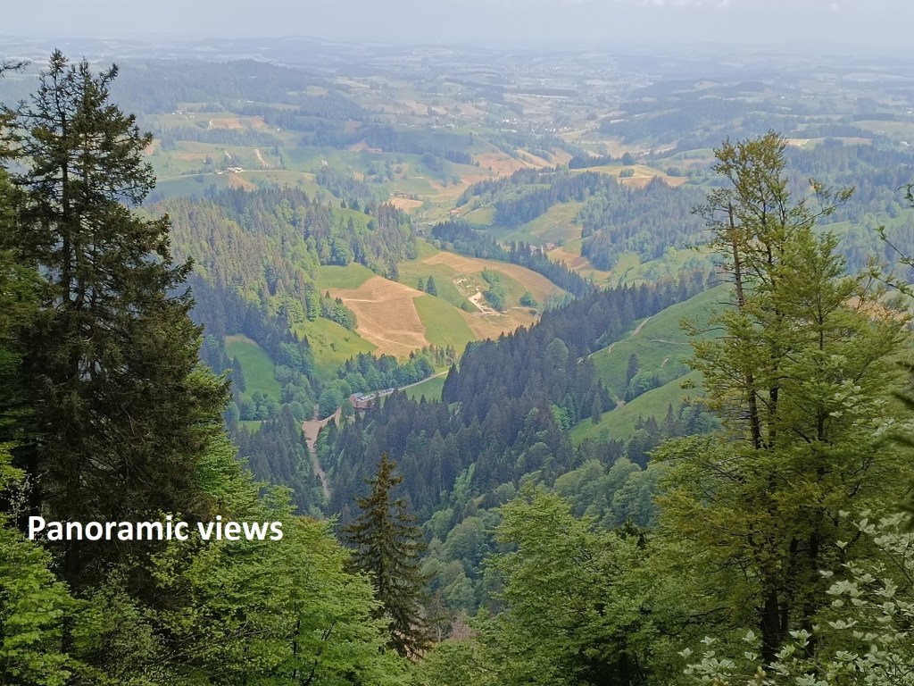
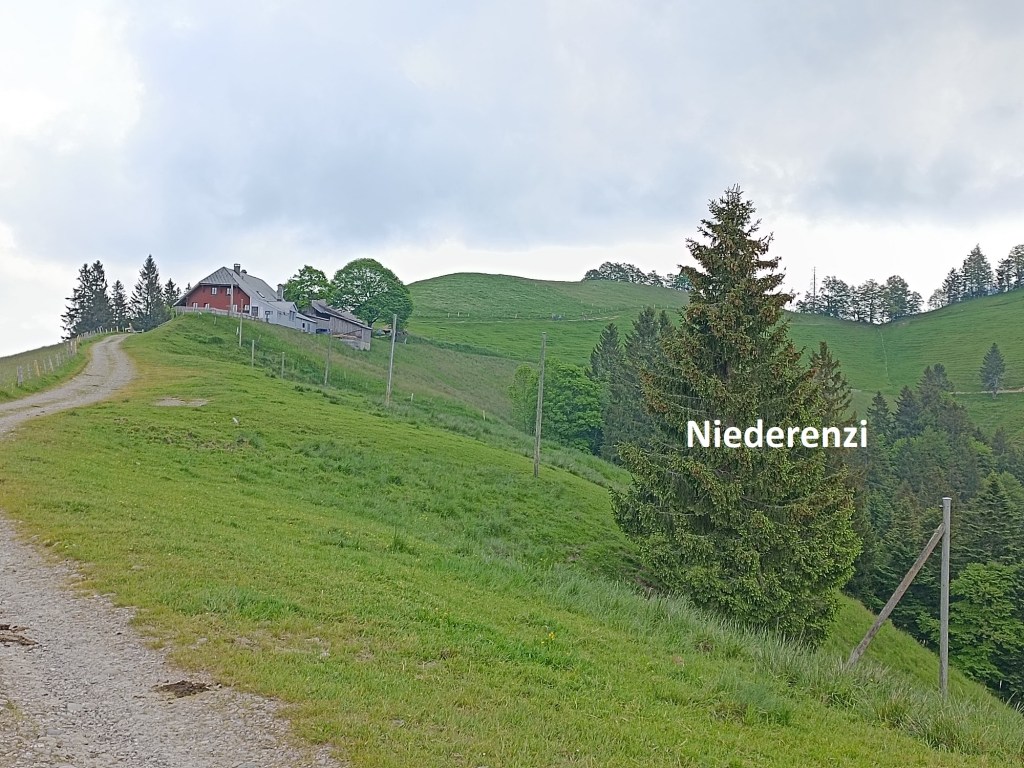
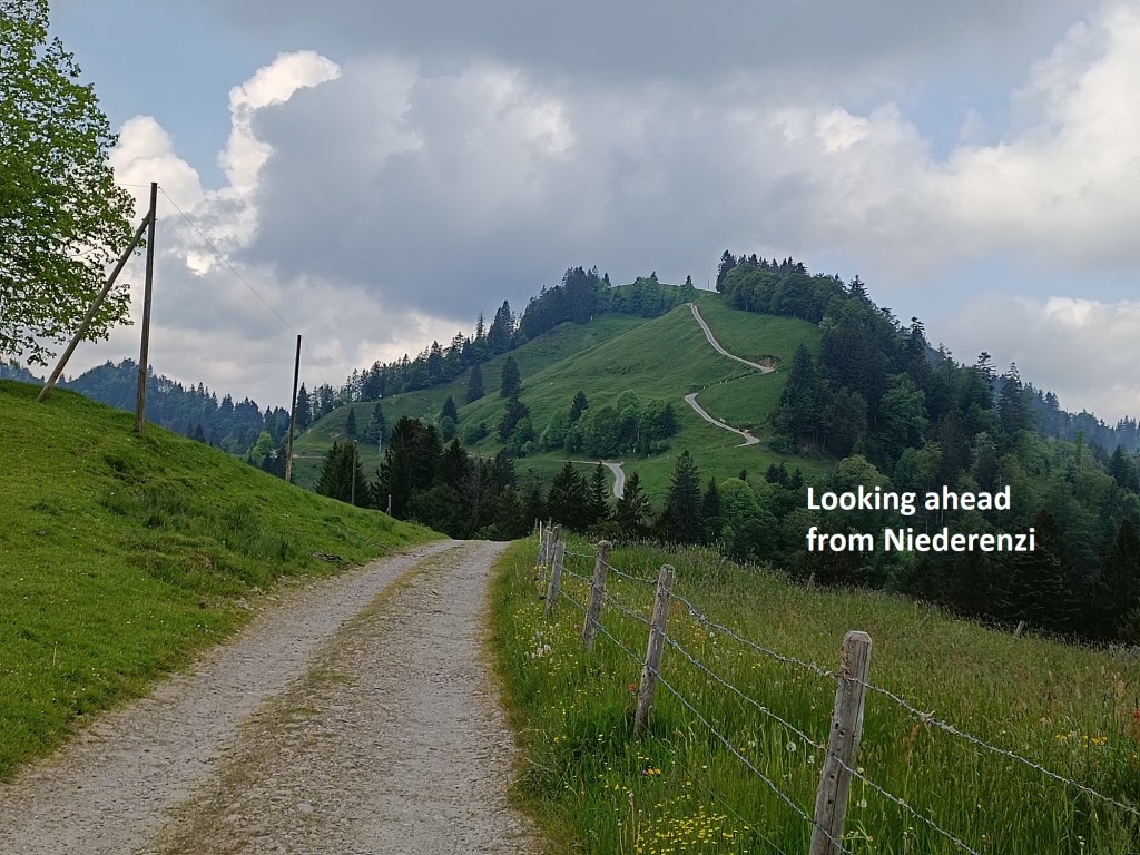
I did not hang around, but went immediately on my way. The trail descends quickly from Napf, making its way through the forest just below the cliffs of Napfflue. In places, there were great views of the Mittelland to the north. The trail comes back out onto open hillside to reach Niedrerenzi and Änzisattel. At this point, the trail had descended over 200m from Napf, and there is then an ascent of 145m. That ascent is steep, though on a good track.
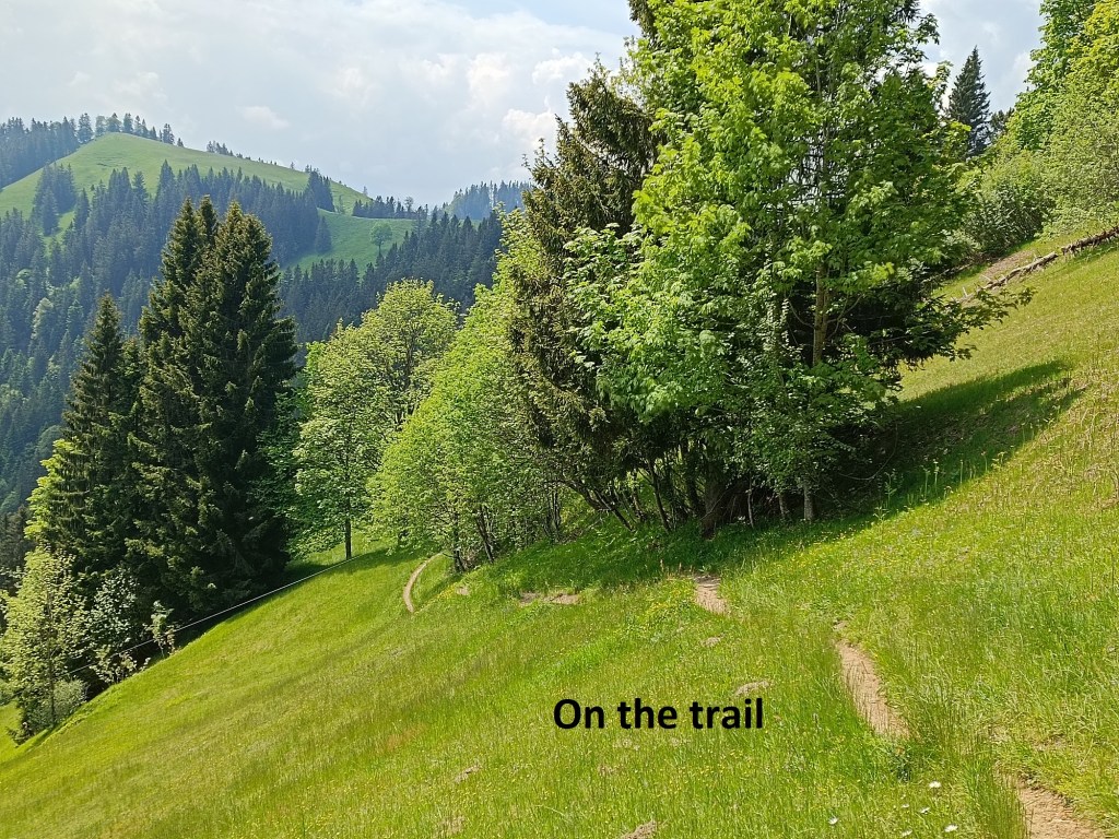
After that, the trail continues to ascend, but more gradually. I reached Hochänzi, where there is a branch of the trail, and took the left fork to continue on the Panoramaweg. From there, the trail winds its way through the forest and out again to reach the Alprestaurant at Obere Lushütten. As I mentioned earlier, I wanted to do a long walk, but the lure of the Alprestaurant was irresistible, and I stopped for just one beer.


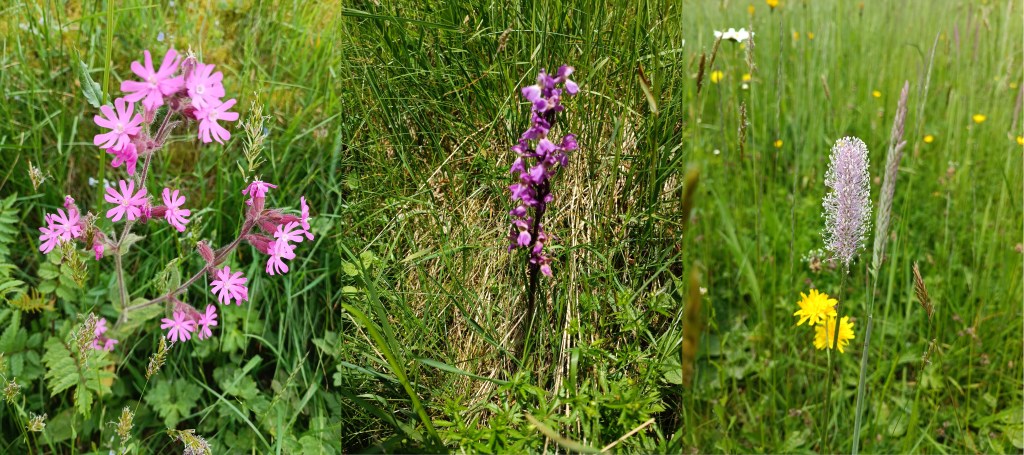
I continued on, enjoying the views all around. The sun was out at this stage. It brightened up the journey, both in the dappled paths of the forest and on the open mountainside. The trail clings to the steep slope, and its south facing attitude allows many flowers to grow, including some orchids. Smaller than their tropical cousins, they have a beauty all of their own.

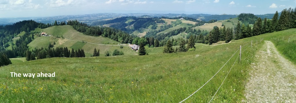
The trail went back to the top of the ridge. This is alpine pastureland, with cows grazing near typical Swiss wooden chalets. And so it continued until I came to Lüderenalp. There is a hotel at Lüderenalp, and I probably could have gotten lunch there, but that would take too long. I allowed myself a short rest and some snacks while sitting on a nearby bench, and then I was on my way again.

My route went up again from Lüderenalp, not much, but in the hot sunshine and after several hours of hiking, every upward step is an effort. And then a downward vista opened up in from of me.
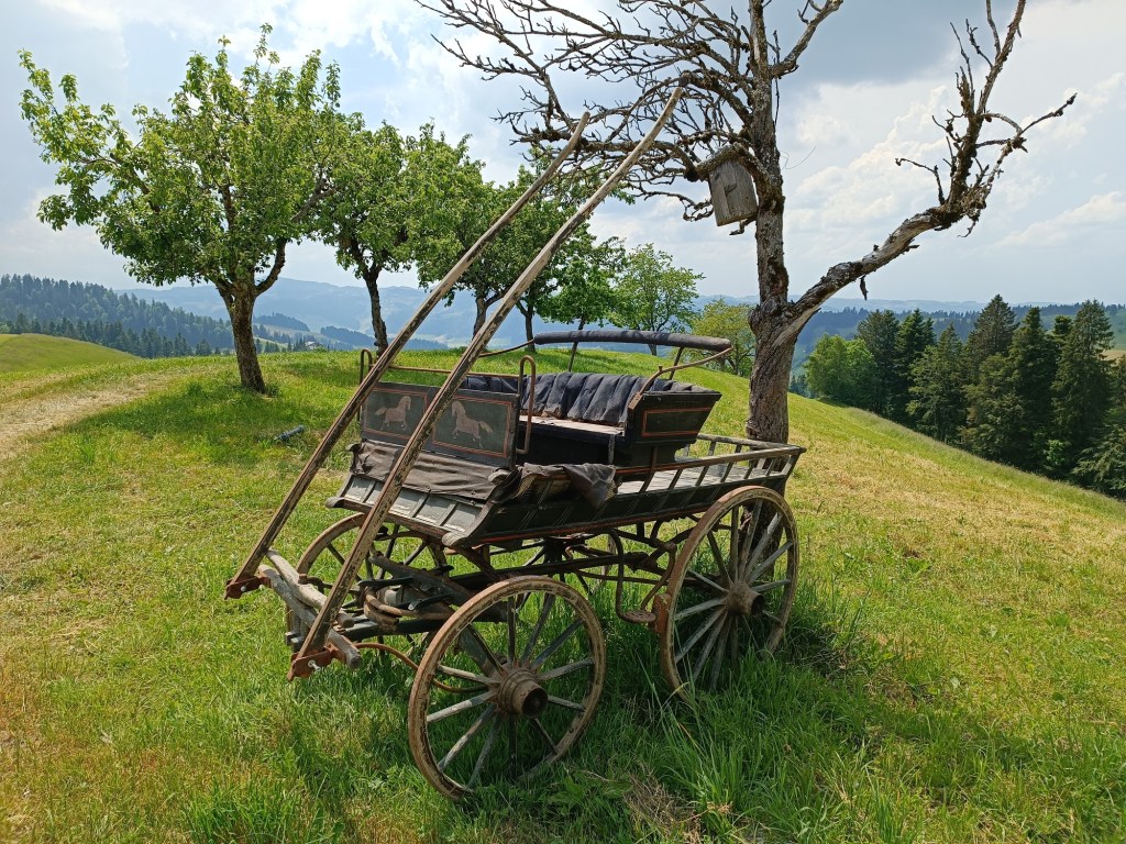
After that, it was almost all downhill. There were occasional level stretches, and even a few hillocks to go over, but nothing much. I was into farmland now. I passed one farm with an ancient cart outside, not going anywhere, but a nice decoration in the landscape.


I continued on, passing a family gathering the cut grass on a slope too steep for normal collection. There was a cottage that should be on a postcard, decorated with flowers and cowbells. And then Emmenmatt came into view.

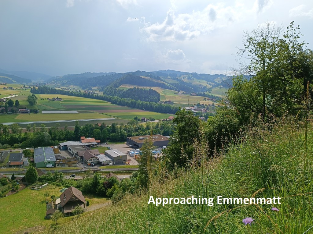
My route was still downward, and before long more, I reached the valley floor. I crossed the Ilfis and then the Emme to reach the station at Emmenmatt.


Emmenmatt is about the halfway point on the trail. In distance, the total trail is 510km, and Emmenmatt is at about 203km. In terms of number of stages, the guidebook allows 29 stages for the entire trail, and Emmenmatt is near the end of the book’s stage 15. However, I have reached here in eleven stages. So I consider this to be halfway.
My total step count for the day was 46,629.


Great walk Thurloch, thanks for sharing – you are getting into good shape💪😃
LikeLike