
There are some walks that stay long in my memory. Sometimes it is a particularly long walk, that I feel a real sense of achievement in doing that walk. Sometimes there is an event on the walk or people I meet, that makes it memorable. Sometimes, there is particular scenery that I remember for a long time. Last Sunday, I did a walk that I will remember for some time. It was not a long walk, but the terrain and the scenery were wonderful.
I had decided to walk up the Brienzer Rothorn, a mountain to the north-east of Interlaken. To get to the start at the little village of Brünig, I took the train, first to Luzern, and then on the Interlaken Express to Brünig. I am not sure why they call it an express, since it goes not go particularly fast. Indeed, it goes quite slowly on some stretches of the route as it trundles through the mountains. That slow speed gave me time to look at the mountains I was passing, and the higher sloes seemed lost in cloud. At times, on the train, I felt slightly anxious about the day ahead.
But I have learned that the weather gods are capricious, and while they sometimes offer discouragement, they rarely put more obstacles in my way than I can manage. So I left the train at Brünig and headed up the trail.

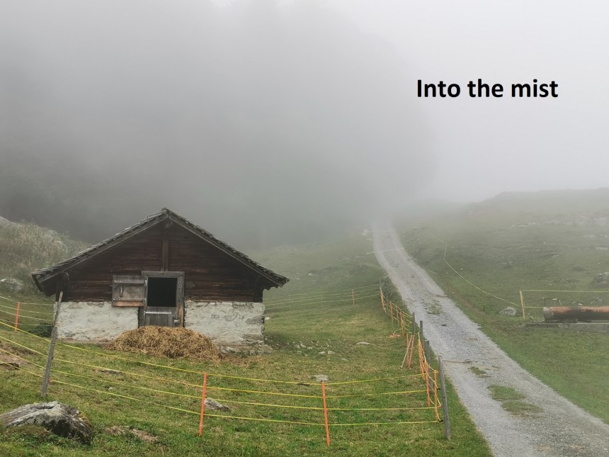
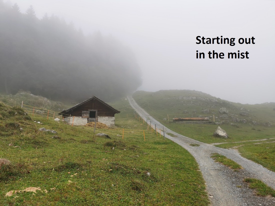
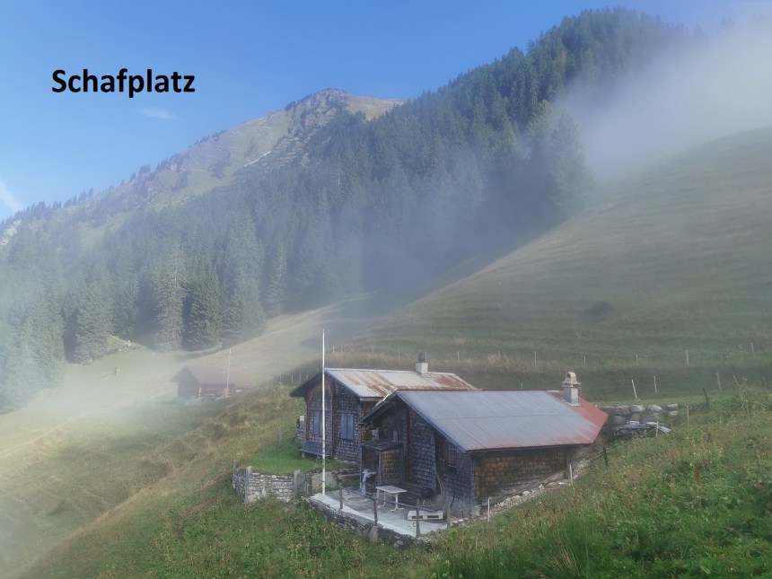
Even at Brünig, there were wisps of mist floating around, and as I headed up the trail, the mist became more dense. By the time I came to Ergiwald, it seemed like I was heading into a soft grey mass. But I kept on. The track soon became a vague trail through grassy pastures. When I reached the farms at Schäri, I could hear, but could not see, lots of cows in the pastures around, their bells clanging softly through the mist. Swiss cowbells only clang softly, never too loud. This continued as I made my way through the woods at Brunni, and on through the pastures to Schafplatz. And there, my resolution not to be put off by the weather was rewarded. I emerged from the mist into sunshine.
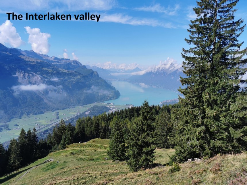

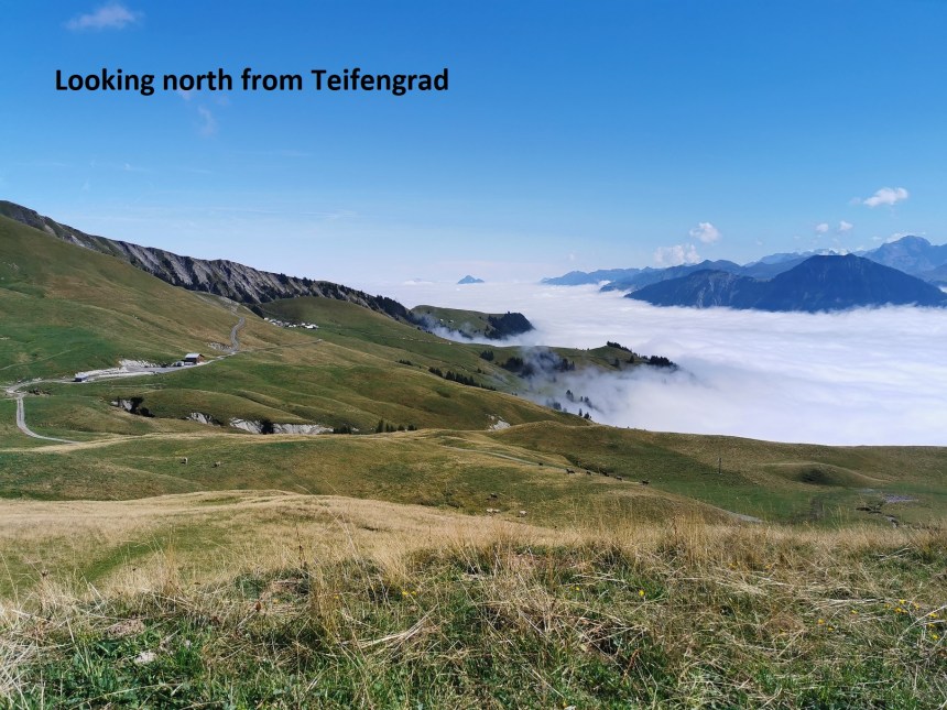
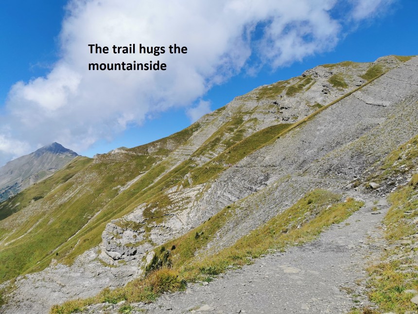
Continuing on, I had magnificent views of the Interlaken valley to my left. The trail wound higher and higher eventually becoming a narrow track hugging the side of the mountain. I had a steep slope upwards to my right, and a steep slope downwards to my left. But the mountainside was bathed in sunshine, and the ground was dry, to it was not difficult. Soon, my destination, the Rothorn, came into view. The trail wound around the contours of the mountain, ascending at the same time, until I reached the ridge at Teifengrad. To the north, the valleys that I had come through on the train earlier were still blanketed in cloud. Far away, the peak of the Rigi was sticking out above the cloud like an island in the sea.
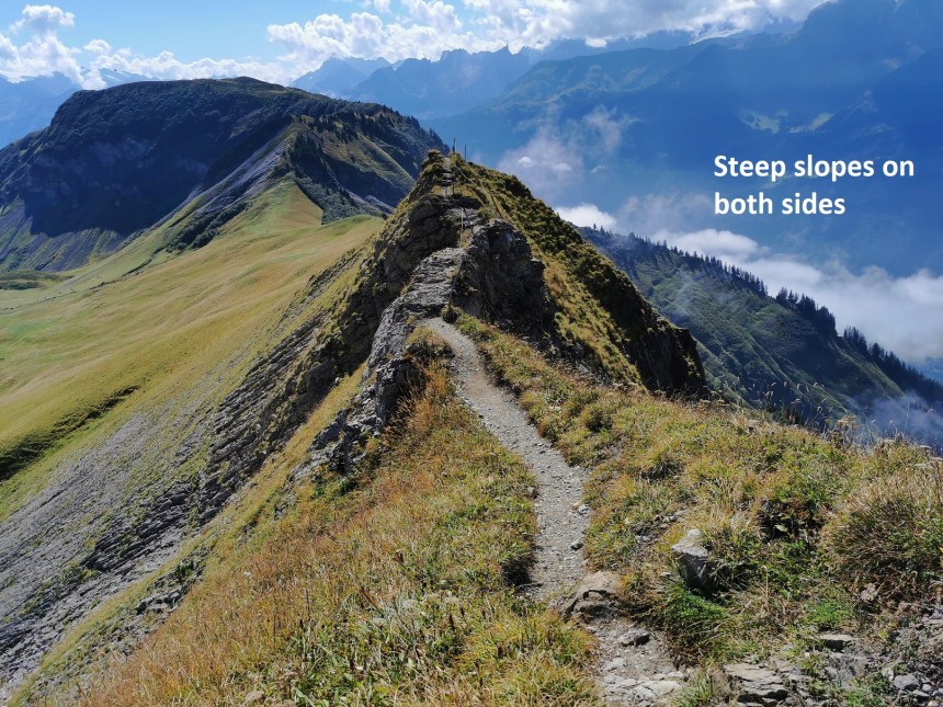
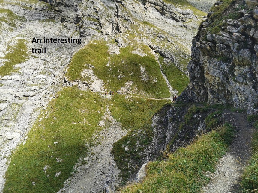
The ridge is broad and flat at Teifengrad, but my route was on upwards, and soon I was walking on a narrow ridge with steep drops on both sides. At Höch Gumme, the trail once again is along a steep mountainside. This time, the ground on both sides was almost vertical, upwards to the right, and downwards to the left. Care was necessary when passing other walkers.
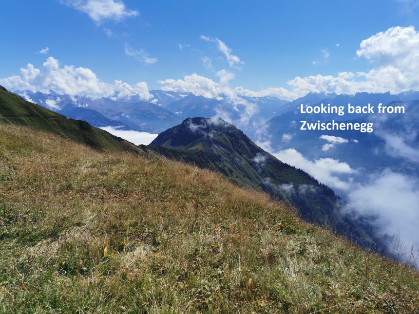
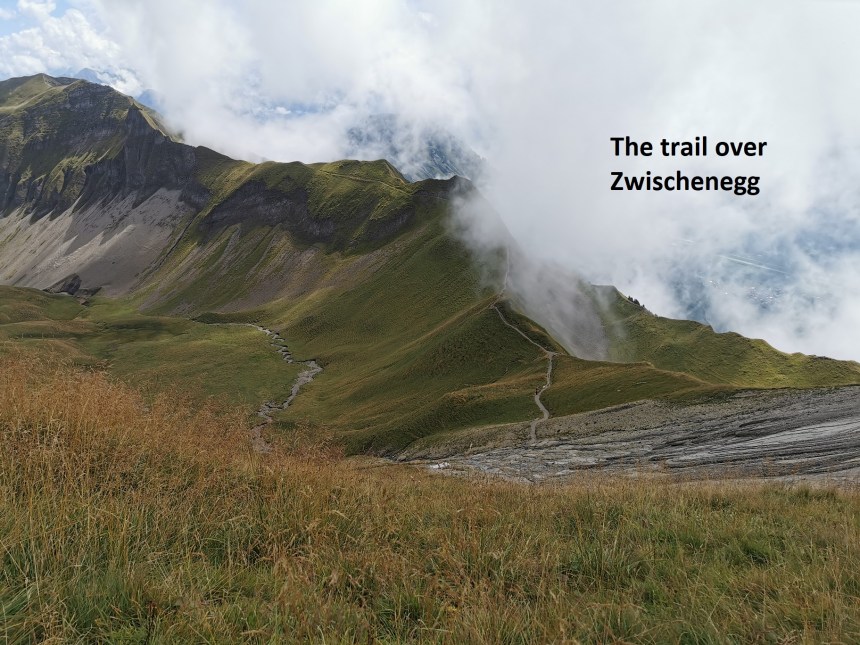
Zwischenegg is also a narrow ridge, though not difficult. It was a short ascent upwards to reach the top of that ridge, and then down the other side.
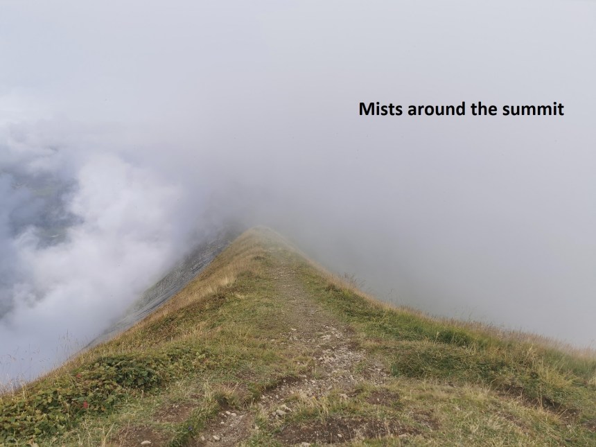
The trail continued over Eisesattel. Zwischenegg and Eisesattel are on the border between Luzern and Bern cantons, and the Swiss, with their penchant for border marking, had placed little stone markets at intervals along the way. After Eisesattel, the trail descends to a col at 2025m before the final ascent to the Rothorn. The Rothorn is a popular destination, with a ski-lift, a cable car, and a mountain railway all bringing tourists to the top. So when I reached the summit, with its triangulation marker, it seemed quite crowded. The sloes below to the east were now subject to swirls of mist, so it was not possible to see much of the way that I had come.
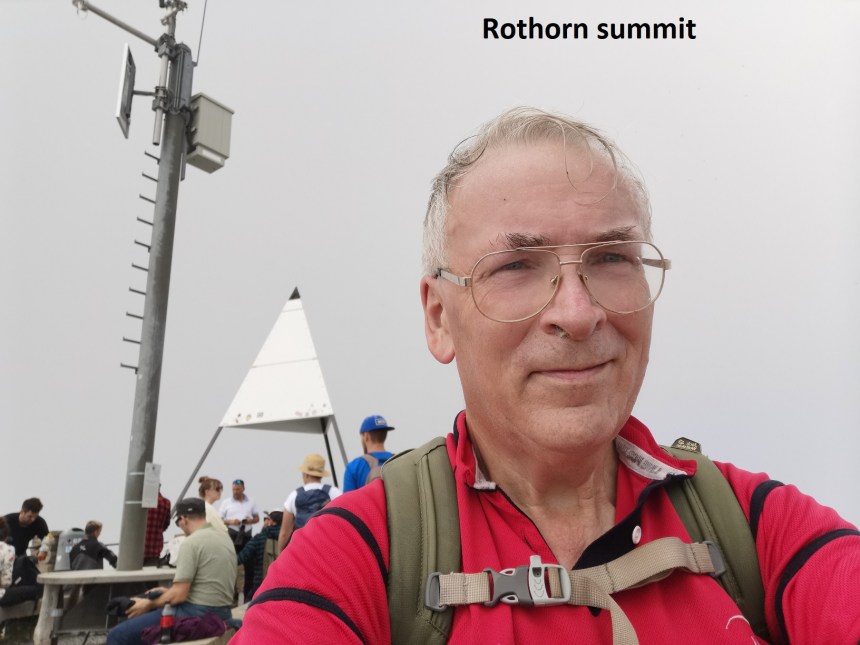
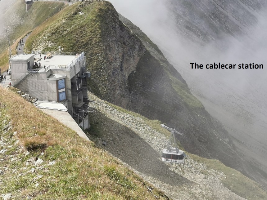
I stayed on the summit long enough to record the event, and then it was a short walk down to the cable car station. The cable car brough me down to the Sörenberg station, and from there, I took the bus and train back to Basel.
This was not a very long walk, and my total step count was just 29,756 for the day. But it was a great day out.

Such beautiful account of a beautiful journey! Thanks for sharing Thurloch!
LikeLike