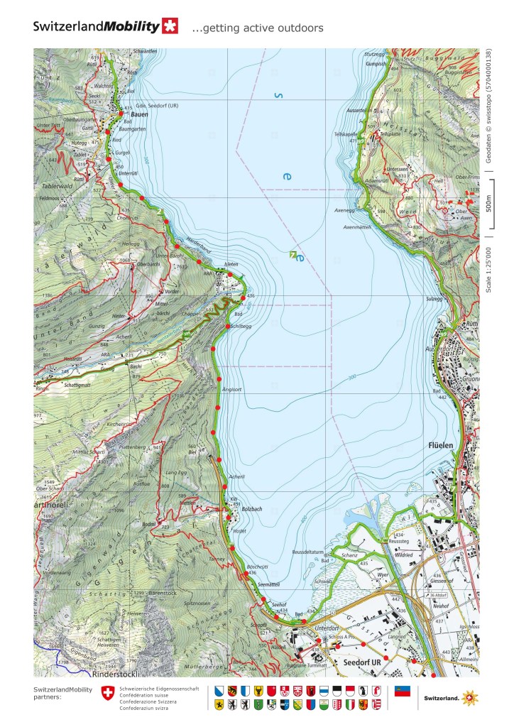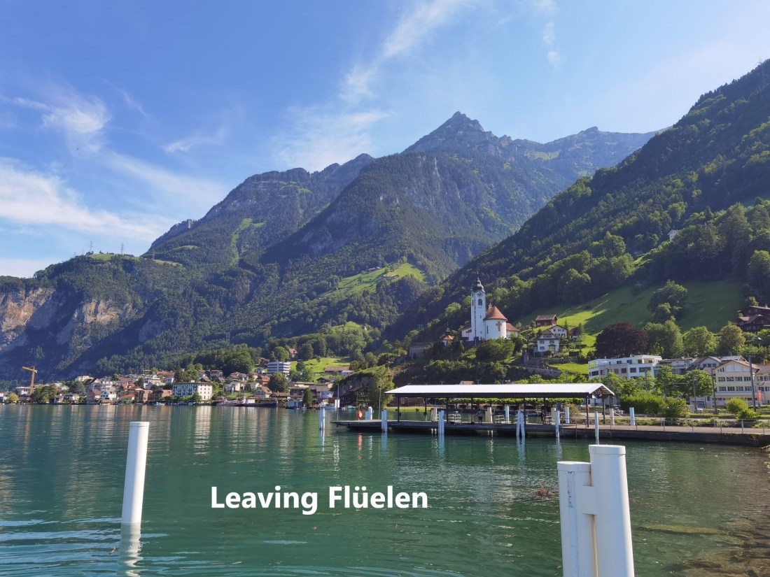
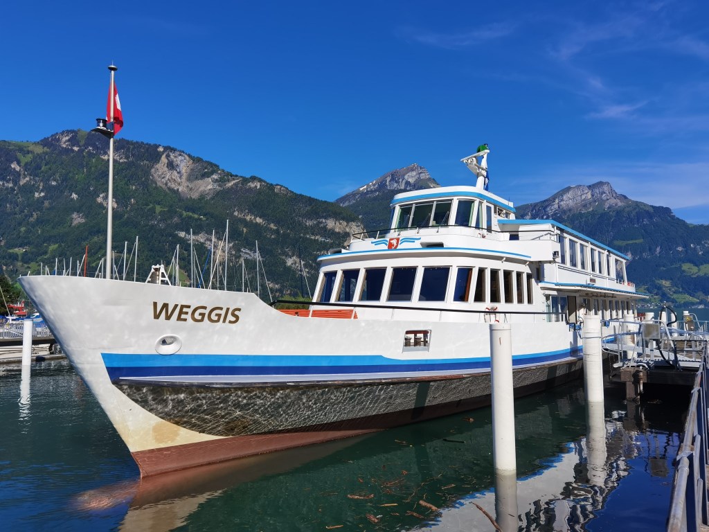
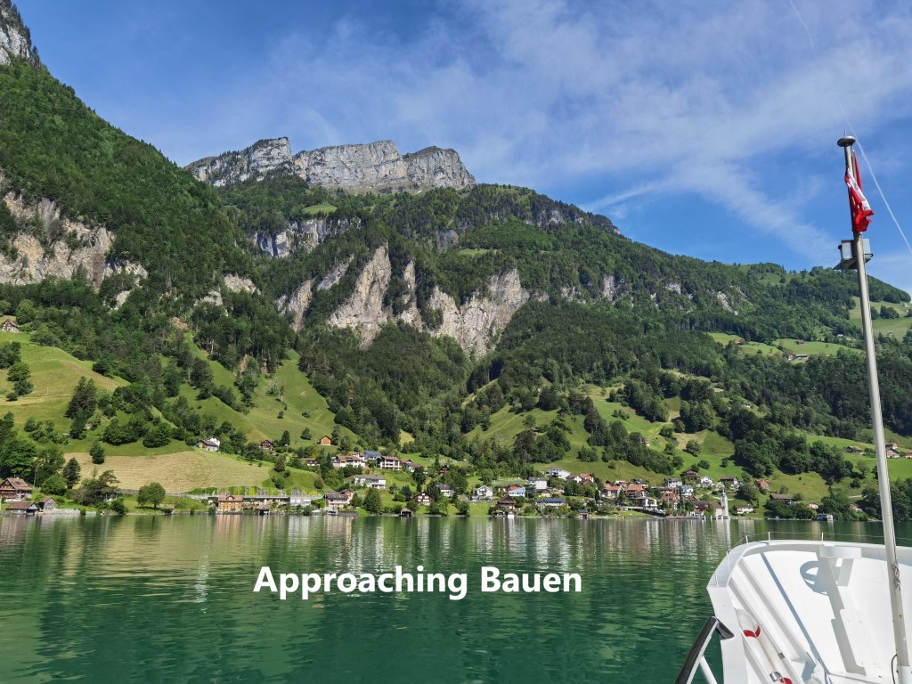
I returned to Bauen last Saturday to make the next stage of the Trans Swiss Trail. My schedule was governed by the sailing times of the boats on the Vierwaldstätter See, so it was a later start than is usual for me. I found myself standing in the sunshine at Flüelin, looking across at Bauen, while the boat, once again the Weggis sat quietly with the crew preparing for the day. But soon enough, the boat was on its way, and a little after ten o’clock, I arrived in Bauen.
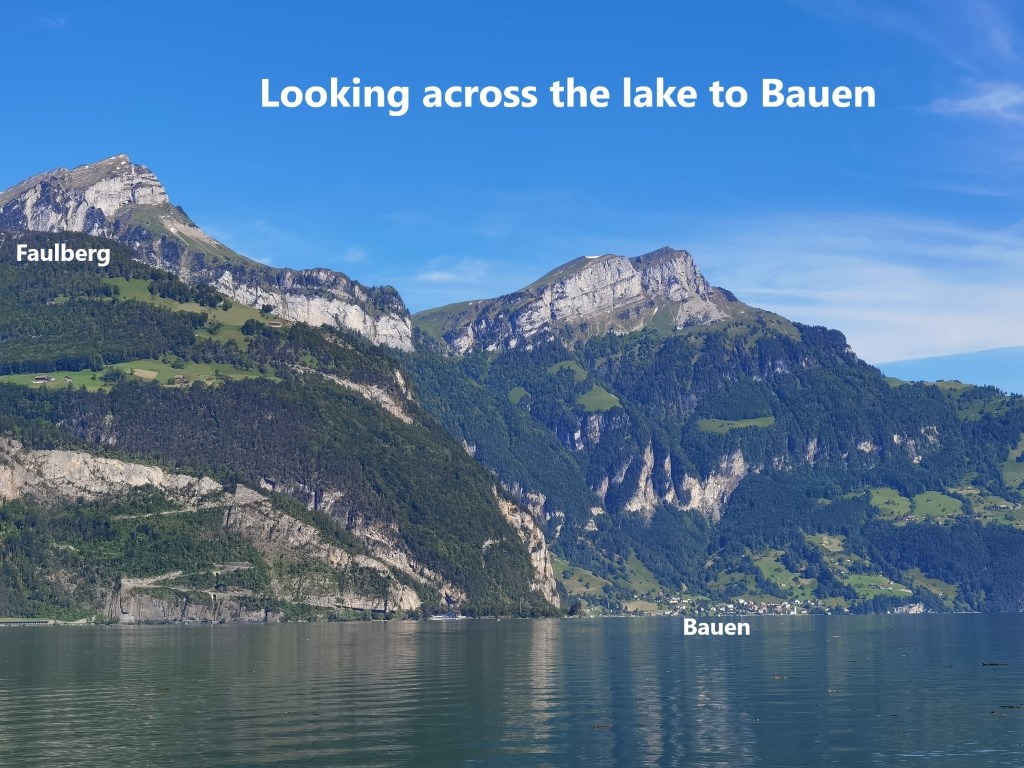
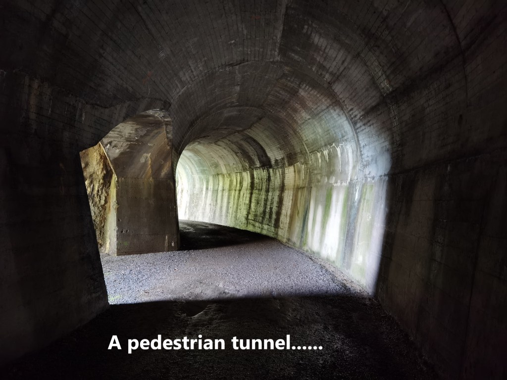
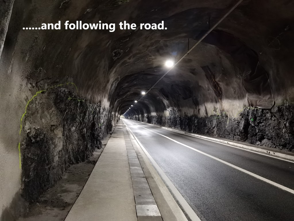
The trail goes southwards along the lake shore from Bauen. On this part of the shore, the mountains come right down to the lake in the form of steep cliffs, so the trail from Bauen to Isleten has to go through tunnels. The first tunnel follows what looks like an old wagon route cut into the rock. But then there is a second tunnel where the pedestrian route is a footpath at the side of the road. It goes on for a little short of one kilometre, and then comes out into the sunshine again at Isleten.
The lake looks so peaceful and benign on days like last Saturday that it is easy to forget that it can claim lives. There are reminders of that in Isleten. A small memorial just after the tunnel reminds of a death while diving in the lake in 1999. A little further on, a plaque marks the death of five people on the lake in December 1949.
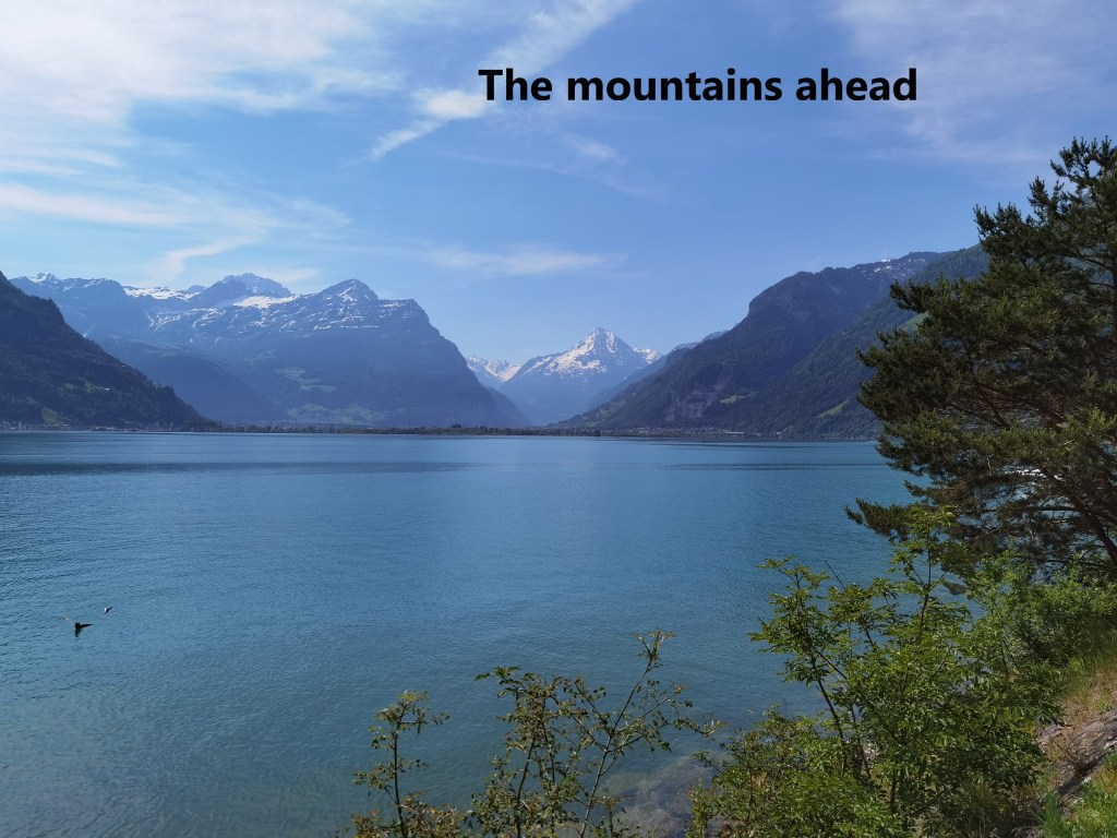
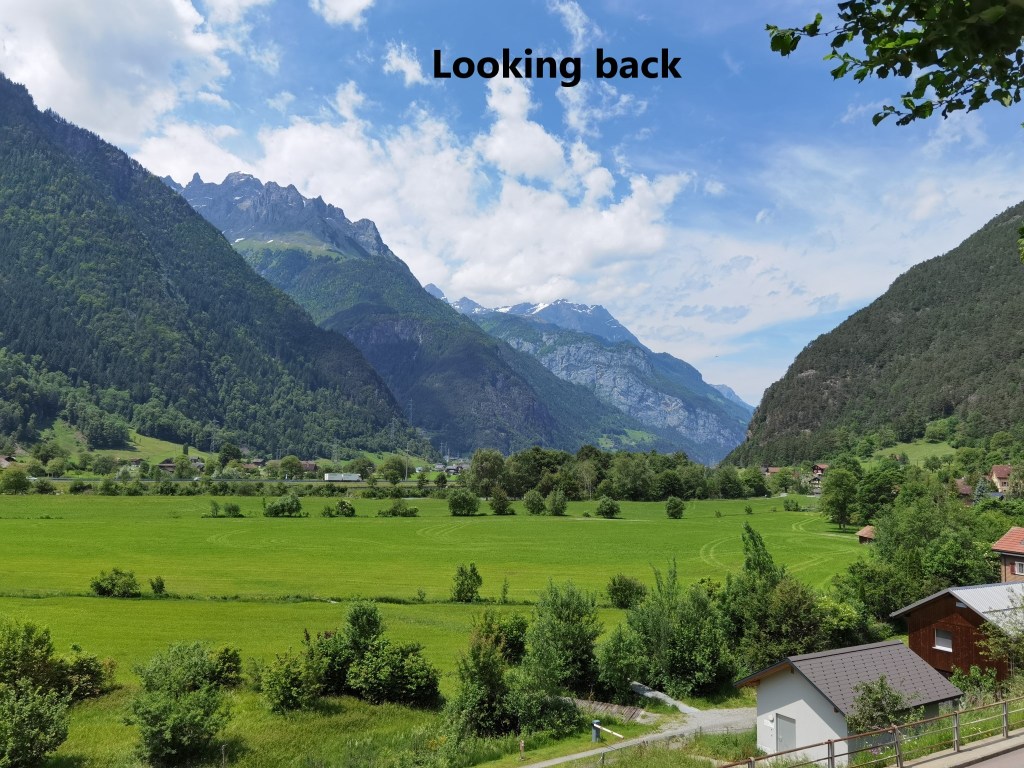
But my route was on land. The trail goes on southward, with the lake on one side and the road to Bauen on the other. At times there were good views to the south, promising an interesting day ahead. It is generally flat walking, and I made good time, soon reaching the southern end of the lake.
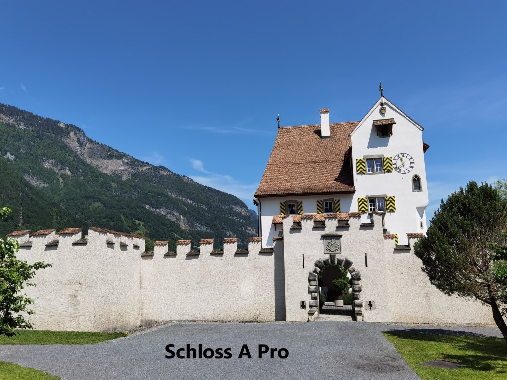
The official trail follows the shore as it curves around eastwards, but I wanted to take a short cut. This was not for any reasons of hurrying, but I wanted to see a castle that is in this area. It is the Schloss A Pro.
The castle was built in the sixteenth century by two brothers, Jakob and Peter A Pro. It really looks the part, complete with moat, bastions at the four corners of the walls, and battlements on the top of those walls. I am not sure how much of all that is original, but it looks impressive. Following the various ups and downs of the A Pro family, the castle was bought by the canton of Uri in 1959. The canton uses the castle for official functions, and it also houses an upmarket restaurant.
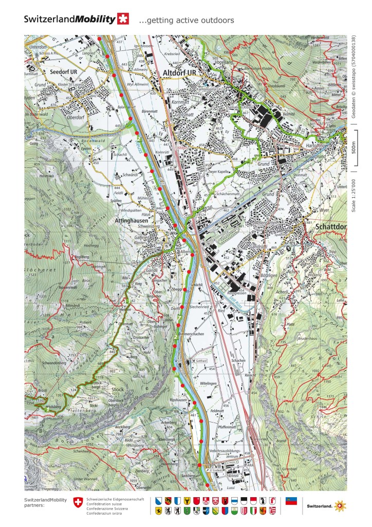
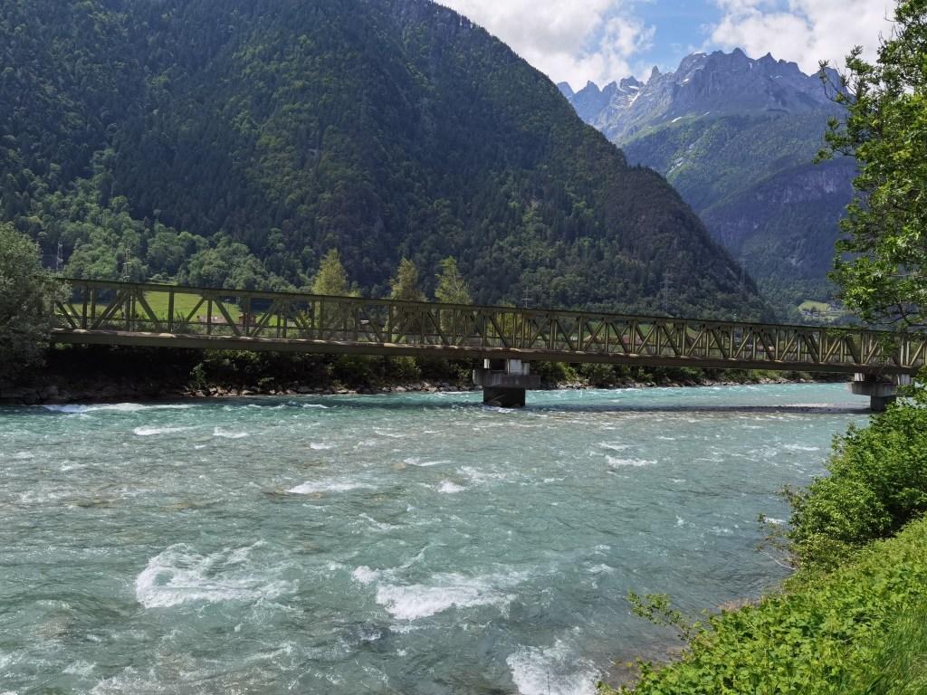
Having seen the castle, I went on, following smaller trails to get back on the main one. Once back on the main trail, I continued southwards. The trail follows the river Reuss.
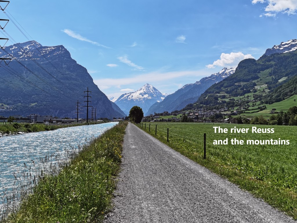
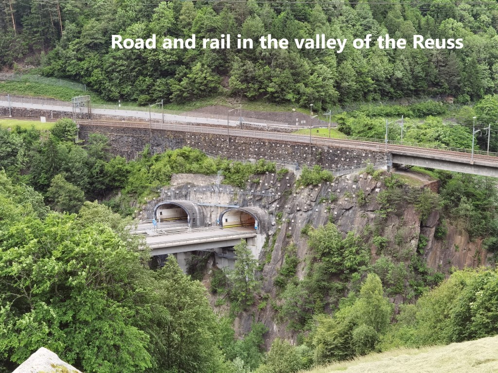
The Reuss is the fourth longest river in Switzerland, at 164 kilometres long. It drains water from the mountains in the Gotthard and Furka areas, through the Vierwaldstätter See and the city of Luzern, to eventually join the Aare. Water management is very important for the Swiss, and the Reuss has its share of reservoirs and power stations along the route. In this section, the course of the river has been straightened and lined with stone to keep it in order.
My route bypassed the town of Altdorf, the cantonal capital of Uri, as I followed the western left bank of the river upstream. Just past Altdorf, the Trans Swiss Trail is joined by the Via Gottardo, another national trail that runs from Basel to Mendrisio. The remainder of my journey will be a joint route of these two trails.
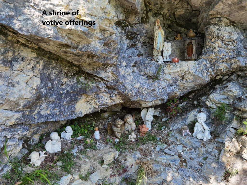
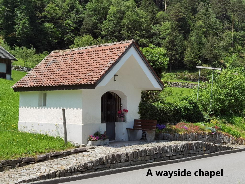
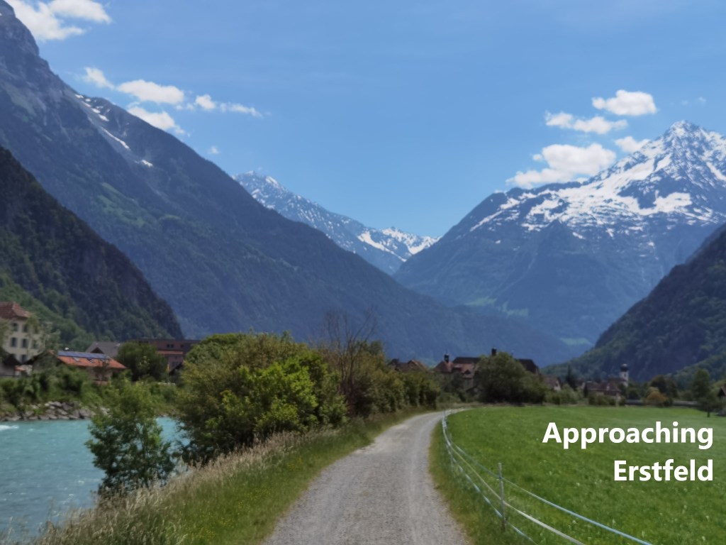
A little further on, the mountains to the west close in on the trail, to the point that the trail has been tunnelled into the rock. Here and there in the tunnel section, there are little alcoves, some of them transformed into small grottoes with votive offerings of statues and other religious items. I also passed a little wayside chapel, unnamed as far I could tell.
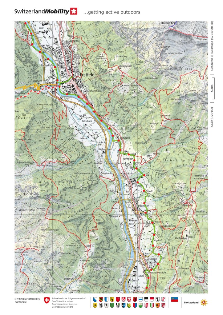
Then, once back on the flatter ground, the trail comes to Erstfeld.
The town of Erstfeld predates the foundation of the Swiss confederation by about thirty years. At that time, back in the thirteenth century, it was called Ourczvelt. Later the name was modified to Hirschfelden, before becoming Erstfeld. The town is at the northern end of the Gotthard railway. The history of travel through the St. Gotthard pass shows how transport has developed in the last two hundred years. The first mail coaches to make a regular route through the pass started in 1832. The service ran weekly. In the 1840s, the journey from Luzern to Milan was timed at 31.5 hours, involving steamboat, mail coach, and rail on the Italian side. With the building of the St. Gotthard rail line in the 1880s, that was reduced massively. Erstfeld railway station served as a depot for the line, housing the locomotives that were necessary for the steep gradients up through the pass. Even with the opening of the Basistunnel in 2016, Erstfeld still houses the maintenance workshops and crews for what is currently the longest rail tunnel in the world.
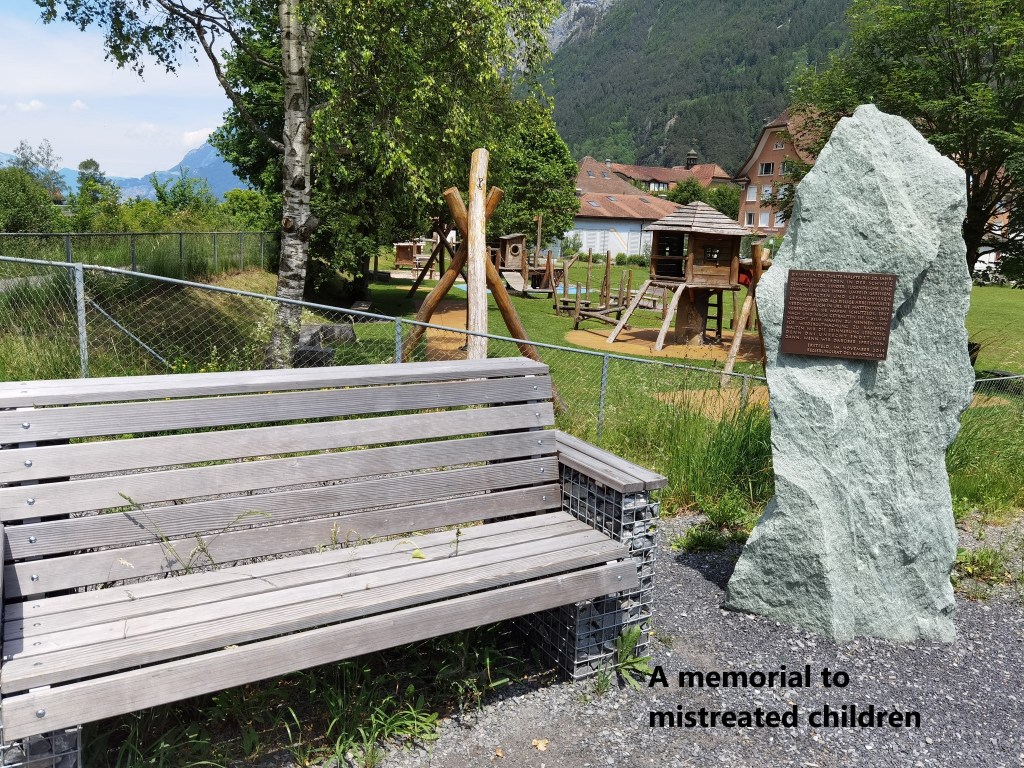
But my route continued onwards. Close to the river, I passed a small memorial to children mistreated by the social systems in Switzerland. A rough stone pillar carries a small plaque stating that until late in the second half of the twentieth century, thousands of children were taken from the families, put into institutions, and exploited economically. The plaque recognises that the children were innocent, and the injustice only stopped when the public began to speak up. It took until 2019 for this simple memorial to be put in place.
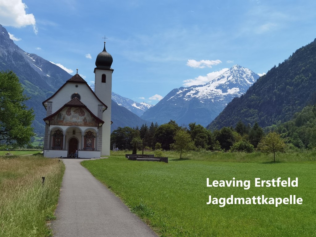
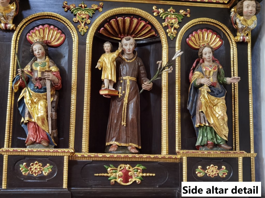
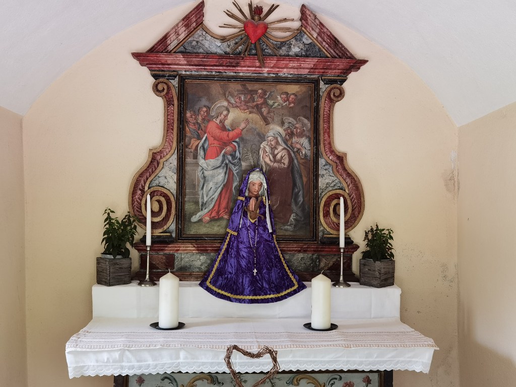
And then, on a more cheerful note, as I was leaving the town, I came to the Jagdmattkapelle. The first mention of a church on this site was in 1339. It was the site of an annual pilgrimage in April every year, where the people of Uri would gather. Later this became a political event, with discussions on the affairs of the canton taking place in the days following the pilgrimage. The current church dates from the 1630s. The inside is richly decorated, as even the side altars show. Near the door is a collection of votive plaques, not nearly as extensive as in Niederrickenbach, but interesting nevertheless.
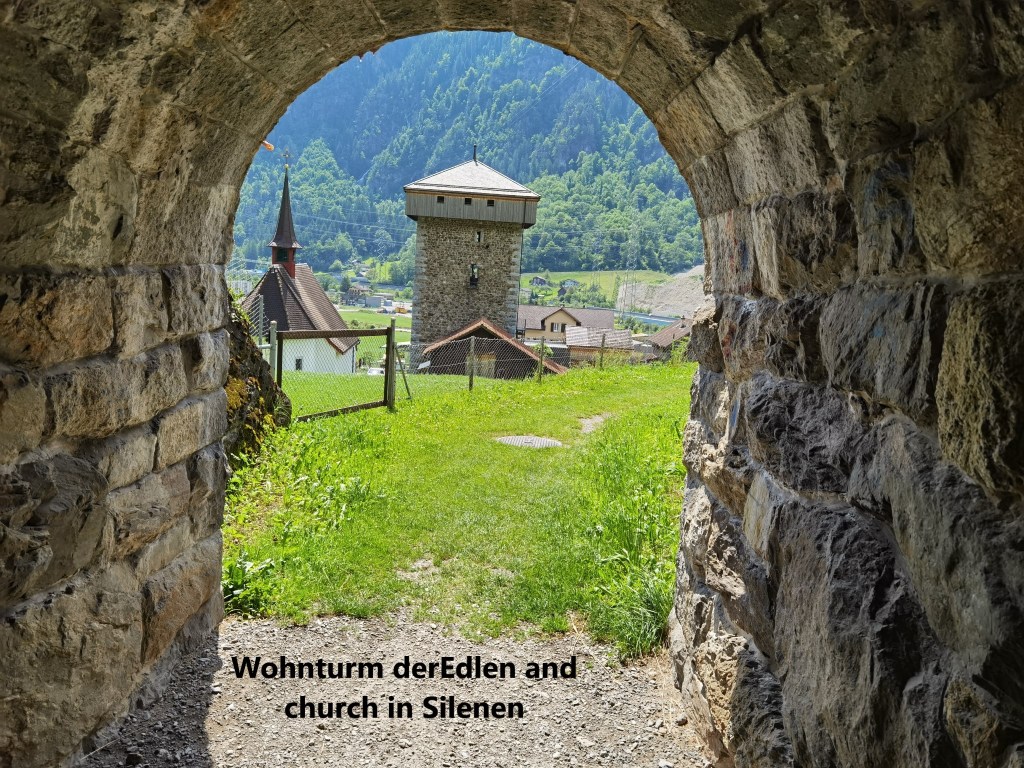
The trail leaves Erstfeld along the road southwards. It passes a “temporary” bridge across the Reuss, one that was built in the 1940s and still serves as a pedestrian crossing over the river. And then the trail leaves the road, taking to the higher ground. The trail weaves up and down, sometimes following the contours, but more often just following the farm tracks, until it eventually comes to the village of Silenen. It approaches Silenen under the railway tracks, framing the village church and the Wohnturm der Edlen, the Tower of the Nobles.
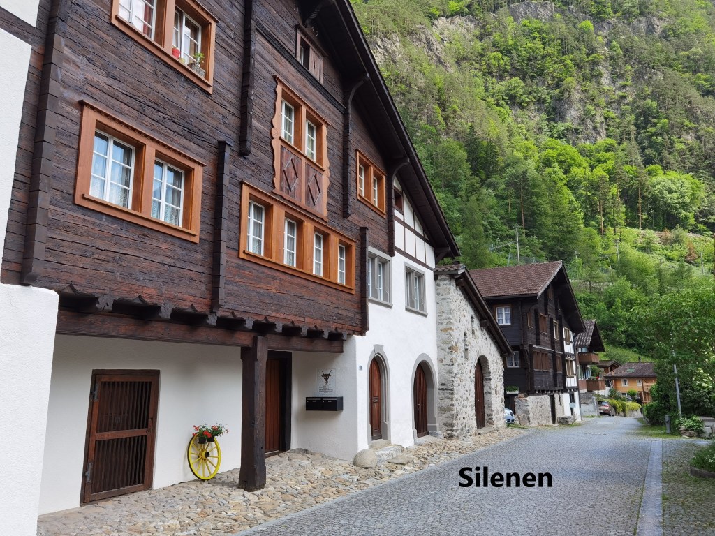
The old street in Silenen has some houses that date back to the sixteenth century. The village itself was a waystation for transport across the Gotthard pass. Silenen catered for the watering, feeding and replacement of pack animals in the days before wheeled transport across the pass became commonplace. At one time, there are estimated to have been about 300 pack animals moving each way across the pass every day. Silenen also had three taverns, a smithy, and a medical facility.
A little further on I came to Amsteg.
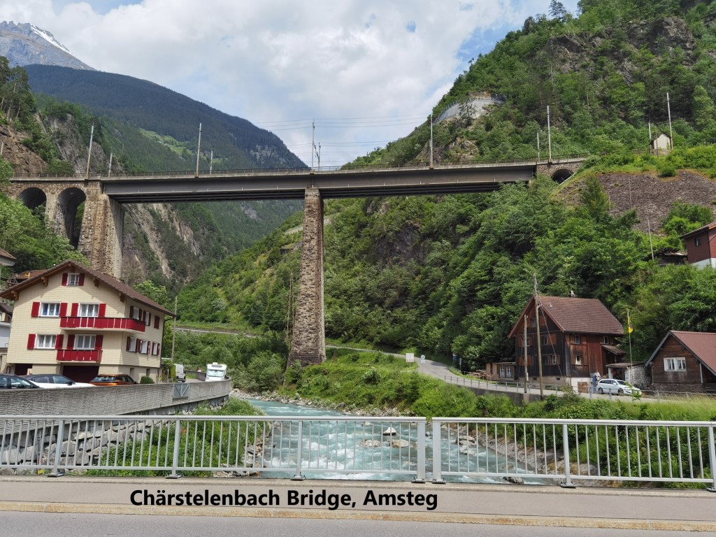
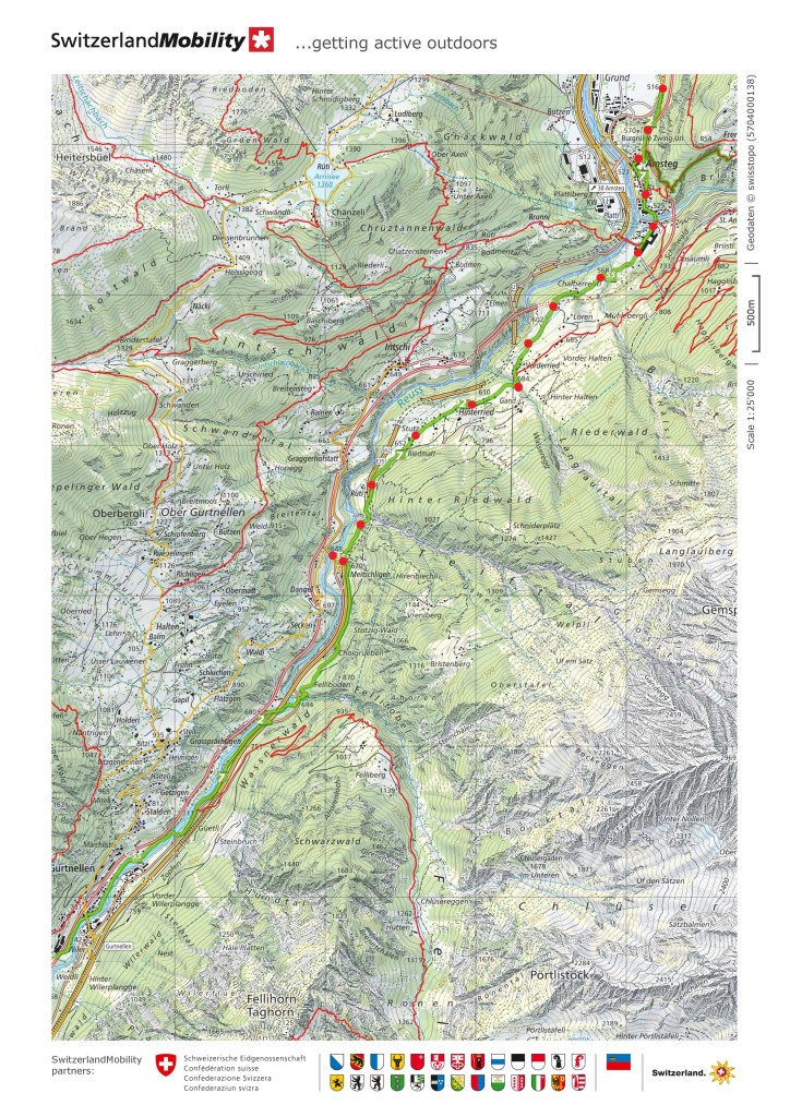
Going through Amsteg, the view to the east is dominated by the Chärstelenbach bridge. At 127m long and 57m high, the current bridge was built in 1912. Previously the Gotthard railway had only a single track bridge across the valley below. Each span of the bridge is 50m long, with the stone abutments making up the rest of the length.
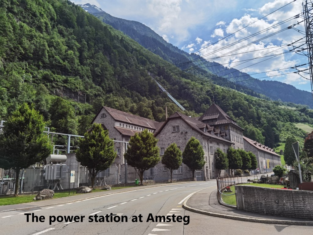
And then on the southern edge of Amsteg is the power station. The plant is described as a high-pressure run-of-river power plant using the waters of the Reuss catchment system, and is specifically for the use of the SBB (Swiss Federal Railways). Proposals for the plant were first drawn up in the early years of the twentieth century. The shortage of coal during the First World War added impetus to the projects. At the same time, more powerful electric locomotives were in development. Everything came together with the commissioning of the Amsteg plant in 1923. As well as the plant in Amsteg, there are two other power plants further up the valley, and two more on the southern side of the pass. In total, the network of hydroelectric plants supplies about forty percent of the electricity used by the SBB.

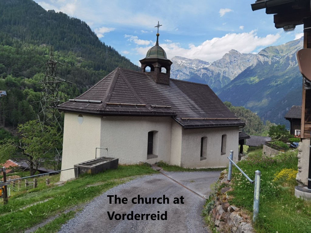
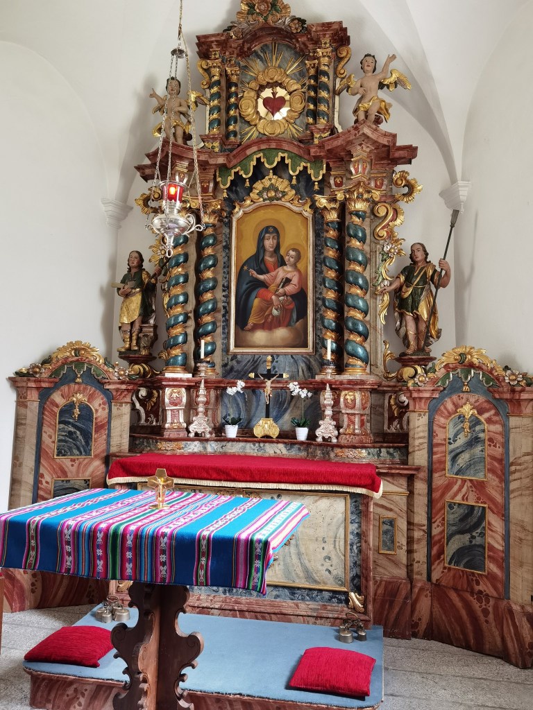
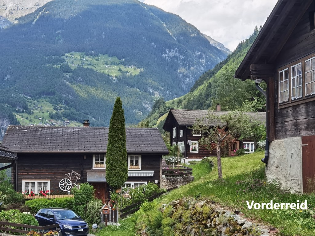
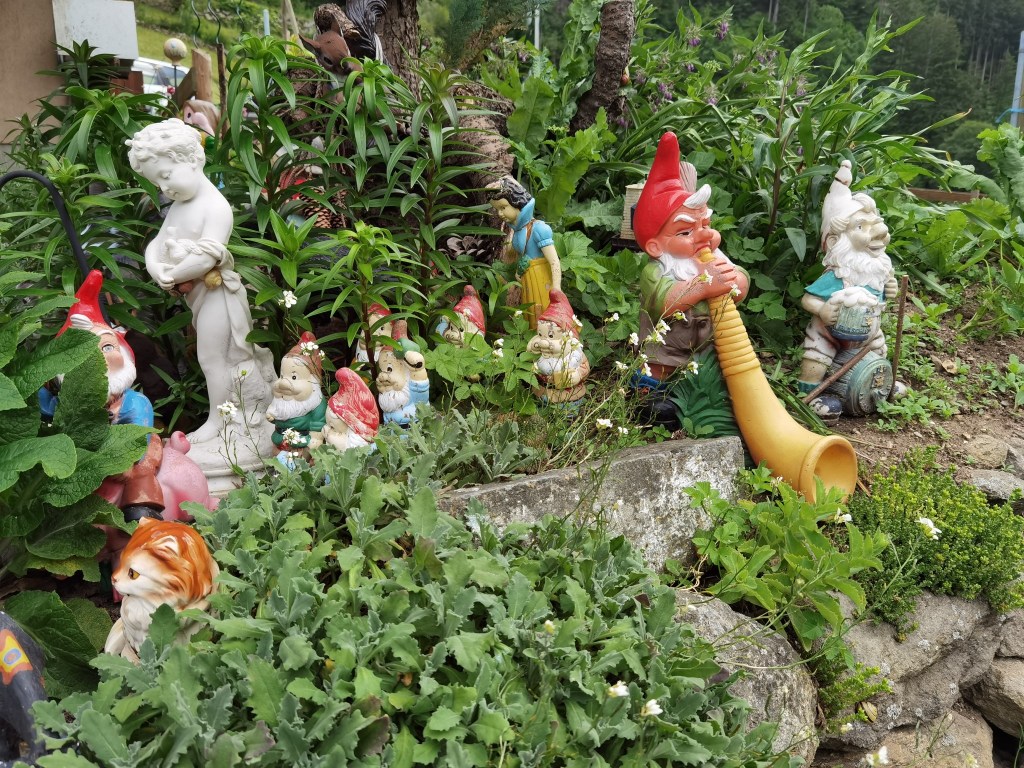
The trail climbs quickly from Amsteg, and curves around the side of the valley. Along the way are several avalanche shelters, but there was no risk of needing them that day. I soon came to Vorderried, with its little wayside church. The church is nicely decorated inside. I was struck by the neatness of the houses in Vorderried, and in one case by the garden decorations.
After that, it was a fairly level walk to Meitschligen, where I went down to the road to take the bus at the start of the journey home.
I am taking a short break from the Trans Swiss Trail now for a couple of weeks, but I will be back in July, and I hope to reach the top of the pass soon after.
Finally, my total step count for the day was 44,912.