When I was planning my last outing on the Trans Swiss Trail, I had a couple of ideas in mind. I decided on that occasion to follow the standard trail route from Stans to Bauen. But I noticed that there were also routes through the mountains to get to Bauen and nearby parts of the lake shore. I felt that it would be premature to go on with the trail before exploring some of these possibilities.
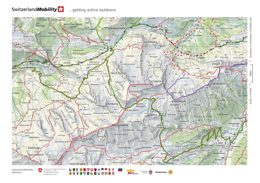
I identified two routes as most promising, going from Stans, through the village of Büren, up the mountain to the tiny village of Niederrickenbach, and on from there. Once into the higher ground past Bärenfallen, there were two choices. I could take a lower altitude route via Faulberg and down to Bauen. Or I could take the higher route going over the pass at Hinter Jochli and down to Isleten on the lake shore. There were advantages and disadvantages to each one. Hinter Jochli is higher up, at 2105m, so there was a good chance that it would still be under snow. The route over Faulberg is lower down, reaching to 1776m, but paradoxically, the total ascent and descent is about the same: about 1550 in each case. And then in the week before doing either route, there was a notice on the website about the Faulberg route. Parts of it were shown as blocked.

The reason for the blockage was given as: “At the end of February, beginning of March, various avalanches fell over the area. The paths are impassable due to fallen trees, earth material, and masses of snow. The clearing work could not be started because of the large masses of snow.” So I decided to set out last Sunday, not sure what I would find. I intended to get to a decision point, pick whatever route I felt most confident about, and if I was not confident about either, then I would leave the route and come down somewhere else.
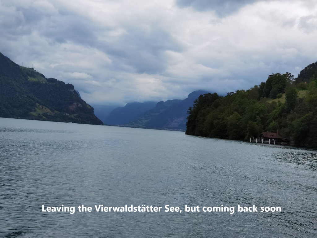
To add to the list of things to consider, the weather forecast for Sunday was not great, with clouds along the eastern shore of the Vierwaldstätter See. But there was no rain forecast before evening, so I set out early. Leaving Stans, the clouds hung low over the mountains.
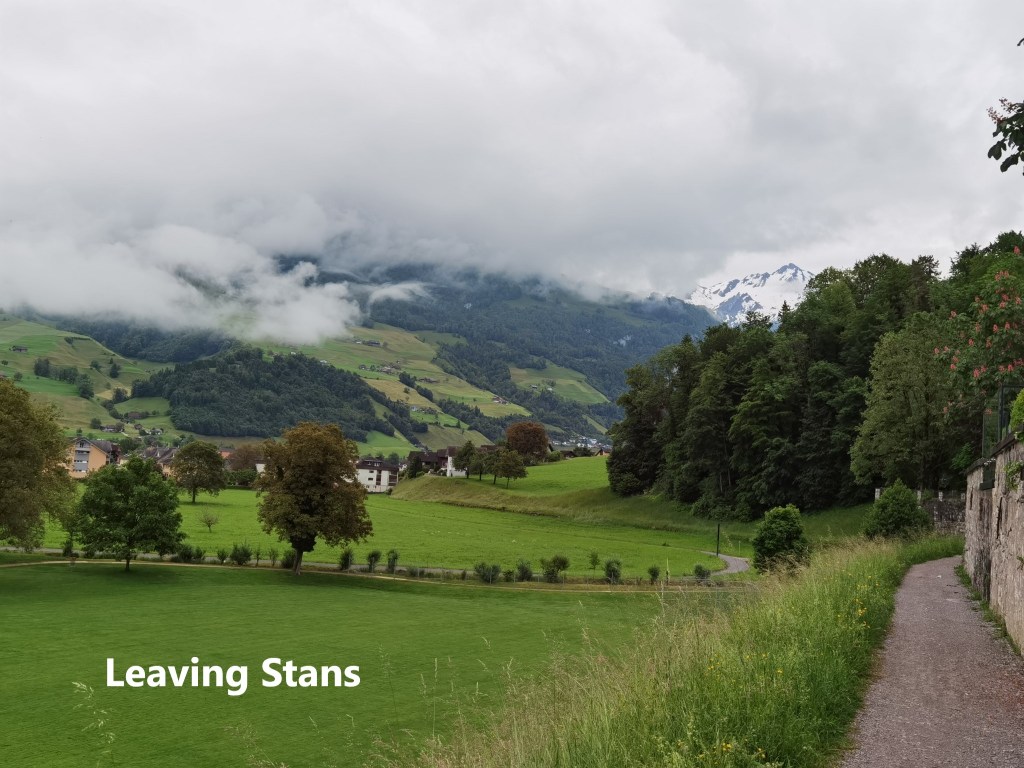

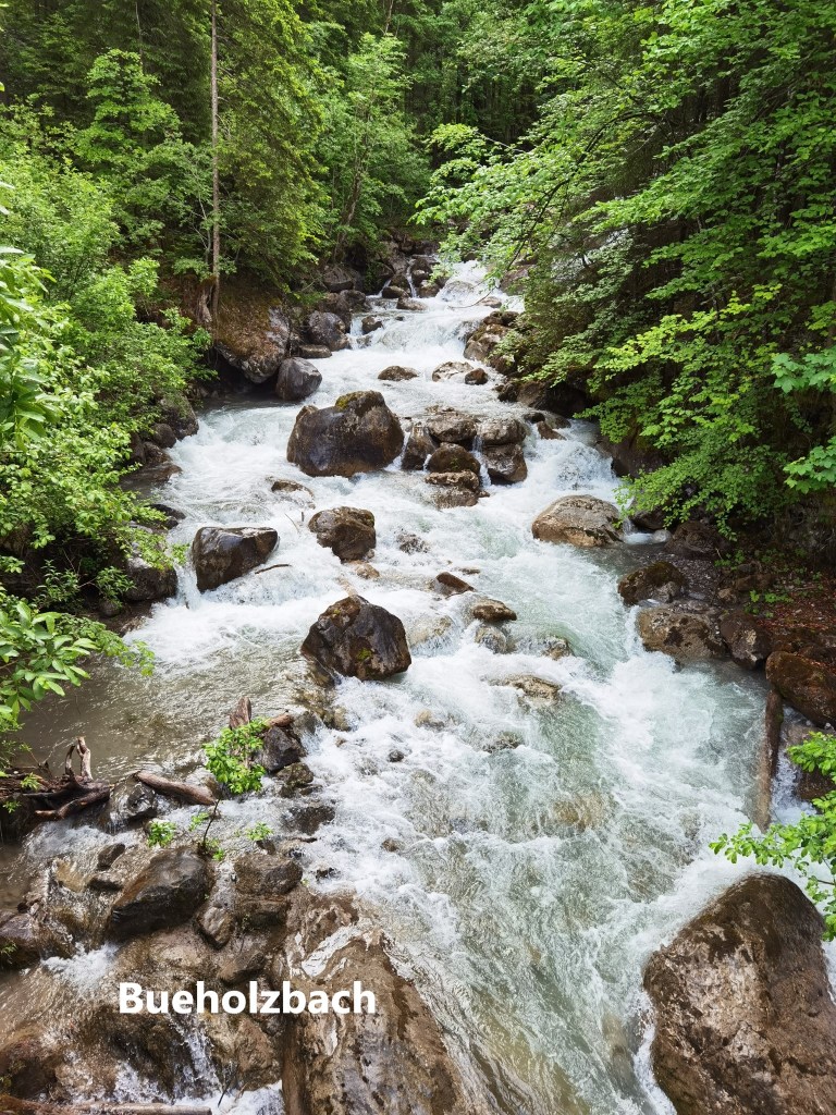
I left Stans quickly, passing the basilica, the “Death and the Maiden” statue, and on out to the St. Heinrich’s Chapel without stopping. That is where my route on this occasion diverged from that of my last outing. I headed southwards along a relatively flat trail towards Büren. It would be the last stretch of flat ground that I would see all day. I crossed the Engelberger Aa, and went through Büren. And then, after leaving Büren, the ascent began. I went up through the forest and crossed the Bueholzbach as it tumbles down over rocks and stones. And in the woods just past that stream, I was privileged to see a Black Salamander.
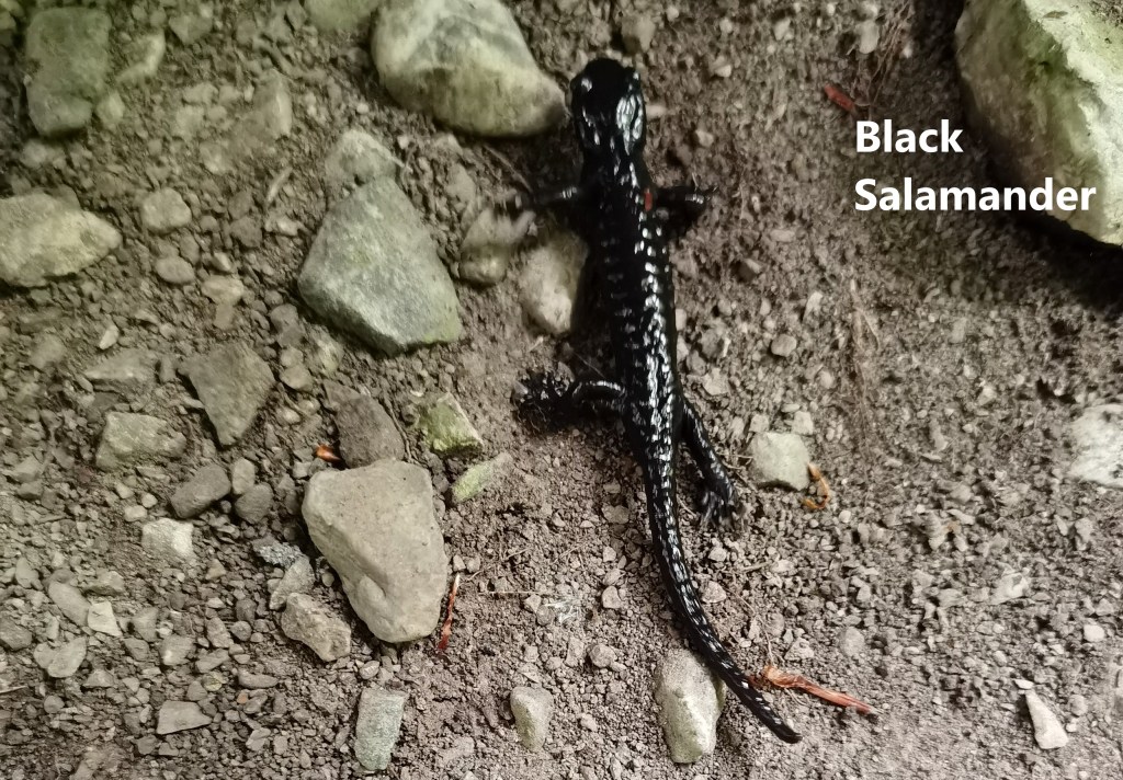
The Black Salamander, also known as the Alpine Salamander, is known to live in the mountains from the west of Switzerland to the Dolomites in the east. I had seen them before in Austria, in the Karwendel range. The come out after rain, and they are so prolific in the Karwendel that on a rainy morning, it is difficult to walk the trail without stepping on one. But in twelve years of hiking in Switzerland, I had never seen one. They tend to be in higher altitudes, above 700m, but this one was below 600m. Apparently, they don’t move very far, only about fifteen to twenty metres in a season. They are harmless, eating insects and spiders, so I left this little guy to do whatever he wanted and went on my way.
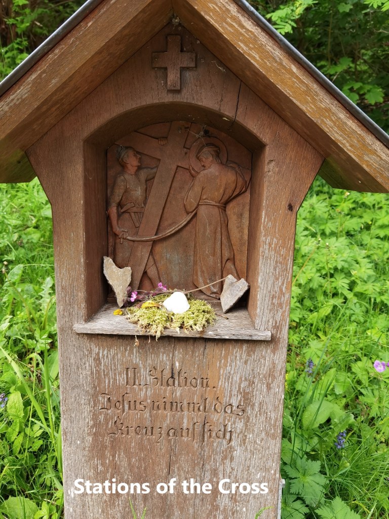
I continued on upward, eventually coming back onto to the road that leads to Hasenmatt. Along the road, there are the Stations of the Cross, that representation of the passion and crucifixion of Christ in fourteen stages.
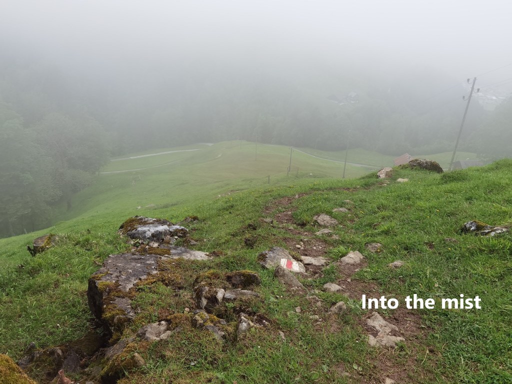
The route does not follow the road all the way, but takes short cuts, tackling the slope more directly than does the road. At Hasenmatt itself, I entered the cloud layer, and I would be in the clouds for most of the rest of the day.
A little way beyond Hasenmatt, I came to the village of Niederrickenbach. This tine village, with no traffic, has been a site of pilgrimage since the 16th century. The story is that in the spring of 1528, a young shepherd boy named Zumbühl from Büren in the canton of Nidwalden was tending sheep in the Haslital area of Bern. Nidwalden is a Catholic canton, while Bern had adopted the Protestant faith in the Reformation. The boy saw the burning of statues and images and rescued a statue of Mary with the child Jesus. He took the statue home with him at the end of the season. The next spring, when brought his sheep to the area of Niederrickenbach, he brought the statue with him, and placed it in a maple tree where he could treat it with due reverence. At the end of the season, he was unable to remove the statue from the tree. The statue could only be removed after a walled chapel was built around the tree. The story is commemorated in two stained glass windows of the church of St Mary in the Maple.
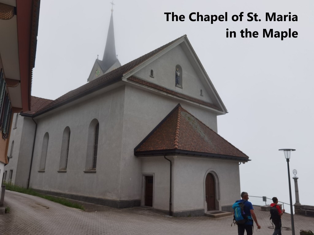

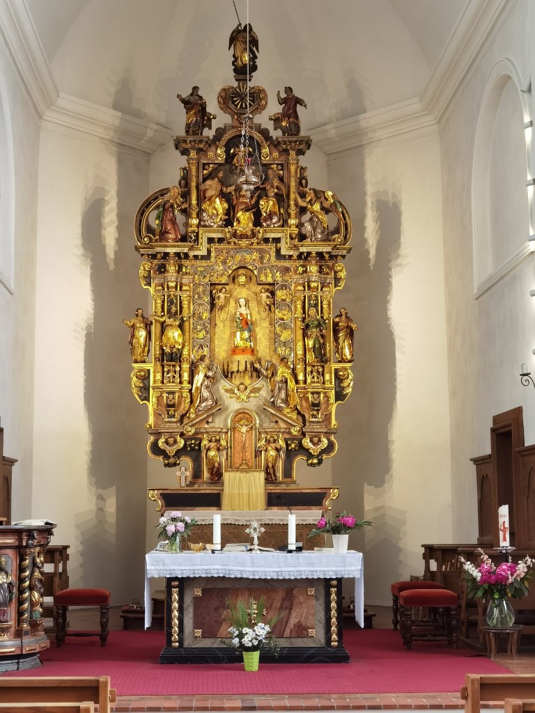
The first church was built in 1565, and was replaced by a later one in 1688. The current building dates from 1869. The richly decorated altarpiece still houses the statue that Zumbühl rescued centuries ago. The inside walls of the church are decorated with votive plaques going back to 1606. I must confess that while they are an interesting decoration, I could not understand many of them.
There is also a Benedictine convent in the village, specialising in the production of herbal teas. In the rich natural landscape around the village, there can be no shortage of alpine herbs. As I mentioned, there is no vehicular traffic in the village. There are some houses with families and farms close by. Apparently, the local children get to school in the valley by cablecar.
I did not stay long in Niederrickenbach but went on. The route continues to ascend, but more gently now. The mist was dense at this stage, but the trail was clear and well marked and I made it to Bärenfallen without difficulty.
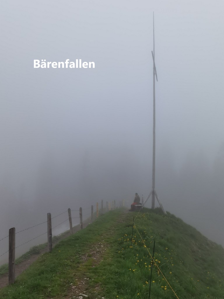
There is an easier way to get to Bärenfallen. Taking the cablecar from the valley to Niederrickenbach, and then another cableway to Musenalp brings you to 1755m, and it is actually downhill from there to Bärenfallen at 1579m. But a walker walks, and I had walked all the way up from the valley to this point.
There is a fork in the route at Bärenfallen. I had to get to the hut at Stafel, and I could either go by the direct route or by the Swiss Alpine Club house at Brisenhaus. The direct route is shorted, and with less ascent, so that is the route that I took.
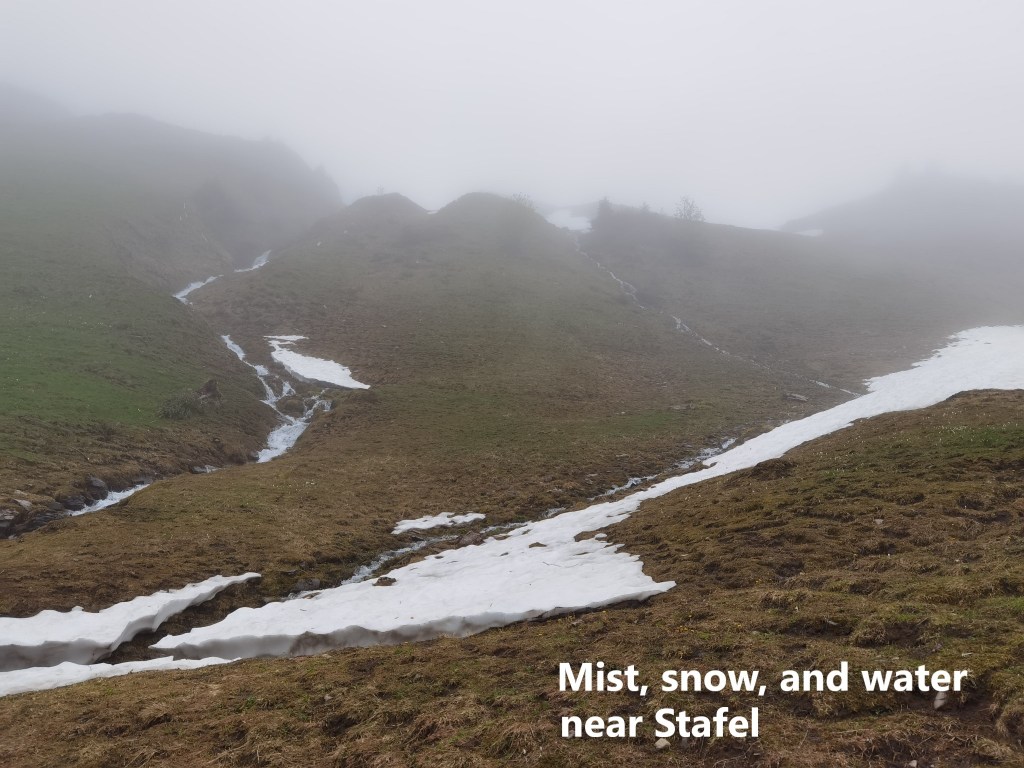
Bärenfallen is not the highest point on this section. The highest point is just a little further along at 1601m. The trail was covered in snow in places, but it was good firm snow and easy to walk on. But overall, it was easy going, and I soon reached the next fork in the route at Stafel. There, I was faced with the decision that I knew I would have to make at some point: whether to take the higher route to Hinter Jochli, or the lower route to Faulberg.
Having run into snow patches along the route from Bärenfallen, I knew I could expect significant snow between Stafel and Hinter Jochli, so I decided to take the lower route. The website said the route was blocked with avalanche debris, but I wondered to myself, how serious could it be?
And so I decided to take the lower route.
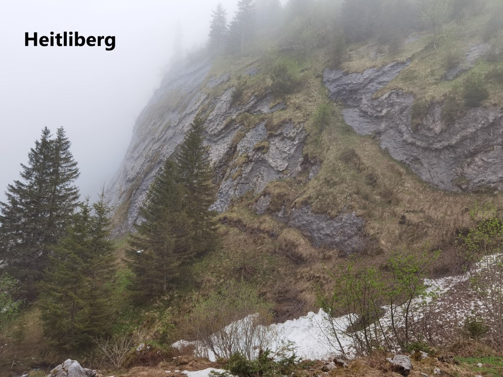
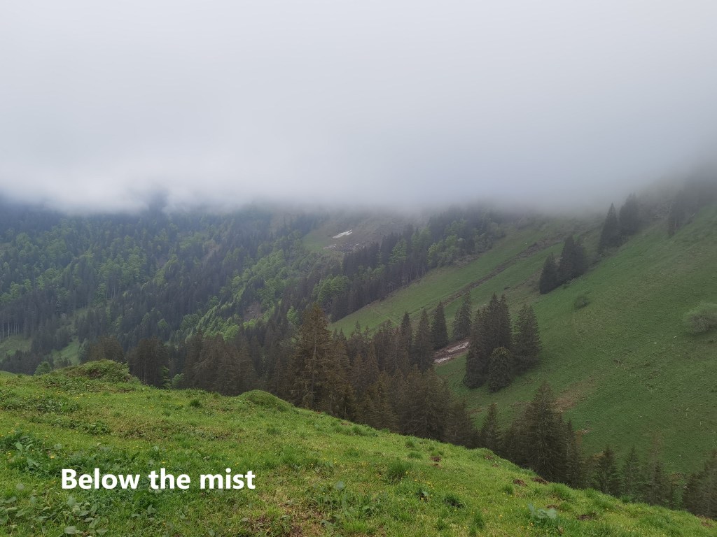
I went on down the trail, passing the cliffs of the Heitliberg on my right. This section of the trail was still open, as it is possible to go on down to a different part of the lake shore. I continued to take the right branch at each fork, coming down below the clouds. At the sedond fork was the point of commitment, and I decided to go on. After all, I told myself, the blocked section of trail was about two kilometres. It would have to be a mighty avalanche to block the entire distance, so one or more smaller avalanches were the probable scenario. And entering the blocked section, I found myself below the cloud layer, so at least that was one factor less to worry about.
As it happened, there were four blockages on the route, and they were of two types. The first type that I came to was where a mass of snow coming down the mountainside had strewn a mixture of snow, earth, and vegetation across the path. But surely, I thought to myself, they can’t consider that enough to block off the path.
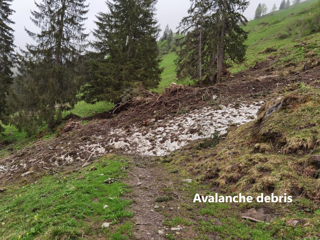
I crossed that one easily and went on. The second type was a little bit more tricky. In that case, a mass of snow had tumbled down a river gully, completely blocking the path. The lumps of snow were as hard as blocks of ice, though, and created a bridge over the stream where they had fallen. That meant it was possible, with care, to go across.
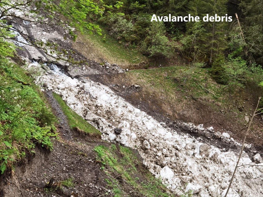
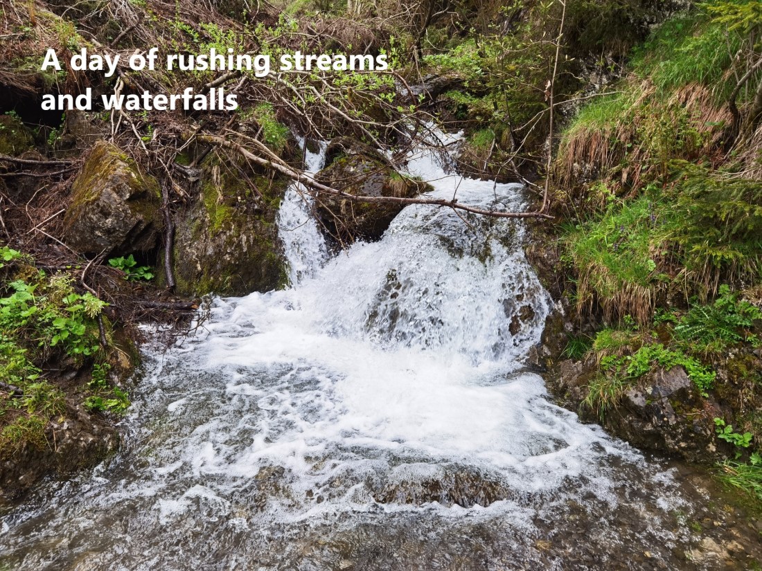
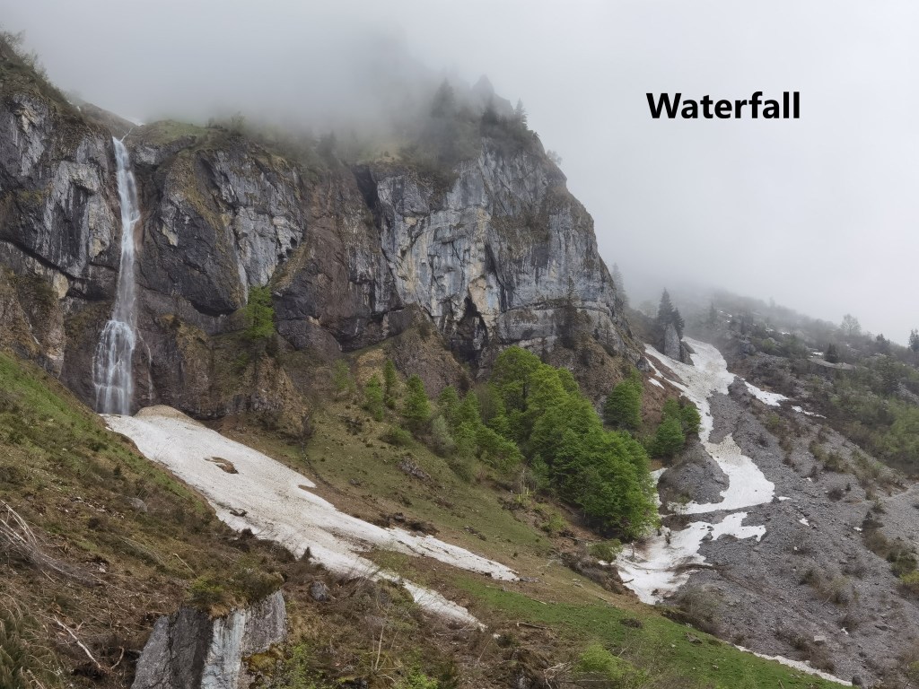
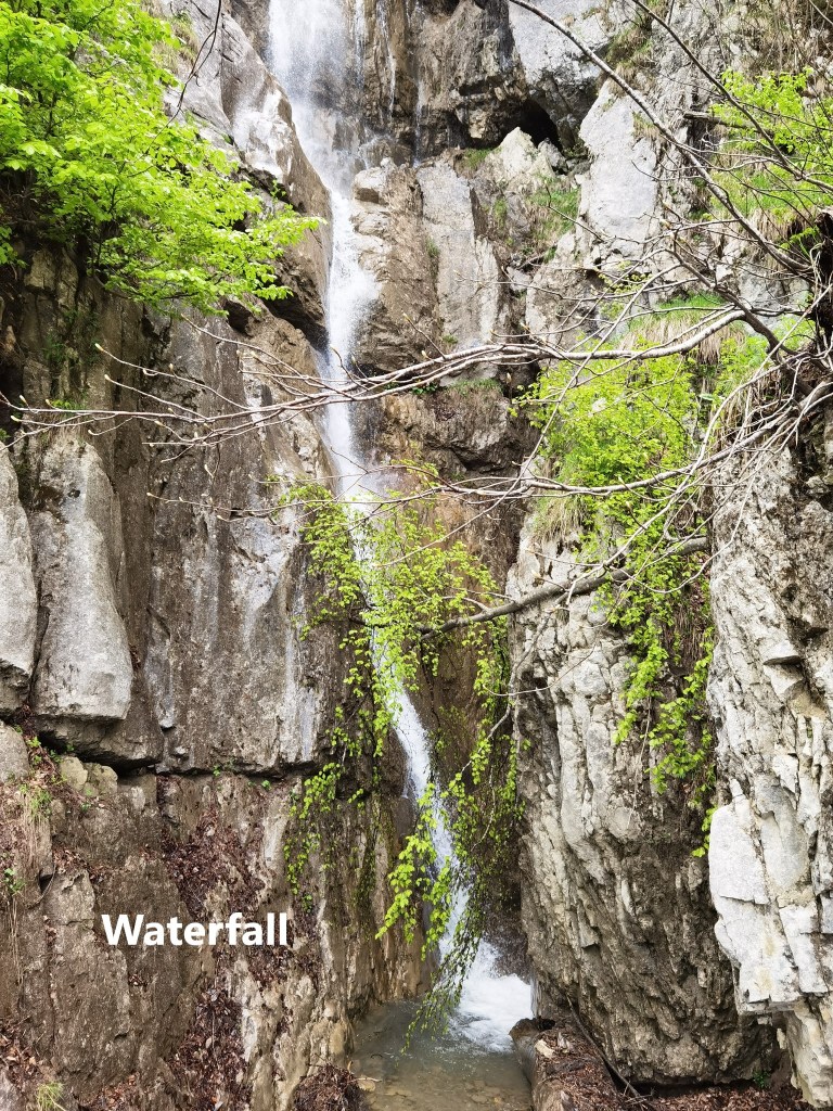
The third and fourth blockages were similar, and I got past them in the same way. I passed high cliffs and waterfalls as I went. I do not encourage anyone to do the same as I did. When the routes are marked as blocked, it is for a reason, and that reason is the safety of the hiker. I can only say that based on my experience and knowledge of my own capabilities, the risks were not excessive. And I was encouraged that in the parts where there was snow, I could see the footprints of others who had made the same decision.
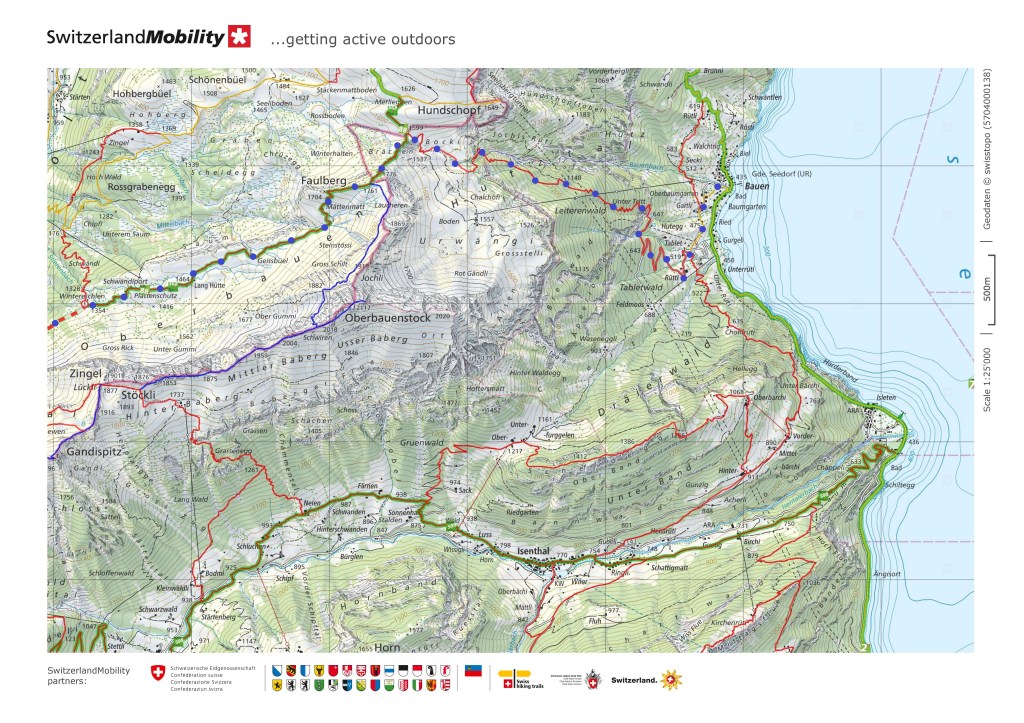
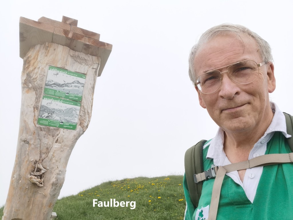
I came back onto the unrestricted section of the trail and started the ascent towards Faulberg. By now, my energy level was lower, and it was a slow progress upwards. But I got there, and reached the high point for the day at Faulberg summit, 1776m.
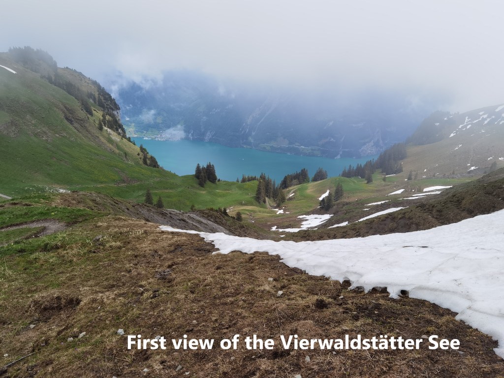
From there, it was downhill. The route descends quickly at first and levels out as it comes to the junction of trails at 1599m. Just above the junction, I caught my first sight of the Vierwaldstätter See below. Journey’s end. The more popular trail goes northwards to a cableway station, but my direction was eastwards. The descent to Bauen is steep, going down nearly 1200m in a horizontal distance of about three kilometres. Most of it is in forest, so I soon lost sight of the lake again. There were places where the trail managers had placed fixed cables, such is the steepness. And at times, on the muddy floor of the forest, it was easy to lose one’s footing. But I managed to stay upright. I crossed several streams, in one case the trail going within the spray distance of a waterfall.
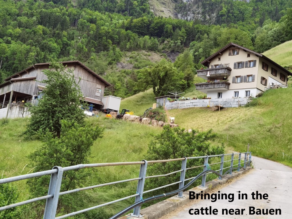
I came to farms above Bauen just as the farmers were bringing in their cattle. End of the day, and a good time to be finishing the route. When I reached the harbour area, I was too late for the local restaurant, but with the ferry coming in a few minutes that didn’t matter.
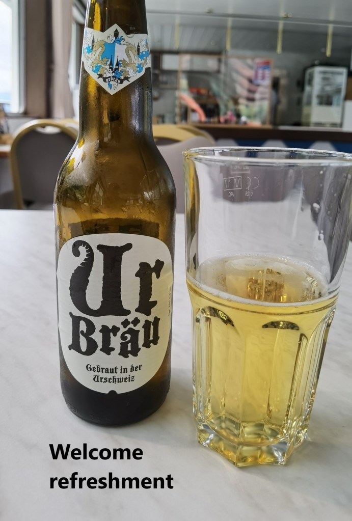
My vessel this time was the Weggis, built in 1990, she is more modern and not as interesting as the ship from the last time, but I was able to get a very welcome beer. And so I said goodbye to the Vierwaldstätter See for now.
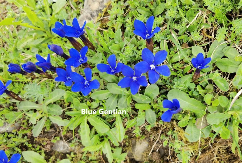
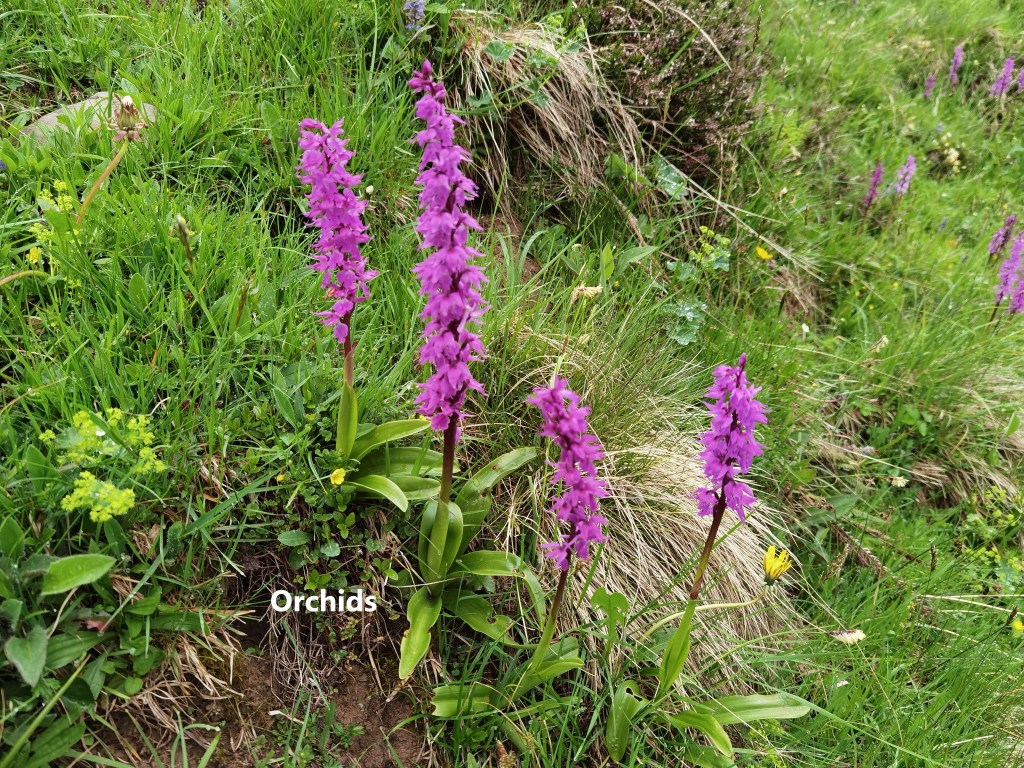
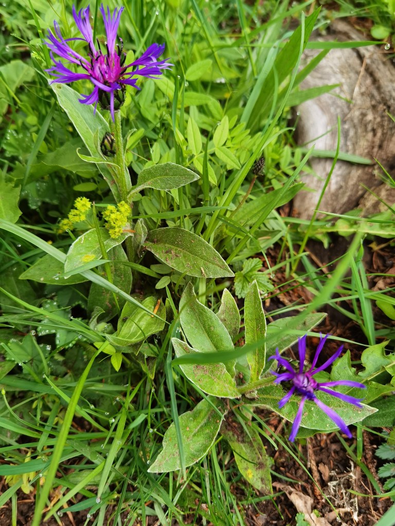
One of the abiding memories of this walk will be the flowers. In spite of the mist, it is possible to appreciate and admire the flowers on the mountain: Gentian, Orchids, and others whose names I do not know.
On the map, this route looks shorter than the standard Trans Swiss Trail route, but I believe that it is in fact longer. It took me about almost two hours longer in time. I don’t know the exact distance, but whereas the last outing was 50,489 steps for the entire day, this one was 57,003. The additional 7,000 steps accounts for one hour, and the effort in so much ascent accounts for the second hour. The conclusion is that this is a longer and tougher route than the standard trail route. But I am glad to have done it and the trail goes on from here.
I usually mark my route on the maps with red dots, but the maps already have so much red that I used blue on this occasion.