
“Winter is coming”. The phrase is most closely associated with the popular novels and TV series of Game of Thrones. But in the days after my last outing on the Trans Swiss Trail, it seemed as if winter had returned to Switzerland. In Basel, there was snow visible on the hills around the city, and I read that the Feldberg in the Schwarzwald (Black Forest) is also under a cover of snow.
Finishing the last stage at Bumbach had left me with something of a dilemma. For this next stage, I could either just go the short distance to Sörenberg, or I could take in a complete extra stage according to the guidebooks, and go all the way to Giswil. My natural inclination was to go all the way to Giswil, but with the uncertain weather, I wasn’t so sure. I made plans to go all the way, but looking at the escape routes, so that if I found myself in difficulty, I could always leave the trail and come down to lower and safer ground.
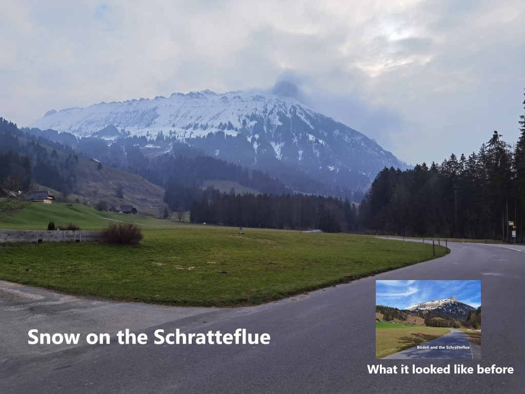
When I arrived in Bumbach at the Bödeli bus stop, it was clear that the snow would be much more plentiful than it had been on my last day‘s hiking. The Schratteflue looked like it had significantly more snow than the last time.
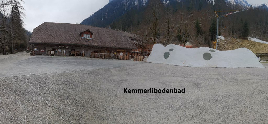
So it was with some nervousness that I crossed the river and set out on the trail. And as I went, my natural optimism returned. I was making my way on a clear trail through woods and meadows. There was, at this point, nothing to give me undue concern. Walking quickly, I soon came to Kemmeribodenbad. There is an activity centre there, and it looks like a popular spot for walkers. In the parking lot, they had piled up snow and made snow caves in the pile.
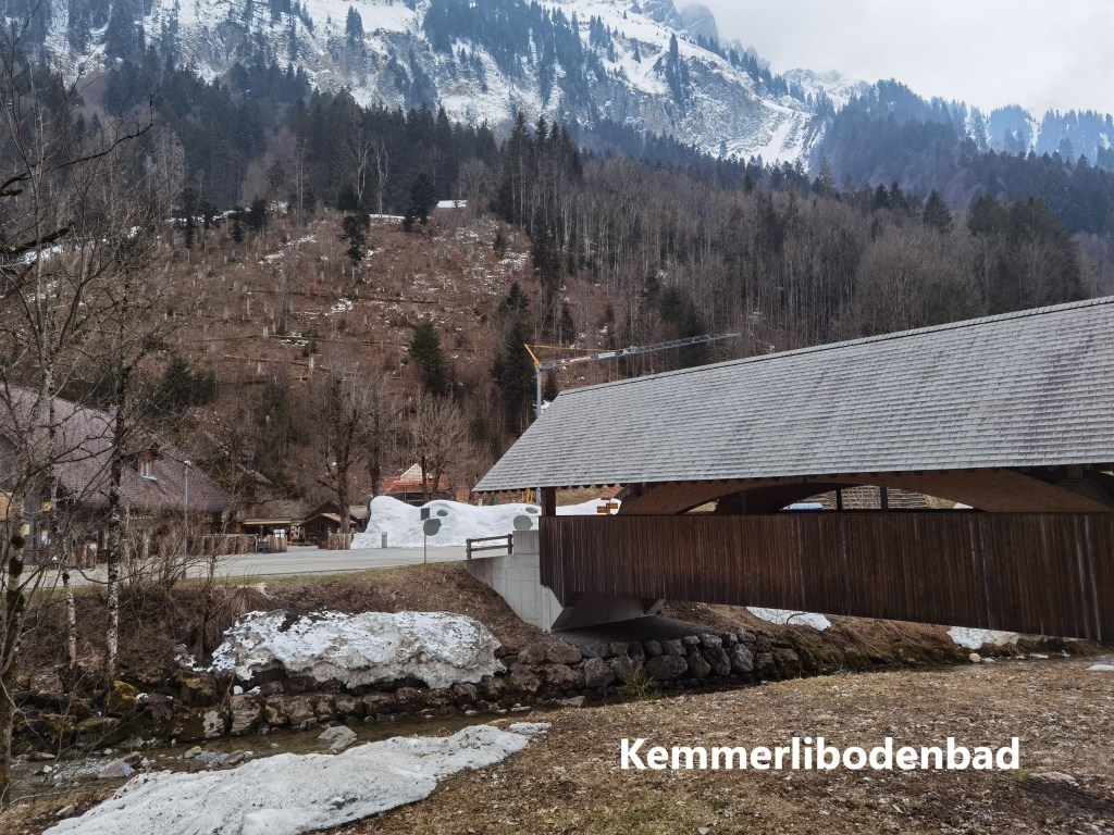
I crossed back over the river on a covered wooden bridge. This would be last one to see in Bern canton. Ans then I left the river and the road and started up the hill. I was finally leaving the valley of the Emme, a river that had dominated my walking for the last few stages.
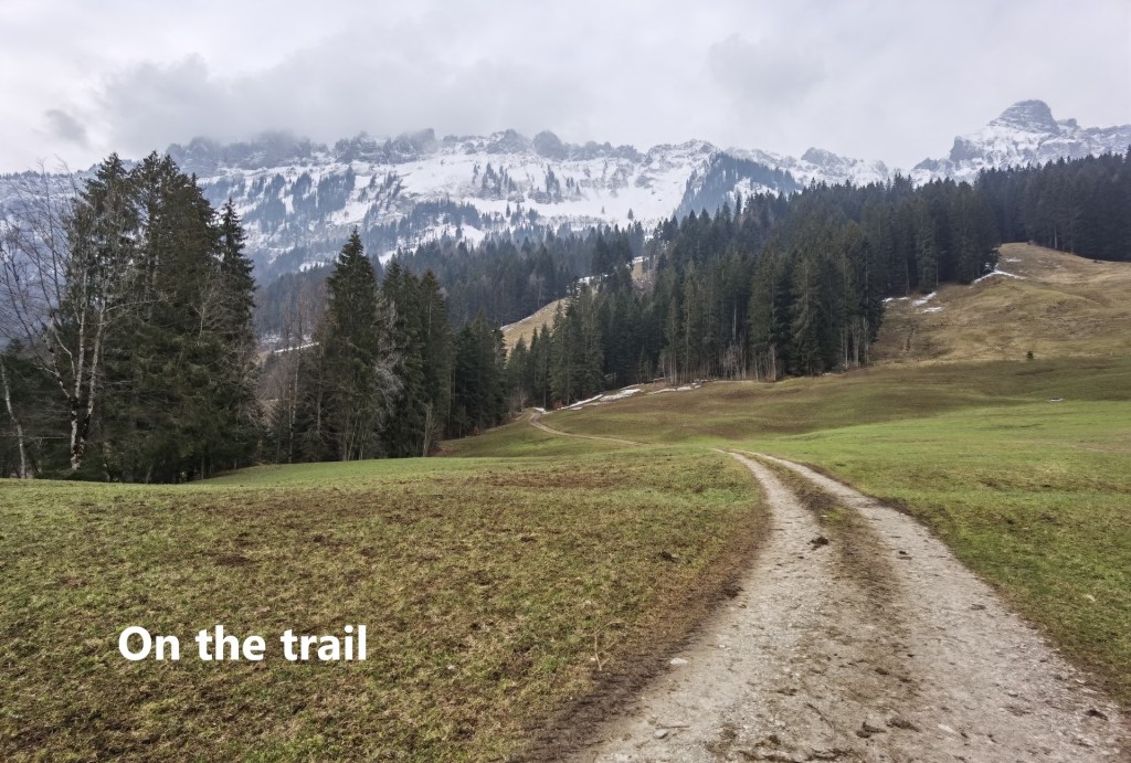
The route went up through the forest, not too steep, but not too easy either. I passed two other walkers, the only walkers that I would see in the entire day. It did not take long until I came out of the forest close to the 1100m contour. The track levels out a little then, and though still going upward, it was easier on this piece of the track.
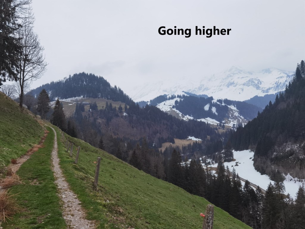
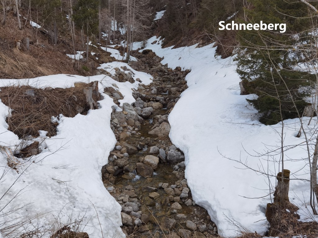
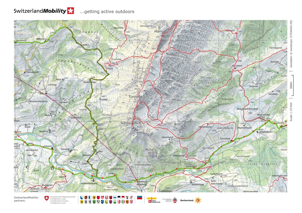
All the way to the farm at Schneebergli, I had great views of the valley below. The tree line in Switzerland is at about 1400m, but once you get to 1200m, the trees thin out and become less frequent. Once I was past Schneebergli, I was into that zone, and there were lots of open areas of mountain pasture all the way to Schneeberg itself. Or perhaps I should say that there would have been plenty of open areas of mountain pasture but for the fact that there were a great many patches of snow.
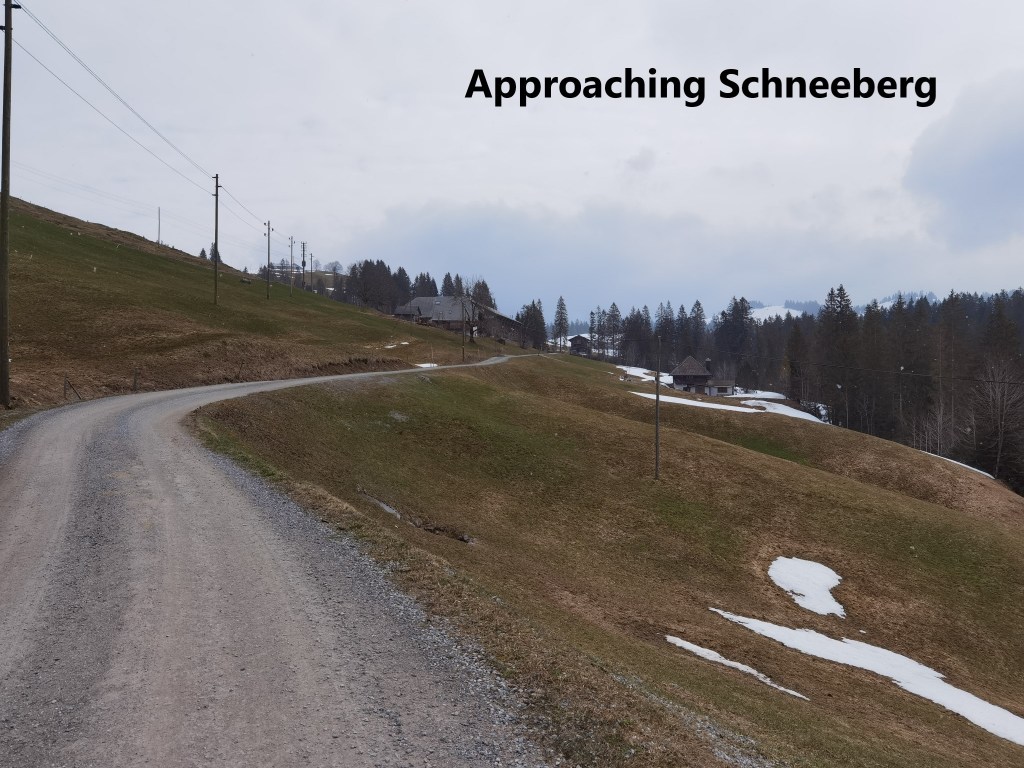
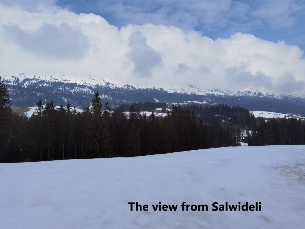
After Schneeberg, the route is almost flat as far as the holiday chalet village of Wagliseiboden. This far, the route had all been on good mountain track, almost completely free of snow, and easy to follow. But at Wagliseiboden, the track leaves the road and the ascent to Salwideli was all in snow.
After Salwideli, the route follows the road for a short distance and then goes back into the snow. It is worth saying a few words about snow at this stage. There are many different kinds of snow. From my homeland in Ireland, I am well used to the wet snow that does not last long and soon turns to slush. Coming through the Jura mountains on the earlier stages of the Trans Swiss Trail, I was well used to the powder snow that swallowed my legs up to the knee at every step. But the snow on this section of the trail was different. In some places, where vehicles and skiers had been, it was packed snow, firm and good to walk on. In other places, it was as if the snow had melted and refrozen, before getting a light coating of fresh powder. The hard crust of frozen snow was also good to walk on. And so I had good walking conditions up onto the hill at Husegg. This is the highest point on this section of the walk, at 1446m. And on the way up, I had great views to the west and north: mountains and clouds, with the clouds like something out of a Paul henry painting.

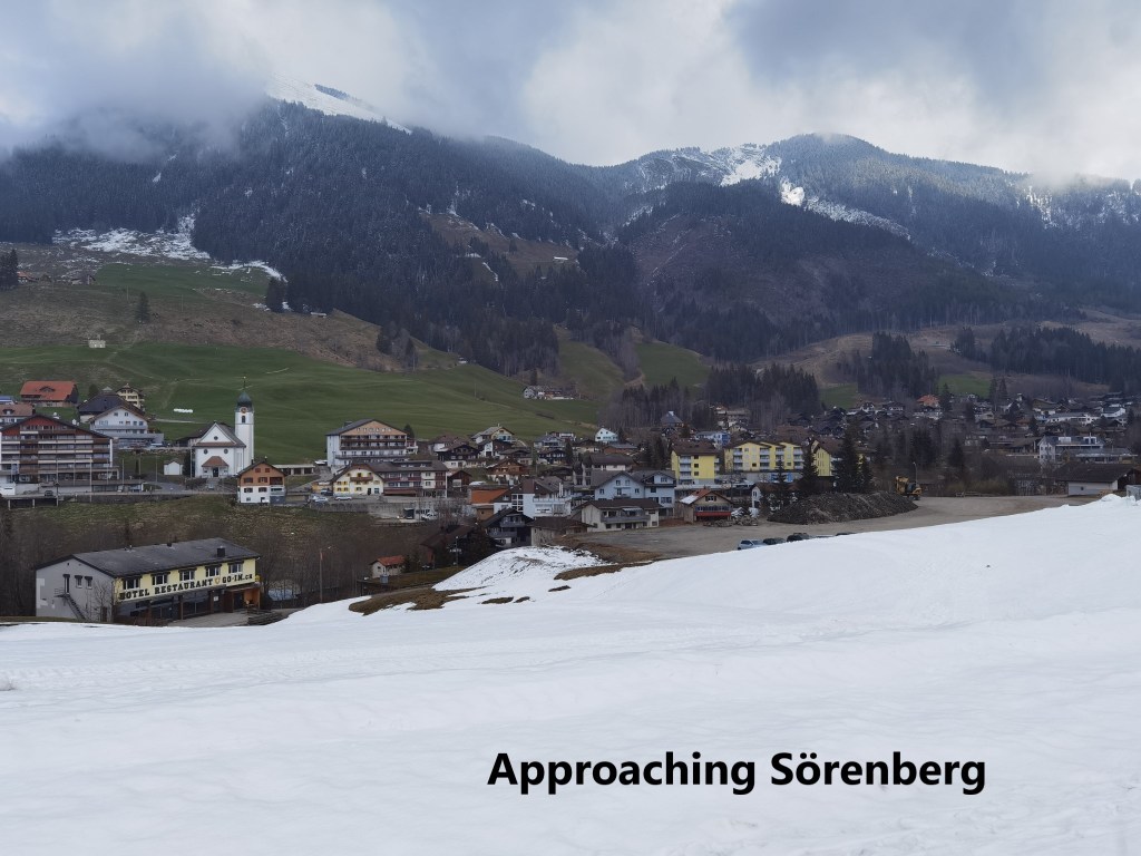
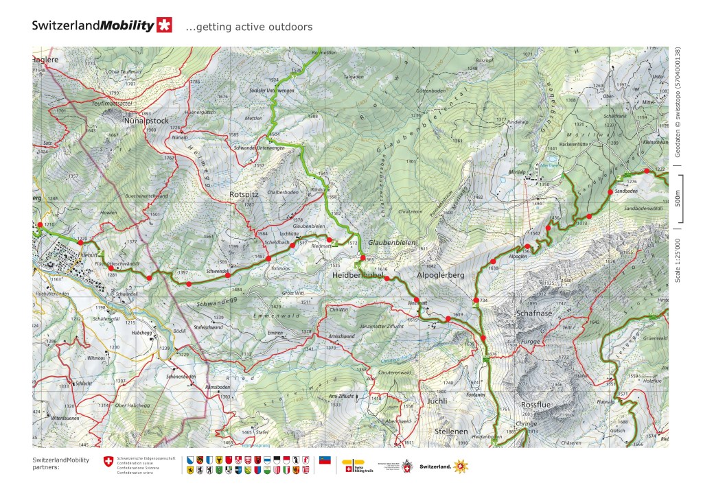
From Husegg, the trail descends. It is a slow descent at first, until it meets a skilift, and then the descent is more rapid, going almost straight down to the little town of Sörenberg. Sörenberg is one of those towns and villages that live on a winter tourist economy. It has chalets and apartments that I reckon are only occupied in winter, and the area around is dotted with skilifts and cable cars. But importantly for me, it was where I had set the decision for whether to go all the way to Giswil or stop here at Sörenberg. I reckoned that if I got to Sörenberg by one o’clock, it would be worth going on, but that if I was later than that, I should stop. As it happened, I reached Sörenberg a few minutes before 12:30, so I would definitely go on.
In Sörenberg, I found one of those signpost peculiarities that I thought only existed in Ireland. A signpost said it was 4 hours 25 minutes to Giswil. A little further on, another signpost said it was 4 hours 30 minutes to Giswil. It was as if I had lost five minutes somewhere. As it happened, both were wrong. In the conditions that lay ahead, it would take more than 5 hours to get to Giswil
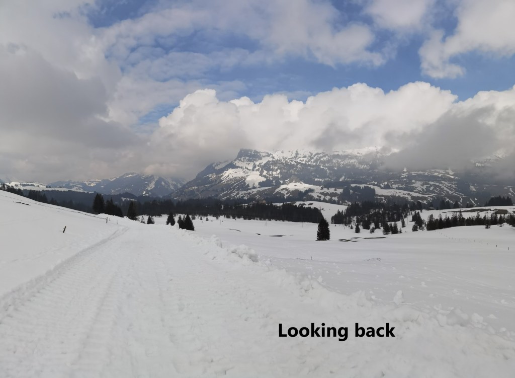
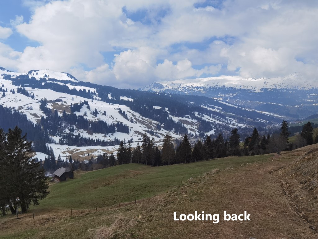
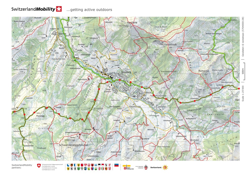
I did not hang around but headed straight on up the trail. It didn’t take long to get back on the higher ground, where I had great views back to Husegg and the way that I had come. To the south, the view was a little more ominous, with mist coming in over the cliffs on the other side of the valley. A little further on, I could see some of the highest parts of the walk. My route would take me to the Glaubenbielen Pass, where the road goes over the mountains from Luzern canton into Oberwalden. Then, I would have to go south for a little bit, before turning north and east to take the saddle between Alpoglerberg and Schafnase


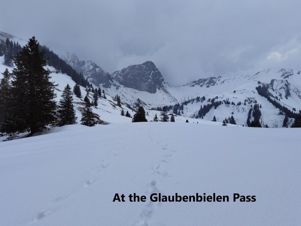
By the time I passed the 1400m contour, the patchy snow was becoming joined up into larger snowfields. Once I was above 1500m at Schwendell, it seemed like everywhere was covered in snow, with only occasional glimpses of bare ground. The route was following some kind of track, but the track itself was nowhere to be seen. Only the fence posts along each side showed where the track was going. Following where the track should be, I came to the Glaubenbielen Pass. The pass was entirely under snow. Sticking out of the snow was a bus stop, showing that this is a popular spot in the summer. There were picnic tables as well. But there would be no busses today. The busses only come in summer, and I had no time for a picnic in the snow.
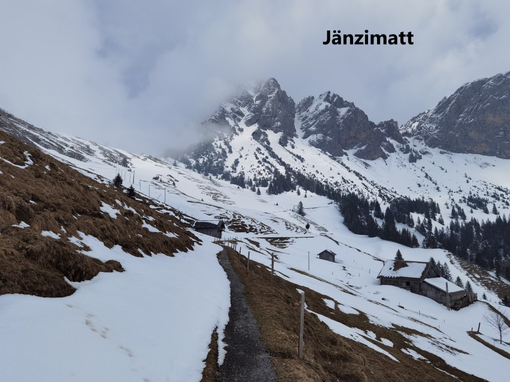
I went on from the pass, over a small rise, and then the settlement at Jänzimatt came into view. I expect that in summer, this is actually a small village of several houses, and even a church. But in the snows of winter, the village was abandoned. The farmers bring their cattle here in summer, and some of the houses even had signs advertising the sale of home-made cheese.
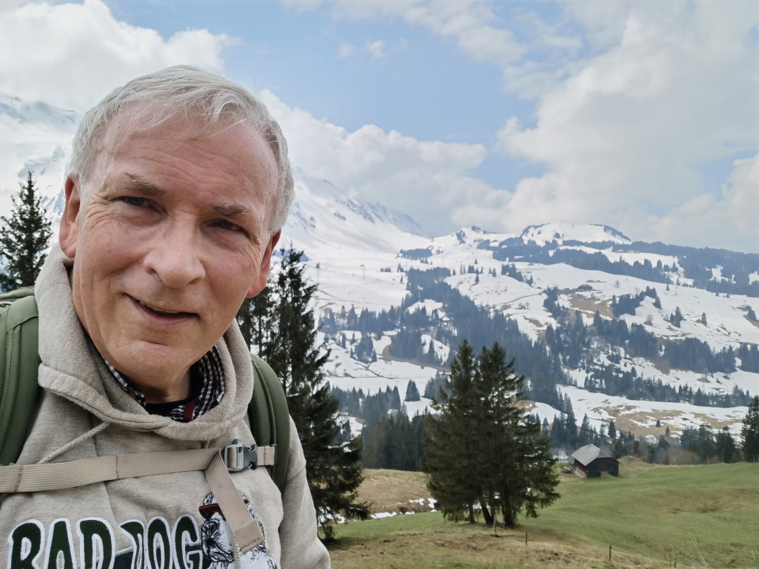
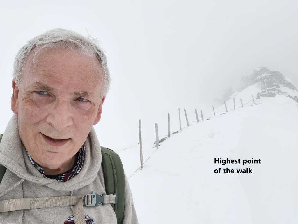
Looking to the heights, I could see the mist rolling in, getting progressively more dense. I wasted no time but continued on southwards before doubling back onto the north-eastern route to the saddle between Alpoglerberg and Schafnase. By the time, I reached the saddle, I was surrounded by the mist, with flurries of snow as well. I took just enough time to make a selfie to record the moment at the highest point of the walk, 1734m.
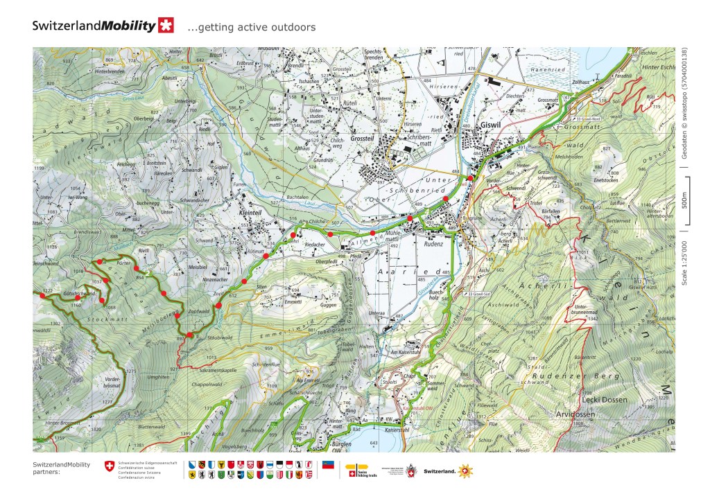
Then I went on, now on the eastern side of the mountains. In the mist, with almost white-out conditions, I had to concentrate on navigation. Following a track that was hidden beneath the snow, with visibility down to a few metres, made the going difficult. But as I went further down, the mist became less dense. By the time I got to the 1400m level, it was clear. I could see farther, though under dark clouds. I continued downwards, and into a forest. Eventually, I got my first sight of the day’s destination: Giswil and the Sarnersee.

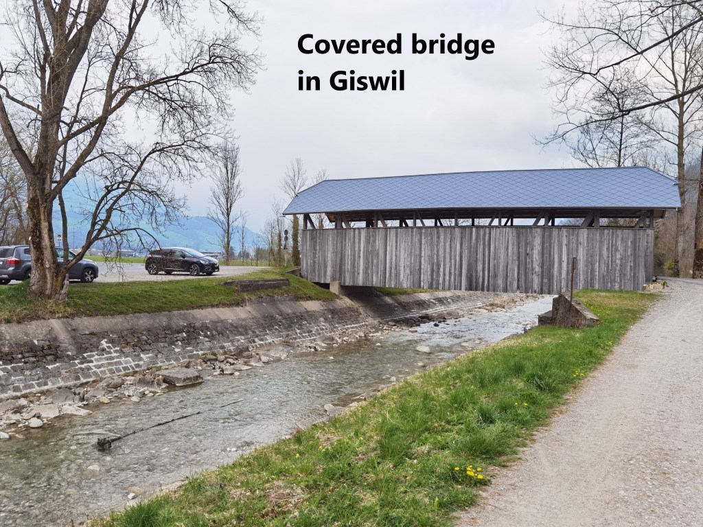
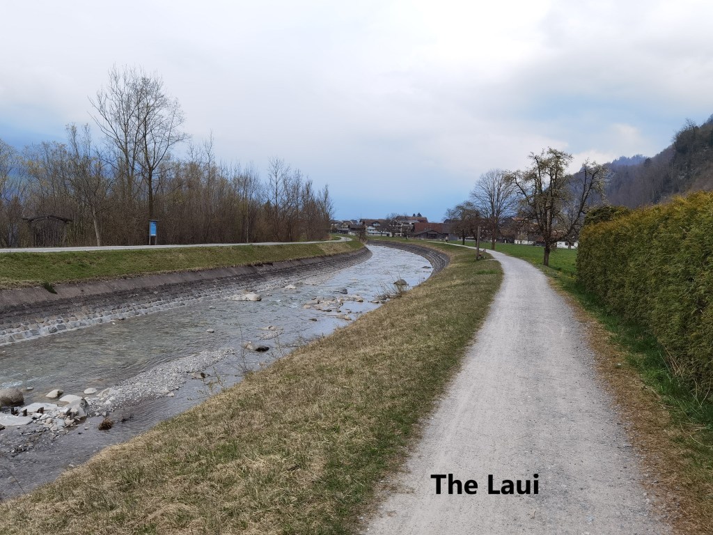
The downward route continued, and I eventually came to fairly level ground. This was the valley of the Laui river, a relatively small river that flows into the Sarnersee. My route followed the river, and I soon came to a covered bridge. This Oberwalden, and the bridge is very different from those of the Emme valley in Bern canton.
I came to the station at Giswil, where there is a statue of Ruedi Ryman. A native of the town, he was a singer, with one of Switzerland’s most popular records ever credited to him. Titled “dr Schacher Seppli”, it was an adaptation of a traditional song. The record got gold disk status twice over, a rare thing in Switzerland.


For me, Giswil was the end of the walk. I walked a total of 57,716 steps that day, much of it through difficult conditions.
I have now walked sixteen of the thirty two stages of the Trans Swiss Trail, covering 265km, more than halfway on the number of stages, and on distance. And I have ascended a total of 8000m and descended 7890m. Quite a bit done, but much still to do.

Incredible great walk – I know the area a bit and under these conditions not easy – congratulations, you must feel great! And already 16 stages done in April 🙂
LikeLike