After such good weather and a great walk on my last outing, I was determined to get one more piece of the trail done during the long Easter weekend. The weather forecast indicated deteriorating weather in the week ahead, , but at least the Monday looked good.
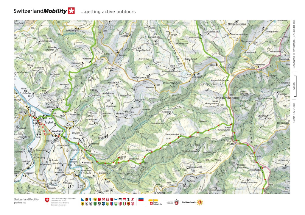
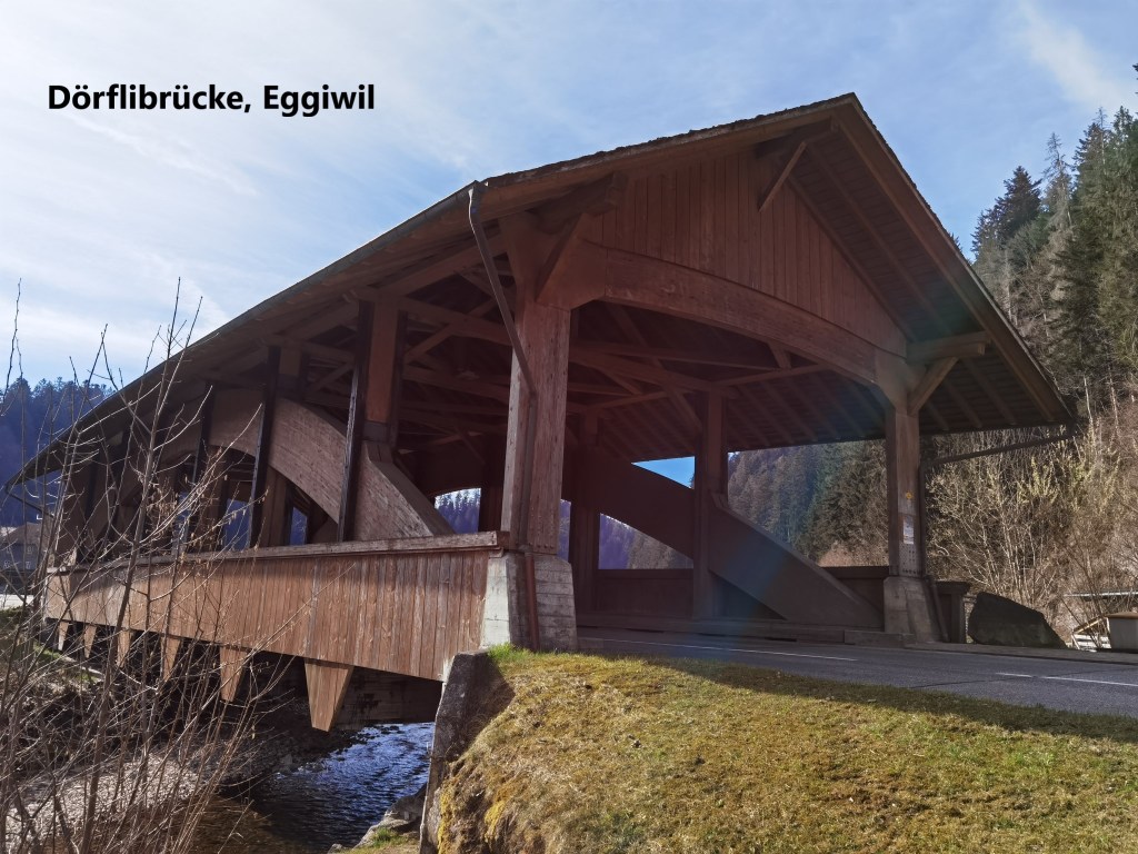
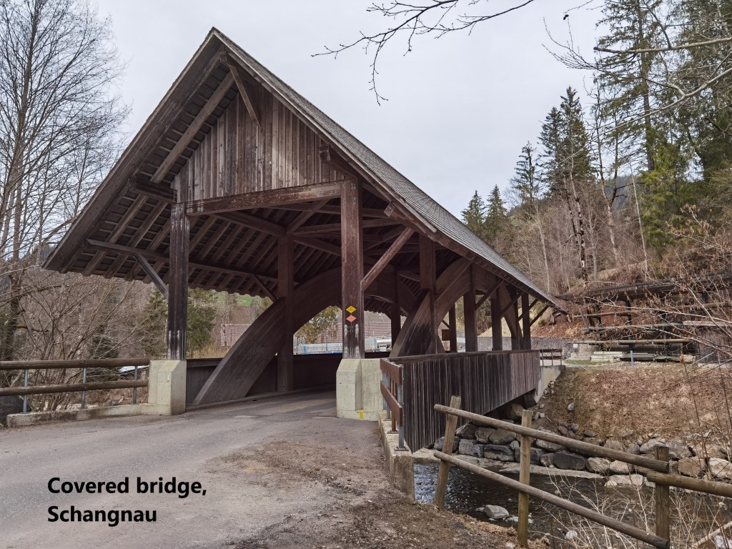
Thus it was that Monday morning had me on the way back to Eggiwil to go walking again. The trail is taking me farther from Basel now, and the villages are more remote, so I didn’t get to Eggiwil until nearly ten o’clock in the morning, with the sun already well up and day advanced. I walked back the road a little to the Dörflibrücke, to make that the start of my walk.
The Dörflibrücke is a wooden covered bridge that was built in the nineteenth century. There had been a ford in the Emme at this location, but in times of high water, it was dangerous. The proposal to build a bridge came in 1827, but necessary adjustments to the course of the river, and the great flood of 1837, both delayed the project, and the construction only began in 1839. It was 1855 when the bridge was successfully completed. The bridge had to be renovated and strengthened in 1936, but then was completely rebuilt in the 1980s. One might expect that it would have been replaced by a much more modern structure at that point, but it is part of the Emmental heritage, and so the covered bridge style remained.
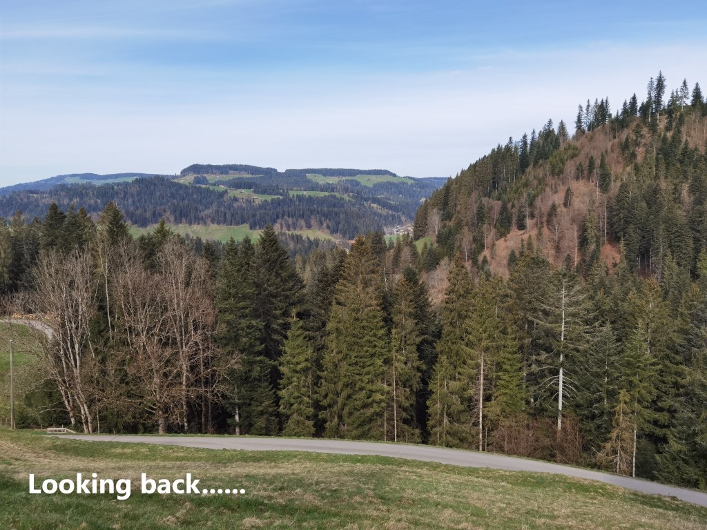
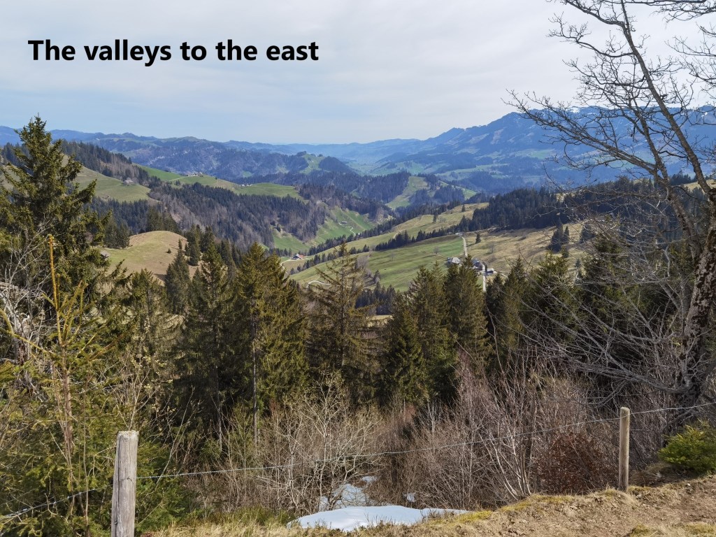
From the Dörflibrücke, I went back through the village and on up the valley beyond. The route initially stays parallel to the river, but soon leaves it, at first to follow the Geissbach stream, and then to ascend the ridge on the northern side. It is a steep enough ascent on a forested hillside, and I will readily admit that I was out of breath when I came out into the sunshine on the ridge above. There were magnificent views back to the Emmental, and even if I had not had to pause for breath, I would have paused anyway for the views.
However, the ascent did not stop when I came out of the forest, it only got a little less steep. But continuing upwards, it wasn’t long before I got a glimpse of the Hohgant ridge to the south. At first, it was just a faint line above the other side of the Geissbach valley, and then becoming clearer and more magnificent as I went higher.
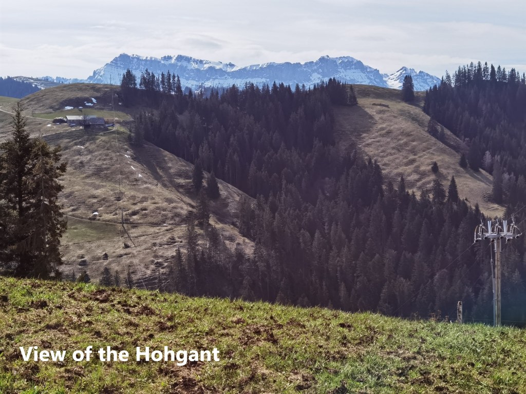
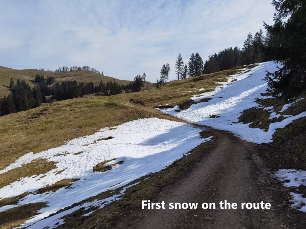
Going higher still, the route levels out to become a very gently ascent indeed, and I made good time. It was somewhere about the 1000 metre contour that I came across the first patches of snow. But it is old snow, existing only in the shaded areas on the north side of the crest, where the sun and rain have not yet reached it. And all the way along this part of the route, the Hohgant was prominent on my right.
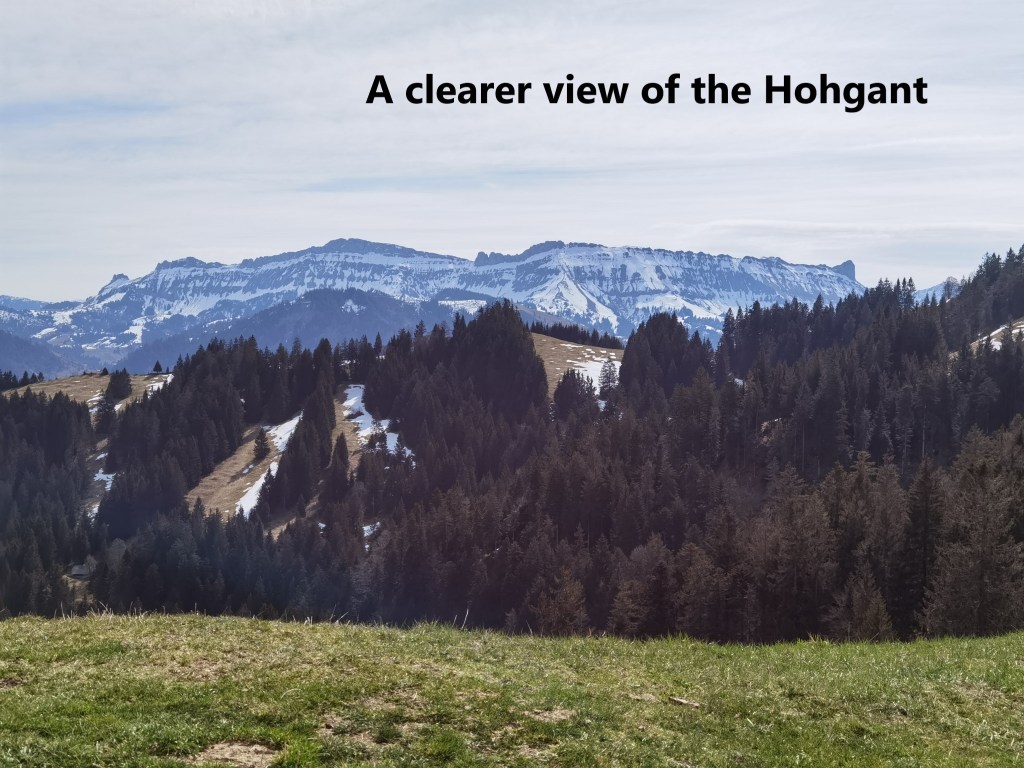
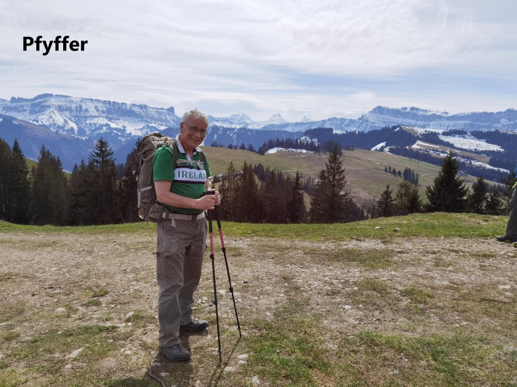
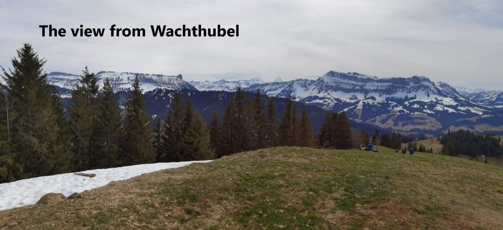
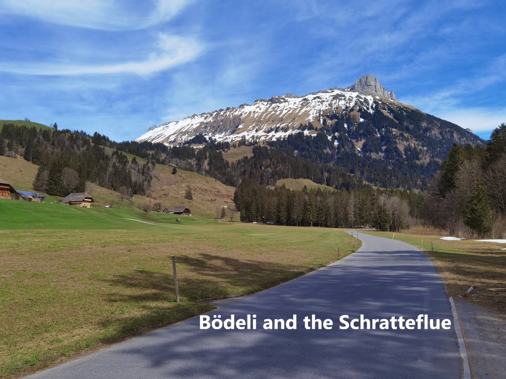
At Hinterrämisgummen, the Trans Swiss Trail meets another trail, the Grenzpfad Napfbergland trail, and both go south from there. To the east, is only a steep descent to the valleys, and following the ridge is the logical way to go. There was still a short ascent to reach to waymark point at Pfyffer, and that is where the whole vista to the south becomes clear. On the right is the Hohgant ridge. On the left is the Schratteflue. And in the middle, away in the distance, is the Finsteraarhorn, the highest mountain in Bern canton.
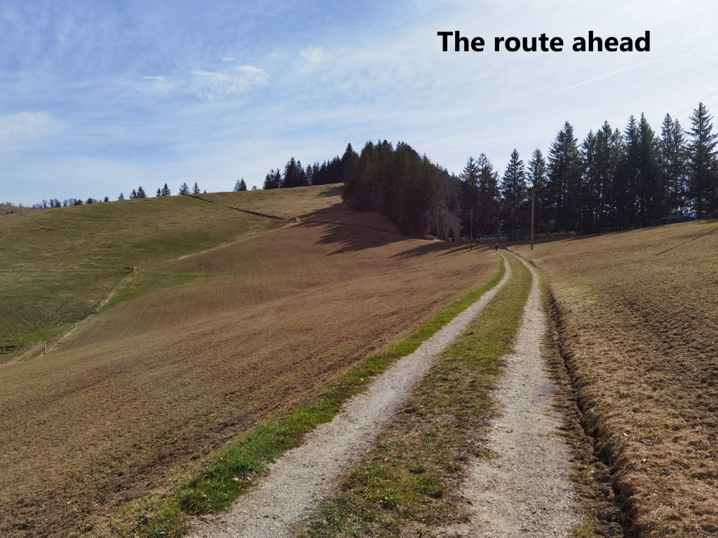
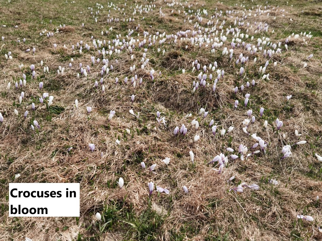
The upland pasture on the route south from Pfyffer was dotted with crocuses. I suspect that the snow has only recently cleared, and these flowers, belonging to February in places like Basel, are only now getting the chance to blook up here. Eventually, after a long easy, almost flat, stretch of walking, I had a short ascent to reach Wachthubel, which at 1414 metres was the highest point on the route that day.
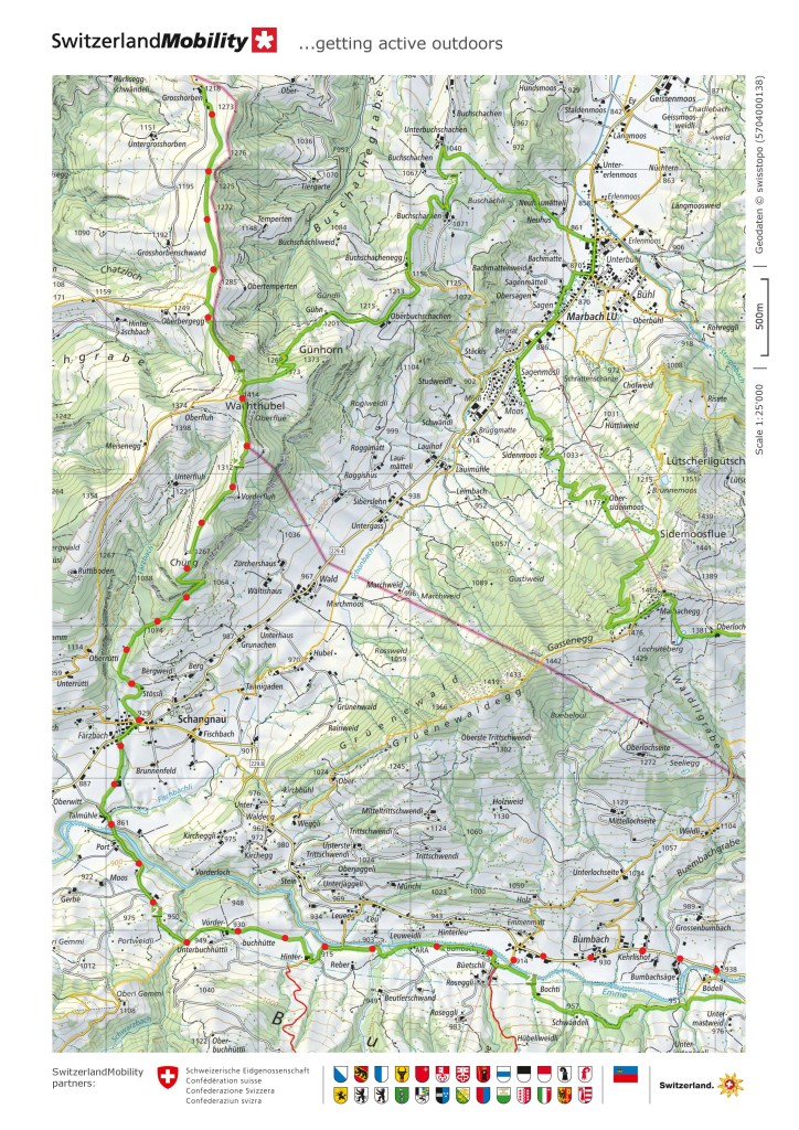
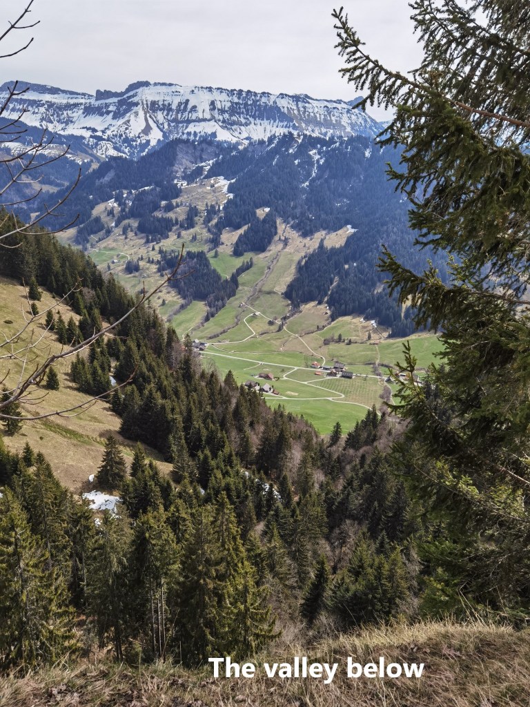
The peaks to the south were nearer now, and clearer than ever, but my route went down into the valley in between. It is a fairly steep descent, not difficult though, and sometimes offering views of the valley. In the descent, the route twists and turns, and it took longer than I expected to reach Schangnau.
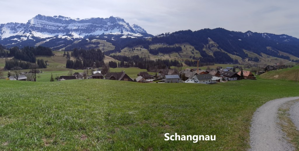
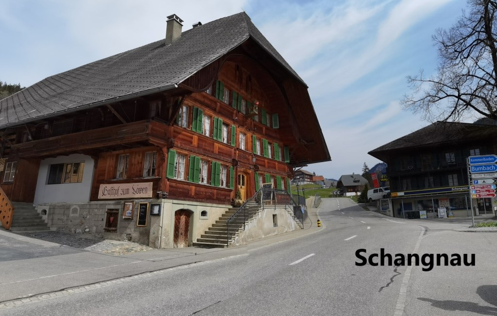
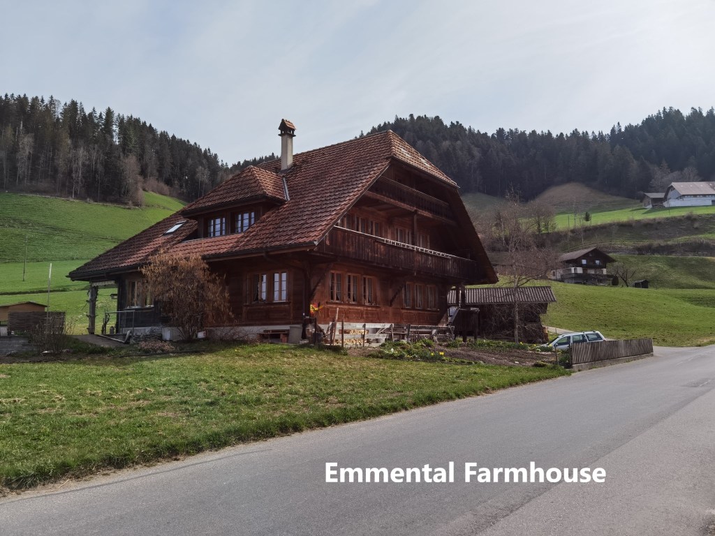
Schangnau is first mentioned in documents from the year 1309. The settlement and the lands around were owned by a group of knights in feudal service. Later in the fourteenth century, they sold the village to a local nobleman, whose descendants in turn sold it to the canton of Bern in 1420. The area has always been agricultural, and without rail connections, Schangnau stayed that way. Even in the twentieth century, more than half the employment in the area is connected to agriculture.
It is a small village, with a nascent tourist industry, but in these troubled times, there are no tourist facilities open, so I went straight through and down to the Emme. My route crossed the river and ascended the bank on the other side.
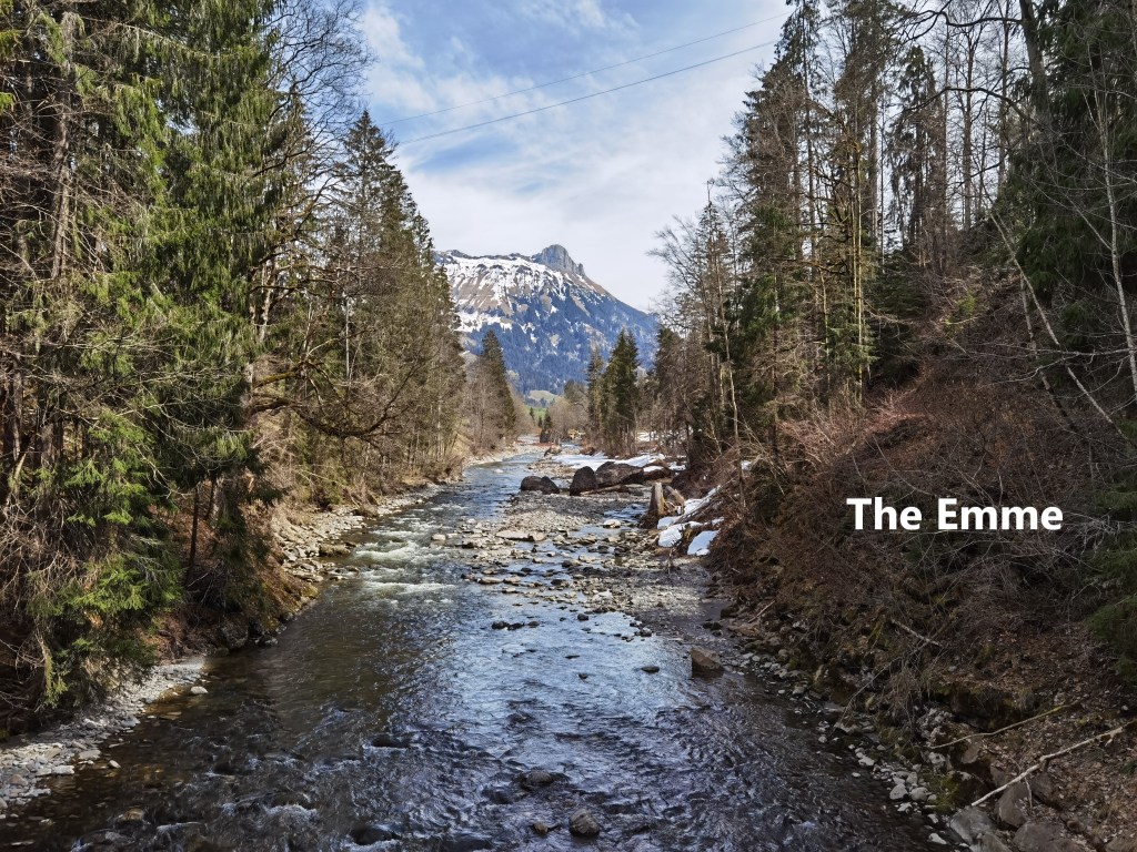
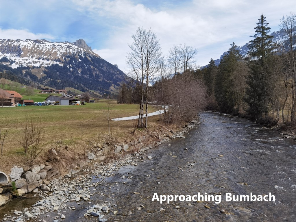
This is farmland, and the farmers were out spreading the manure from their cow barns, giving a distinctly agricultural aroma to the walk. The route stays close to the river. If the Emme back at Lützelflüh was the mature adult, then here above Schangnau, it is the teenager predecessor. At Lützelflüh, it is as if the river knows its own strength, and can afford to be gentle, but in this valley above Schangnau, it shows signs of erratic behaviour. While it was gently when I was there, the boulders strewn along its course showed that it has the power to tear rocks from the mountains and bring them down in the floods.
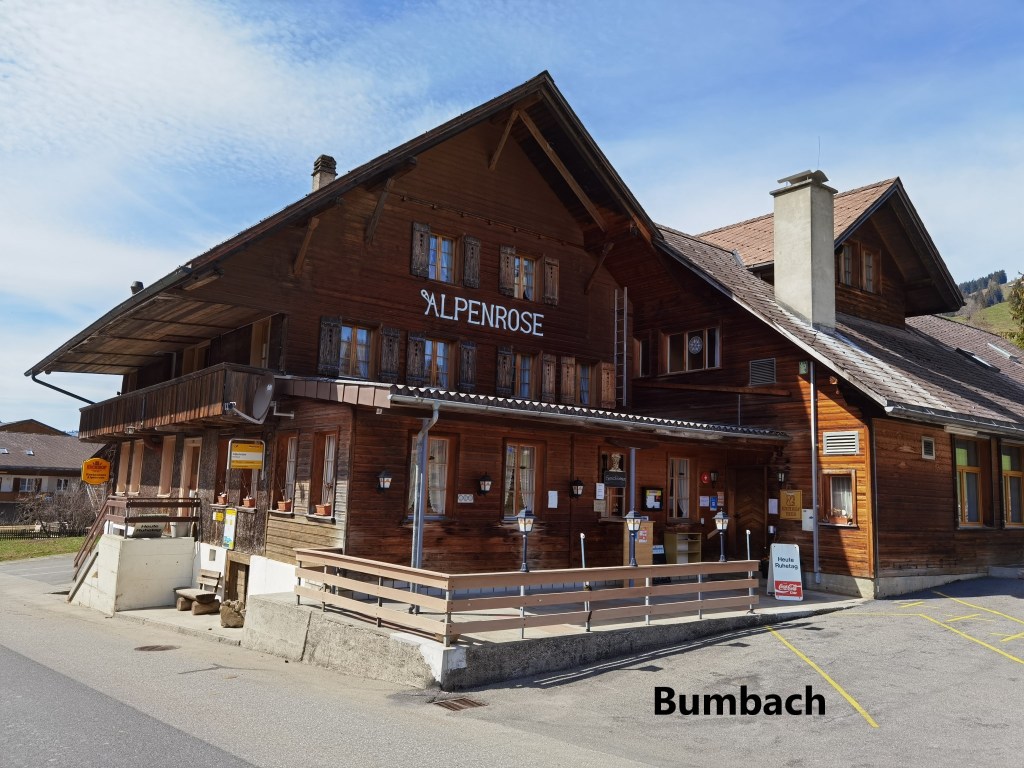
My destination was not a standard destination from the guide to the Trans Swiss Trail. I was heading for the little village of Bunbach. So I left the trail shortly before the village and crossed over the river. I walked on through Bumbach to reach the Bödeli bus stop, and that was the final point of my walking for the day.
From there, a bus and trains brought me back to Basel. The next stage of the walk is a difficult one, and as I write the weather forecast is not good, so it might be a little while before I take to the trail again.
My total step count for the day was 34, 587.