
I wrote in my last posting about being extremely busy with work, and that continued for the rest of March. But one of the benefits of project management is that there are deadlines, milestones, and end points. And thankfully, one of those projects that was keeping me so busy had a deadline to be finished by the end of March. Through the later part of the month, I was looking forward to April, with the Easter weekend, and time to get back on the trail.
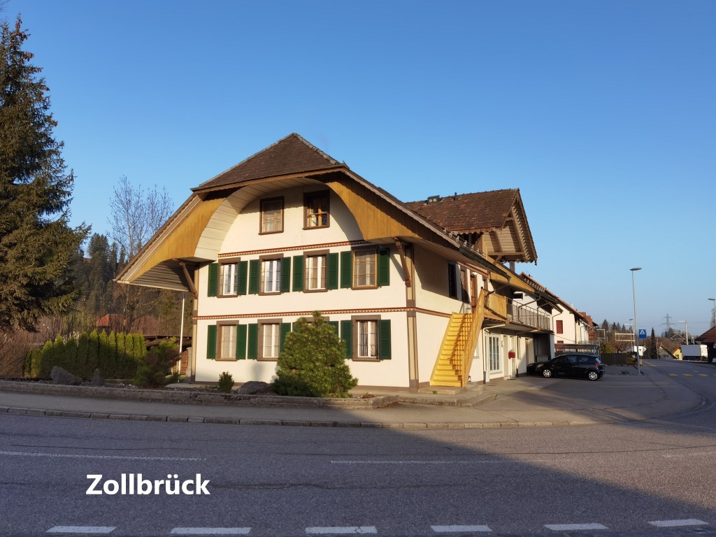
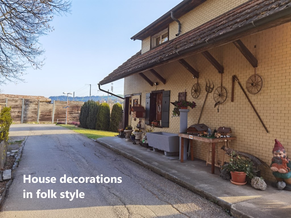
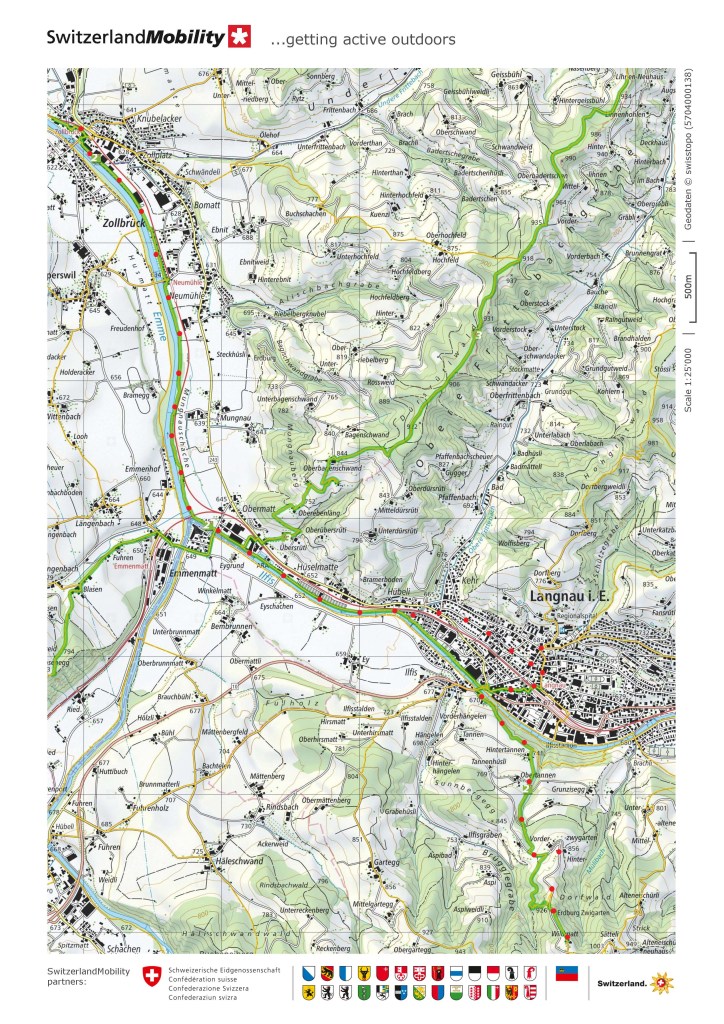
So I made my plans, and as soon as my schedule allowed, I was on my way back to Zollbrück to continue my way on the trail. Once off the train, I wasted no time, but went straight onto the trail along the river side. The weather has been benign since my last outing, and the Emme continues to be in gentle mood. The route from Zollbrück goes between small houses on one side and the river on the other. Some of those houses were decorated with a combination of folk and craft decorations.

I passed Neumühle and soon reached the point where the Ilfis joins the Emme. Sadly, the Ilfis loses its identity once it joins the other, thought the Emme at this point is certainly no bigger than the Ilfis. I suspect that there is an element of cantonal pride in the Emme’s name retention of the name. The Emme is effectively a Bernese river, rising in the alpine parts of the canton, and spending most of its journey through the canton. The Ilfis rises in Luzern canton, so it is perhaps seen as a visitor.
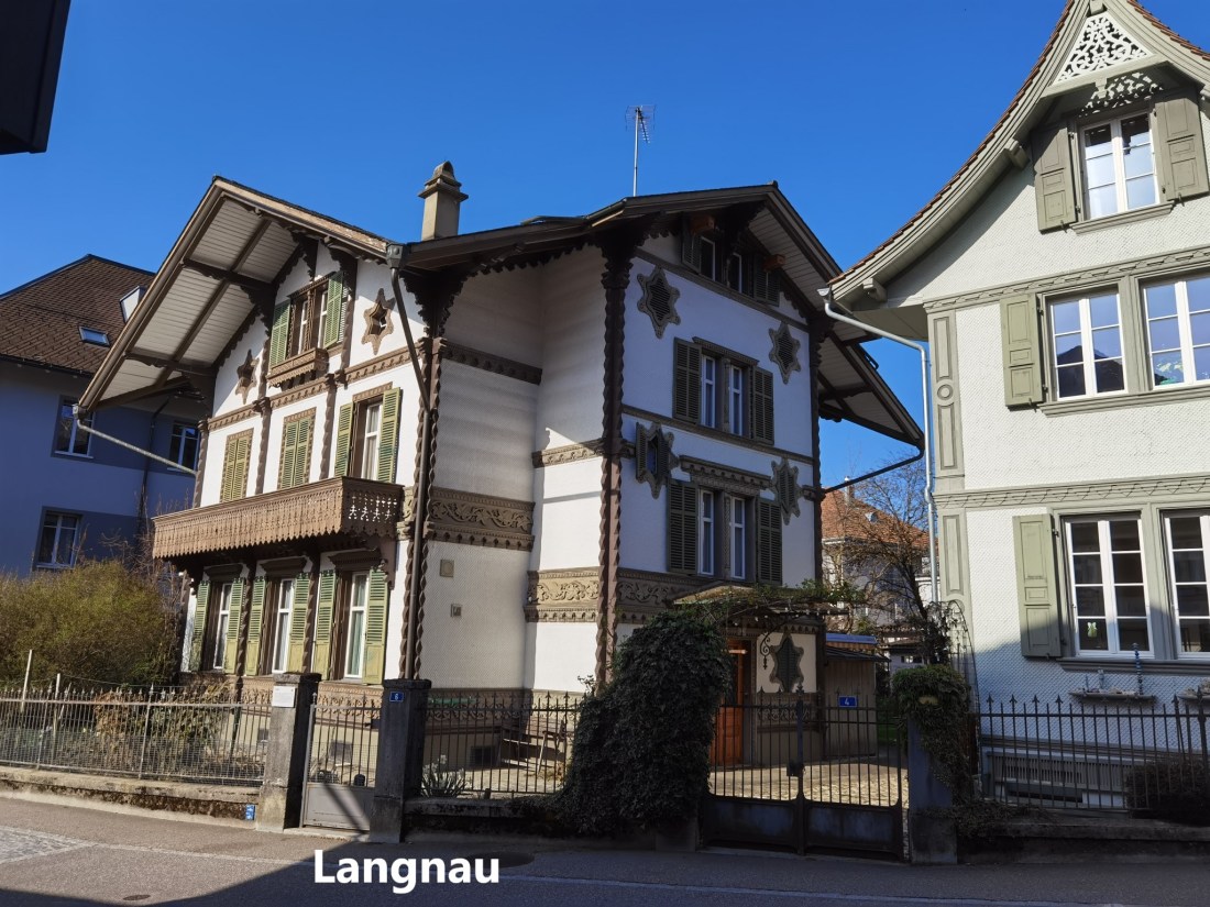
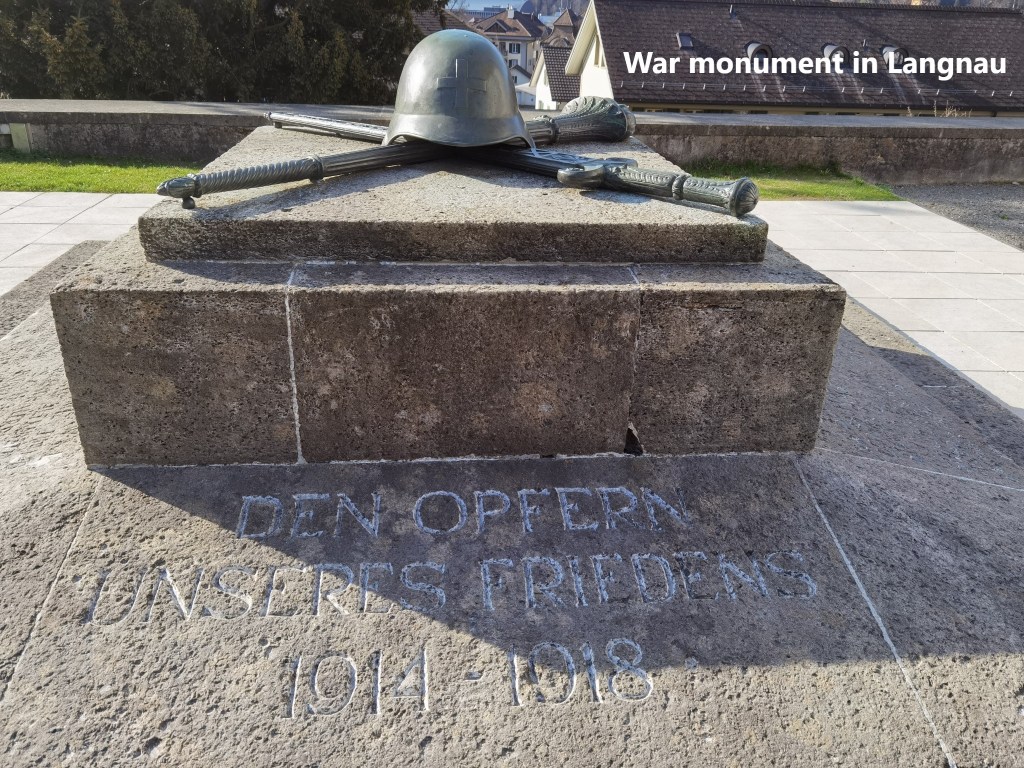
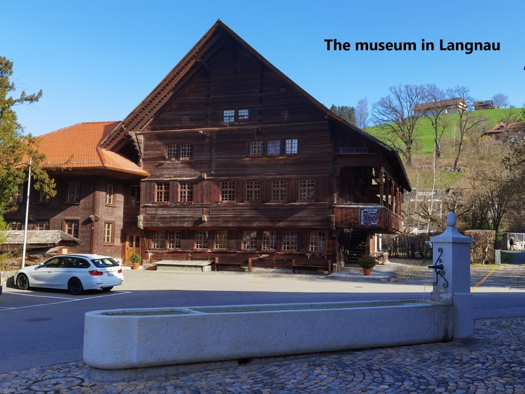
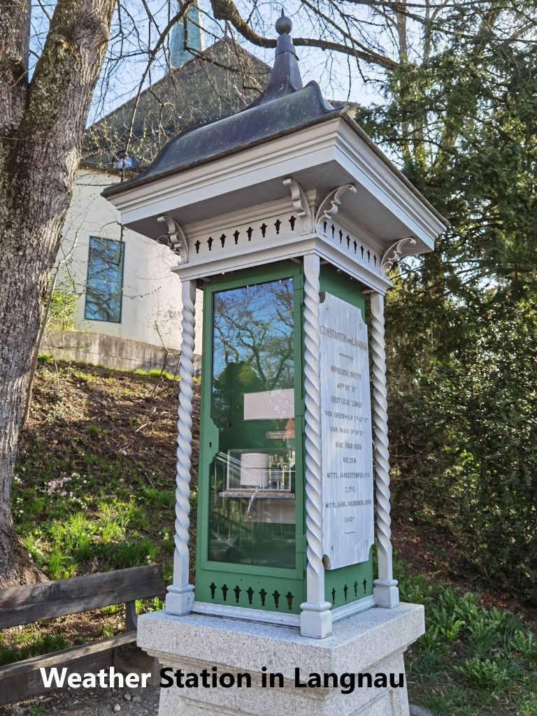
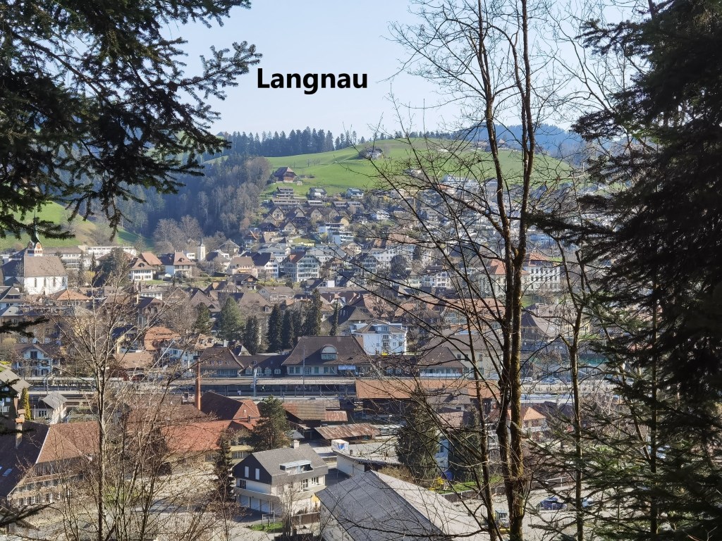
In any case, I left the Emme, and followed the Ilfis, and it did not take long to come to the edge of the town of Langnau. I left the trail at this point and followed the streets of the town to reach the centre. The town dates back to the eleventh century and has always been a centre for agriculture through the centuries. It was a focal point of a farmers’ rebellion in 1653. After the Thirty Years’ War, much of central Europe lay devastated, and poverty, coupled with religious persecution drove some to rebellion. The church has a monument to those who served in the army to protect Swiss neutrality during the First World War. In the Jura Mountains, closer to the borers with the belligerents of the time, the evidence of that service persists in the form of tracks and roads built to serve the Swiss defences. Here in the centre of the country, that must have seemed more remote, so the memorial is perhaps a fitting tribute. Beside the church at the centre of the town is the local museum, though it was closed when I got there. Nearby, I found the local weather station, which dates back to 1908. There is something reassuring about a weather station that uses a barograph and a mercury thermometer. I am quite sure that in the town archives, maintained according to the usual Swiss orderliness, would be all those barograph papers going right back to 1908. It would be an archive for weather researchers to indulge in, but not me. I had a walk to complete.
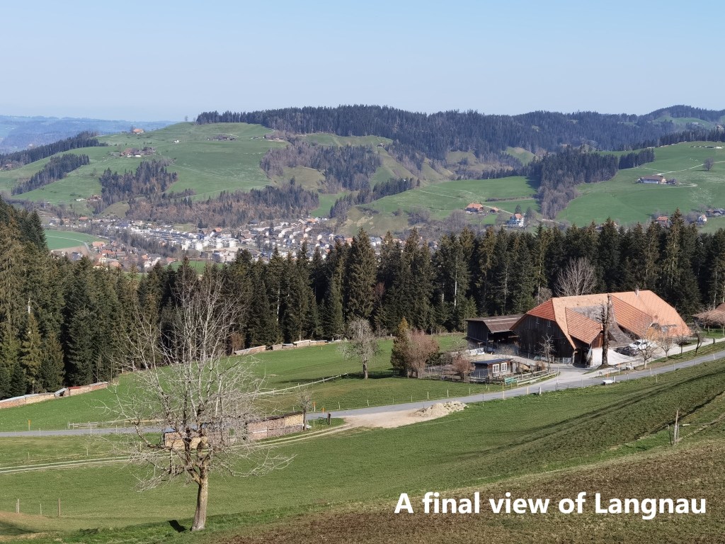
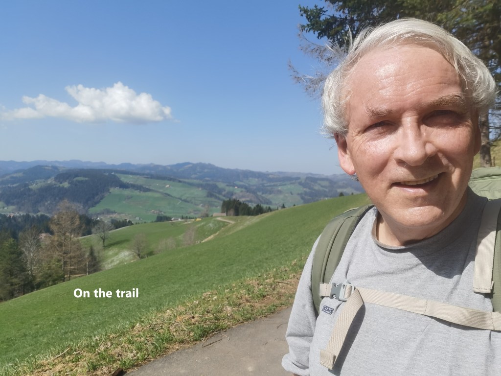
From Langnau. The trail heads up into the hills to the south. It goes through woodland, offering occasional glimpses back at the town, and emerges above the trees at Vorder-zwygarten to give a last look back. I followed the road for a little bit instead of the marked trail, but soon re-joined the trail a little to the south.
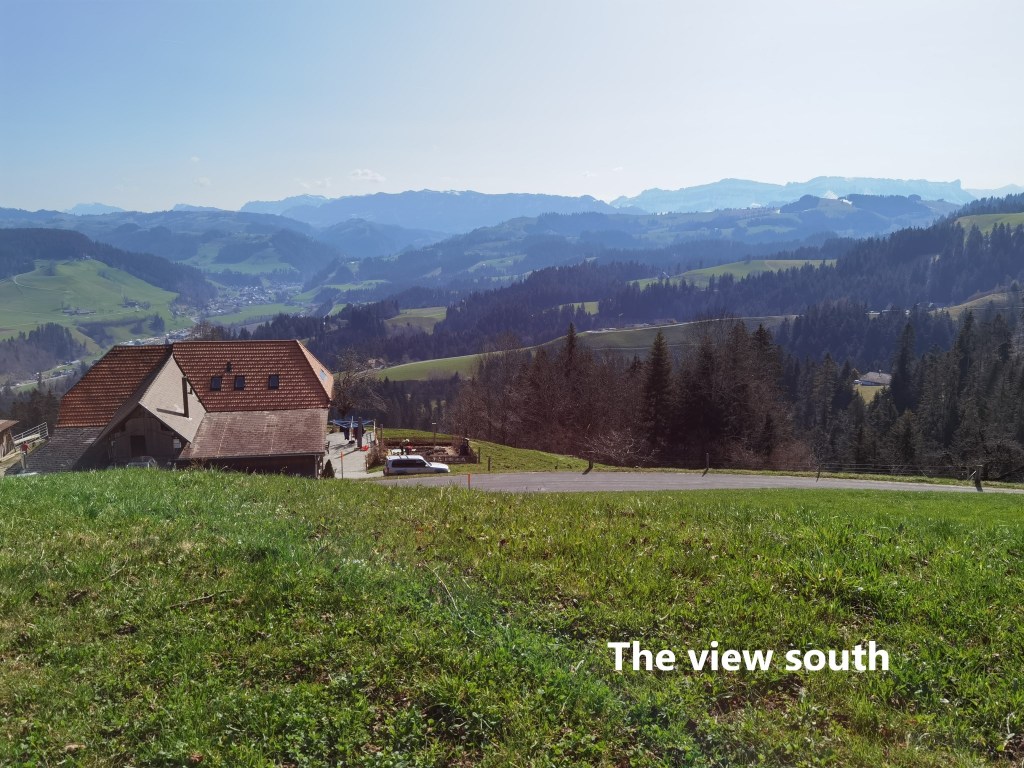
It seemed like I had left the river valleys behind. After the Aare and the Emme, I was glad to be back in the uplands. Passing through the 1000m contour, there were some very small patches of snow, last remnants of the winter that is now surely gone. And as the trail went on, I could eventually see the Alps again to the south. I had last seen them just after leaving Worb, and they seemed nearer now, a reassurance that I was truly getting farther and farther along the trail.
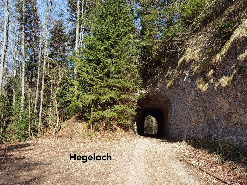
After passing that 1000m contour, the trail rises and falls only slightly. But to maintain that almost level route, it has to get past the Gyrsgrat ridge, and it does that by means of the Hagenloh tunnel. The tunnel was made in the years 1839-1840 using old explosive from left over artillery ammunition. It is reminiscent of the phrase about turning swords into ploughshares.
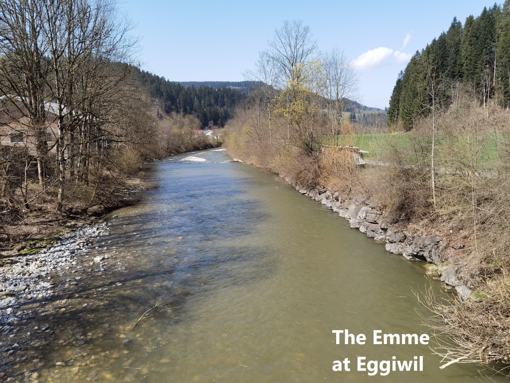
After the Hagenloh, the trail continues at much the same altitude until the Emmental comes back into view. My first view of Eggiwil in the valley was coupled with great views of the Alps. It is a steep descent, and soon I was crossing the bridge over the Emme to enter the village.
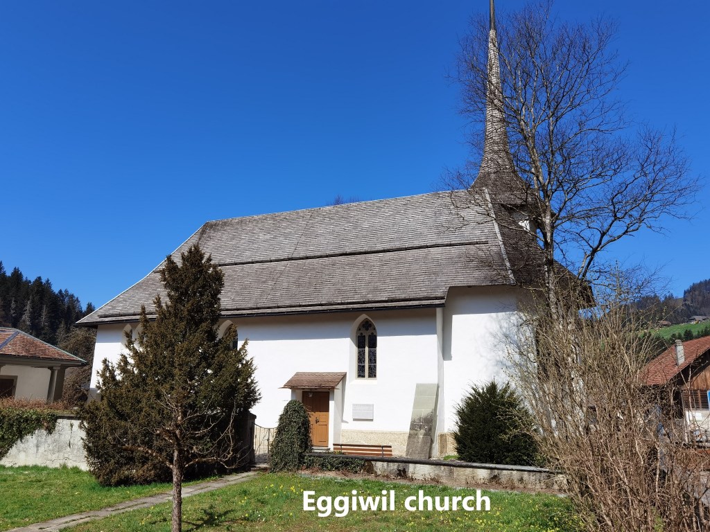
I had arrived in Eggiwil sooner than either planned or expected, so I had time to look around. Many of the houses are in the Bernese farmhouse style. The church dates back to 1632, though it doesn’t look that old. Until then, churchgoers from the village had to make their way to Signau to attend services. The building was paid for by the local lord as part of measures to discourage the Anabaptist faith in the area. Today, it seems part of the Swiss reformed church.
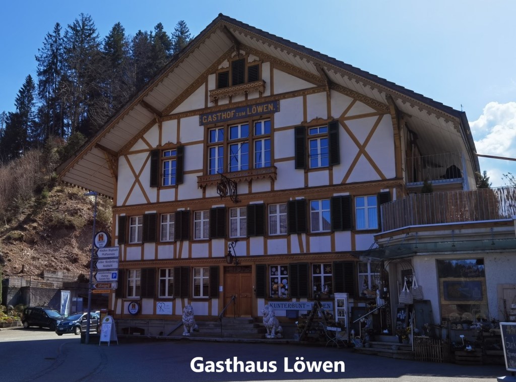
Also prominent in the village is the Gasthof Löwen. It was built as a Gasthof in 1843 and has continued to be in service as a hotel and restaurant ever since. But unfortunately, in these times of Covid-19, it was closed, so there was no refreshment to be had.
After my short walk around the village, it was time to get the bus and train back to Basel. Today was not such a long walk, and I had just 36,349 steps counted in the day. I have now completed over 200km of the 500km trail, so the year is going well.


As always I enjoyed ready this blog. Never seen such a pretty weather station!
Thank you for sharing such wonderful experience.
LikeLike