According to the guidebook, the next stage of the Alpine Panorama Weg would take me from the Schwarzsee to the village of Jaun*. That is just 12km, which seemed far too short for the travel to get there and back. The next stage went through a succession of villages to reach the town of Gruyere, which would be an additional 22km, but with few obvious stopping points in between. Bot when I looked closer at the maps, there is a summit just off the route between Schwarzsee and Jaun, the Fochsenflue, at 1975m in height. So I decided that my walk would be to go from Schwarzsee to Jaun, with a detour to the Fochsenflue. As well as the 12km involved, there would be a total ascent of 1125m. That would be a reasonable day’s walk.
I was the only passenger getting of the bus at Schwarzsee, just before eight o’clock that morning. Unlike my arrival in Schwarzsee on the previous leg, it was not brilliant sunshine when arrived. There was a mixture of sunshine and heavy cloud over the area. But being a veteran of many days of walking in bad weather, I would not allow that to deter me, and I set off.

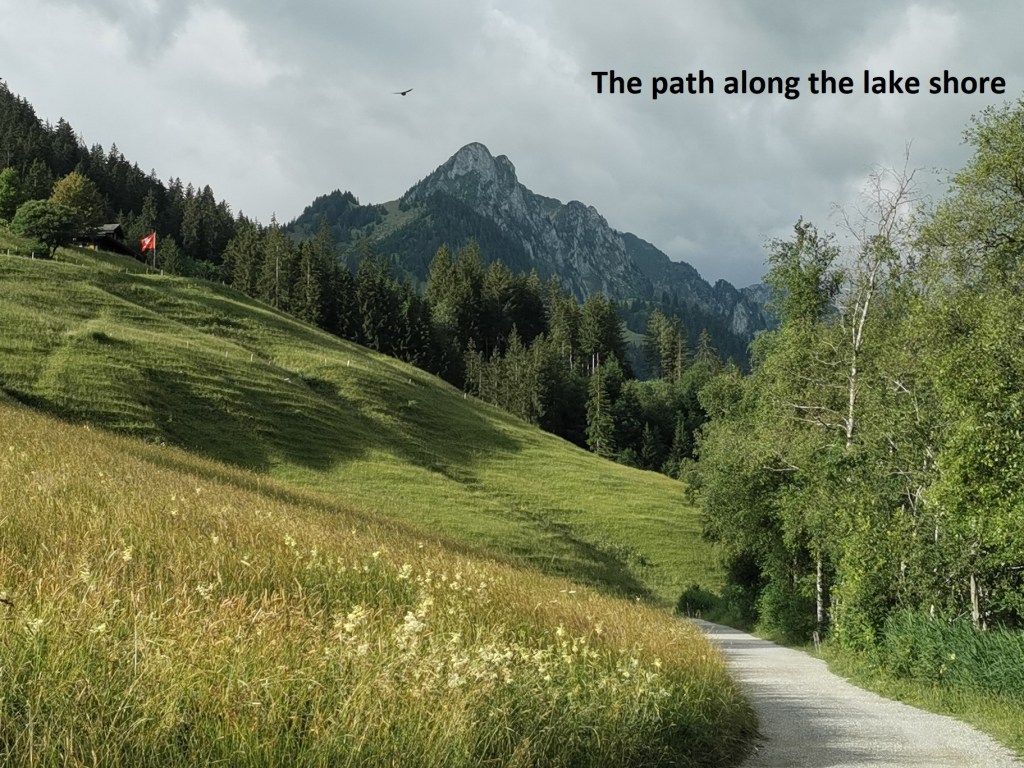
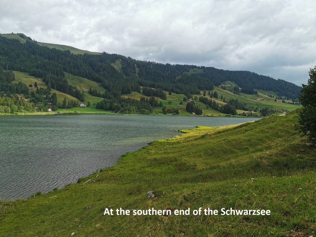
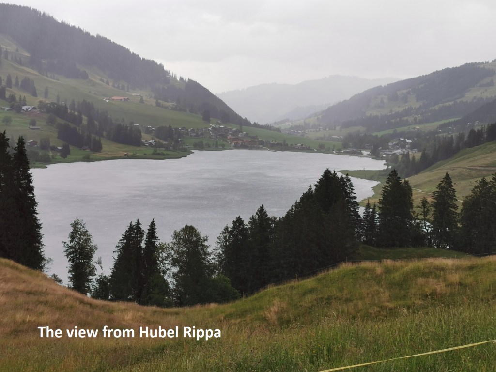
The path follows the eastern shore of the lake and is almost flat. By the time I reached the southern end of the lake, the sunshine that was breaking through the clouds on my arrival had gone, and there were just grey skies over the lake. From there, the trail starts to go up the slopes. I was just approaching the hotel at Hubel Rippa at 1140m when it started to rain. I took out my raingear, and once I had that in place, I continued on my way. The raingear that I use is effective, though it does sometimes impeded on my walking, and I was slower than I might have been as I went on upwards, passing Wälschi Rippa at 1198m, Brecca at 1400m, and Rippetli at 1483m. I almost made a navigational error, taking the left fork just after Rippetli, but realise my mistake and corrected it quickly.

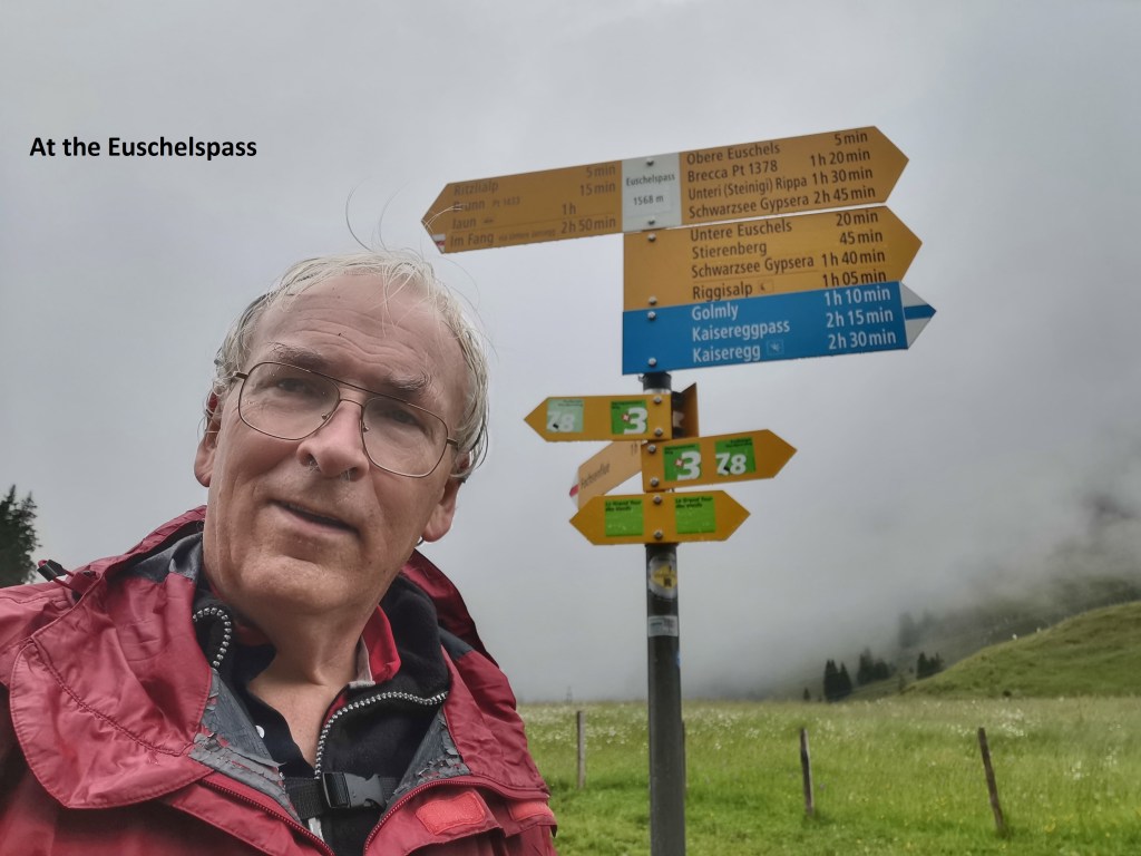
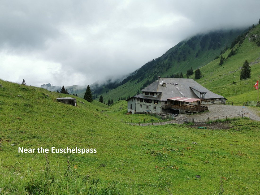
The trail actually descends slightly from Rippetli as it winds its way around the mountain to get to Untere Euschels at 1442m. After that, it is almost a straight track, with gradual ascent up to the Euschelspass at 1567m. The rain had stopped shortly after I passed Rippetly, and I had actually taken off the raingear, but it started again as I came to Untere Euschels, so the raingear went back on. At Euschelspass, I found myself surrounded by cloud.
The signpost at the Euschelspass said that it would be one hour and ten minutes to the top of Fochsenflue, and I se off on the trail towards the summit. I was making good time initially, though the route was steep. This continued up to around the 1800m contour, Then the texture of the ground changed. Up to that point, it had been gritty soil and rocks, both of then giving good grip on the ascent. But after that 1800m level it was a very peaty soil on the trail, with less rocks as well. As a result, the ground was slippery underfoot, so I had to be extra careful. I am sure that in good weather, I would have made as good a time as the signpost suggested. However, in the conditions on the day, it took me one hour and twenty minutes, ten minutes longer than the signpost had indicated. The final few metres is a rocky outcrop going up to a very narrow summit, marked by a cross on top.

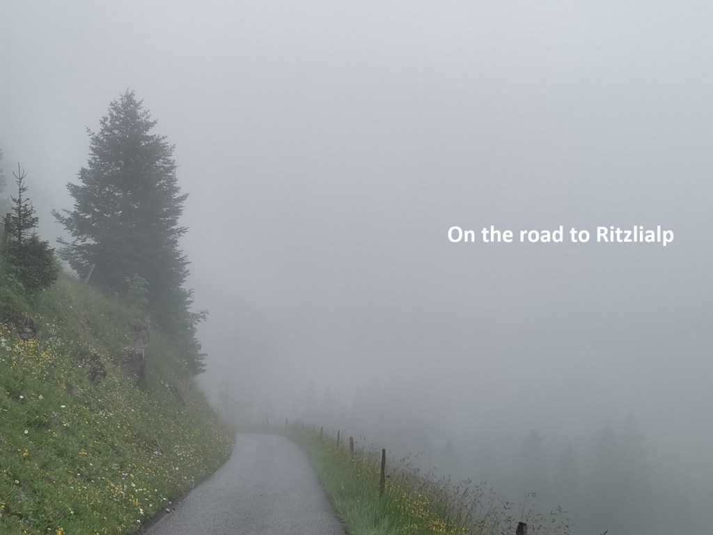
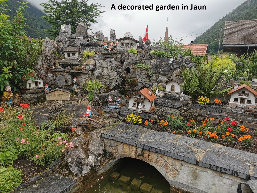
I did not hang around, but started my way back down again without delay. Coming near the pass again, there is a tarred road that leads directly to Ritzlialp. I took the road through the mist. After Ritzlialp, there was less cloud, and I made good time on the descent. I was soon below the worst of the mist, but still in rain, so the raingear had to stay on. There is a road from Ritzlialp down to Jaun, but the trail takes a more direct route, even allowing for the zig-zags that it has to do at times. Eventually, Jaun came into view. It is a pleasant little village, but with nothing special. I passed one delightfully decorated garden as I made my way to the main street and the busstop.


The bus took me the first stage of the way, and then a succession of trains brought me to Basel. My local park was staging a performance that evening by a local Dixieland jazz group, and after dinner, with the sun now replacing the rain in Basel at least, I went there to enjoy the music. The jazz group was called The Steppin’ Stompers. But I had done my stepping and stomping for the day.
Between everything, my total step count for the day was 41716 steps.