The Alpine Panorama Weg is 510km long, and the guidebook presents it in 29 stages. The first three stages of the route are listed in that guidebook as
Rorschach to Trogen, 18km
Trogen to Appenzell, 12km
Appenzell to Schwägeralp, 18km
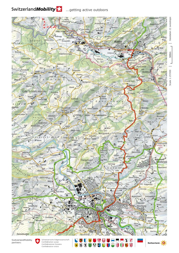
The distance of 12km between Trogen and Appenzell is too short to justify the journey from Basel to the Bodensee region as a single stage. Indeed, the 18km stages are borderline in terms of justifying a day out, and so on my first stage, I had gone past Trogen, with Bühler roughly halfway between Trogen and Appenzell. My target for the next piece would be to go past Appenzell, all the way to Schwägeralp, thus completing three guidebook sections in two days of walking.
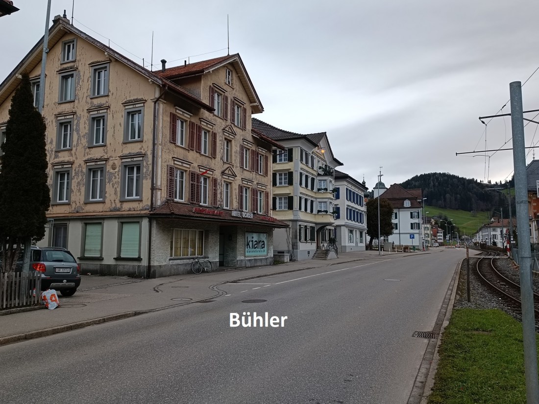
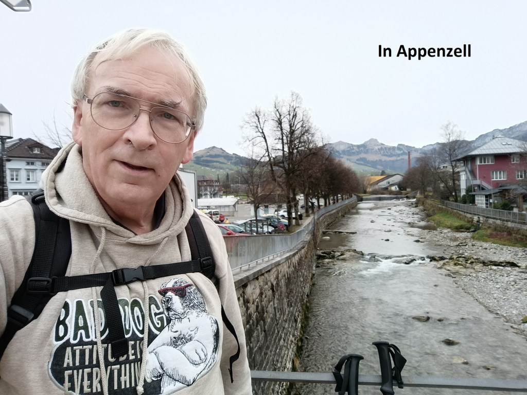
Last Sunday had an interesting weather forecast. There was rain forecast almost the whole day in Basel, but none in the Appenzell area. I decided to take a chance and go ahead with the next piece of the trail. I am a firm believer in the principle of fortis fortuna adiuvat. Thus it was that I got an early train out of Basel, and arrived in Bühler in time to be walking before nine o’clock.

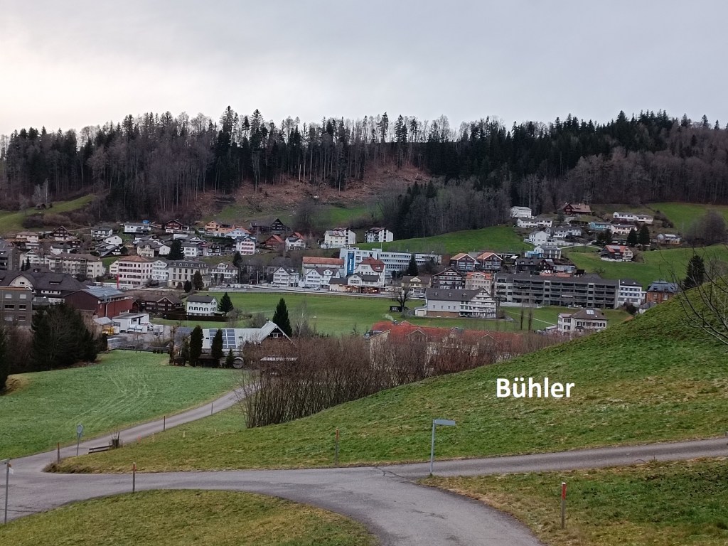
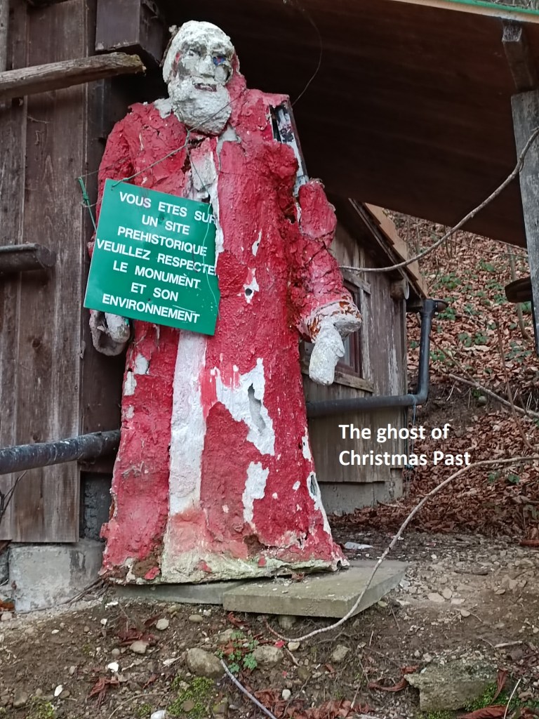
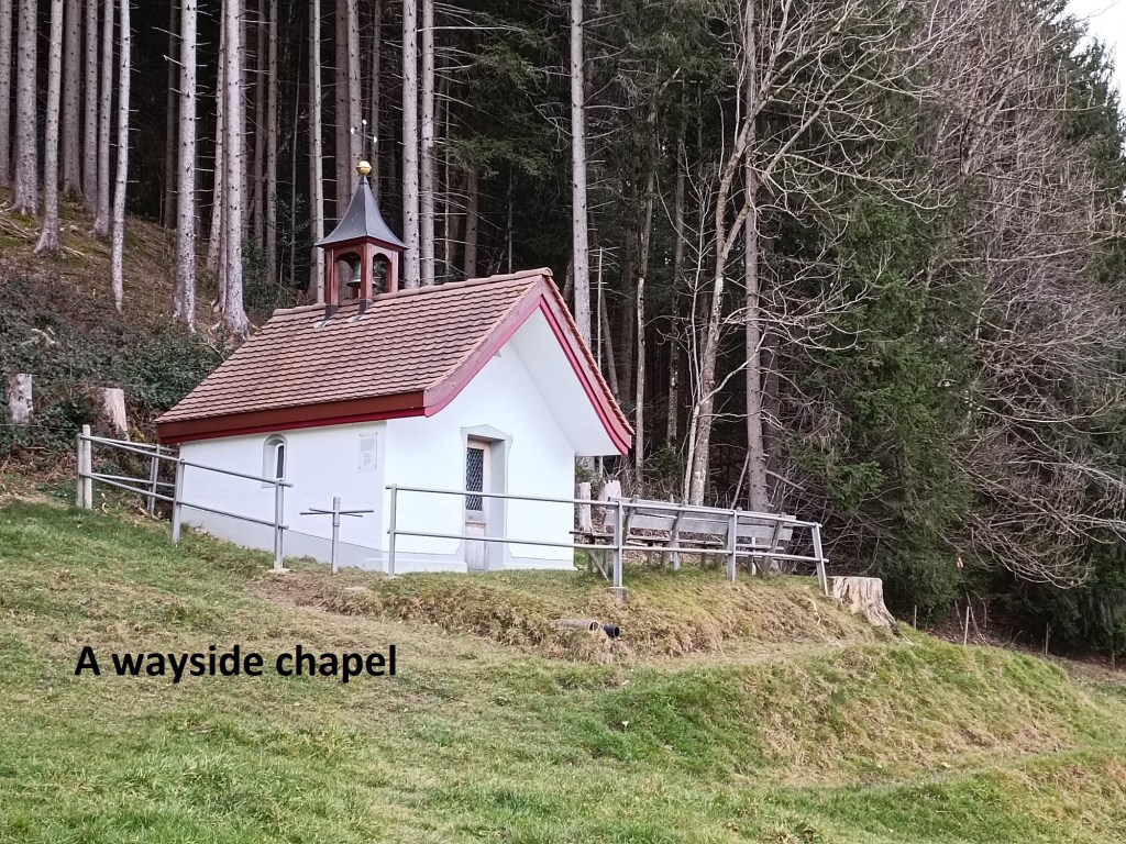
The trail heads westwards and uphill out of Bühler, before curving around to the south. From the hill, I was able to take a last look at Bühler nestling in the valley. A little further on, I came across a caricature of Santa Claus, looking like a Ghost of Christmas Past, asking wayfarers to be careful on this ancient monument. I saw no such monument, and there is none listed in the guidebook. I kept going, and it was not long before I reached the col at Mittlere Saul, 200m up from Bühler. The trail is relatively flat from there, and it did not take long before I came to a little wayside chapel. The chapel and the location are unnamed on the map. I would have liked to go inside, but the chapel was locked, and so I kept on going.

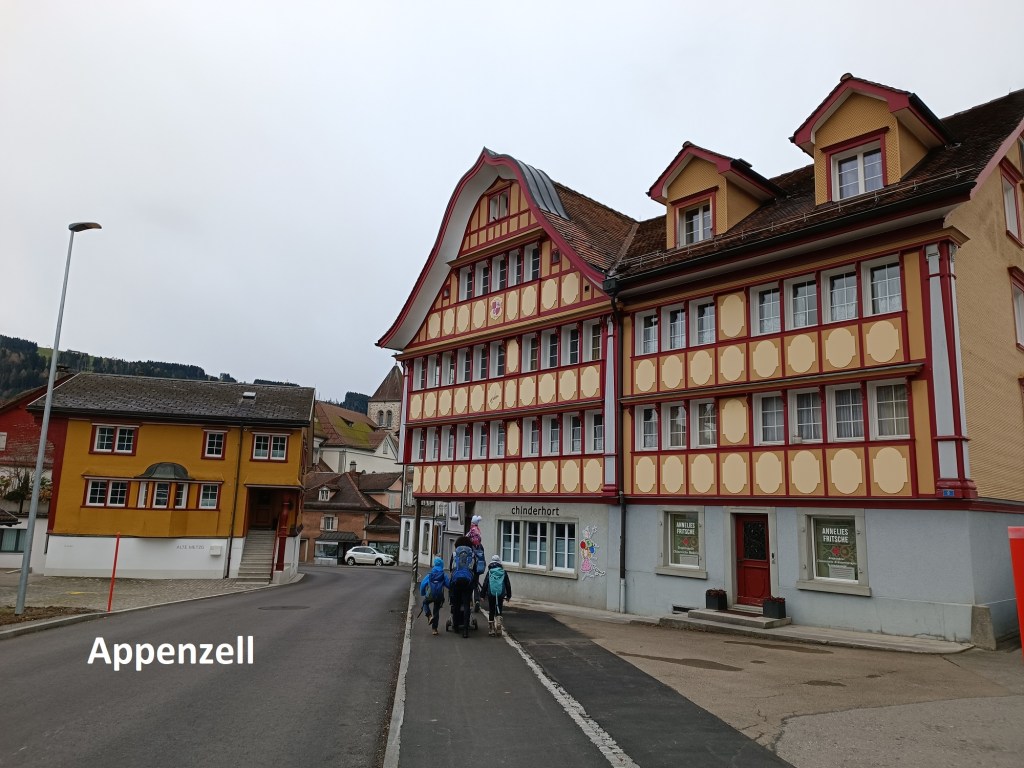
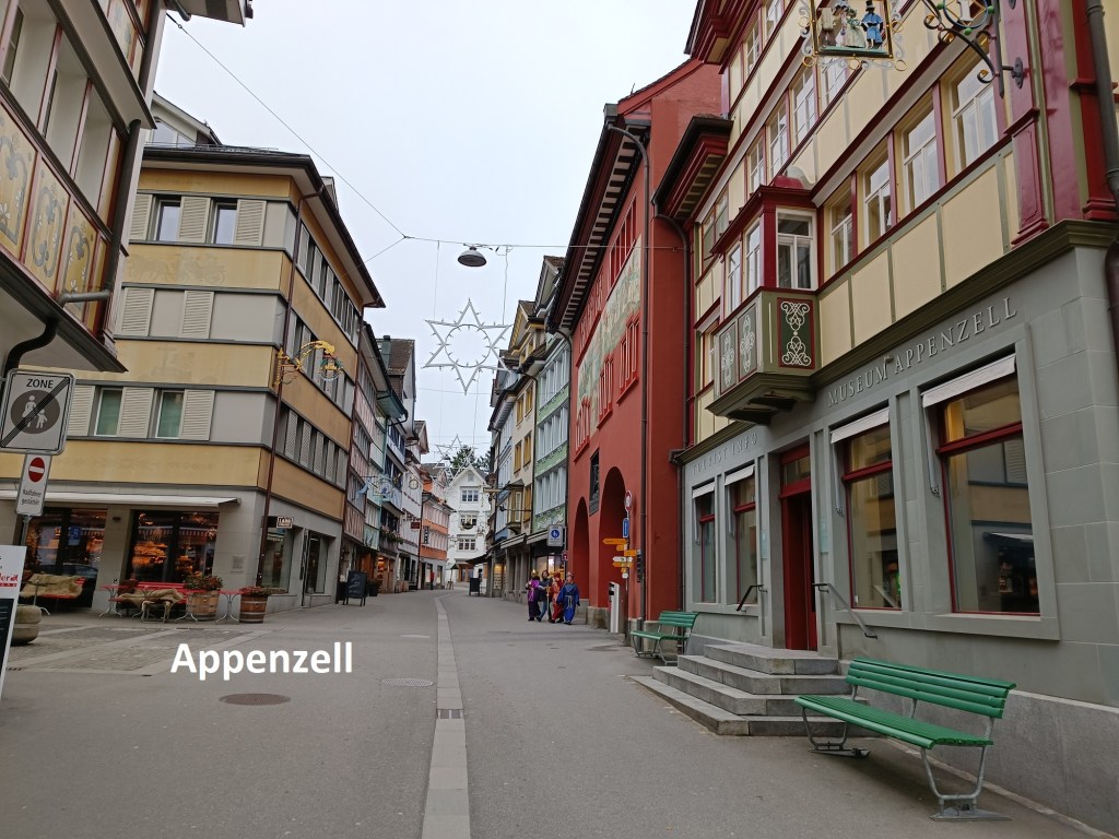
After that, the route begins the descent towards Appenzell, and the town came into view. I continued the descent on roads and through fields to arrive at the town. The guide to the route describes Appenzell as a “beautiful town. Colourful, historic and handsomely decked out homes are lining the roads and streets.” There is a certain beauty to the place, and I paused several times to take in the colourful buildings. The guide also says that “Culinary specialties and crafts are tempting you to shop and cosy restaurants and gardens extend an invitation to relax.” That may be true on other days, but not on a Sunday morning in mid-winter. I was not tempted into any cosy restaurants, but was quickly on my way.

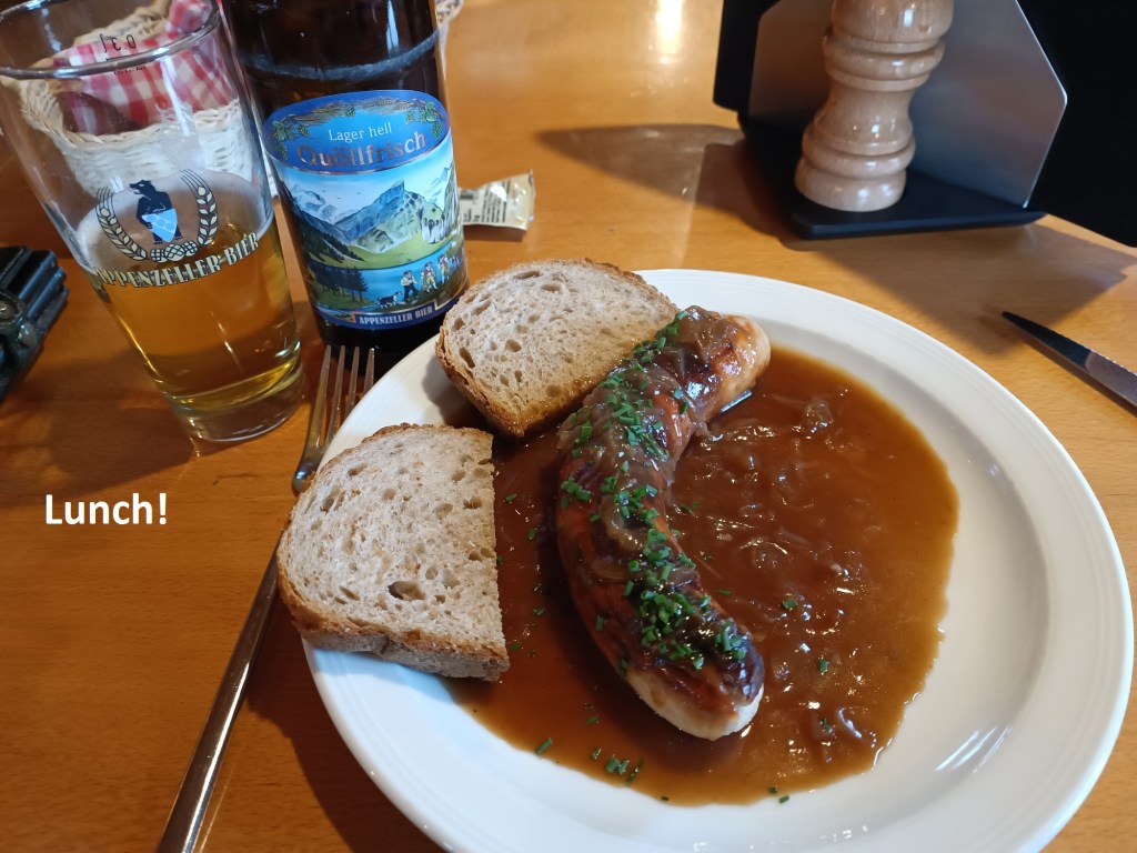
The trail winds its way through the town and beyond, out into the countryside. Once out of Appenzell, the trail begins a long ascent. It zig-zagged up the hill, through the forests to reach the caravan park as Eischen. It was fairly flat then for a while until I passed the hotel at Kaubad. There seemed few signs of life at the hotel, stuck on a mountainside away from town. I was left wondering if it does business in the snows of winter or the heat of summer. But I had no time to waste, so I kept on going, upwards again. I did not stop when the route came out of the woods at Vordere Wasserschaffen. Neither did I stop when I emerged from the next wooded piece at Blatten. But I did stop when I got to Scheidegg. The Berghaus there was open, but only until January 8th, so I was there for the last day before they would close. I went in and had a small, but very welcome lunch of bread and bratwurst. These were the “culinary delights” that I had missed in Appenzell.

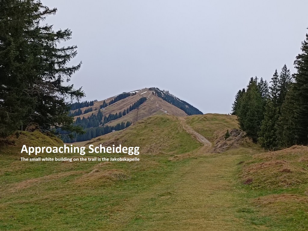
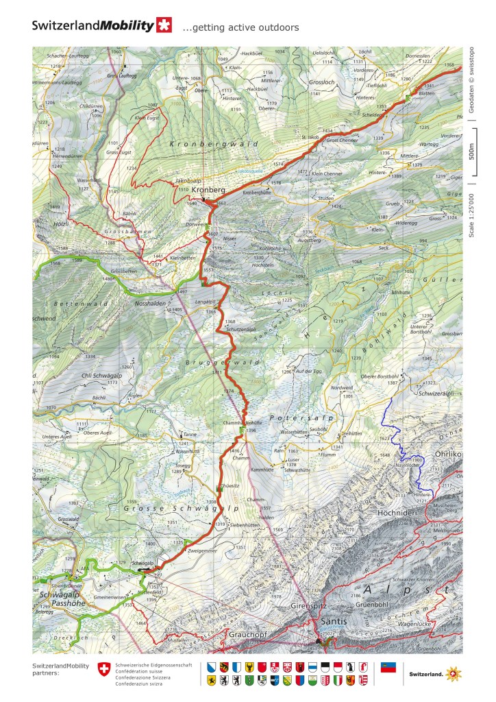
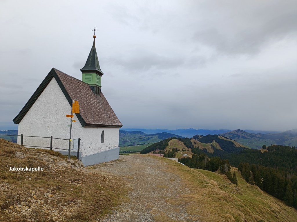
I did not take longer than was necessary at the Berghaus, and after getting on my way again, ascended to the Jakobskapelle. This little church, the highest building on this side of the mountain, has an interesting story. There had been a church in the area since the seventeenth century, but on the current site only since 1859. The existing church was built in the 1920s, after the older one burnt down. The ceiling is decorated with the beatitudes from Christ’s sermon on the mount, while a wooden statue of St. Jakob stands to the right of the altar.
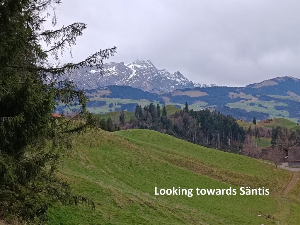
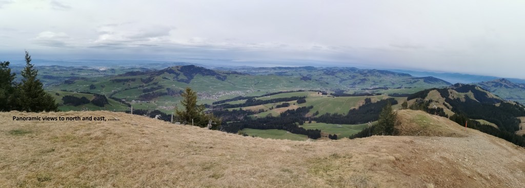
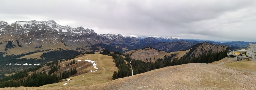
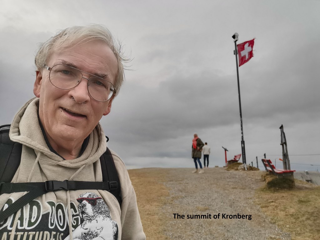
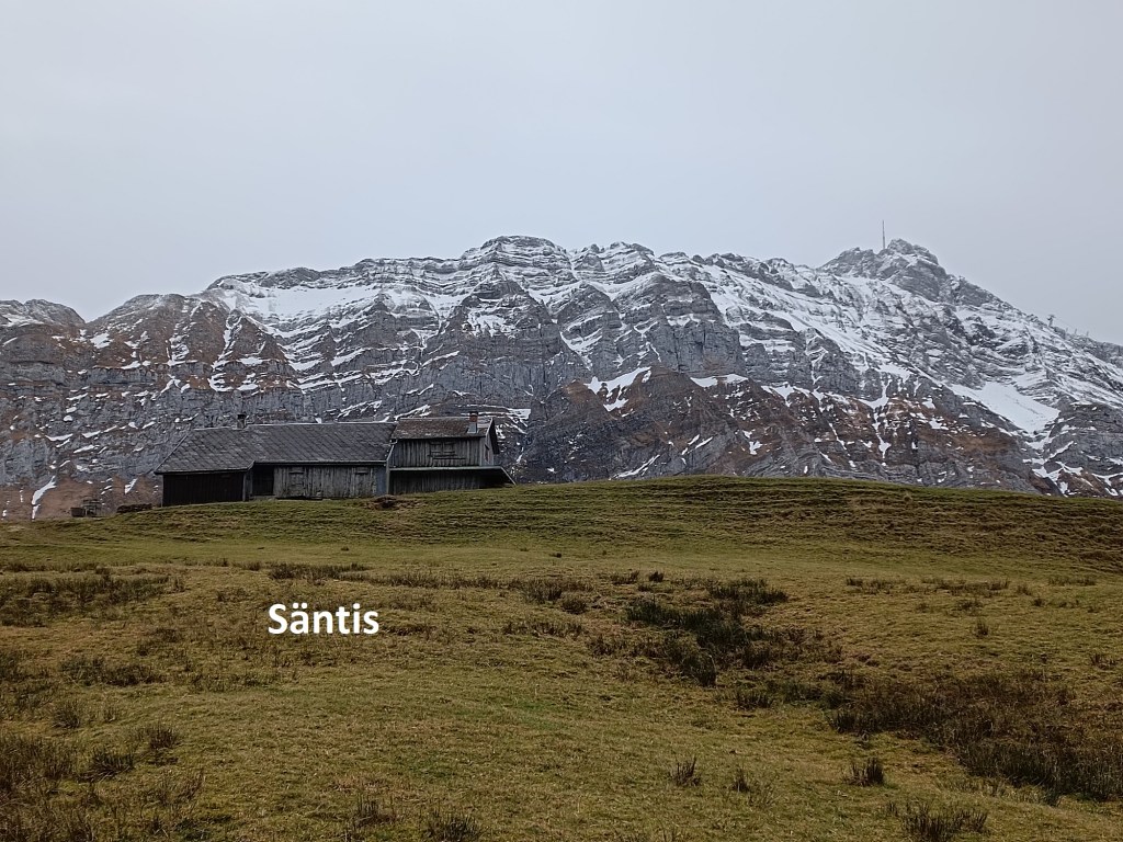
But even the Jakobskapelle is not at the top, and the trail continued on upwards. As I went, there were magnificent views out to the north. I had thought after the previous walk that I would see no more of the Bodensee, but there it was again, distant but still visible. The view to the south was dominated by the Säntis massif until I came to the summit, at which point a whole new panorama of alpine mountains to the south and west came into view. Eventually, there I was, at the summit of Kronberg. In all, the ascent from Appenzell to Kronberg was just under 900m.
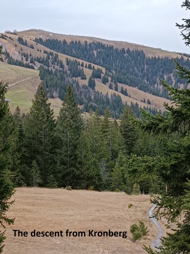
After Kronberg, the descent begins. First there is the short descent to another Berghaus. But whereas the one at Scheidegg is in the traditional style, with wood panelled walls, and massive wooden tables, the one below the summit of Kronberg looks so modern that it seemed out of place. I was glad I had stopped at Scheidegg and not here. From there, it was a steady descent down the mountainside as far as Schutzenälpli. A short upwards piece brought me to Chammaldenhütte, from where I could look back at the descent route from Kronberg.
And after Chammaldenhütte, the route descends again, though not by much. It was almost flat on the last part of the day’s walk towards the Säntis cable car station at Schwägalp. I reached it just in time for the bus to start my journey back to Basel. When I got back to Basel that evening, it was raining. Apparently, it had been raining almost the entire day.
With three guidebook stages done, and 48km of the route behind me, my journey along the Alpine Panorama Weg is well underway.
And my total step count for the day was 40,646.