At the beginning of each of the last few years, I have set myself a Swiss walking objective, and an international walking objective. This year was no exception. My international project was the Chemin de Stevenson, which I have written up in these pages. My Swiss project was to walk to Stans, and walk back from Luzern by a different route. For the walk to Stans, I went by the Via Gottardo, and the first stages were documented in these posts as far as Rothenburg. For various reasons, I did not post some of the stages after that, but they went as follows:
27th February Rothenburg to Hergiswil by the Via Gottardo (7) and Waldstätterweg (98)
27th March Hergiswil to Stans by the Waldstätterweg (98)
10th April Luzern to Willisau by the Via Jakobi (4)
29th May Willisau to St. Urban by the Via Jakobi (4) to Huttwil and thence by the Grenzpfad Napfbergland (65) to St. Urban.
And that is where I let things sit for a while. During the summer, I took in Säntis and other routes, some of which are documented here. But with the coming of autumn, it was time to go back to the project once again to close it out before the end of the year.
The challenge in doing that is that while the route to Stans, and back as far as St. Urban, all followed national or regional routes, well signposted and well used, there was no defined route across the Juras from St. Urban. But chance took a hand in my planning. In a second-hand bookshop in Basel, I found a guidebook dating from 2006 describing a route from Basel to Luzern. That was before the Via Gottardo was officially opened, so this guidebook takes a different route. Going from Basel, it goes over the main ridge of the Jura at Wasserfallen before descending towards Balsthal, Oensingen, and St. Urban. From St. Urban, it follows the route I had already taken from Luzern, but in the other direction. So using that guidebook, I planned a route that would take me from St. Urban to Wasserfallen.
St. Urban is a small village built around a large monastery. The monastery was founded in 1195, with a single monk present. Through the following two centuries, the monastery grew in power and prestige, but in the 15th century, the canton of Luzern took steps to reduce that power. By the 19th century, the abbey was in decline, and today, most of the property is owned by the canton.
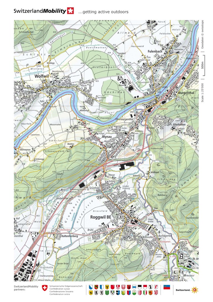
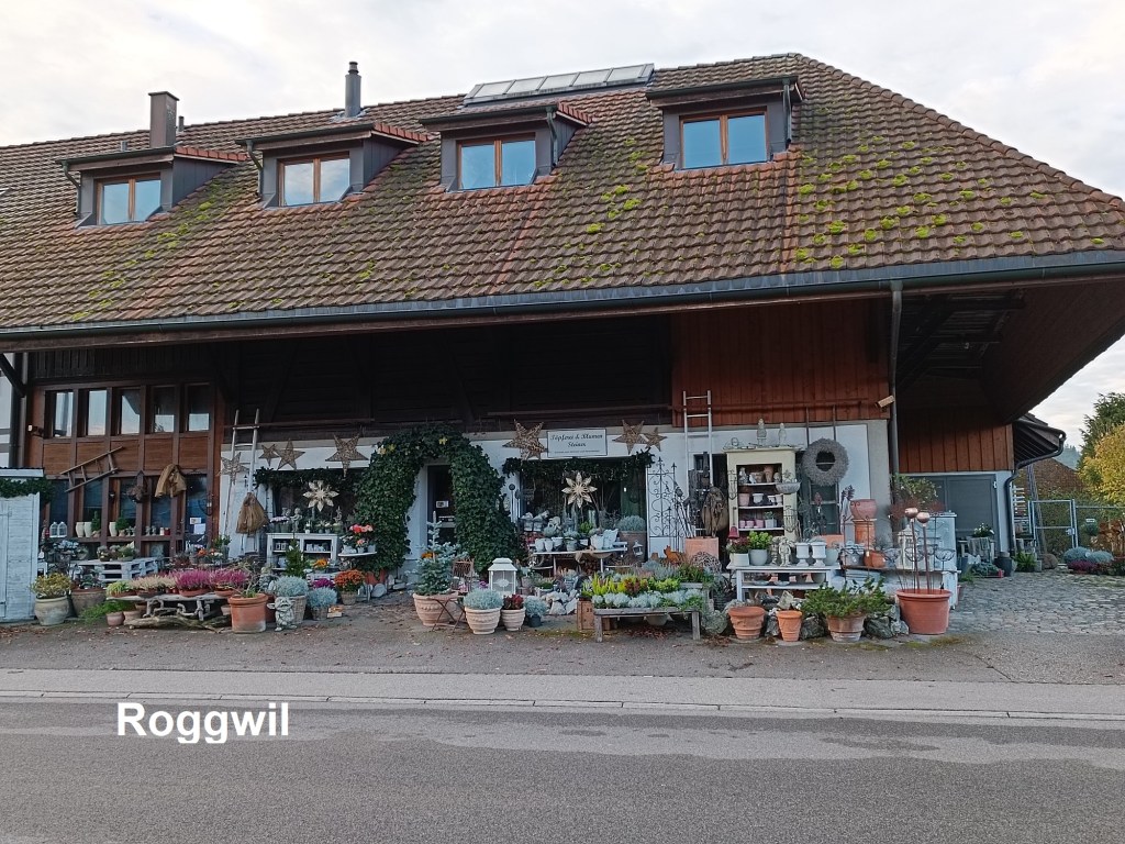
I took an early train to get to St. Urban, and I was on the route by 08:30. Because I was not following one of the major trails, I had to be careful to make sure I was on the right track. The route goes out of the village on a path to the northwest before meeting a road and entering a forest. From there, a forest track circles around until it comes into the village of Roggwil. This part of the route is a succession of villages and small towns. I went straight through Roggwil. The street was mostly deserted at that time, with just a couple of dog walkers greeting me as they passed.


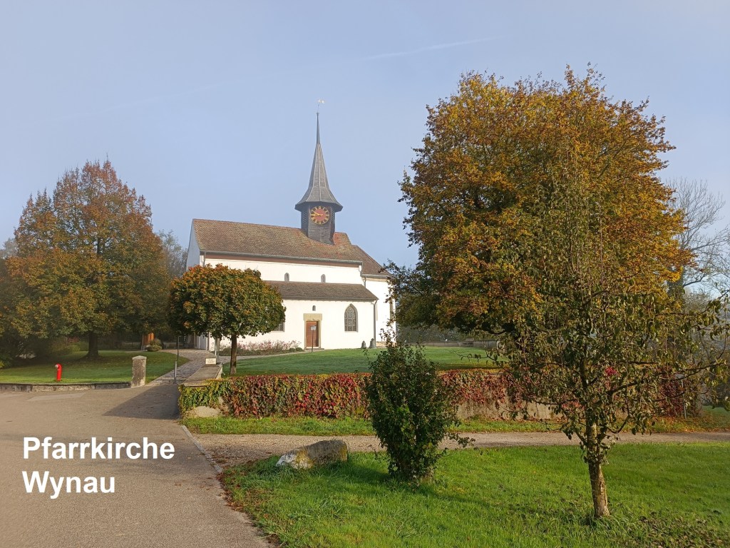
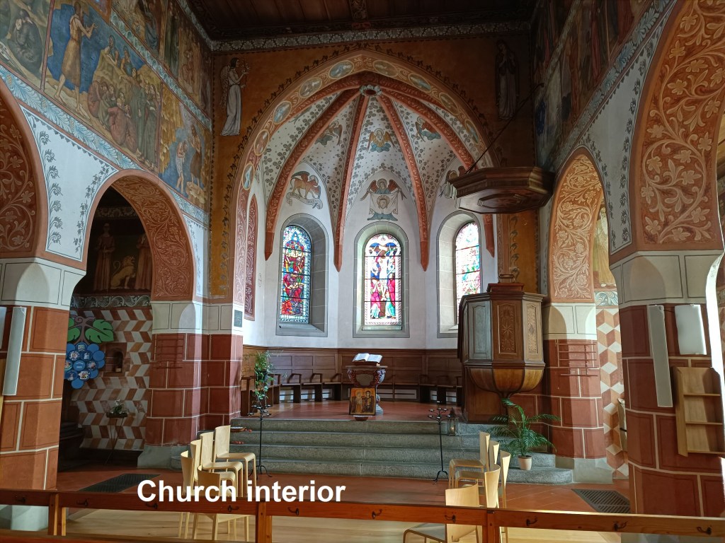
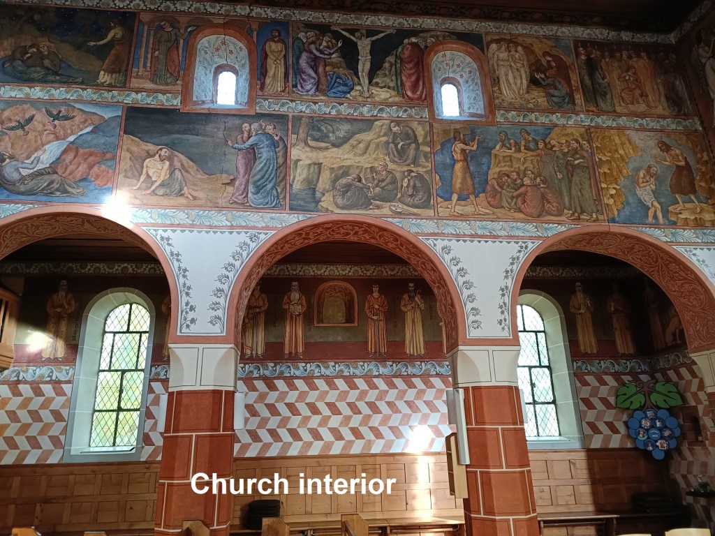
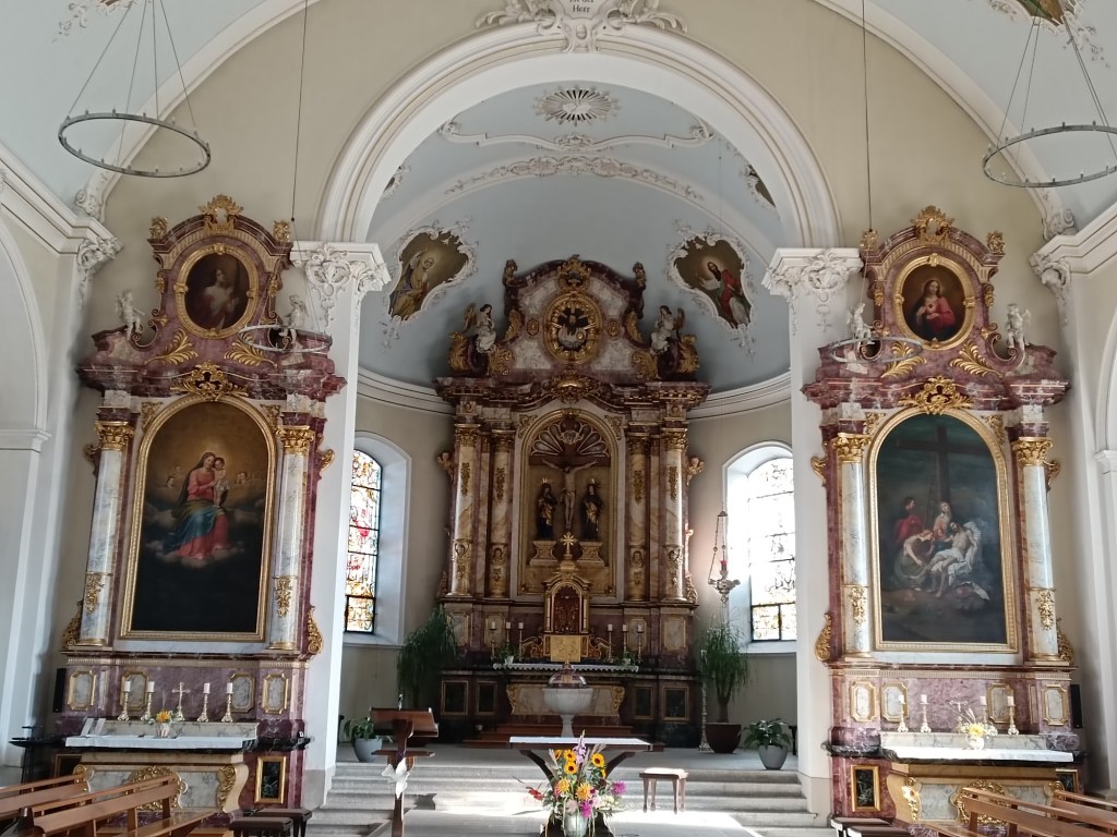
Roggwil almost merges into Wynau, with the two separated only by the railway line, and the joint station of Roggwil. Wynau. I went under the highway and through the railway station to come into Wynau. By now the heat of the day was lifting some of the moisture off the land, giving a haze to everything. It didn’t take long to go through Wynau, and soon I came to the parish church down by the river. The church dates back at least as far as the 13th century. In the 14th century, it was incorporated into the properties of the abbey at St. Urban, so that the abbey appointed the parish priest and paid him. With the decline of the abbey, it reverted back to the parish itself. The church interior is richly decorated with all paintings, and is a popular venue for wedding services.
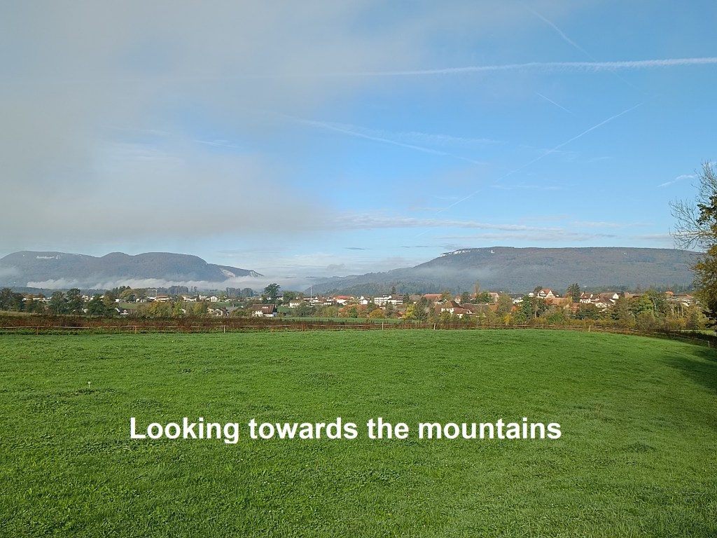
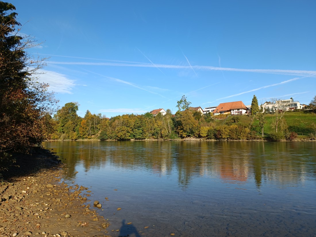
Leaving Wynau, and along by the river Aare, I could see the mountains ahead, with the gap that I was making for. The walk along the riverbank took me past a bend in the river to where the map indicated a crossing. In my naivety, I had assumed that a river crossing would be a bridge, and I had no noticed a little boat shaped symbol on the map. There was no bridge; the crossing is by ferry. And it stops operating at the end of September. This being mid-October, there was nothing happening. I had no choice but to continue upstream to the dam and cross the river there.

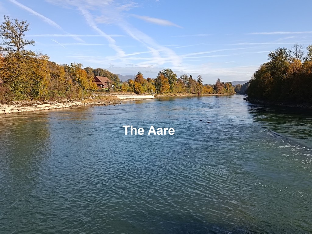
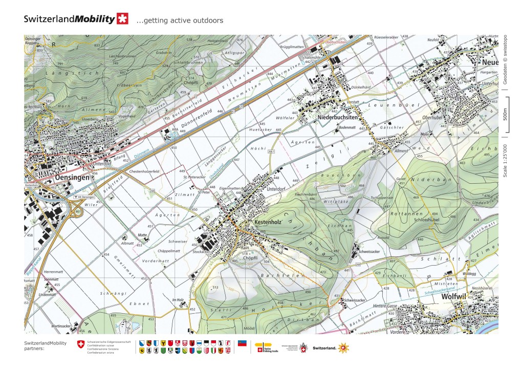
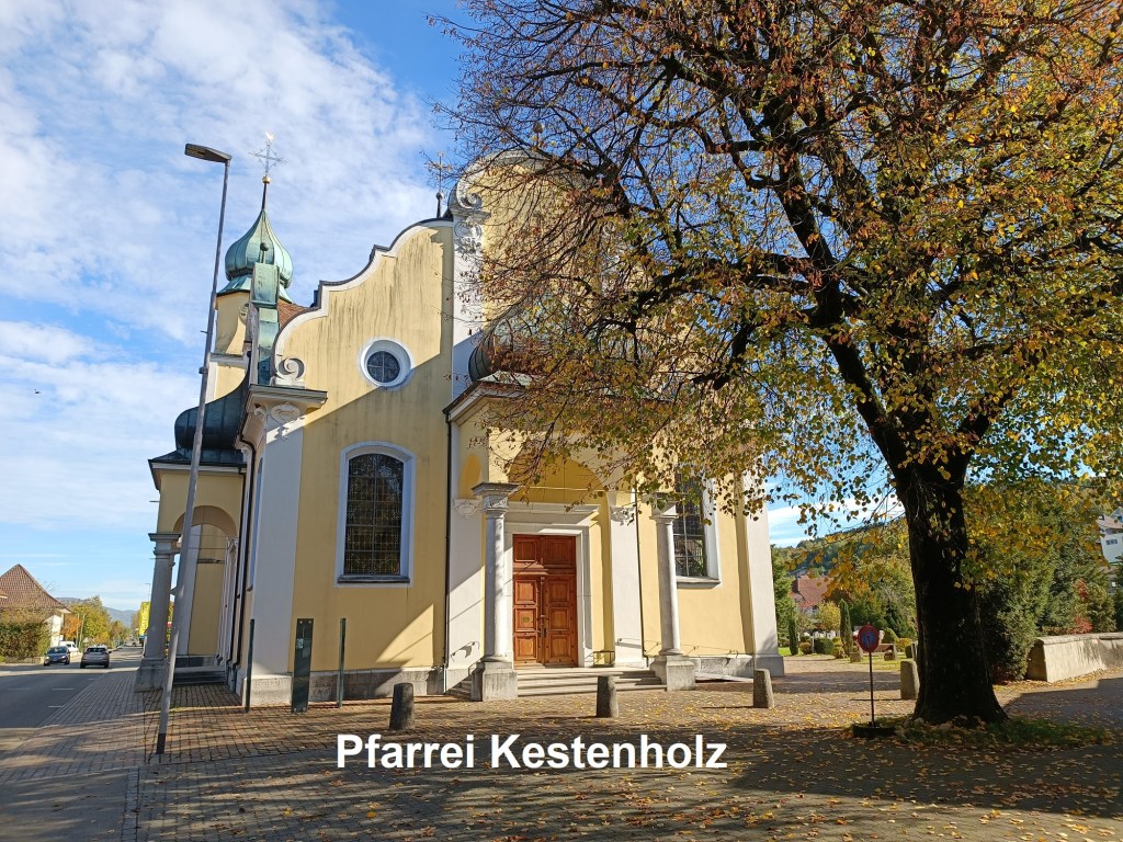
Going off the planned route by crossing the Aare at the dam instead of at the ferry meant that I had to find a way back onto the route as quickly as possible. I had planned to go through Wolfwil, but that no longer made sense. Instead, I followed a trail from the dam to the edge of Wolfwil, and then turned north along the edge of the village. It is where the village meets farmland. At the northern side of the village, the mountains became clearer, and so did the pass that I was making for. I went on the road as far as Schweissacker, and then back onto the trail. It took me up the hill and through the fields before descending into the village of Kestenholz. Kestenholz is one of those villages that has nothing special. Even its date of founding is not certain, just somewhere around 1300. But it does have a nice parish church that was less than 100m off my route.
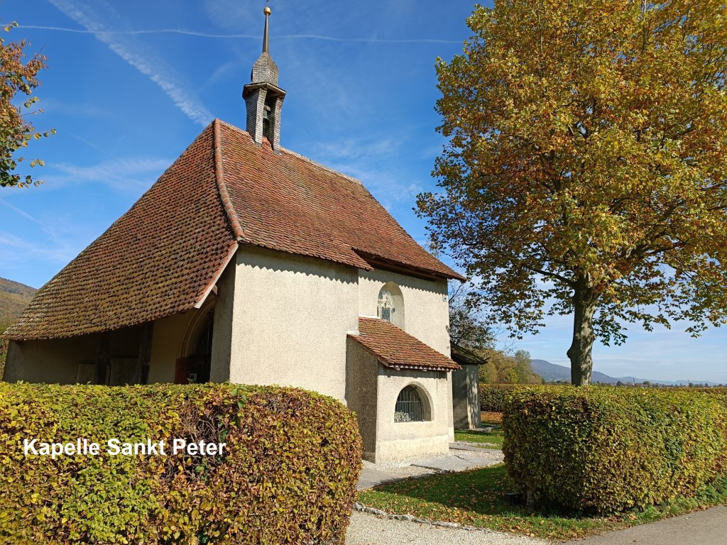
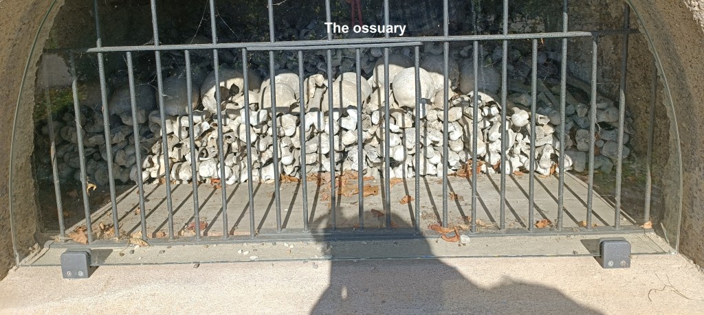

Heading north out of Kestenholz, I soon came to another interesting church. Kapelle Sankt Peter is a wayside chapel. Apparently, it once belonged to a village here, but the village has disappeared. Only the chapel, dating from around 1300, remains. It has been renovated in the 20th century, and while the murals inside may look old, they only date back to a restoration of the church in 1937. There is also a small ossuary in the southern wall of the church, and the gravestones of ancient churchmen lie against the walls.
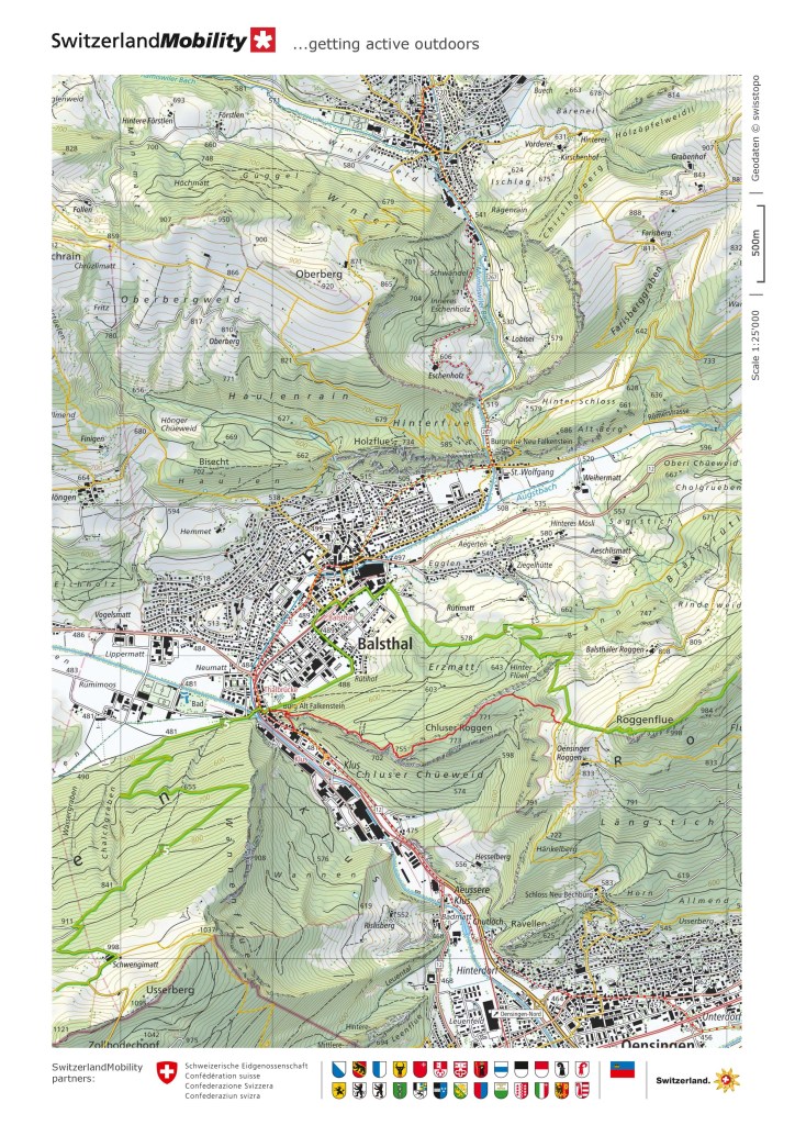
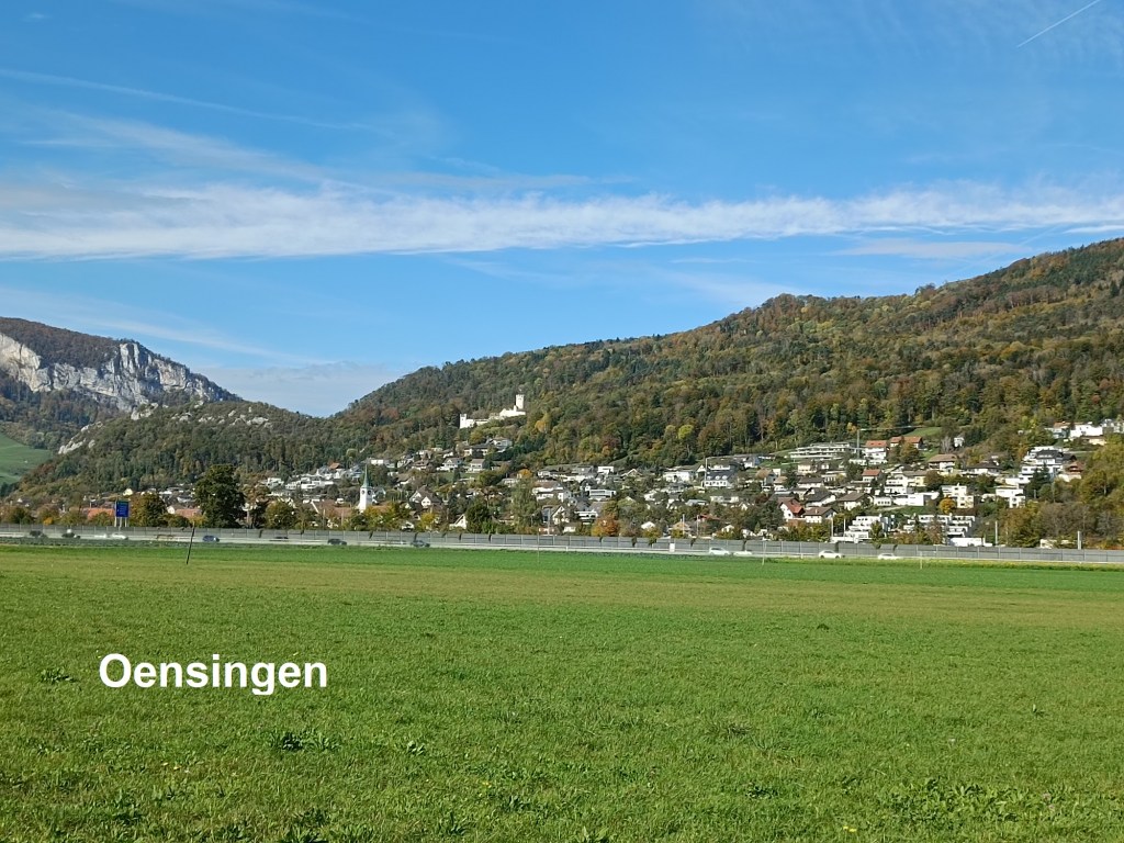
From there, I followed tracks through the fields to come to the road going into Oensingen. By now, it was coming to lunchtime, and I was ready to stop for something to eat. The first place I came to looked quite full, so I went on. I regretted this as I went on through the town and one place after another was closed. I soon found myself on the road out towards Balsthal without having got any refreshment. I took the minor road to Balsthal, which was mercifully free of traffic. It winds around a little, crossing over the main road, and descending to meet that road at a petrol station. Luckily, the petrol station not only had a convenience store, but also had a table and chairs outside. So I was able to get beer and a sandwich, and enjoy them in the sunshine. Suitably refreshed, I went on through Balsthal.

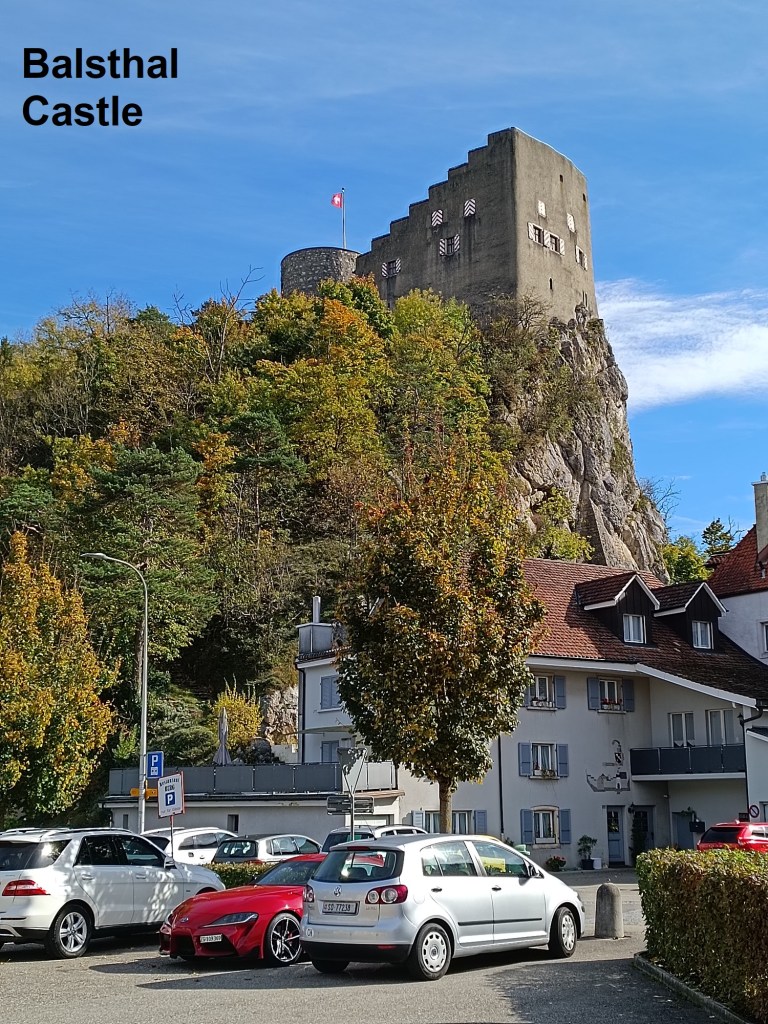

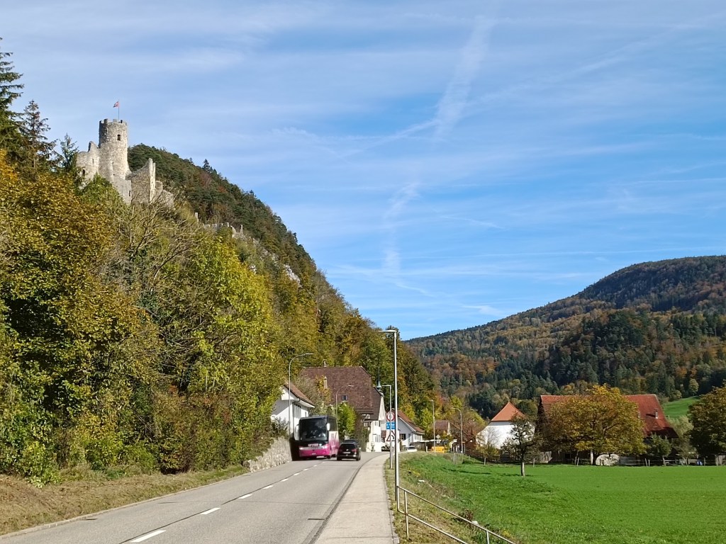
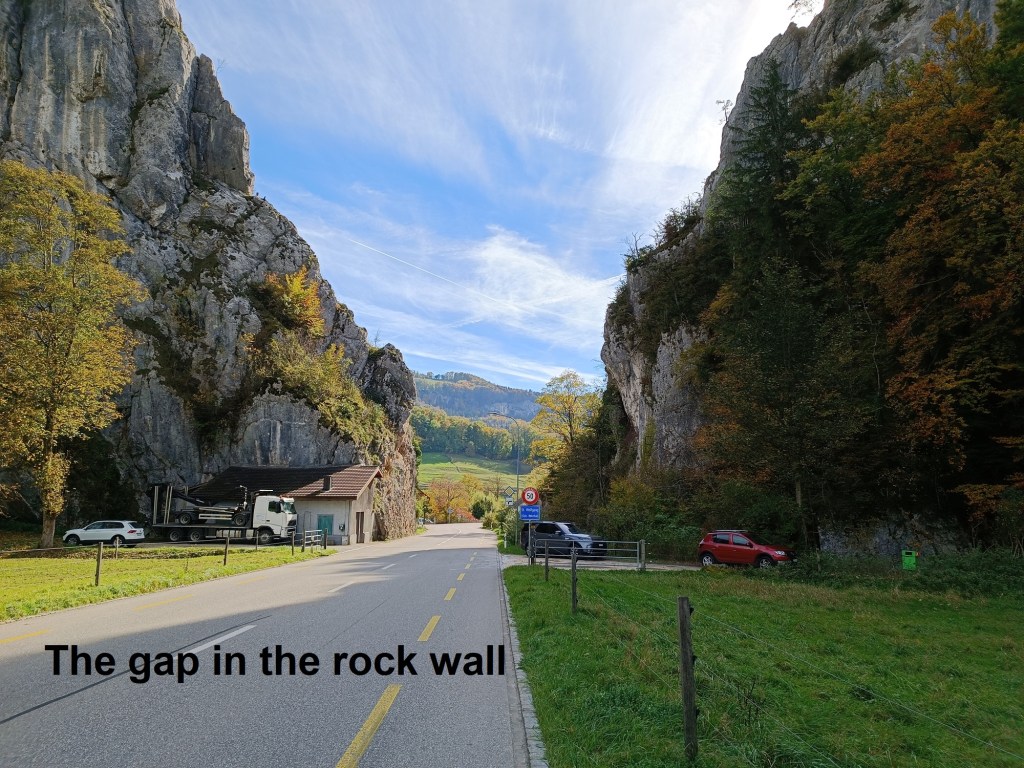
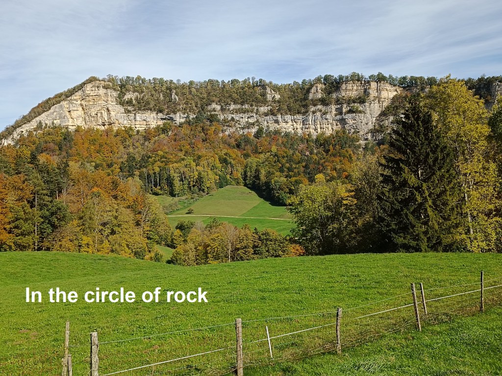
Balsthal is a pleasant little town, but without anything special enough to make me stay there any length of time, so I went straight through. Coming out on the northern side, the route follows alongside a line of cliffs to the left of the road. The line of cliffs looks like it goes on forever, but suddenly, at the tiny hamlet of St. Wolfgang and under the once watchful eye of the ruined Neu Falkenstein castle, there is a break in the line of cliffs and the road turned northwards. The route enters a circular depression where it looks as if a massive area of ground has just collapsed away. I left the road, taking to the high ground, where I had great views of the cliffs on either side, left as the ground must have fallen away.
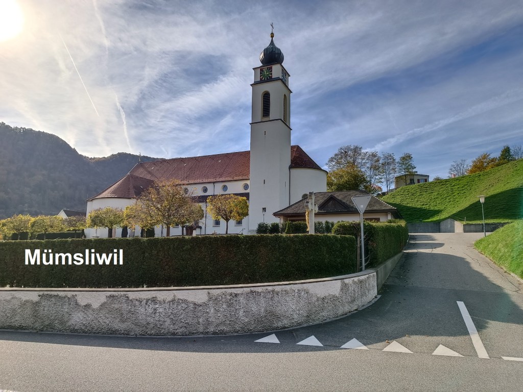
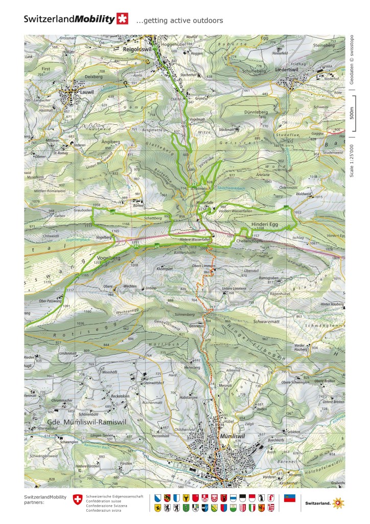
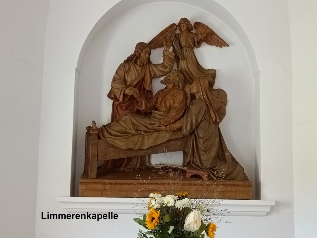
The back road soon came back down to join the main road as it entered Mümliswil, my last village of the day. I was still a little thirsty, and seeing a bar with some bikers outside, I went in for one more beer. I didn’t stay long, but was quickly on my way again, following my route through the village and out to the north. The trail follows an old back road, rising gradually through the 600m and 700m contours. Just above the 700m contour, I came to the Limmerenkapelle. This little chapel was built in the early years of the 20th century to serve the people of the valley, with annual events for the people of Mümliswil as well. The little chapel was renovated in 1970, and again in 2006. I took a few minutes to rest in its contemplative silence before going on.


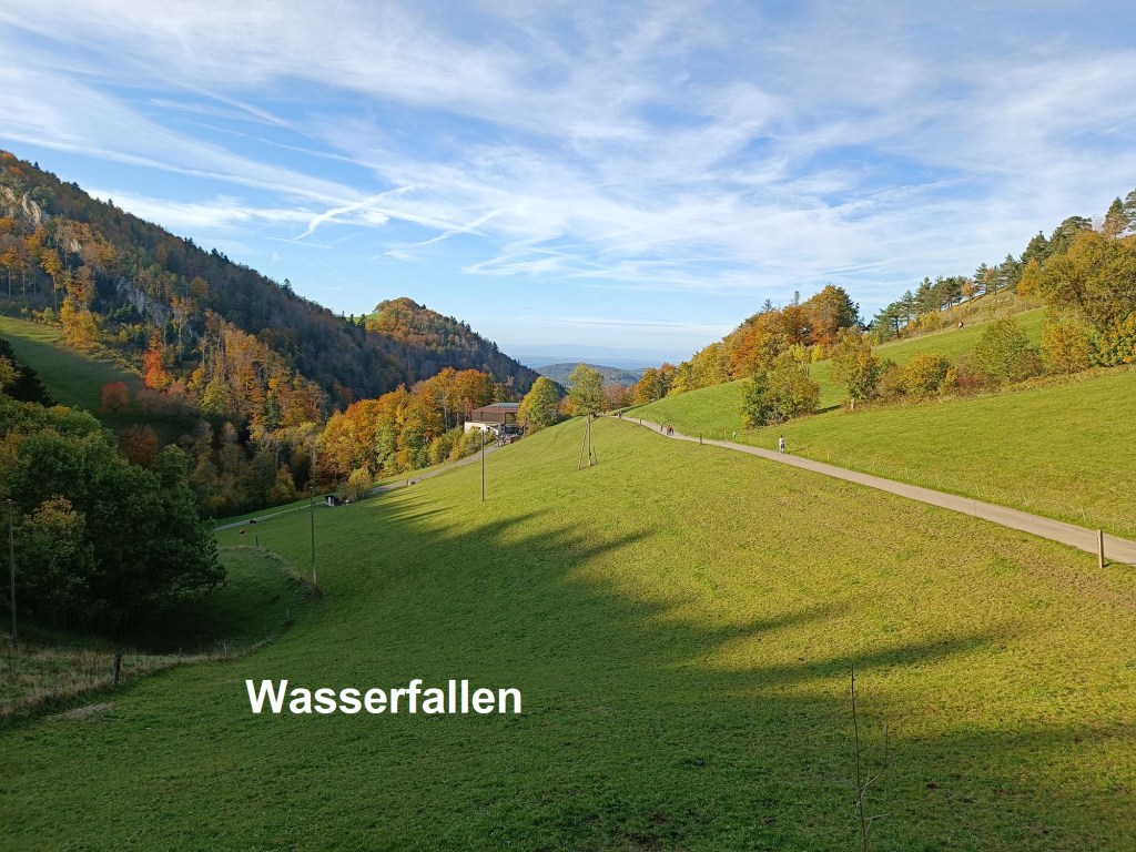
From the Limmerenkapelle, the descent becomes steeper. I left the road and went on the trail through the fields to reach the farm at Obere Limmern (860m). Just above the farm, at 900m, the route enters the forest for the last part of the route to Hintere Wasserfallen. The slope is steepest here, but the route zigzags its way to reach the ridge at 1009m. And then there was just the short descent to the cablecar station and the journey back to Basel.
With the trek from St. Urban to Wasserfallen completed, that just leaves one more journey to bring my route from Luzern to Basel to completion. And it is downhill.
My total step count for the day was 52,119.