
The next stage of my journey along the Trans Swiss Trail presented an interesting planning question. According to the guidebooks, the next stage would take me just ten kilometres from Giswil to Flüeli-Ranft. That seemed far to short, and also, most of that route is flat, going along the lake shore. There is no challenge there. Adding on the next section, to bring me to the town of Stans would add seventeen kilometres, but even that seemed to be lacking something. So how about if I added in a mountain or two? The obvious candidate was the Stanserhorn, a conical mountain overlooking the town of Stans and Lake Luzern. That would mean leaving the standard trail well before Stans, and going up onto the mountainous ridge. But in my ambition, I decided to go for broke, and to take in not just one mountain , but two. I decided to go for the Gräfimattstand mountain as well.
Having decided what to do, the only other question was when to do it. The weather was set fair for last Sunday, and so I started out early in the morning. Approaching Giswil, the prospects were enticing, and I looked forward with optimism to a good day ahead. But as the Scottish poet said, and as will become clear here, “The best laid schemes o’ Mice an’ Men gang aft agley”.
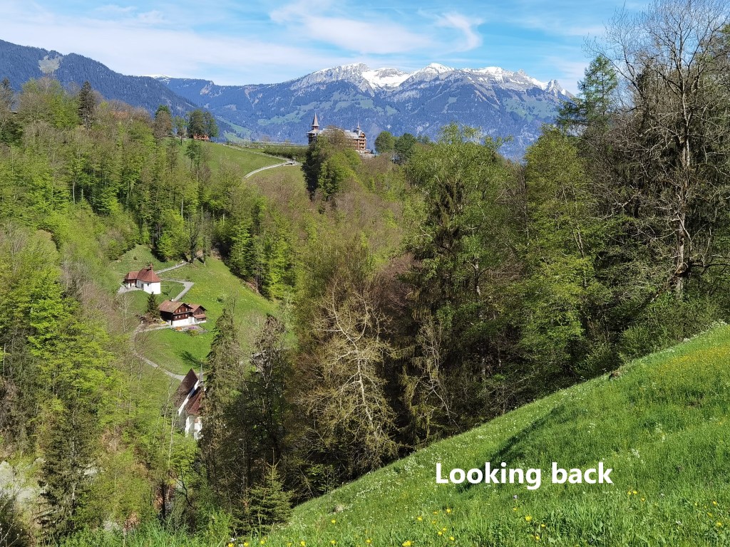
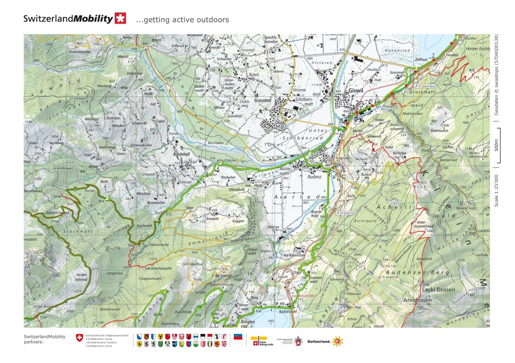
Starting out from Giswil, I was even able to look back at the pass that I had come over on the previous stage. That day, it was shrouded in mist, but now it was clear in the sunshine.
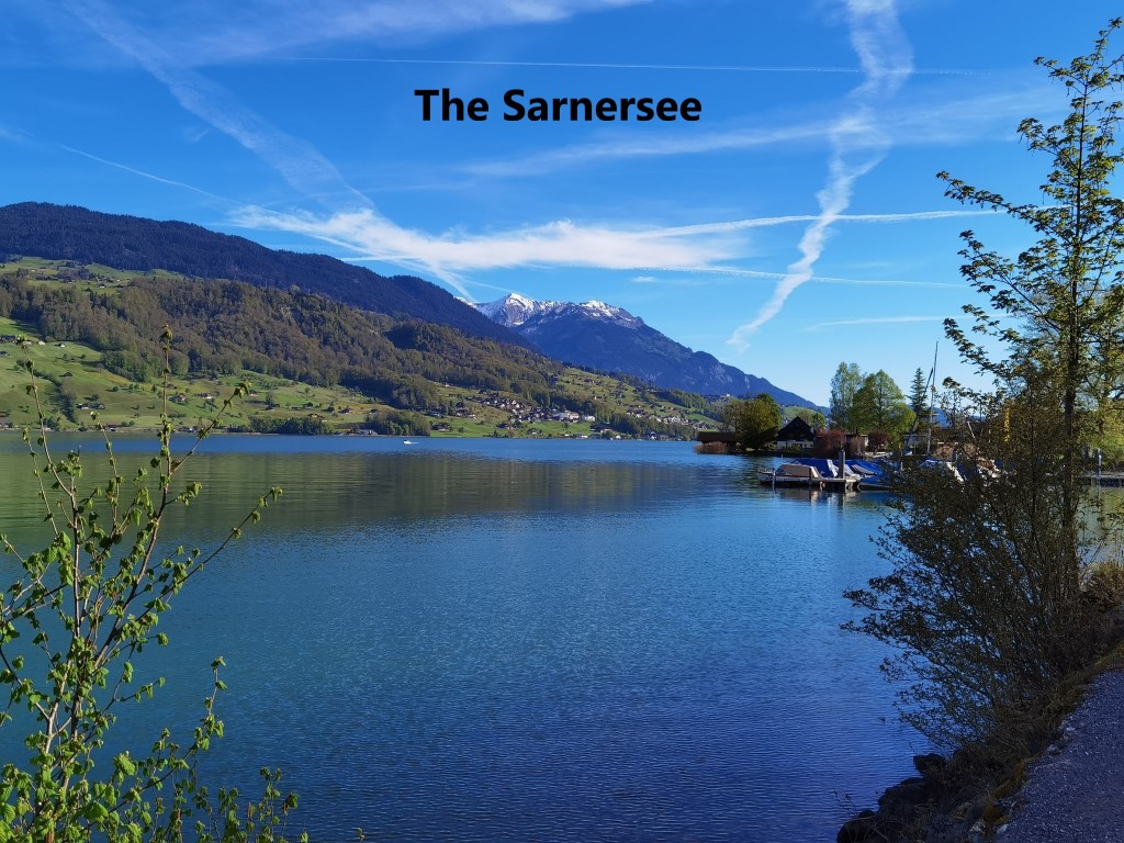
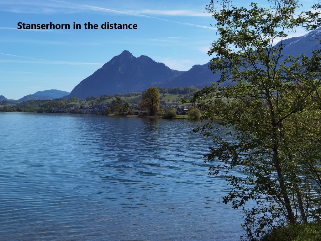
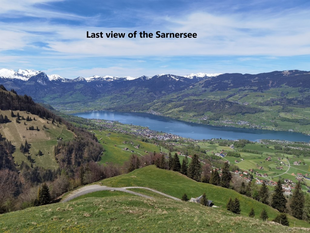
The first part of my route was quite flat, following the eastern shore of the Sarnersee lake. Over on the other side of the lake, I could see out to the Pilatus mountain, while ahead of me and to the right, the Stanserhorn was clear and looking inviting.
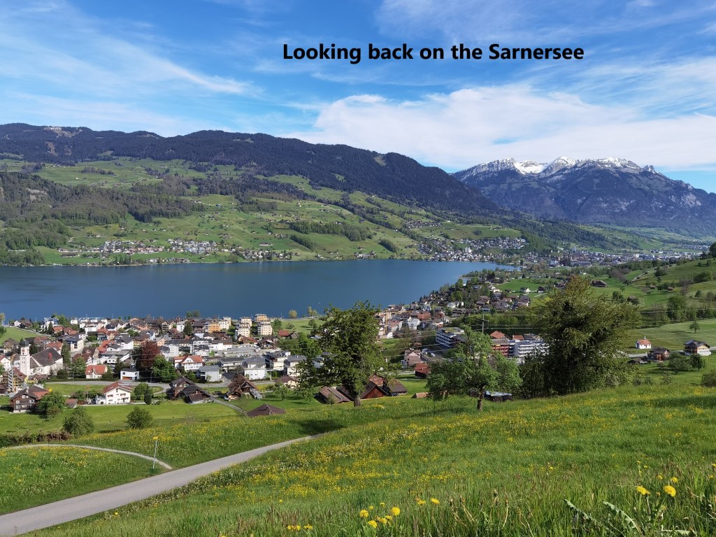
I had set myself a decision point that I should reach Flüeli within two hours if I were to go ahead to Gräfimattstand, so I wasted no time. I took a small detour at the village of Sachseln to shorten the route, and then I was heading upwards. On such a glorious morning, the route allows fantastic views of the Sarnersee, and I paused here and there to enjoy those views. In one stage of the route, some energetic young cows tried to chase me from a field, but waving the stick at them soon quietened their enthusiasm.

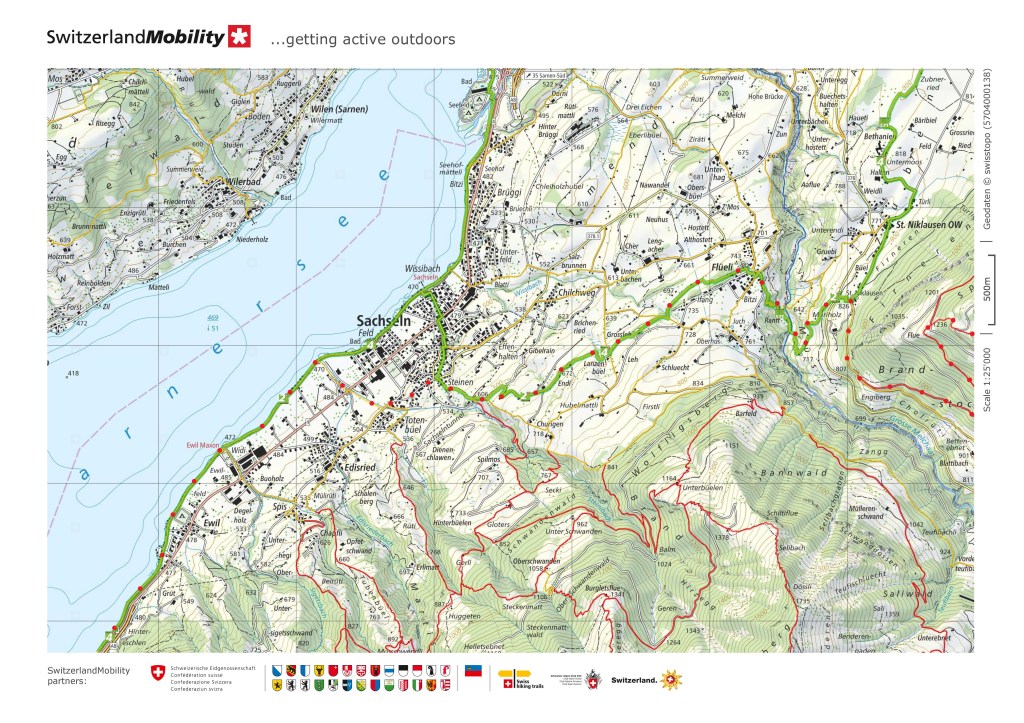
Entering Flüeli, I was met by a black cat crossing the street in front of me. In some cultures, including Ireland, a black cat is taken as a sign of good luck. There are other cultures, where it is taken as a sign of bad luck. I will not offer a definitive opinion on that.
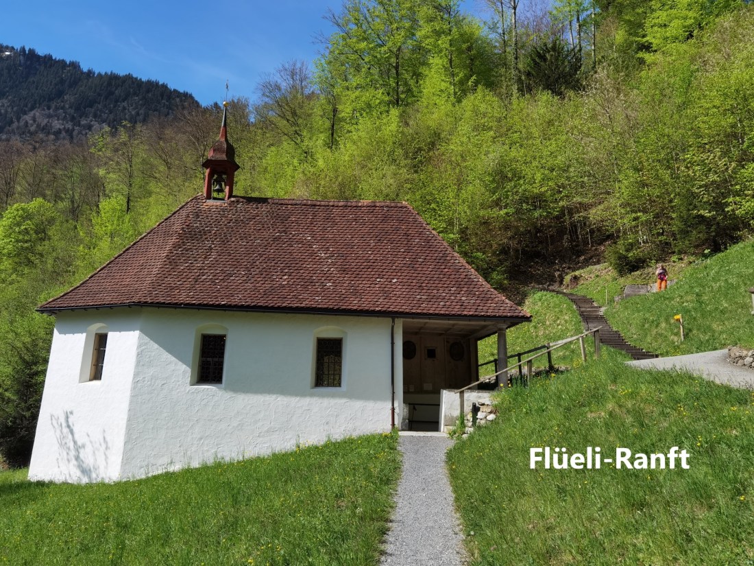
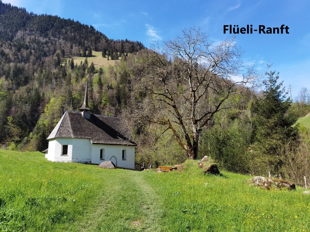
I made it to Flüeli in just under two hours. Flüeli is a small village that seems to be the embodiment of what people imagine Swiss scenery to be. It is also a place of religious significance. Nicholas of Flüe was initially a soldier in the armies of the Swiss Confederacy. As the confederacy struggled to establish itself and the independence of the cantons, Nicholas fought in several battles, distinguishing himself for his bravery and his devotion. After leaving military service, he lived in Flüeli, and was for a time a judge and a councillor in his canton. But after some visions, he decided to leave the affairs of the world and he became a hermit in the nearby gorge of Ranft. The legends say that he survived for 19 years with no food except the Eucharist. He gained a reputation for wisdom and piety, becoming known as Brother Klaus, and it is with that name that he is most often remembered. Pilgrims on the route to Santiago would go to see him and seek his counsel. There was constant tension between the cantons at that time, and his intercession prevented civil war in 1481. Brother Klaus died in 1487 and is still revered in the area half a millennium later.
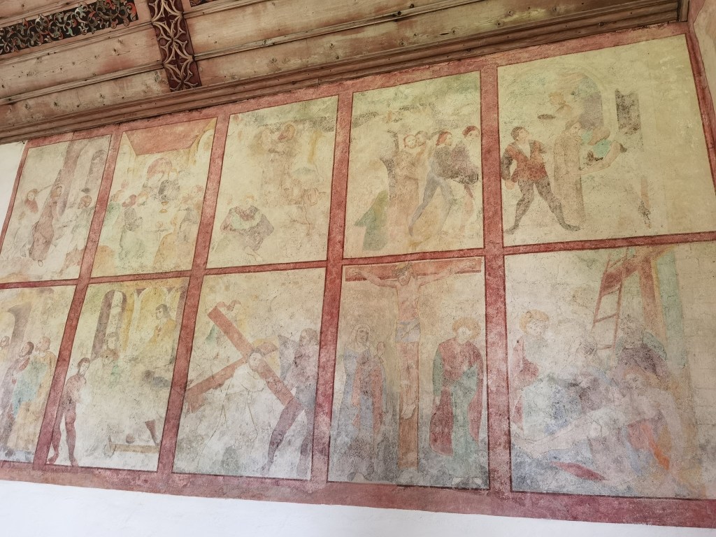
The valley gorge of Flüeli-Ranft where brother Klaus lived is the site of two small churches, with a third one on the hillside further on. All are neatly decorated and well looked after in this haven of tranquillity.


From the valley at Flüeli-Ranft, the route goes on upward, and soon comes to another church at St. Niklausen. At that point, I left the standard trail, and headed on upwards. The route twists and turns, zig-zagging upwards. It goes in and out of the forestry, but at one point emerges to give a stunning view of the lake below.
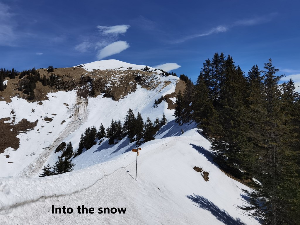
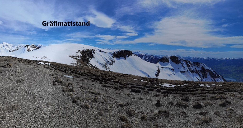
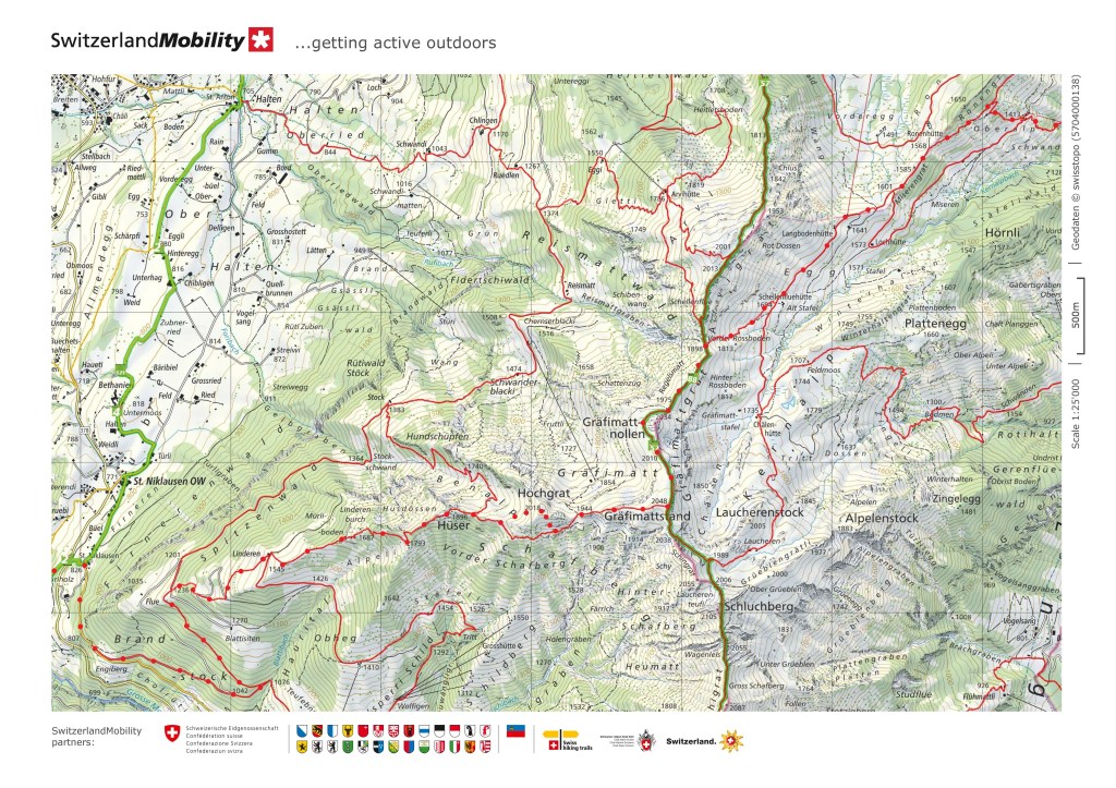
Then it was back into the forestry again. The Sarnersee is at 470m above sea level, and the mountain that I was making for, Gräfimattstand, is at 2048m, so the total ascent from the lake would be just under 1600m. When making such an ascent, I like to break it down into stages, and to know when I have passed each significant contour. And so I tracked my way to the 1200m height, then 1300m and 1400m, to reach 1500m at the Linderen hut. After a short refreshment break there, I went on again. The ridge narrows, and at times was just wide enough for the trail along the crest of the ridge. Somewhere on Hüser, I came to the first patches of snow at about 1800m. After Hüser, the trail comes out of the forestry, and a summit ahead was visible. The route goes around to the right and southwards briefly, but then turns back towards the summit of Gräfimattstand. And this is where I made a significant error in navigation. I mistook the signs and turned back towards the summit too soon. The result was that I found myself on the secondary summit of Höchgrat instead of the route to the true summit. This brought me into a snowfield which was difficult to get through, and it cost me valuable time
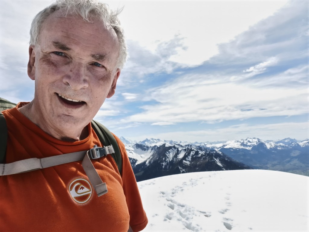
But nevertheless, I got back on the correct route, and made it to the summit of Gräfimattstand. The snow was deeper towards the summit, and this was not good snow. I have written about the different qualities of snow before, from the soft but dry powder snow I faced in the Juras to the hard packed snow of my last outing. I like snow to be, as the Christmas song puts it, “deep and crisp and even”. The snow here on Gräfimattstand was deep. At times I could probe almost a full metre in with my walking poles. And it was definitely not crisp. While the powder snow in the Juras was dry and soft, this was wet and soft, and in places, my feet sank deep into the snow. It looked even, but that only served to hide the hollows in the ground beneath. On one footstep, I might touch ground only a few centimetres below the surface, and on the next step sink in up to my knees. And at one point, a loud noise behind me reminded me of the dangers of such snow, as I turned around to see a small avalanche.
But I got to the top. I did not hang around. It was well into the afternoon, and I decided to go on immediately. The route heads north from Gräfimattstand. It curves around the side of the northern secondary summit of Gräfimattnollen. On the southwestern sides of this knoll, the snow was OK, but as I came around to the north-west, it became near impassable. Nearly everywhere was almost a metre deep, and every step was an effort. At one point I slipped and fell in the snow and had to get myself upright very carefully to avoid sliding downhill out of control. But I made it around the knoll. There was one more small rise before the nearest exit point. It was late afternoon by now, and descent at the nearest exit point was important if I was not to be stuck out overnight. I got over that last knoll without too much difficulty, though once again, the snow on the northern side was deep and soft. And then I was at the exit point, though still at 1898m altitude. I went downhill quickly. I took out a plastic sheet, and sitting on that, with my walking poles as rudders, I slid down the first piece of the way, creating miniature avalanches as I went.
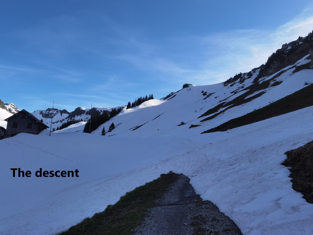
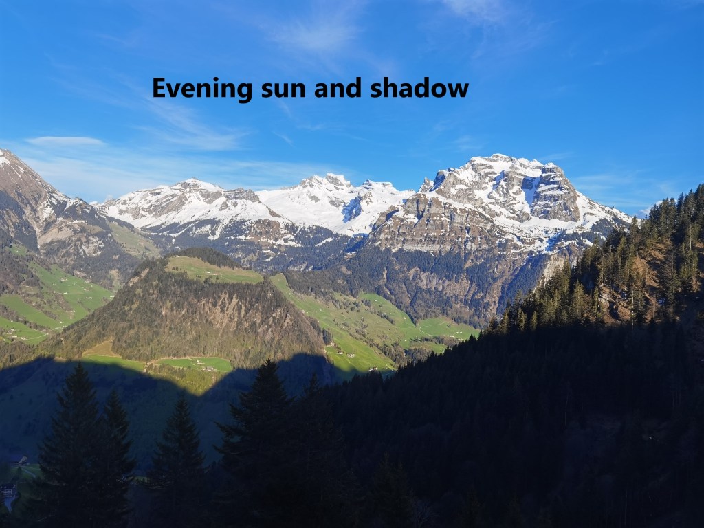
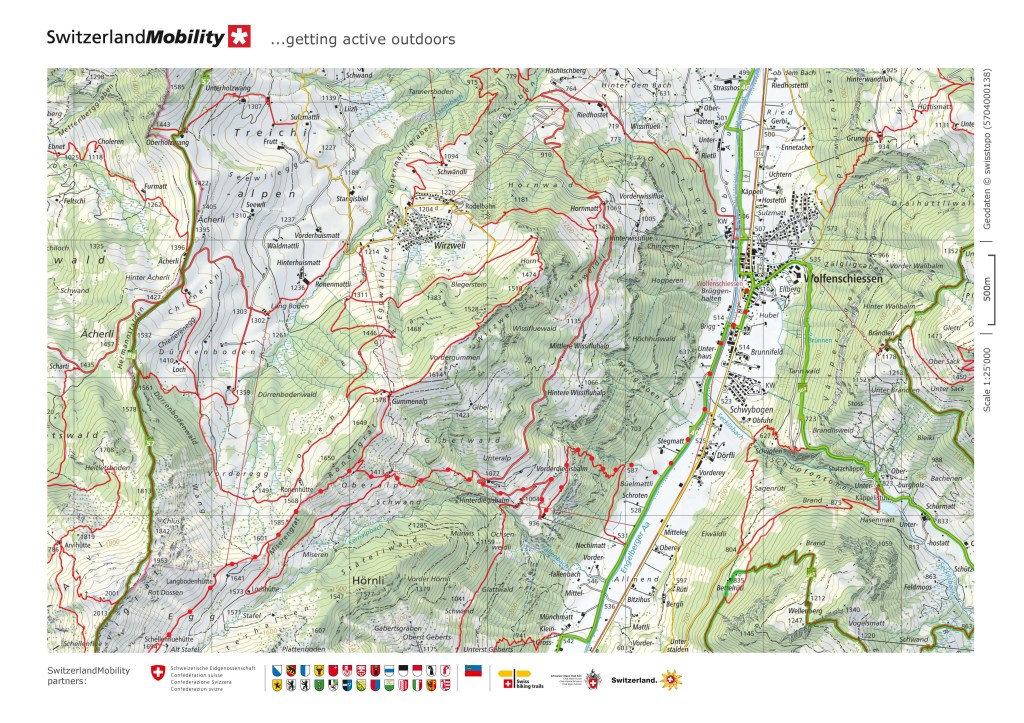
Once I reached the Schellenflüehütte, I was out of the snow. There were some further small patches, but the danger was gone. I headed downhill to the east. With the sun setting behind me as I went downhill, the mountains ahead were bathed in sunshine, while the valley below was in shadow.

I even found a little time to admire the flora on my way down. One of my favourite flowers is alpine gentian, Gentiana verna. There is no other flower that I know of with such a vivid deep blue colour. The photograph does not do it justice. And if the gentians are in bloom, then summer is not far away.
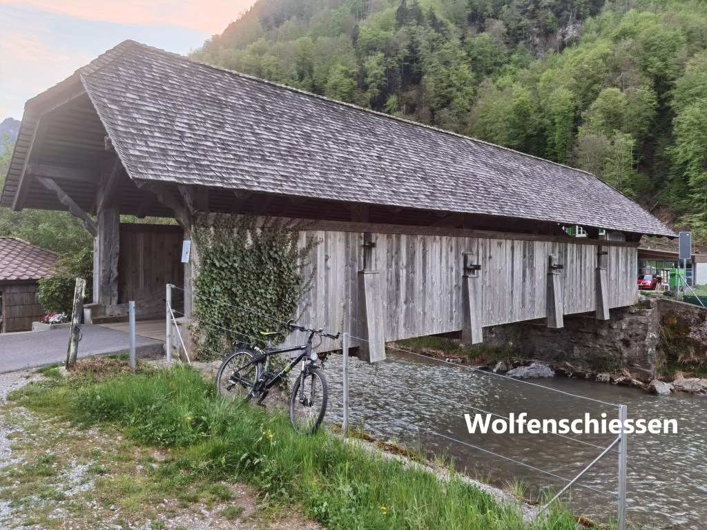
The descent seemed to go on forever, but eventually, I came to the valley floor and walked the short distance to the station at Wolfenschiessen.
It had been a long day, and I had not achieved what I set out to do. But in the circumstances, I felt I had achieved something in reaching Gräfimattstand safely and getting back down. Whether my not doing everything that I planned was due to bad planning, over-ambition, or the black cat in Flüeli is discussion for another day. But in any case, I am reminded of the lines from the song:
Yes there were times, I'm sure you knew,
When I bit off more than I could chew,
But through it all when there was doubt,
I ate it up and spit it out.
I faced it all, and I stood tall,
and did it my way
As long as I can say that, then things are OK.
And my total step count for the day was 62,687 steps.
The maps below show the route that I actually took, though after Gräfimattstand, it was not as originally intended.

Adding to your lines Walkingman:
“My friend, I’ll say it clear
I’ll state my case, of which I’m certain
I’ve lived a life that’s full
I traveled each and every highway
And more, much more than this
I did it my way.”
This sums you up. Enjoy and keep walking .
LikeLike
What an impressive hike Thurloch – congratulations, not only >60000 steps, also at least 1500 altimeters 💪 and on addition difficult conditions in the mountains- you can be proud 👏👏👏
LikeLike