
The weather forecast predicted a reasonably good day. There would be rain during the night, but by morning it would be gone. And so I took the tram and bus from Basel to Mariastein. Waiting for the bus I wasn’t sure if the grey skies were the aftermath of the night’s rain, or the prelude to more. And as the bus driver switched on the windscreen wipers, it didn’t look too good.
But I was in Mariastein early, and having been unable to see the church properly on my last visit, I took advantage of the relative quiet to see what I could. The origins of Mariastein go back to the 15th century. There were reports of people falling from the cliffs and being held up by the virgin Mary. The Monastery was founded in the 15th century, and supported throughout the turbulent times of the reformation, though those times did take their toll. The current abbey dates back to 1648 when the Benedictine order of monks took it over. The monks had to leave in the aftermath of the French revolution, and only returned properly to Mariastein in the 1940s. Since then it has been peaceful and tranquil.
The church is really two churches. Associated with the reported divine rescues of people who fell from the cliffs, there is a cave in the limestone which became a grotto to the virgin Mary. It is now a church that is part of the abbey complex. The main church is above ground, and while it looks unassuming from the outside, it is richly decorated in a Baroque style inside.


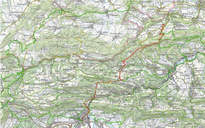
From Mariastein, I followed the route number 32. This is the Via Surprise regional route. This is a circular route that takes in the borders of Basel Landschaft and Solothurn cantons.


The route goes first to Rotberg. Mariastein has no accommodation for pilgrims, but there is a hostel at Rotberg just a short distance away. By the time I reached Rotberg, the rain was definitely coming, and while the forest afforded some initial protection, I was forced to take out the raingear soon enough.
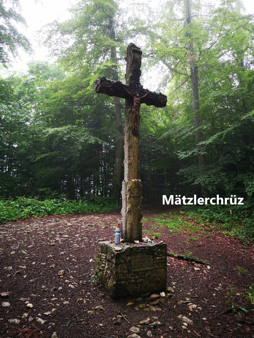
It was still raining when I reached Mätzlerchrüz, and it continued raining all the way along the trail to Challpass. This part of the trail follows the ridge line for the most part, but veers left as it comes to the pass. In the rain, with my glasses misting up, I almost went wrong a number of times due to lack of visibility, but thankfully I made it OK. Challpass is one of the older passes through the Jura mountains, and even has a bus service these days. For me, the important thing was that as I reached there, the rain stopped, and I could take off my raingear without too much fear of having to need it again.
Having said that, it was still cloudy as I continued on, still giving a dismal feel to the day. It was between Challpass and Kleinlützel that I saw the first signs of the religious significance of this route. Not far from Challpass, I came across a sculpture of pilgrims at the side of the trail. And shortly before Kleinlützel, I came to a Bergkapelle.
-A")


The Bergkapelle is actually part of a set of stations of the cross, a Catholic practice that commemorates Christ’s punishment and death. The kapelle is number 13. Just outside it is a large wooden carving of an angel. And on the way down to Kleinlützel are stations one to twelve.
Kleinlützel itself nestles in the valley below, between two ridges. It is also the lowest point of the walk, at just 420m above sea level.


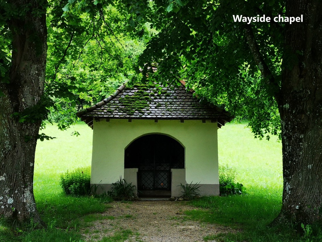
And leaving Kleinlützel I faced the steepest ascent of the day, up to the settlement at Ring, 601m above sea level. But it was not too difficult, and I still had plenty of energy left for the further ascent up to the waymark point at Oltme, another 49m higher. From Oltme, the route is fairly flat. This is regional route 80. This route is the Via Jura, and it claims to follow the ancient traffic route south from Basel to the plains in the middle of Switzerland. It was only a short distance to Käpelli at 653m, with its wayside chapel. This chapel is wide open and the flowers and lit candles show that it is used, though the altar is locked off.


By now, the sun was getting the upper hand in its struggle against the clouds, and I continued on to Albach. After Albach, the route descends towards Reselle.

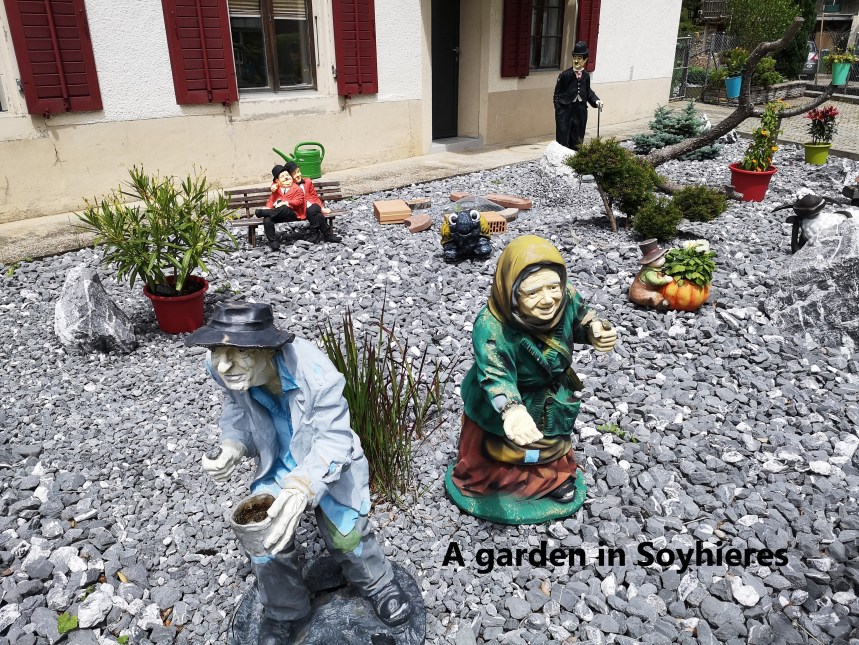
And at Reselle the route turns south. It skirts around a small lake before reaching Soyhieres. Like Kelinlützel, Soyhieres is a small village that offers few reasons to delay. The church dates from 1937 and has nothing special. But I did come across an interesting garden on the way into the village.
South of Soyhieres there is a sharp gap in the limestone crags. The road and rail routes go through the gap almost as if it had been cut specially for them. To either side the cliffs are steep and rocky. It would be tempting to take an easy path through that gap, but that would mean missing Vorbourg. So I continued on route 80 as it went to the high ground west of the gap, and then south to reach Vorbourg. And I was not disappointed. The views to north and south are spectacular.


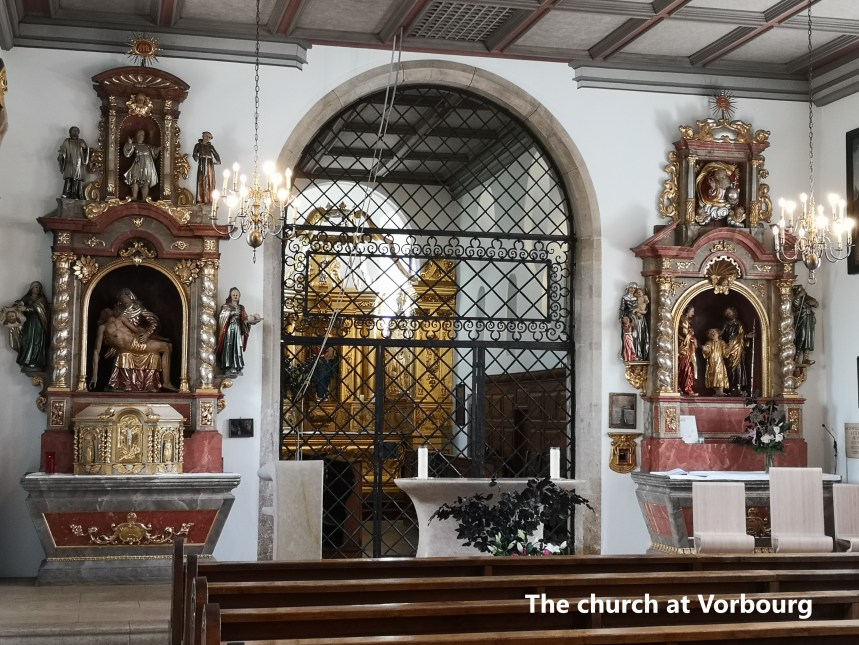
Vorbourg is also the site of a small church community: Notre Dame de Vorbourg. It has been there for 150 years. On the hill above are the ruins of an older castle, something to visit on another day. The church is small, but the walls inside are heavily decorated with paintings, many of which go back to the 17th century.


To reach Vorbourg, I had left route 80, which takes longer to reach Delemont. For me, and from Vorbourg, it was a relatively easy descent to reach the edges of Delemont, and then flat street walking to the station.
 The distance on this section is something between 25 and 30km, and my step count was 43,023 for the day.
