
The end of the last journey is the start of the next one. So I arrived in Maisprach early in the morning, exactly where I had stopped last time. Maisprach and the surrounding farmlands are part of Basel Landschaft canton, but like a peninsula jutting out into Aargau territory. So I was faced with the decision as to whether I should walk the perimeter of this “peninsula” or take a short cut. I decided to take the longer route, for two reasons. First, I had seen the last day that there is some kind of tower at the top of the Sunnenberg to the south of Maisprach, and being curious, I wanted to find out what it was. The second reason is simpler: because it’s there! I was determined to keep as close as practical to the borders of Basel canton, so I would walk this route if there was a practical way to do it. And there was, so that was it. No more discussion.
So I left Maisprach on a cloudy morning heading north-east, through orchards and up the hill. At one of the junctions, I came across a stopping place that was interesting for two reasons. Walking is a common pastime in Switzerland for young and old, and it is quite common to find seats placed near villages where people on walks can take a rest. But the other feature of this place is how it shows Swiss agriculture’s relationship with insects. We all know that bees are great for pollination, but Swiss farmers know that many other insects are involved as well. So it is quite common to find an “insect hotel”. In the photo here, what looks like just a wooden pillar with holes in it is actually one of those hotels. The holes are drilled purposely so that insects can hibernate there, and come out in spring ready to pollinate the trees and crops.

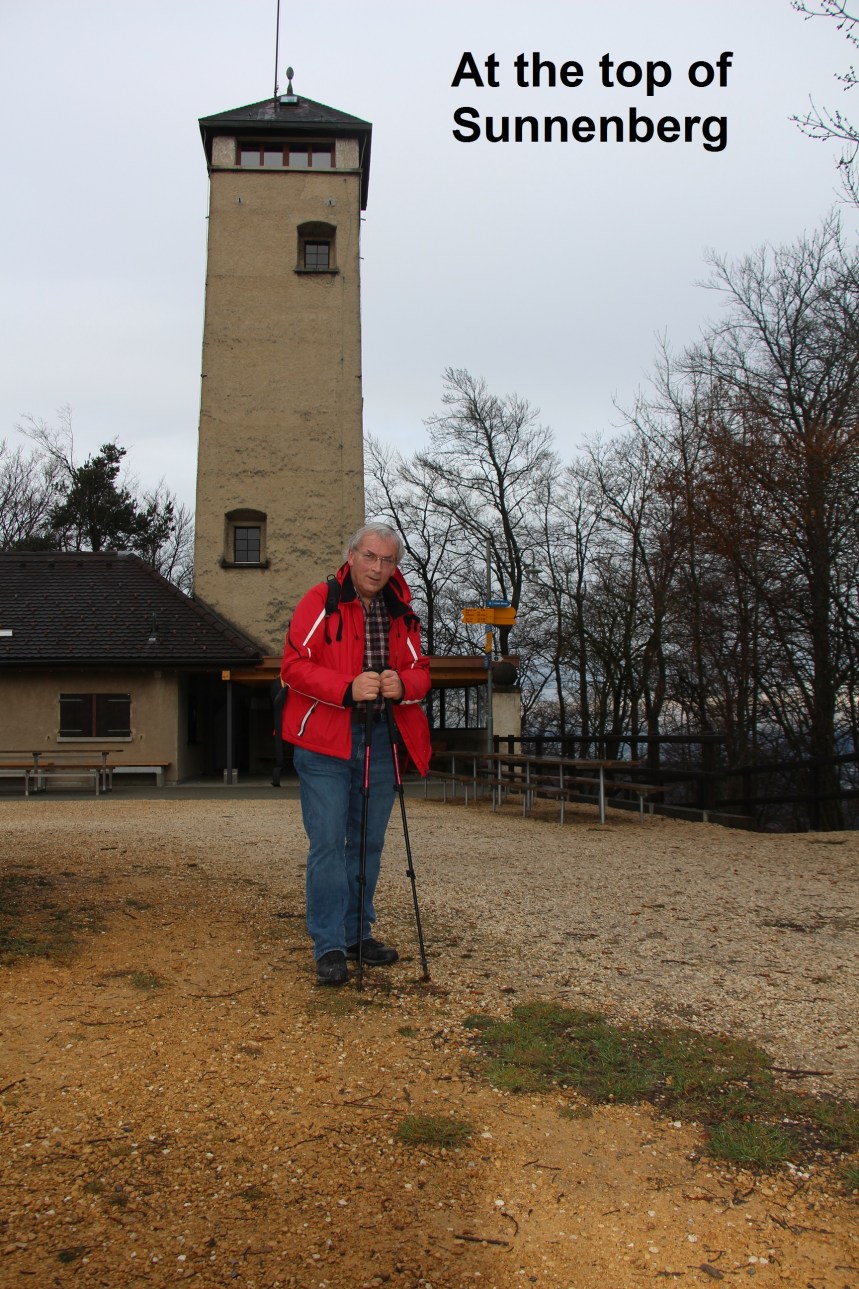
Going onwards, I came to the first of the many border markers I would see that day. This one was dated 1819, and in good condition, with the arms of Basel on one side and Aargau on the other. Going on through the forest, I reached the top of the Sunnenberg. The tower there looks like it used to be some sort of watchtower, though now it is a place for refreshments and picnics. But today it was closed.

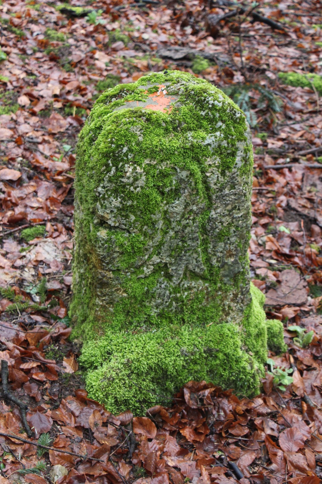
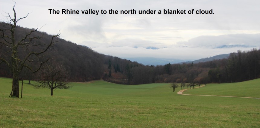
My route then wound downwards through the forest before emerging to give an excellent view of Maisprach in the valley below. Then there was a long stretch through the Schönenberg forest where there were several border markers, most covered in moss, as in the heading photo. Once back into farmland, the route turned eastwards, giving good views of a cloud-covered Rhine valley to the north. At Eigenried, the farm there proclaims itself to be a “Texas Longhorn Ranch” and a member of the Swiss Texas Longhorn Society, though I must say that sounds like a contradiction in itself.

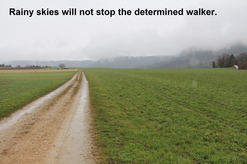
From Eigenried, I again had one of those decisions about the route. A small finger of land protrudes northwards into Aargau canton, and I could walk it or bypass it. I chose to walk it, and was rewarded with the sight of two deer. I disturbed them at their grazing, and before I could do anything, they were running off into the forest. Sometimes the most exciting things that I see are ones that I cannot capture with my camera. As I passed the settlements of Asp, Rigiberg, Rütihöfe and Junckerschloss, the skies that had been just threatening started to rain.
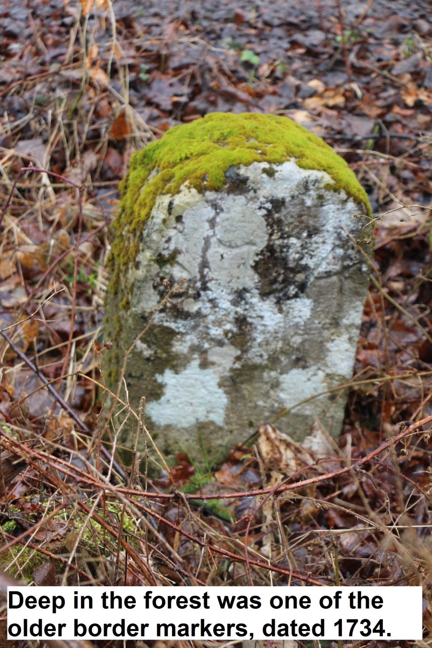
Just before Rütihöfe I came across a border marker dated 1780. But there was even older to come. When the route turned eastwards between Talhof and Asphof, it took me into a forest, where the trail follows the cantonal border almost exactly. It was there that I came across a marker dated 1734.
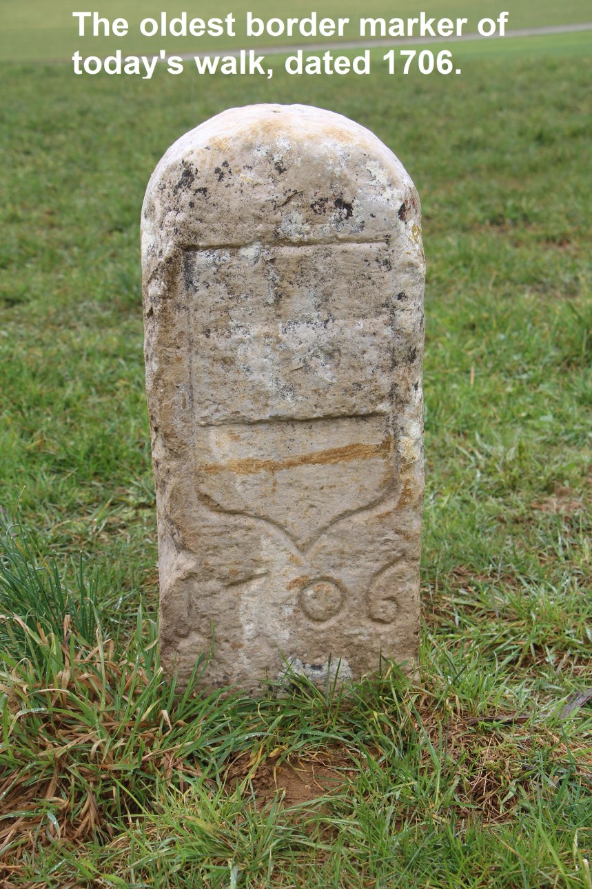
And so I came to a junction of trails near Buschberg. My old notes of previous walks told me that I had been at this junction before, on the 31st August last year when I was walking the Aargauer Weg between Frick and Aarau, as mentioned in one of my earlier posts here. But on that occasion, I had come from the north and was turning east, whereas this time I had come from the west and was turning south. From there, the route heads almost due south, first along the edge of the forest, and then through it, before emerging into fields above the village of Anwil. And this is where I came across the oldest border marker of the day, dated 1706.
At Anwil, there is once again a piece of Basel Landschaft sticking out into Aargau canton, and once again I made the decision to walk around it. One of the reasons is that about halfway around is very close to where the three cantons of Basel, Aargau and Solothurn meet. I wasn’t sure what I would find there. Perhaps there might be some extra-special marker. But the actual meeting point is about fifty metres off the trail in dense scrub, and I could see nothing, so I went on. Also, the maps are unclear whether the track would go all the way around. It doesn’t, but instead peters out in the forest near a telephone relay mast. I followed a stream uphill to a small pond where I disturbed a heron. I watch as he launched himself into the air, an expert hunter of fish and frogs, but ungainly in getting airborne. It seems that when I do something I don’t have to do, like walking this extra piece, I am rewarded with the sight of something special.

From that pond, I scrambled up a slope of light woodland to emerge at a roadhead, and a track that brought me back into Anwil from the south. By now the rain had stopped. The sun had not yet come out, but for me it was time to make my way homewards.
