There is something special about borders. No, I don’t mean the borders that you cross when you fly. That is too easy. I mean those invisible lines on the ground that are marked out sometimes by fences and checkpoints, or sometimes by just a sign or a stone marker. Moving at ground level gives them a physical presence that the air traveler misses. When we come to one, our natural impulse is to want to cross it with the maximum of pomp and ceremony. We want the passport stamped, a barrier raised, and someone to salute us as we pass through. And if all of those are missing, we will at least take a selfie, preferably with one foot either side of that border.
Some of these things were going through my mind when I made the decision to add a project to my 2018 walking program that I would walk the borders of Basel. Basel in Switzerland is made up of two half-cantons: Basel Stadt and Basel Land. So my project is to walk the circumference of the combined entity.
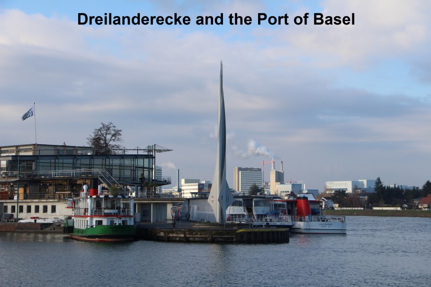
And this week I made a start on that. I decided that a good walk for one day would be to walk the entire border of that part of Basel canton that lies on the right bank of the river Rhine. And naturally, the place to start would be in Kleinhueningen at the port of Basel. Switzerland is an inland country with no coastline, so it may come as a surprise to people to find that Basel has a good sized port. It is on the river, and barges come and go, and there is also rail and road traffic in and out of the port. So early one morning I made my way to that part of the port beside the German border, close to a spot known as Dreilanderecke. There is a point in the middle of the river, where the borders of three countries meet: France, Germany and Switzerland. The Swiss have erected a marker on the nearest land point, and the spot has become known as Dreilanderecke, which means Three Country Corner. The marker is not exactly at the German border, but just across a small channel, so I was starting just north of the marker, right at the point where the Swiss-German border touches the Rhine.
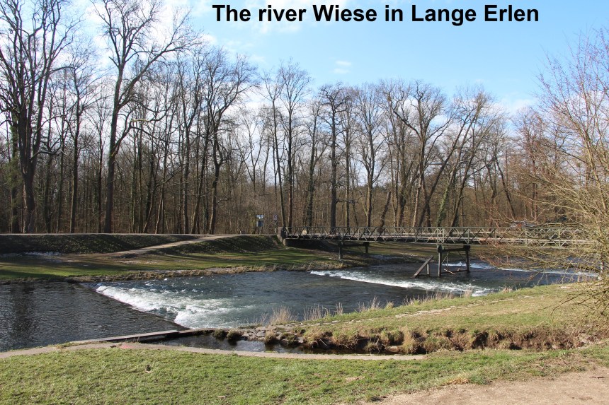
My route took me eastwards along a road and then a track with the two metre high border fence on my left. I went on pas the Kleinhueningen customs station to a small track, still going eastwards. The track is flanked on one side by the railway and on the other by the border fence, with run-down allotments on the German side. Emerging into a car park, the track seemed follow the fence onto an embankment and past a railway signal box, but at that point I realised that something was amiss, and following the fence would have me trespassing on the railway. I turned to find the signalman at the door, ready to give me a warning, but as I retraced my steps, he went back inside. So my route followed the aptly named Grenzstrasse (Border Road) to Neuhausstrasse, which in turn brought me to the Otterbach customs post. South from there for a few hundred metres brought me to Lange Erlen, where I turned west, following the track eastwards. Lange Erlen is a linear woodland park that lines both sides of the River Wiese.
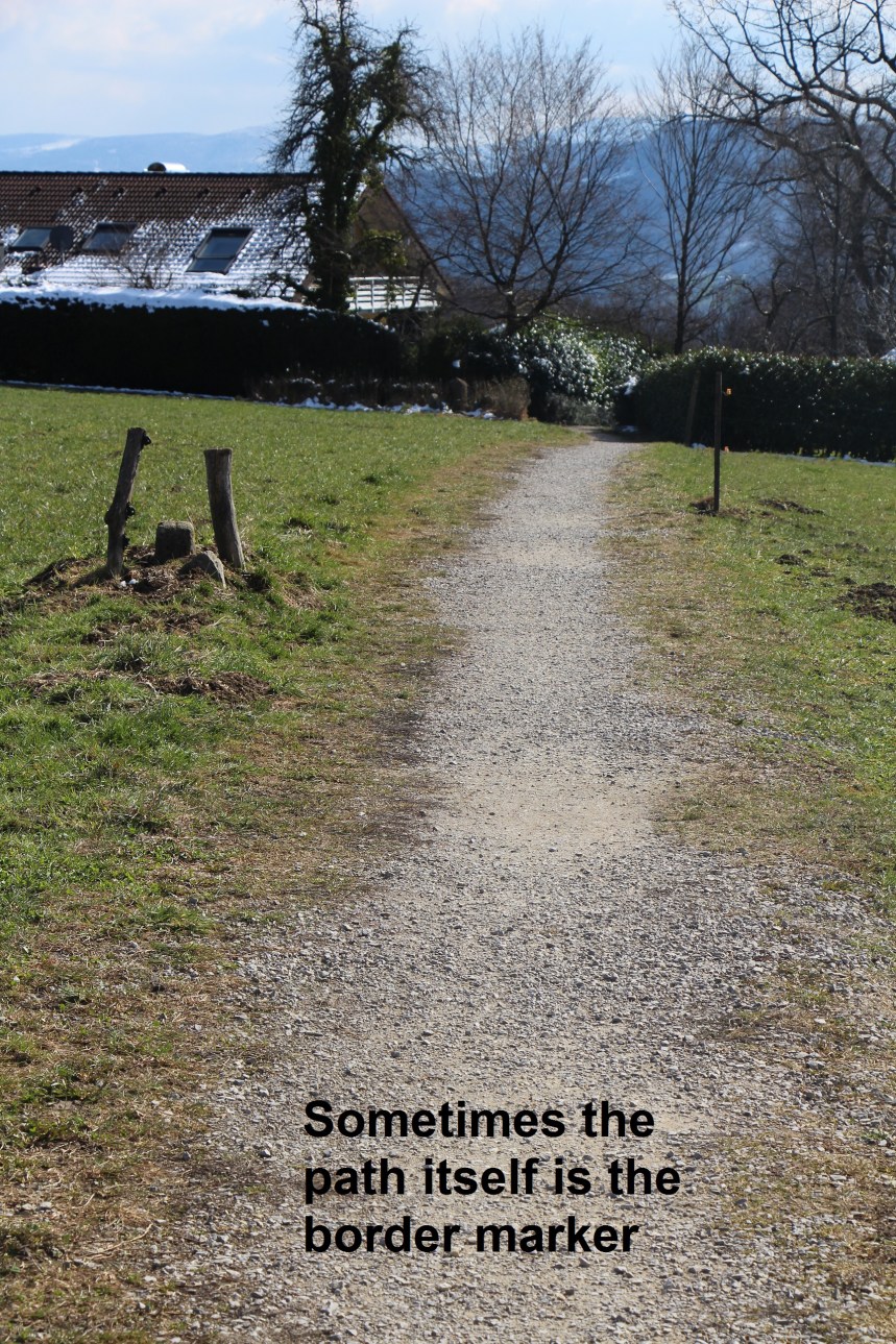
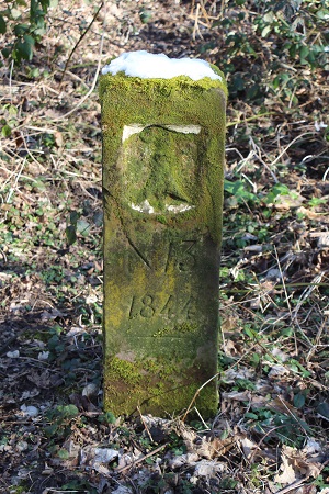
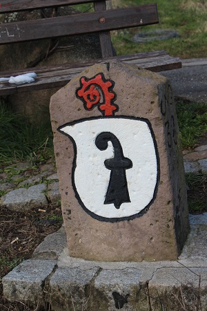
There is a narrow strip of land on the right bank (northern side) of the river that belongs to Switzerland and my track followed this for some distance. At intervals the border is marked by small stone pillars. These were to be feature of the walk throughout the day. Interestingly, they do not show a Swiss national mark. Instead they are marked with the symbol for Basel on one side, and the local German municipality on the other. This seemed in keeping with the nature of Switzerland which devolves power and authority to the lowest appropriate level. Most of the markers are dated, and through the course of the day, the earliest date that I recall was 1838, and the latest was 1905. So this is a case of Basel marking out its territory rather than Switzerland.
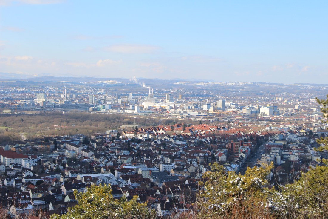
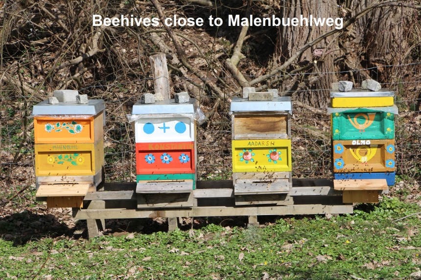
When I left that track it was to go into Germany. My route skirted the eastern edge of the town of Weil-am-Rhein before ascending to the settlement at Obertuellingen. This spot gives a wonderful panoramic view to the west, overlooking the entire city of Basel, as the heading photo shows. From there I descended through vineyards, with the vines still naked of any leaves. Winter has not yet completely let go of the land here. The route descends further and I soon reached the town of Loerrach, where I took a short break for lunch. Once refreshed, I wound my way through Loerrach to Malenbuehlweg, a small road that leads up to the nearby hills. Although winter had not yet completely left, spring must be close, as evidenced by bees flying in and out of hives that I passed on Malenbuehlweg.
Malenbuehlweg ascends into a forest where I crossed the border again back into Switzerland, and reached the settlement of Malenbuehlhof. And here there is the option of examining a curious feature of the border. There is a finger of Swiss territory, no more than a couple of hundred metres wide that extends from Malenbuehlhof into Germany for over a kilometer. This strip of land is almost entirely forested and there is a track that follows its circumference. It is worth walking for no other reason than that it is there. One can only wonder what land ownership in historical times gave rise to this strange twist in the line of the border.
From Malenbuehlhof, the route descends to a valley and the Inzlingerstrasse. I crossed that, and was soon going uphill again into the woods at Orthalde. And then emerging into the open at Chrischonatal, I was treated to an amazing site. A large bird, whether an eagle or some kind of vulture I could not tell, was flying just above the trees not far away. It seemed to rise effortlessly, riding the thermals in circles with just an occasional flap of its wings. Once it had reached what it must have considered sufficient height, it flew away, and I too went onwards. My route continued onwards and upwards until I reached St. Chrischona, a monastic settlement on a hilltop. Close by is a massive Swisscom tower, visible for miles around.

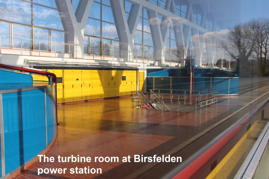
From St. Chrischona, I skirted around the nearby hospital, and descended through the woods on the German side of the border until I reached Neufeld. From there I followed the border exactly, around the edge of the village, through fields, and back into forest of Unterberg. The stone border markers make the route easy to follow, and I eventually emerged at the Grenzacher Horn customs post. A short walk along the bank of the river brought me to the power station at Birsfelden, where I crossed over the other side of the Rhine.

And so ended my walk. In total I had walked over 45,000 steps, which is about 30km. But more important is the insights and feelings that it gave me about the border in this part of Switzerland. Basel has marked its territory as separate from the neighbouring German municipalities, but for all that, this border is completely porous. People come and go, and the people and communities see each other as neighbours. It has been an interesting walk, and it is time to start planning the next stage.