After ignoring the Schwarzwald in favour of hiking in Switzerland for almost 16 years, I have already been there twice this year. On my first visit, I went to the third highest summit in the Schwarzwald, which was Belchen. Then there was the second highest summit, Herzogenhorn. So it made perfect sense that my third visit to the Schwarzwald should take me to the highest summit, the Feldberg.
The Feldberg is a large mountain, not so much in terms of its height: it is not very much higher than Belchen and Herzogenhorn. But it covers a large area, large enough to have two minor summits considered part of the same mountain. There is also a corrie lake just to the east of the mountain, the Feldsee. I was resolved to get to all of these features, and planned my route accordingly.
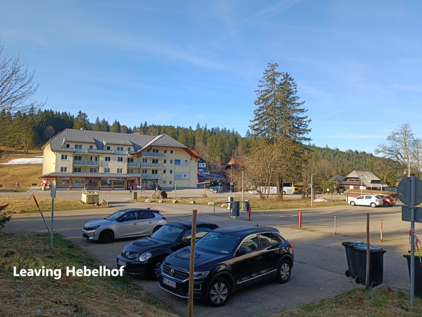
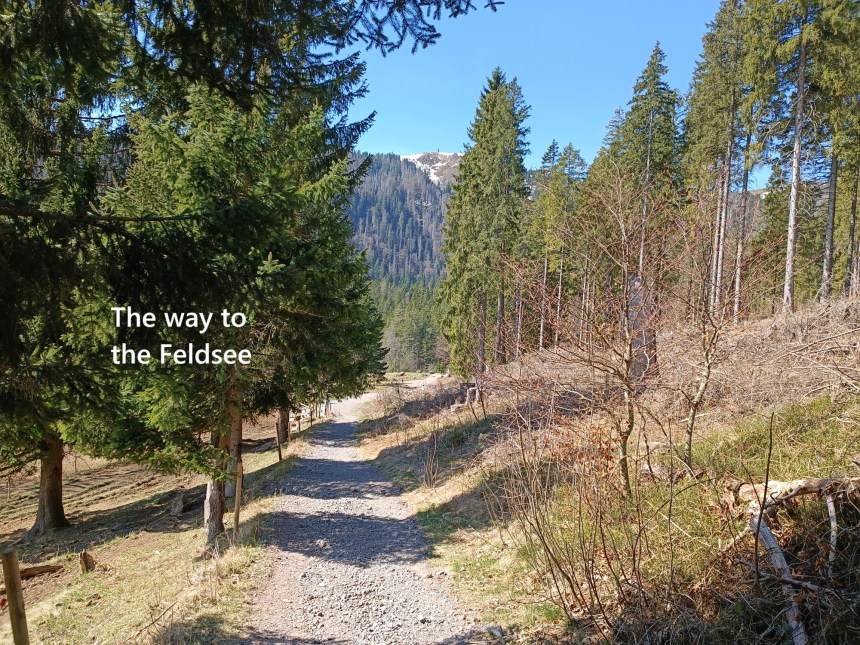
Thus it was that I set out from Basel early one morning and thanks to a train and a bus, found myself back at Hebelhof. The last time, I went south for Herzogenhorn. This time, I wend north for the Feldberg. I was quickly on the trail, going up through the forest with blue skies promising a good day ahead. The trail from Hebelhof is not steep, bus ascends steadily and gradually. The trail soon brought me to the road. It is somewhat disappointing to find roads where there should be wilderness, but the road seems to have been built to service the facilities built on the mountain. I followed the road around and upwards until I came to the Seebuck Tower, which marks one of the lesser summits of the Feldberg.

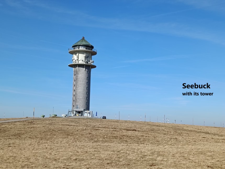
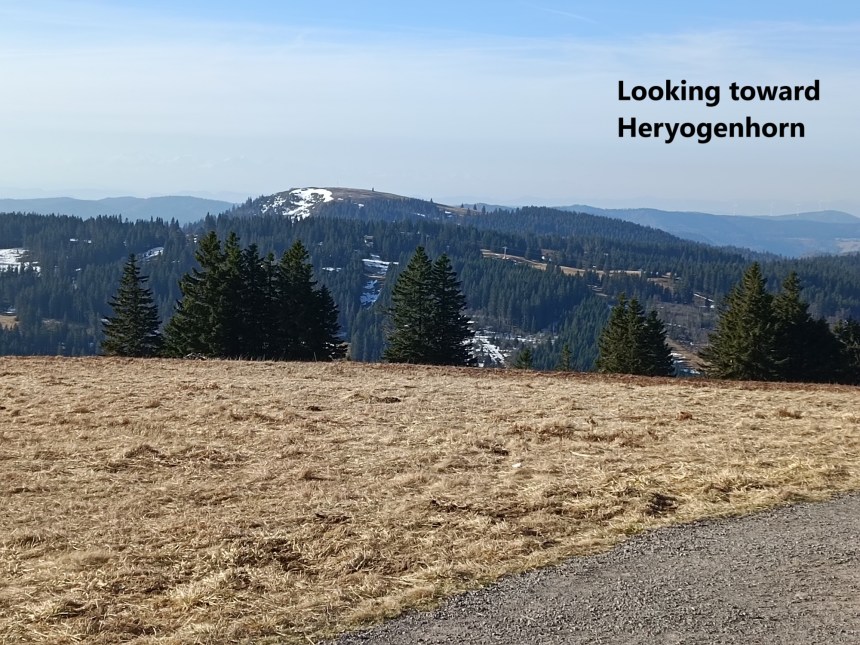
The Seebuck Tower was built in 1955 by the German Südwest Rundfunk broadcasting service for the purpose of relaying television signals into the valleys and villages of the Schwarzwald. Advances in technology made it obsolete and it was decommissioned in 2003. Since then, it has been an observation tower, available to tourists and hikers. A sign at the entrance also proclaimed that the tower hosts a Schinkenmuseum. I never thought that such a thing existed. But when I arrived it was closed, so I was unable to avail of the delights of the observation platform or the Schinkenmuseum. It is said that on a good day, it is possible to see the Swiss Alps from the Seebuck, but I was satisfied to get a good view of the Herzogenhorn.
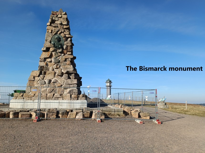
Just a very short distance from the Seebuck Tower is the Bismarck Denkmal. The first chancellor of the unified Germany left office in 1890, to the great disappointment of many people, and there were moves all over Germany to erect monuments to him. The Schwarzwald Bismarck Denkmal was erected in 1896. Its construction was supervised by the city architect of nearby Freiburg. Bismarck himself did not attend the inauguration of the monument, but did send a letter of thanks. The monument was the site of an annual walk by admirers of the “Iron Chancellor” from then until 1941.
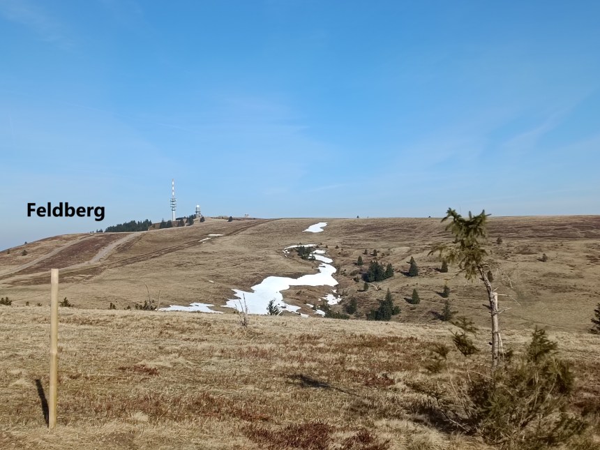
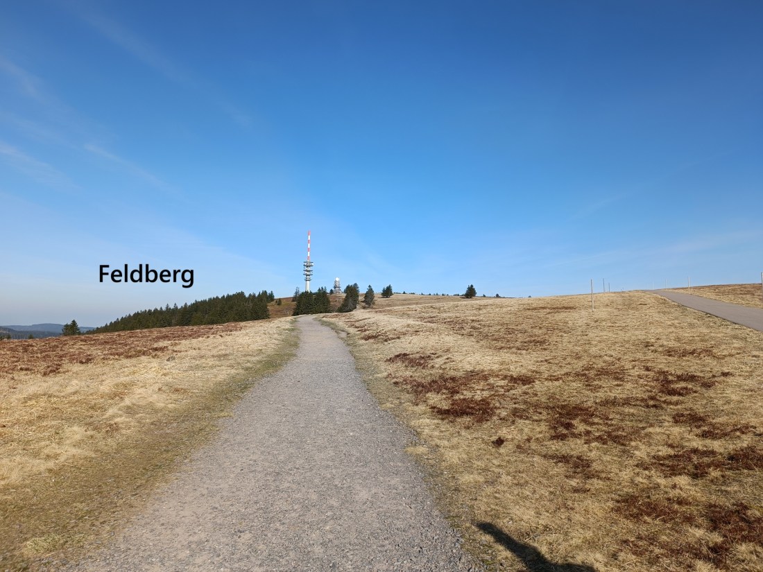
After visiting the Bismarck Denkmal, and admiring the views of the Feldsee below, I turned back and went over Seebuck summit again. I went down to the saddle between it and Feldberg itself and on up to the main summit. It is an easy walk, with the tower of the new communications mast visible all the way. The summit is just to the east of the communications mast, and carries a plaque to tell the visitor that they are at the highest point in all of Baden-Würtemberg. Just to the north is the weather station. Also on the summit is what looks like a radar installation. Alas, the once wild summit of the Feldberg has been well and truly tamed and civilised.
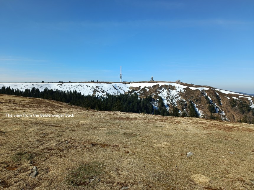
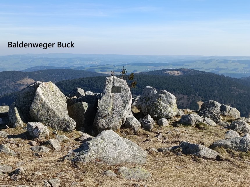
I went on from there, following the trail that curves around to the third summit of the mountain, Baldenweger Buck. There were large patches of snow still visible on the northern sides of Feldberg. The Baldenweger Buck summit is marked by a pile of stones, one of which carries a plaque to tell the visitor that on this spot, on August 3rd, 1963, lightning killed 113 sheep belonging to the shepherd Heinz Seywald. The wording does not make it entirely clear if Mr. Seewald was also killed. I suspect that he was.

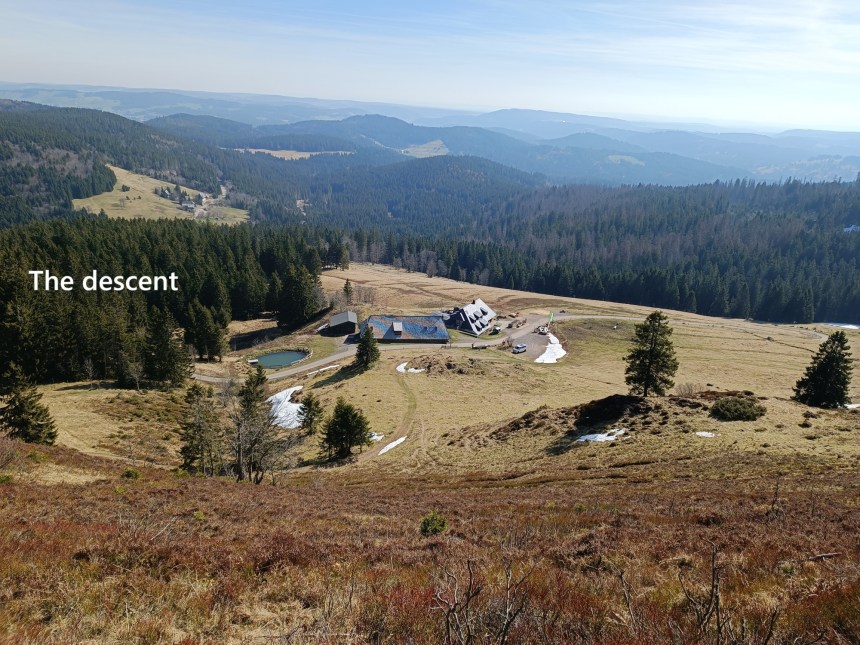
From there, my route took me downhill, zigging and zagging until I came to the road. There is a trail marked as going through the forest, and it would be shorter than following the road, but a sign at the edge of the forest said the trail was closed. The sign said that this was to protect the winter animals in the forest. Sometimes, I ignore signs, but sometimes I don’t, and on this occasion, I decided to respect the sign. I made my way back to the road and followed it on downhill.
There were then a series of tracks through the forest on the way to the Feldsee. On the last stretch just before the lake, there was again a sign saying that the track was closed, with detours in place. This time there was no reason given, so I chose to ignore the sign and went on without incident.

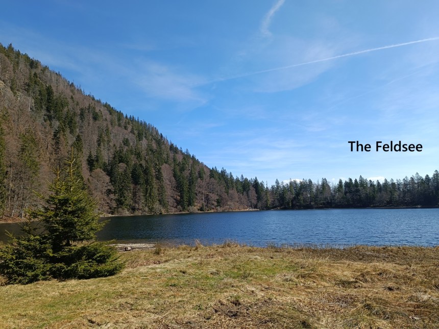
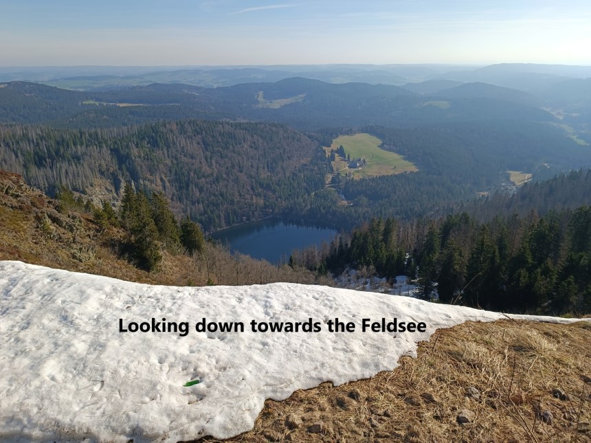
That brought me to the Feldsee itself. It is a perfect corrie lake, with an amphitheatre of mountains around it. Corrie lakes are remnants of the last ice age, when glaciers gouged out parts of the mountain. At 1109m above se level, the lake is 3.7 hectares in area and 17m deep. I walked around the lake, and on the southern shore, under the shadow of the mountains, where were still patches of ice on the surface. Spring might be on its way, but has not yet completely removed the effects of winter.
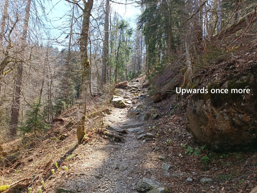
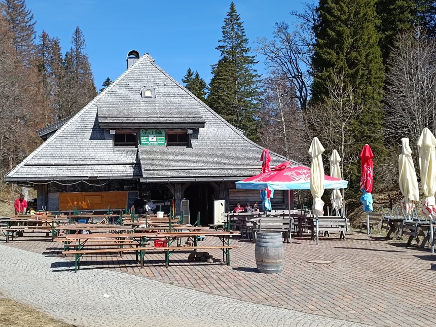
After walking around the lake, I then took the trail up through the forest. Just where it goes over the ridge, I came to a hostelry, and since I was nearing the end of the walk, I decided it was time for a beer. I was now at the Feldberg resort. This didn’t look like my kind of place, and after the beer, I didn’t hang around, but went on down by the road and back to Hebelhof. From there, a bus and a train brought me back to Basel.

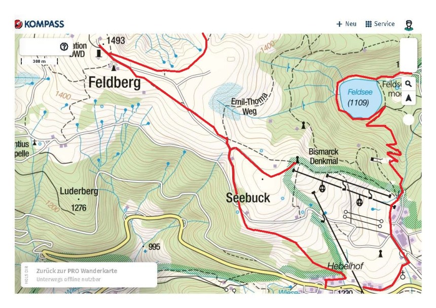
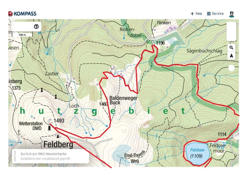
My total step count for the day was 29,061. The route that I followed is shown in red on the maps below.