
Not many instrumentals make it into the pop charts, but in 1965 one did. “Eine Schwarzwaldfahrt” by the German musician Horst Jankowski was released in other countries as “A Walk in the Black Forest”. I have amended that title slightly for this post, returning the area to its German name of Schwarzwald.
Unfortunately, work had kept me away from hiking for a few weeks, but on my return to Switzerland, I knew I needed to get out on the hills, even if it was only to see if Spring had arrived. And that thought got me wondering, how do you know if it is Spring? We are still some distance away from the first cuckoo, or the first of the swallows if it comes to it. But the snow has been receding. There are primroses in bloom, and the daffodils are about to bloom. And last Sunday, in Basel, I saw my first lizard of the year. SO even if it is only the early stages of the season, it is definitely Spring.
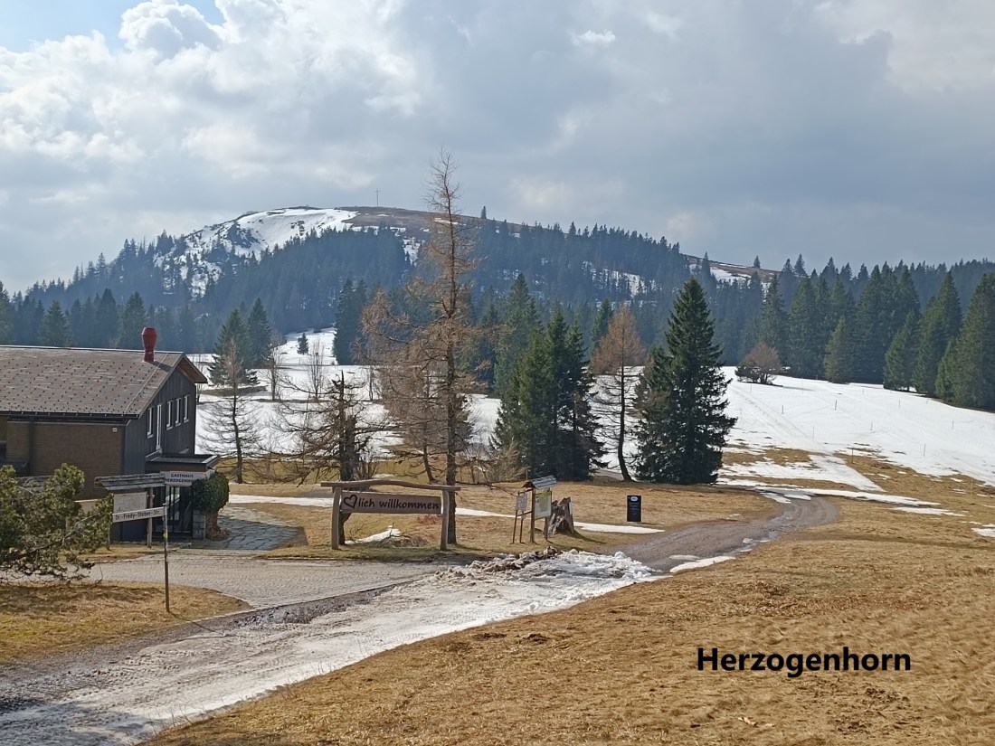
My last outing had been to Belchen in the Schwarzwald. At 1414m, Belchen is the third highest summit in the Schwarzwald. The second highest, Herzogenhorn, is just one metre higher at 1415m, so I decided that should be my next place to go.
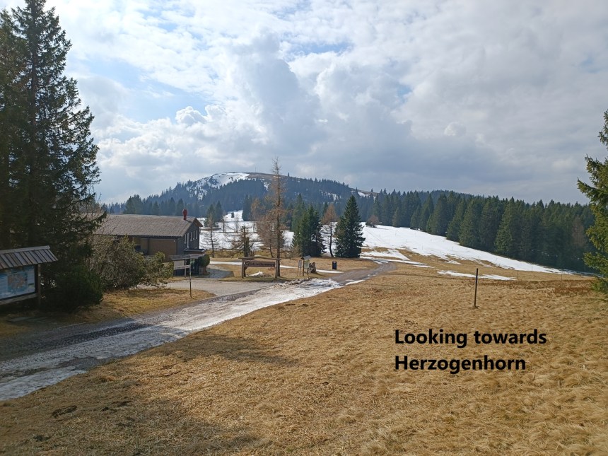
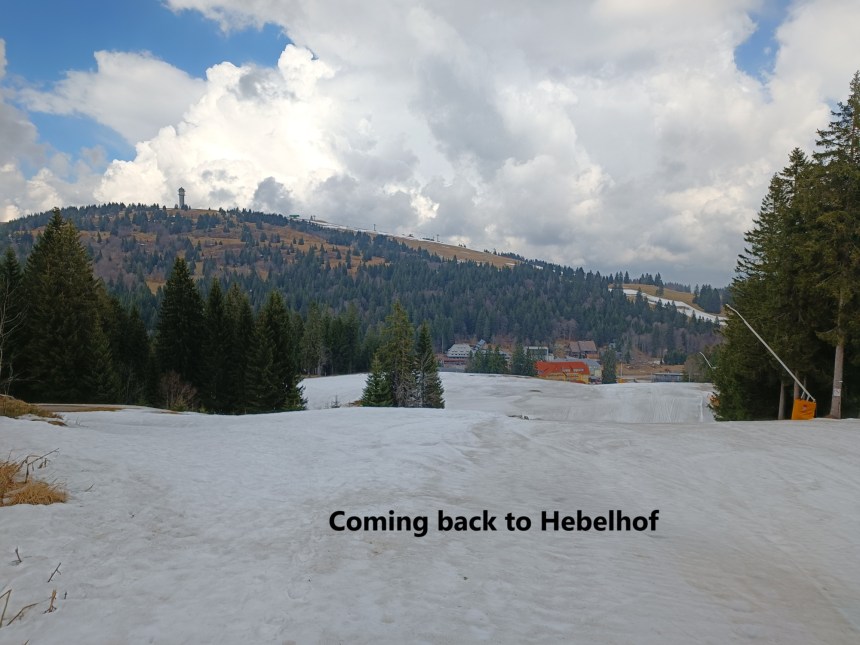
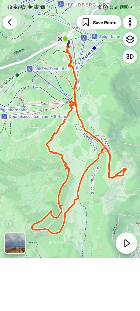
A train and two buses brought me to the little hamlet of Hebelhof, nestled just south of the Feldberg. As I got off the bus, I could see the snow still on the ski slopes above me.


I made my way up the slope. According to the map, there is a track that goes up that slope, but it was almost entirely invisible, with just small patches of tarmacadam to be seen where the snow had melted away. I followed it on up, and I soon came to the top of the ridge. Once there, just above the ski lifts, I turned right to reach the summit of Grafenmatte. At 1377m, it was my first summit of the day. Whether it is really a separate summit from the Herzogenhorn is debateable, but Wikipedia lists it as a summit, so I will accept that. The summit itself is unimposing, with trees all around, and a tiny marker to show that it is a summit. There is a hut very close to the summit, which actually serves as a better marker than the actual summit marker.
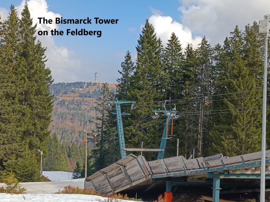
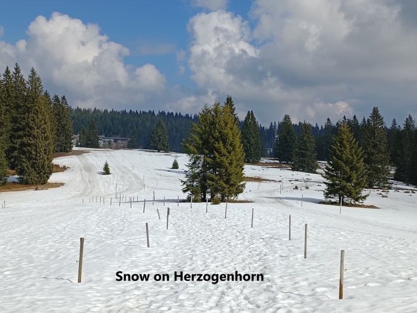
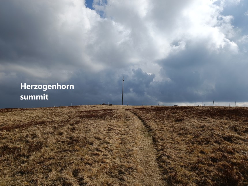
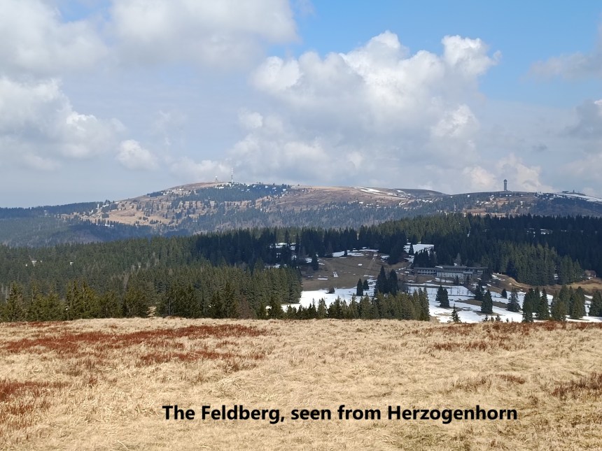
From Grafenmatte, I was soon mack on the main trail, descending to the DSV Nordic Ski Centre. There, I was joined by a group of schoolchildren who had come up from the valley to the west. Their way and mine continued briefly until they went back down to the west, and I was left to go the remainder of the way up Herzogenhorn alone. The route went up through the snow, before reaching clear ground near the summit. The summit is marked by a large wooden cross. There were great views to the north, with the Feldberg visible in all its glory.
I wasn’t sure what to do next. One option was simply to descend to Menzenschwand to the east, but it seemed too early in the day for that. Off to the west, I could see a mountain that looked interesting. A quick check on the map allowed me to identify it as the Silberberg, which is the seventh highest summit in the Schwarzwald at 1358m. I decided that should be my destination.
I went back down the way I had come, and followed a trail on down into the valley between the Herzogenhorn and Silberberg. While I have some doubt as to whether Grafenmatte can really be treated as a separate summit, I have no such doubts about Silberberg. The distance and the descent between it and Herzogenhorn are such that it is definitely a distinct summit.
After the trail brought me down into the valley, I took a direct cross-country route to get onto another trail heading to the top of Silberberg. The map shows the trail ending just short of the summit, but it actually weaves around and gets to the summit from the western side. This is not a well-walked trail. It looked like it there more for the foresters than the hikers. And Silberberg, like Grafenmatte, has only a miniscule summit marker. But it is there.


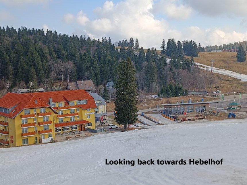
And then it was time to make my way back to Hebelhof. There are trails marked on the map, but I had difficulty following them. There are other trails, used by the foresters, and they led me astray. The GPS was not entirely reliable, and I found myself walking through the snow to get back on the right track towards Grafenmatte. This was soft west snow. It actually reminded me of a similarly named mountain in Switzerland, Grafimattstand, where I had some difficulty a couple of years back. The snow evens out the ground, so that on one step, you can be in snow barely 10cm deep, and with the next step your foot plunges 50cm into the snow. But I got back on the right track eventually, and went over Grafenmatte towards Hebelhof below. And once I reached Hebelhof, all I had to do was to wait for the bus to start the journey back to Basel
It was not a long hike, but it was a good one. My total step count for the day was 22,856. There are still some more hikes to do in the Schwarzwald.


💕🙏
LikeLike