After my last outing in the snow, I went out and bought a pair of snowshoes. I have walked without them for over forty years, but after my last walk in deep snow, I have finally succumbed to the temptation. And after such a purchase, I just had to try them out. With that in mind, I recently went on the next stage of the Alpine Panorama Weg, as always, starting where the last stage ended.
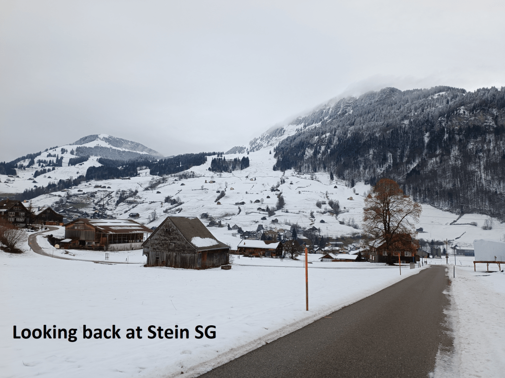
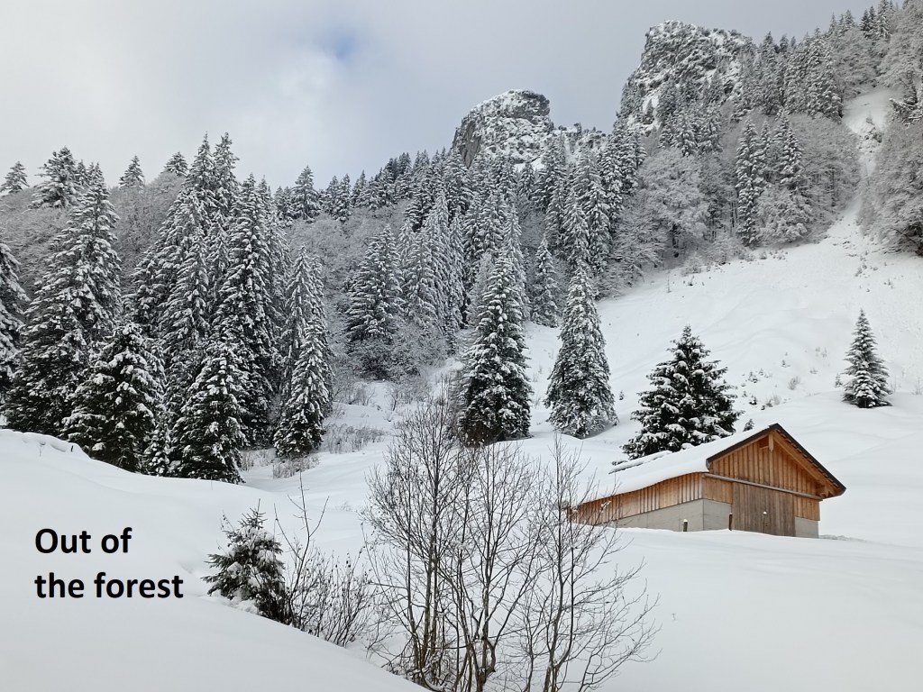
As before, it was an early start in the morning, but I got to Stein SG and was ready to walk by nine o’clock. At that hour, the sun had not yet warmed the ground, and the road up the hill from the village still had glatteis from the cold of the night. The fields all around were covered in snow to give an overall wintry feel to the day. But I did not have to stay on the road for long, as the trail soon turned left towards the trees, walking through a field of snow to get there. Once in the trees, I put on the snowshoes, and proceeded uphill.
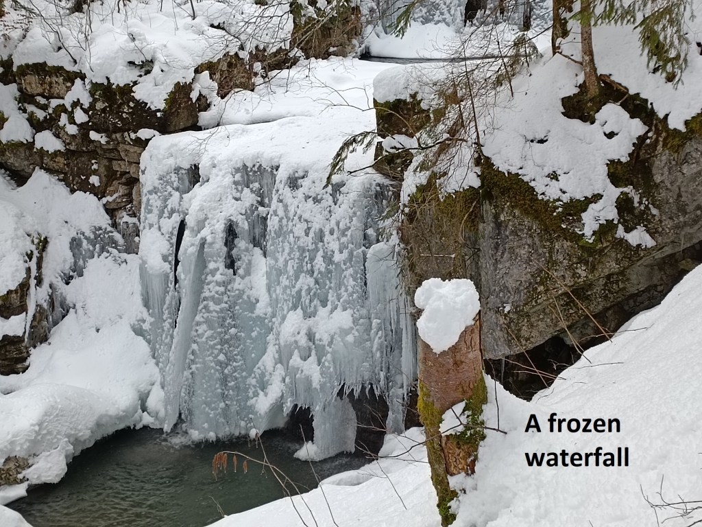
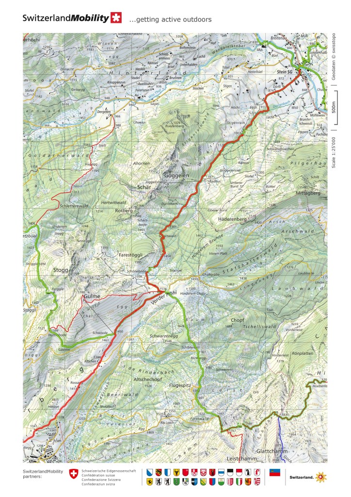
The route follows the Dürrenbach stream as it ascends the hill. The stream has been channelled over the years to control its flow, and it cascades over a series of waterfalls as it goes down into the valley. In the weather of the day, most of the individual falls on the cascades were partially frozen. The route itself was largely untrodden, but there were the marks of just one previous walker, also wearing snowshoes. The trail was well marked with signs on the trees to indicate the way, so that even if there were not the footprints of the last walker, I think I would have had no difficulty to find the way.
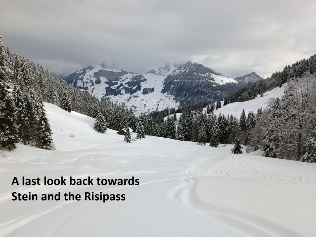
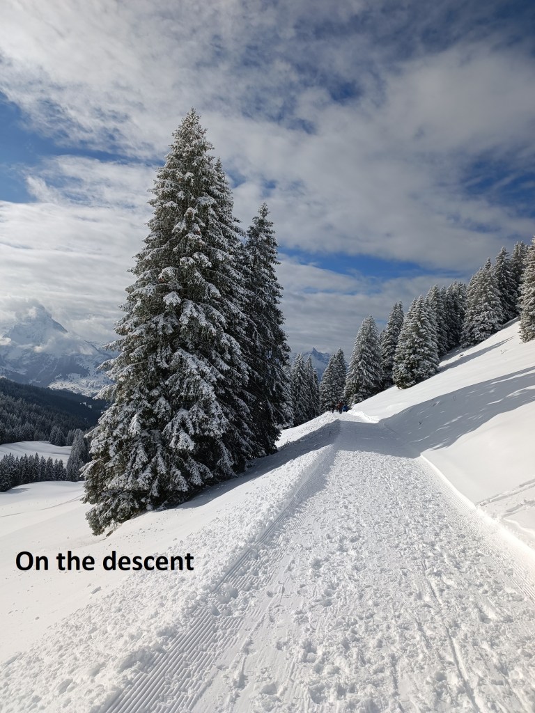
I continued on upwards, winding my way through the trees. I passed a junction close to the 1000m contour. I cannot say that the going was effortless, but the snowshoes definitely made a big difference compared to my previous outing. I was still going through forest up to where the trail meets a road close to 1200m. In the snow, the road was clearly used as a skiing route, and there were ski tracks now to guide the way as well as the usual route markers. I followed the trail, and the markers, along the road, on upwards to come out of the trees and onto an open slope. It gave me the chance for a last look back at the Stein SG valley and the Risipass where I had come the last day.

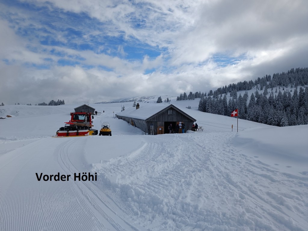
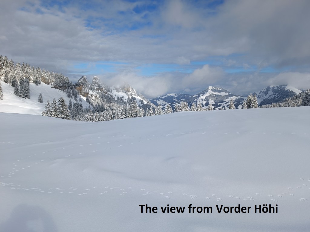
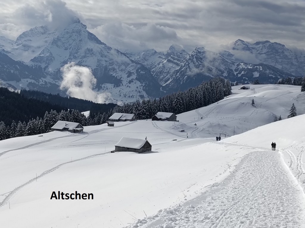
My route went on, going back in among the trees on the snow covered trail. The going was easy along the well-trodden route. I came out of the trees onto level ground near the junction at Schöneboden, and after that, there was just a short ascent to Vorder Höhi. Vorder Höhi has a Berghaus, and clearly uses the best mechanical equipment to keep it supplied. There were plenty of people there, with more arriving. They all came from the direction that I was to take going down. In spite of the smell of bratwurst coming from the Berghaus, I did not stay around, but quickly started on the trail downhill.
The trail follows what looked like a snow covered road downhill. After a while, the official route of the Alpine Panorama Weg turns off to the right, and for no apparent reason, wanders around the mountains in a large semi-circle before the final descent to Amden, which is the end of this stage according to the guidebook. I could see no reason for the detour, and in any case, I was going farther than Amden, so I continued on the route that I was on, down to Heigge, and the junction of trails near the cable car station of Amden Bittertanne. This was my cue to turn right, and follow the trail directly towards Amden. This trail is not as well marked, and there was no evidence of previous walkers in most places, so I had to be careful to follow the right route. It skirts the northern edges of Amden, past Gschwendsegg and Untersellen to reach the road just beyond Büttel. At this point, I was reaching the edge of the snow, and I could take off the snowshoes. They had served me well on the route so far. Just below the snow line, the centre of Amden came into view.
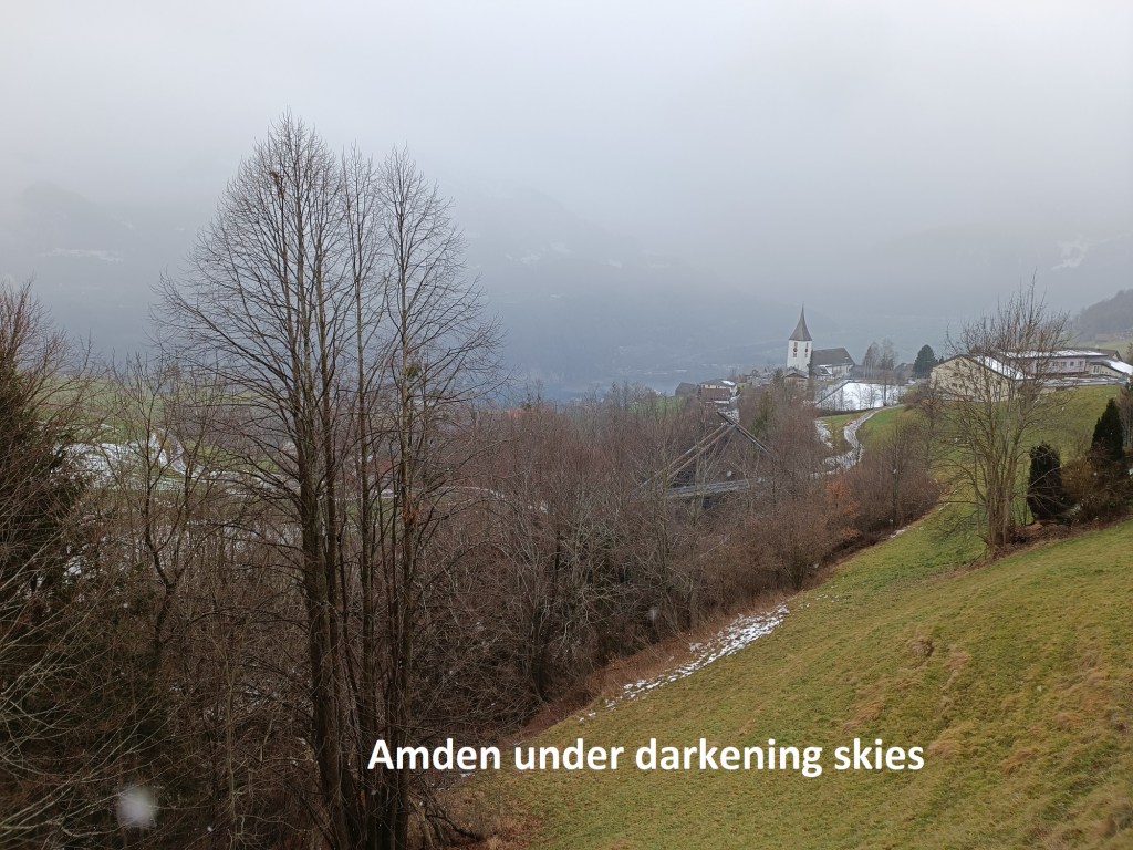
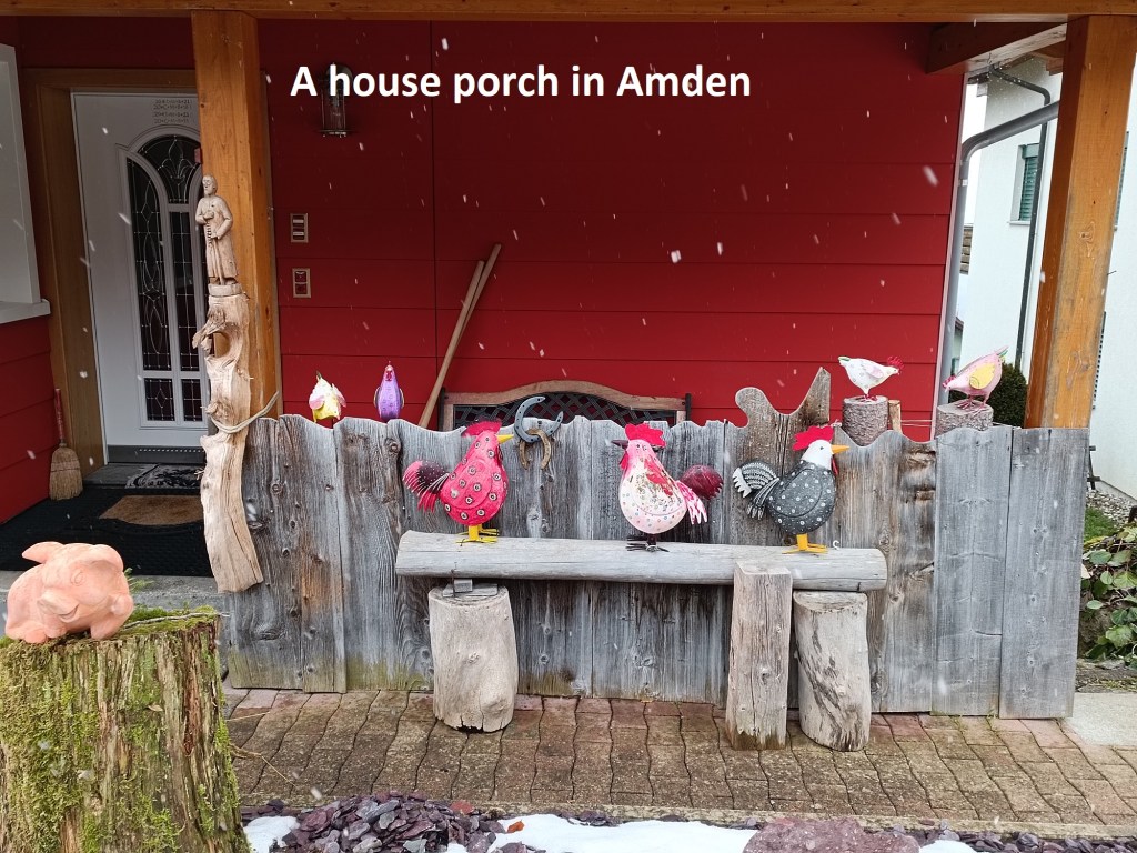
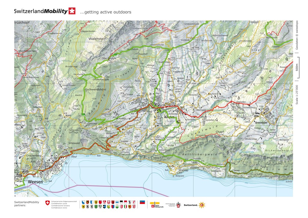
I went on down through fields of light covered snow to reach the village. By now, the weather had changed somewhat. The bright sunshine that I had enjoyed on the heights was gone, and clouds had rolled in. As I reached Amden, there was even an occasional snowflake falling, and though it was more like sleet than snow, it did give some white flecks on my photograph from the village. I didn’t hang around in the village, but went straight on through. This had me back on the official Alpine Panorama Weg. At first, it was easy going. The route went only gently downhill, was often level, and here and there it even went up a couple of metres. It was all fine until I came to the Chäppeli Treppenweg. Before the current road into Amden was built in the 1880s, the Chäppeli Treppenweg was the only access route from Weesen on the Walensee to Amden. It is basically a rock staircase, a few hundred metres high. It is steep, and uneven, and with the steps of this staircase being quite narrow, it is not the easiest place to walk. And as my descent reached lower altitude where there had hardly been any snow, it happened. I slipped on some mud, and my feet went from under me. A bruise on the elbow, and a slight twisting of the knee was the extent of the damage. I picked myself up and went on down towards Weesen.

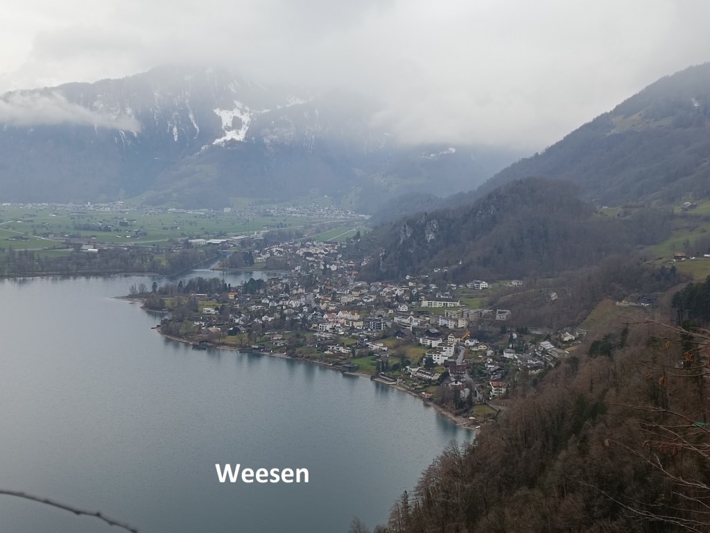

Weesen is on the shores of the Walensee. The village itself has no claims to fame. The Walensee is divided between St. Gallen and Glarus cantons, with Weesen in the former. It is a pleasant little village, and I might have been tempted to stroll around had it not started to rain just as I was coming towards the bus stop. This will be my last stop in St. Gallen canton, so I have now effectively completed two cantonal sections of the total trail.
My step count for the day was 34,892.