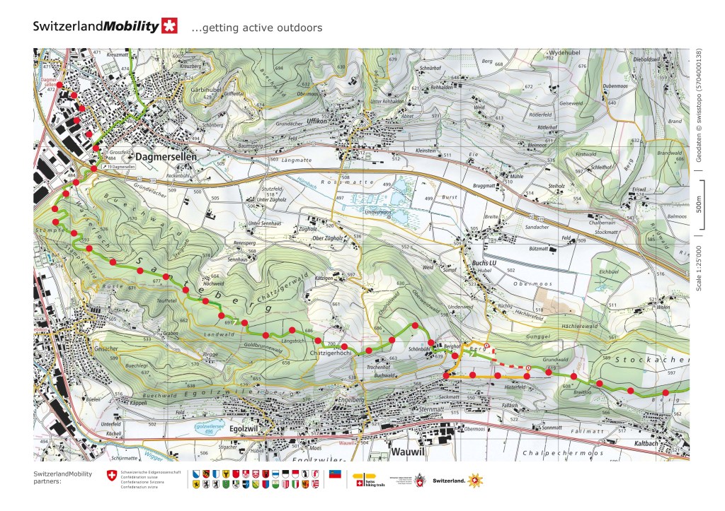
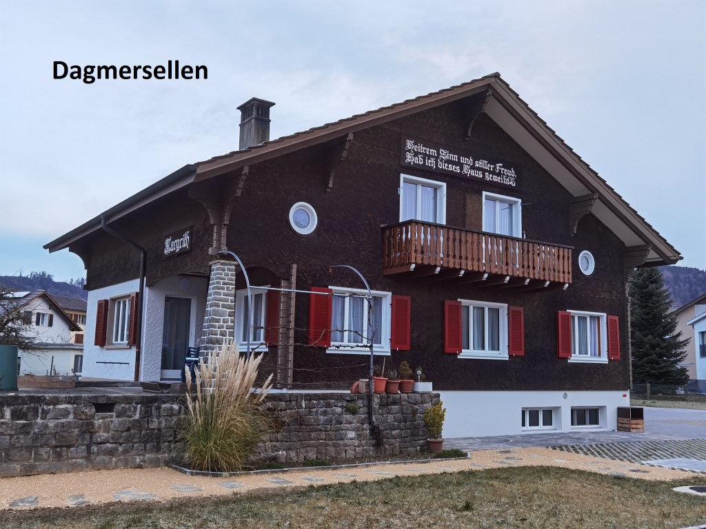
Early on a frosty morning, I set out from the train station at Dagmersellen. I was the only person getting off at that stop, so it looked like I would be walking alone for much of the day. The roads were silent as I made my way through the town, but that changed as I approached the motorway. I crossed over the bridge and went down into a hollow, before coming up and starting the ascent to the hills beyond. Just at the edge of the forest I took the chance to look back.

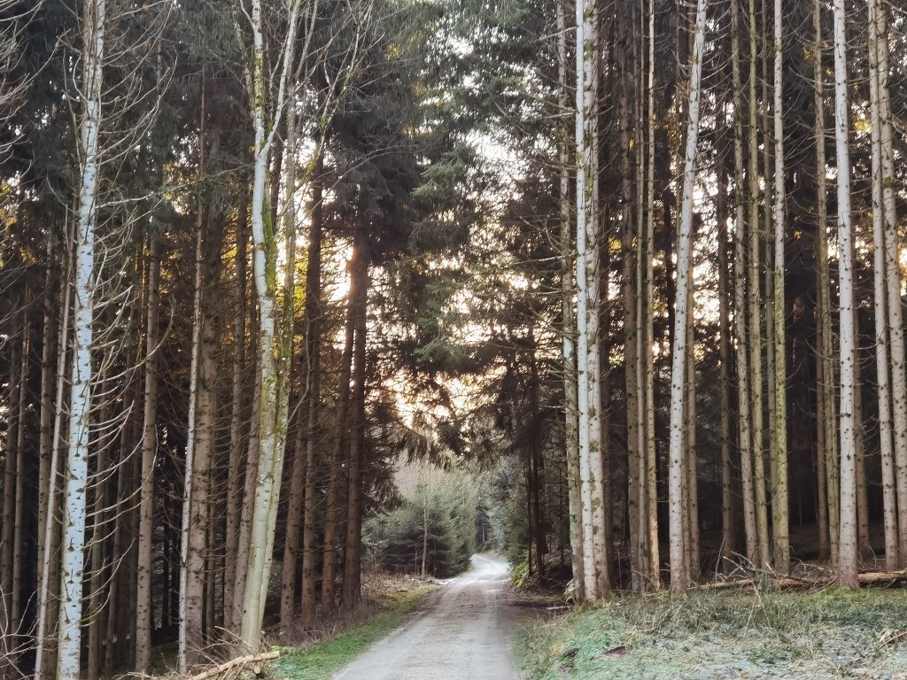
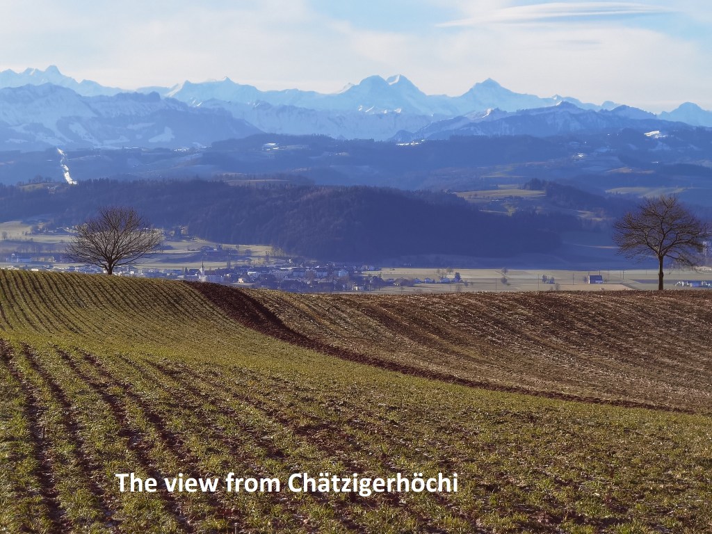
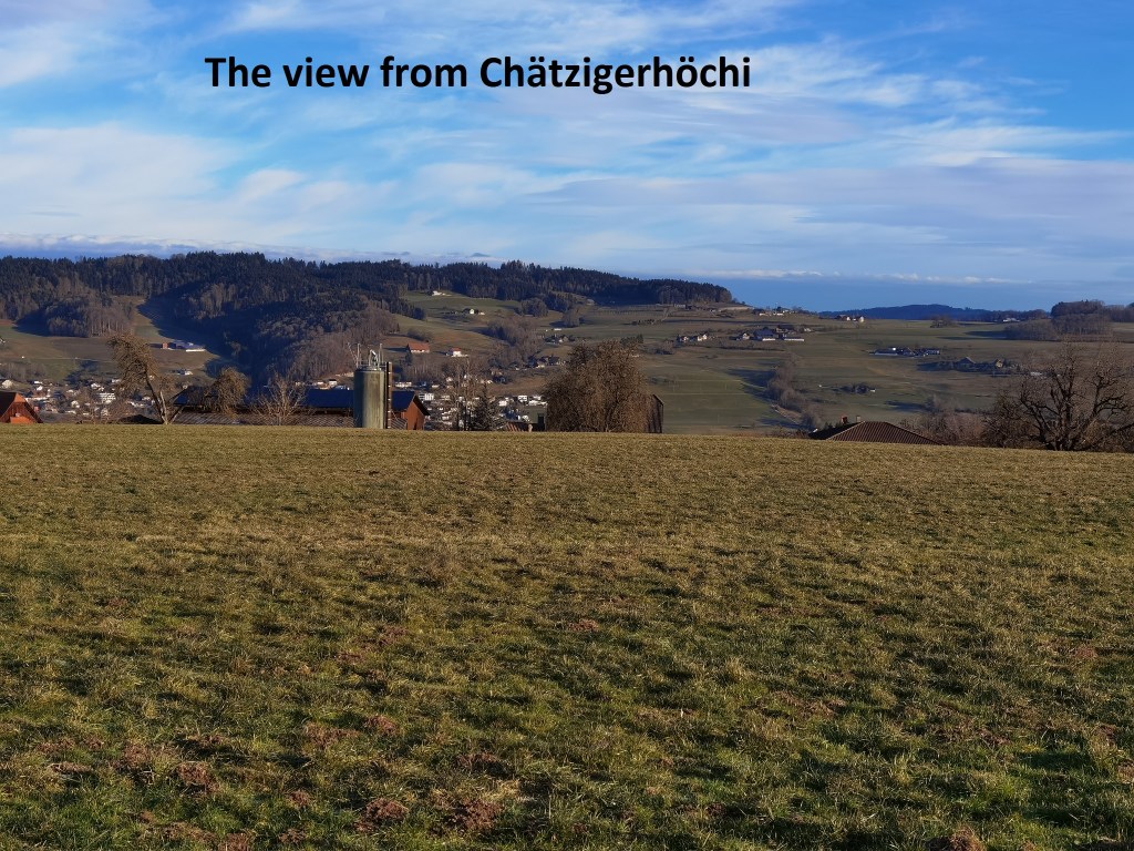
It is a gentle ascent up through the forest of the Santeberg. Either the going was easy, or I was just full of early morning energy, or both. Either way, it didn’t take long until I was above the 600m contour, with patches of snow here and there. I passed the summit of the ridge and continued on, coming out into the open again at Chätzigerhöchi. There, the patch briefly follows a ridge going south-east, with views of the mountains away to the right, and nothing but farmland to the left.
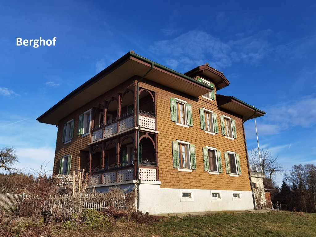
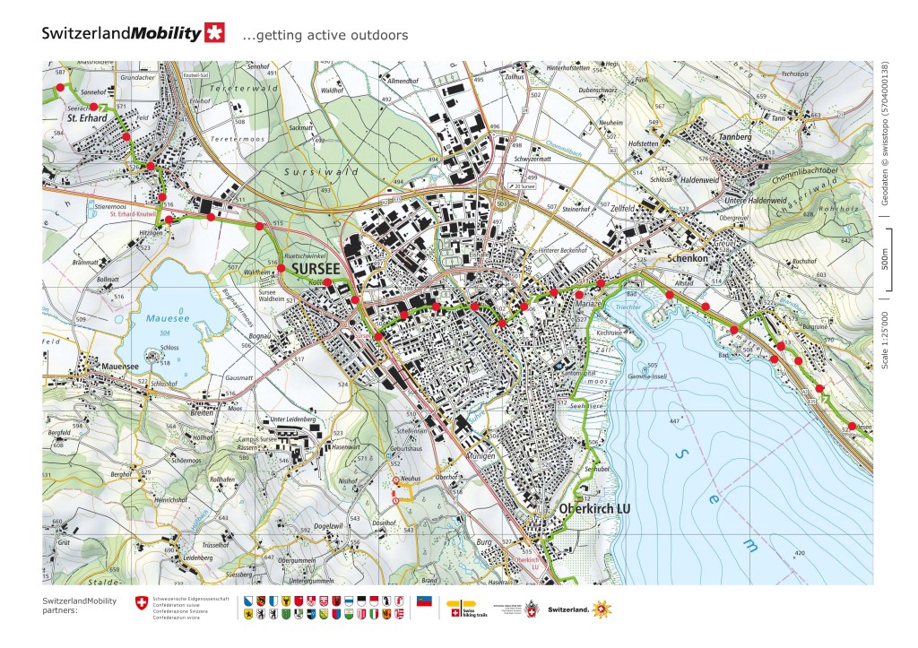
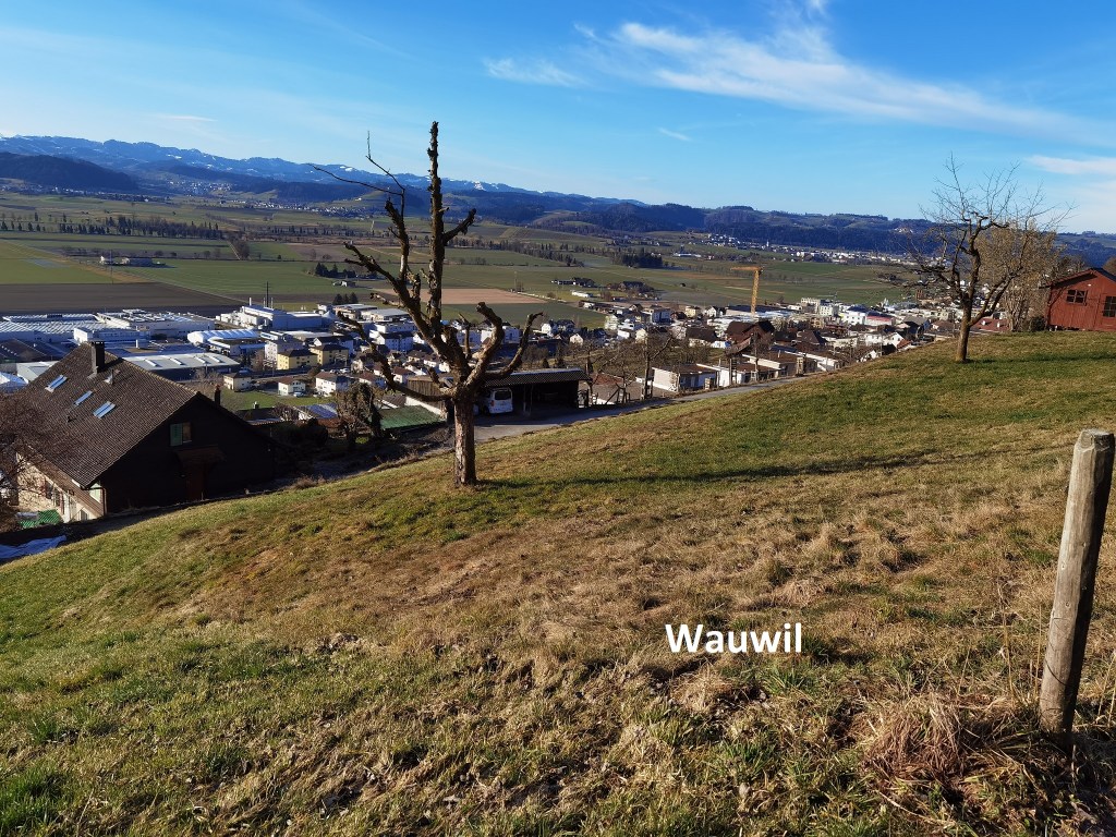
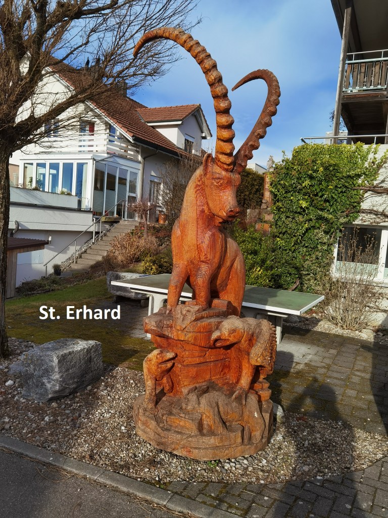
From Chätzigerhöchi, the trail curves around and downwards passing Berghof. The map showed restrictions on the trail just after Berghof, and I took the detour, though I am not sure it was really necessary. The guidebook said there would be shooting in the area on some days in February, but all was quiet as I passed, without any sound of a shot. It is a short detour and has great views of nearby Wauwil and the valley below. After that, the trail is quite flat, skirting the edge of a wood until it comes to St. Erhard. St. Erhard is not really a village, more just a residential area, but I did see some interesting garden sculpture there.
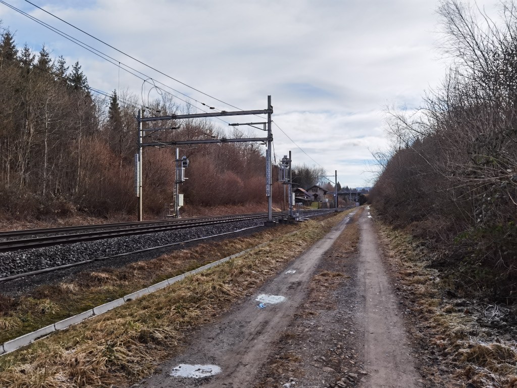
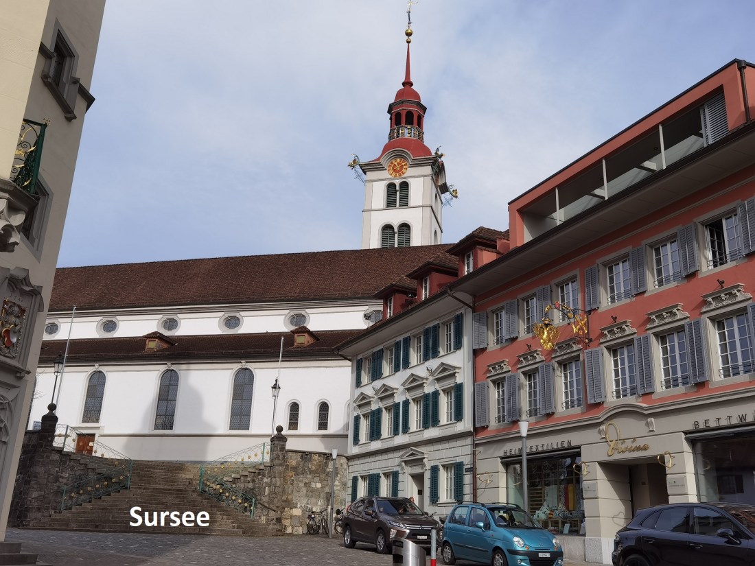
I continued on downwards reaching the railway line and following it towards Sursee. I soon arrived in the town, coming in at the railway station and going on into town.
There is evidence of settlements in the Sursee area going back to prehistoric times. The origins of the present day town go back to Roman occupation of the area. What started out as a Roman settlement became a village, and then a town. The first mention of the town is in documents from 1036 when Ulrich of Lenzburg gifted the then village to the nearby Beromünster Abbey. By the thirteenth century, the village had grown to a town, and it was granted city rights by the dukes of Austria. The canton of Luzern conquered the town in 1415 and it has been part of the Luzern canton ever since.
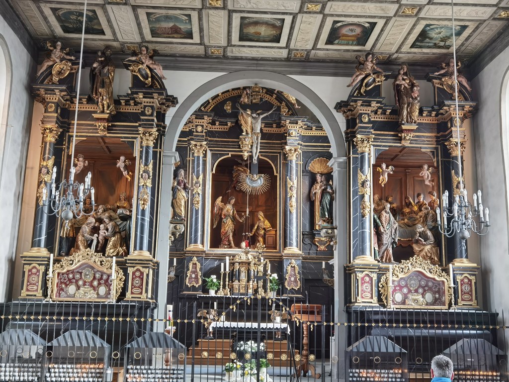
As a city in the Luzern canton, Catholicism prevailed as the major religion, and that is evident in the many churches in the town. Just before entering the town gates, I came to the Kreuzkapelle, or Church of the Cross. This small church is a gem. About a hundred people died of plague in Sursee in 1628, and whether to give thanks that it was not more, or to mourn those who died, the town decided to build the church just outside the gates. The building was completed in 1629, and it has stood since then.
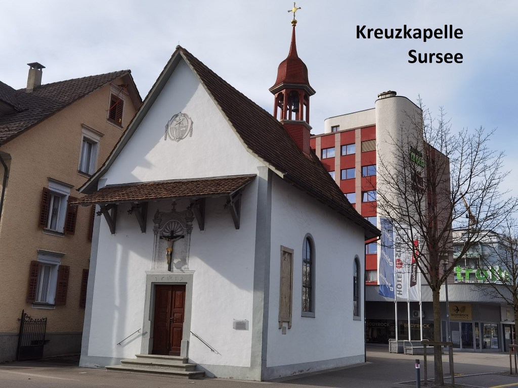


The main altar of the church was added after the building was completed. The crucifix dates form the nineteenth century. Standing on the altar are figures of saints Stefan, Francis, Sebastian, and Anthony of Padua. The two cherub candlesticks date from the seventeenth century. The building has required renovation over the centuries, most recently in 1978.
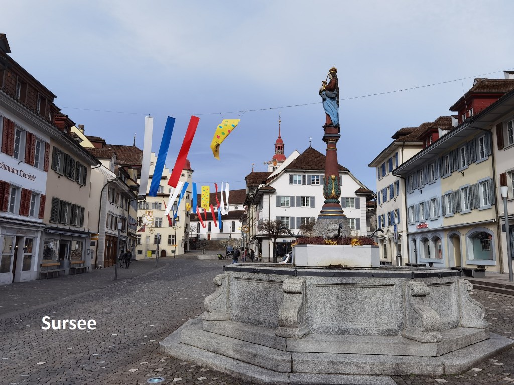
I went on along the main street. I would have liked to go into the main city church to see that too, but a service was in progress, so I went on through the town.
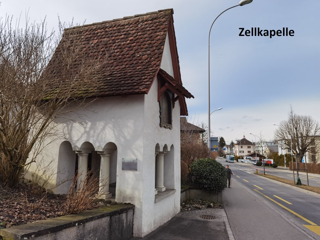
After coming out of the old town through another gate, my route turned left, going up a gently hill. I passed the tiny Zellkapelle before turning off the official route to get to Mariazell, and my second church visit of the day. The present church at Mariazell replaced an older building down at the shore of the Sempachersee. The older building was demolished in 1657, and the present building was inaugurated in 1658 by the bishop of Lausanne. The main and side altars date from the 1660s and are richly decorated and show scenes from the life of the Virgin Mary. The church has been a place of pilgrimage over the centuries, but today one of the adjacent monastic buildings has been turned into a speech therapy school.

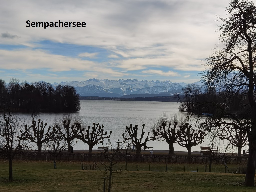
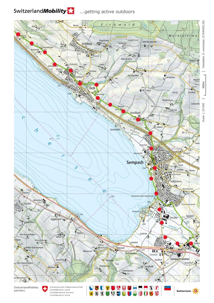
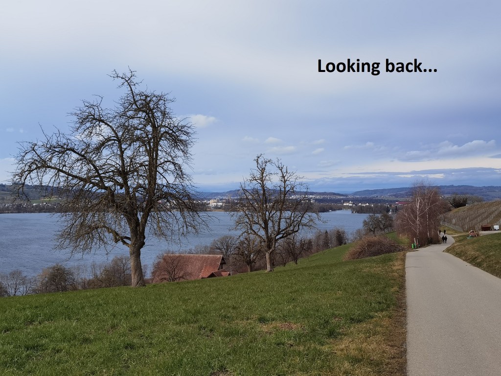
After Mariazell, my route took me along the road towards the lakeshore. The mountains seemed much closer than they were when I passed Chätzigerhöchi. I continued along the path close to the shore. That path goes upwards giving good views of the Sempachersee lake. There were many walkers out in the cold sunshine, despite the cold. And so I came to Eich. The trail does not go into the village proper, but just passes through a residential area called Eichhof and then curls around above the village itself. The trail does go past the church and seeing the day had many churches so far, I went into this one as well.
Photos
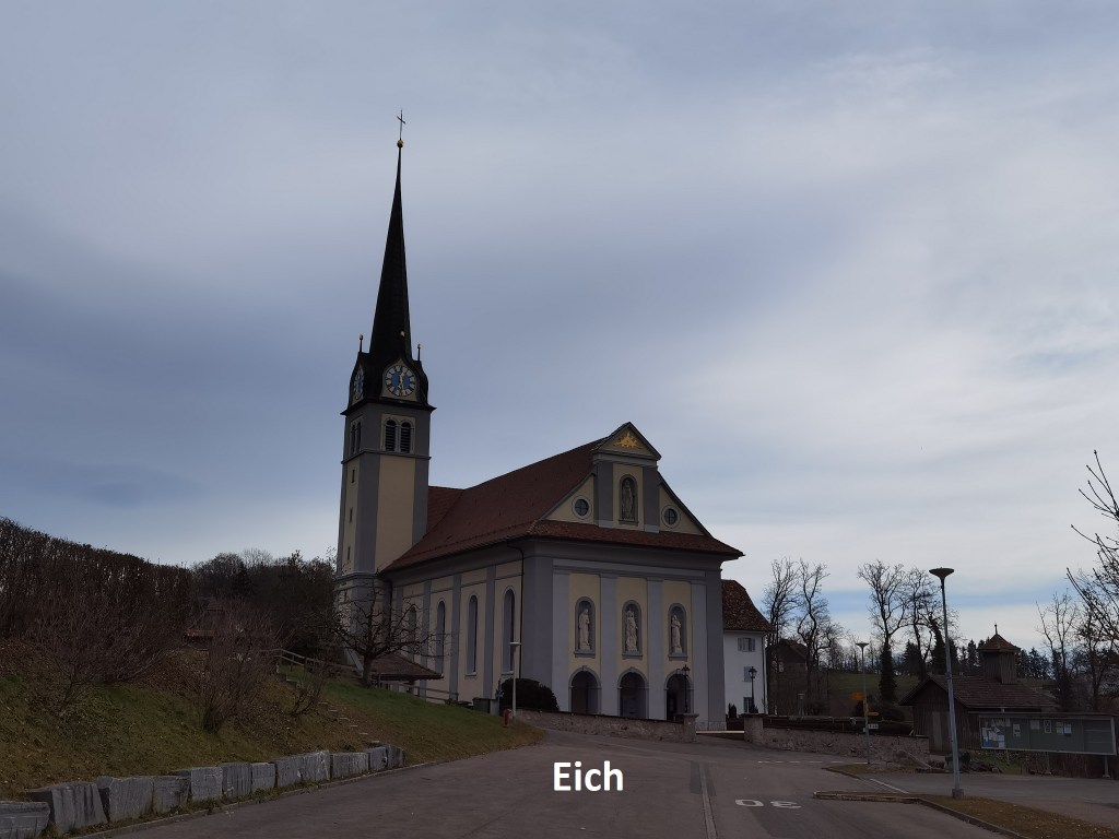

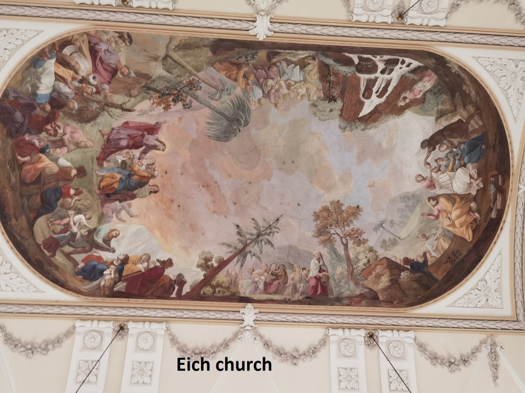
Although the village itself is about a thousand years old, the church is a mere youngster with an age of just two hundred years. It is dedicated to St. Laurentius. It is tastefully decorated, though not as richly as some of the others on the route that day.
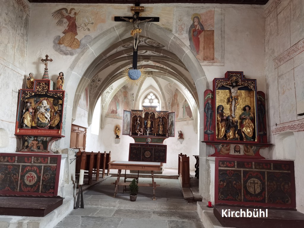
I went on, and soon came to the little hamlet of Kirchbühl, which is the location of one of my favourite churches in all of Switzerland. The church there goes back many centuries. The remains of a roman settlement were found in the grounds during excavations in 1958. Parts of the current church building are over a thousand years old. The exact age is uncertain, but it is mentioned in documents from 1375. The interior is simple, just a main altar and two side altars. But part of what makes this church special is the many frescoes on the walls. The side altars do not fit properly into the space, extending out into the arch that leads to the main altar, and they are thought to have been transferred to Kirchbühl from somewhere else. The left side altar shows a pieta sculpture, while the right shows a crucifixion group. The main altar is a triptych, with in the centre, a depiction of St. Martin handing the cut robe to a beggar. That is flanked by statues of St. Magdalena and St. Barbara.

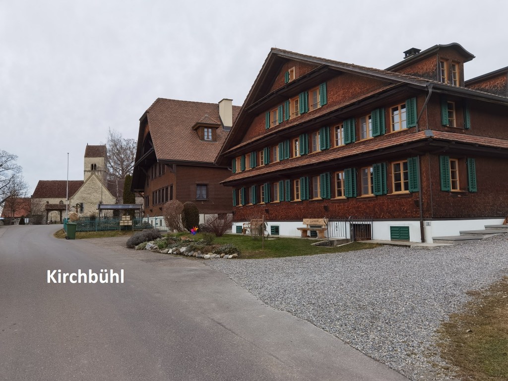
I left the church and went on through the little hamlet. The trail turns right and goes downhill to Sempach, the town that gives its name to the lake.
Sempach is the site of one of those battles that marks a crucial point in the development of Switzerland as a unified country. After the initial formation of the confederacy in 1291, Luzern, Bern, and Zurich joined in the 1300s. Austria was most displeased, and friction grew as the century went on. There was no formal declaration of war, but the Swiss tried to take over several towns from Austrian rule. It got to a point where Austria could no longer ignore the threat to its rule, and the way began in January 1386. Initially, the Austrians were successful, but Luzern called on other members of the confederacy to give assistance. There was a sham attempt at a resolution, but neither side was giving way. The Austrian Duke Leopold gathered his troops and set out to teach Luzern a lesson. He was joined by 167 minor nobles, each hoping to gain, and each sending their own declaration of war to the Swiss. The Swiss expected Leopold to attack Zurich, and so mustered most of their troops there. However, Leopold moved south through Zofingen, and seemed to be heading directly for Luzern, laying waste the countryside as he went, and reaching Sempach in July. With Leopold’s intentions now clear, the troops of Luzern and the forest cantons of Uri, Schwyz, and Unterwalden had marched quickly to meet him. The two armies met about two kilometres outside Sempach. Neither was fully prepared, but they quickly formed up for battle. The Swiss held the high ground, which made Leopold’s superiority in cavalry ineffective, and forcing the knights to fight on foot. Despite being outnumbered, the Swiss attacked. The battle could have gone either way. Some say it was the July heat that tired out the heavily armoured knights. But the Swiss legend is that Arnold no Winkelried personally opened up a gap in the Austrian lines, though losing his life in the process. Whatever the truth is, the Swiss managed to break through the Austrian lines, and turned the battle in their favour. In the Swiss victory that followed, Duke Leopold and many of the Austrian nobles were killed. The battle was a significant blow to Austrian interests in what is now Switzerland and discouraged further attacks on the confederacy.

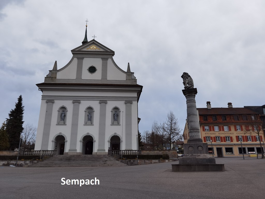
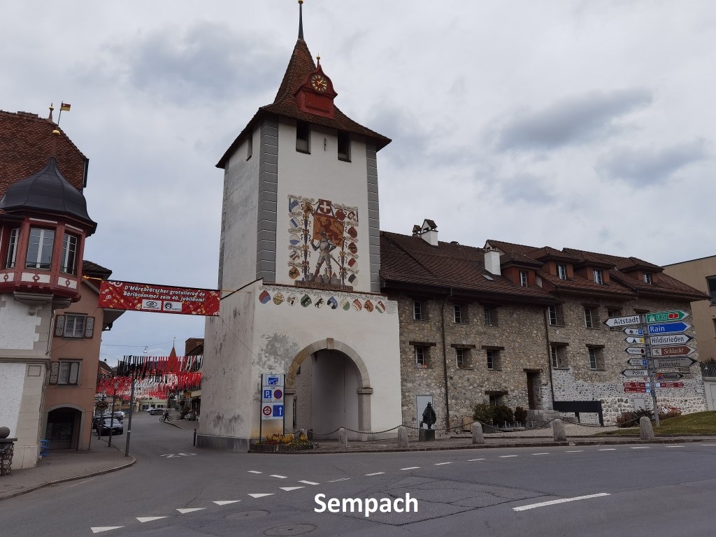
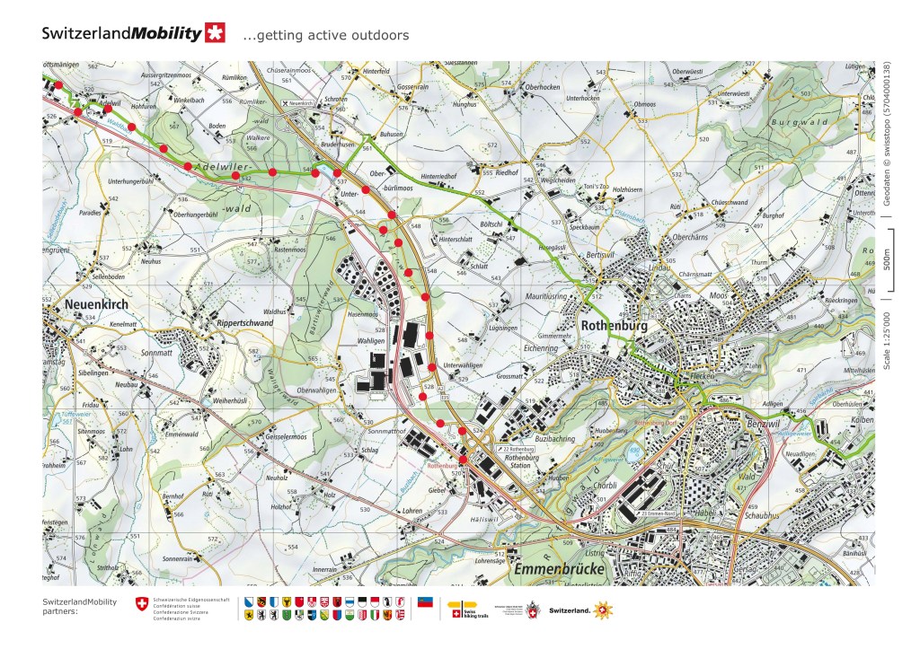
I came to Sempach and went on into the town. Just inside the gates is a church, with a monument to Arnold von Winkelried. I went on through the town and out along the road to Sempach Station. The trail turns left into the countryside, but I continued on along the road. Just before coming to the village of Sempach Station, I turned left to re-join the official route. I followed the stream called the Gross Aa, which translates as Big Aa. It most be the only place name that consists of just two letters, both the same. It is as small stream, and I wonder if there is a Klein Aa. If there is, it cannot be more than a trickle. I took a short detour to visit the church in the hamlet of Adelwil. Dedicated to saints Gallus and Einbeth, it is a little gem.
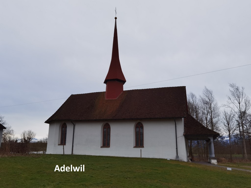
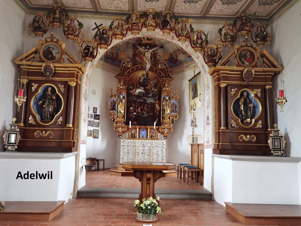
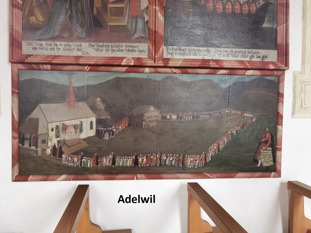
The current building dates from the 1610s, though the exact date is not certain. There has been a chapel on the site for much longer. It has been renovated several times over the centuries since then, most recently in 1988, and it was officially declared a Swiss monument. It holds the relics of St. Einbeth. The walls are decorated with numerous paintings showing episodes from the lives of the two saints.
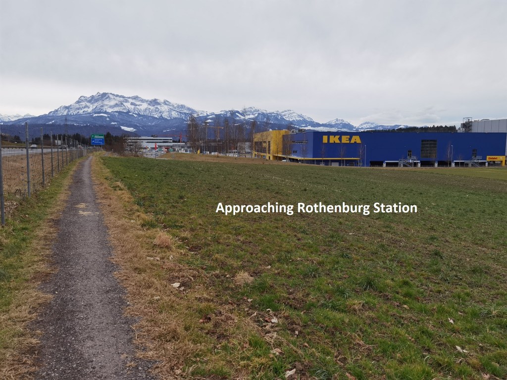
I went on from there, parallel to the railway line at first, then up through the woods towards the motorway, and then following local trails to my destination. I passed an unnamed lake before coming out into the land close to Rothenburg station. The IKEA store sits against a mountain backdrop. I was much closer to the mountains than when I started out.


It was just a short walk from there into Rothenburg station itself, and the train back to Basel.
And my total step count for the day was 51,916.