After completing my two main projects for this year, the Camino de Santiago, and the Trans Swiss Trail, I started looking around for what might come next. In the last few years, I have managed a Swiss project and an international project. In 2020, the trans Swiss Trail was my Swiss project, and the Camino de Santiago was my international project. I want to continue this approach into 2021, but starting early on the Swiss project. And after the Trans Swiss Trail, the logical one to go to next would be the Via Gottardo.
The Via Gottardo starts in Basel and runs in a generally south-eastern direction as far as Luzern. Then the route has the walker taking a boat across the Vierwaldstätter See to Flüelin; after that, it goes the short distance to Altdorf, where it joins the Trans Swiss Trail for the climb to the St Gotthard Pass.
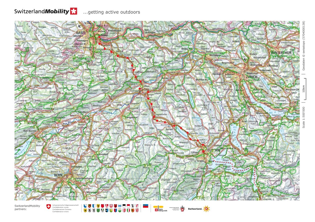
My interest in the Via Gottardo is not in completing the entire route, but it would be good to walk the route as far as Luzern, and then go around the lake to Stans, which I went through on the Trans Swiss Trail. And I would also like to come back from Luzern by a different route.
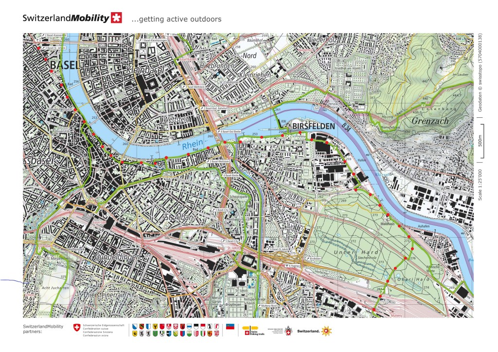
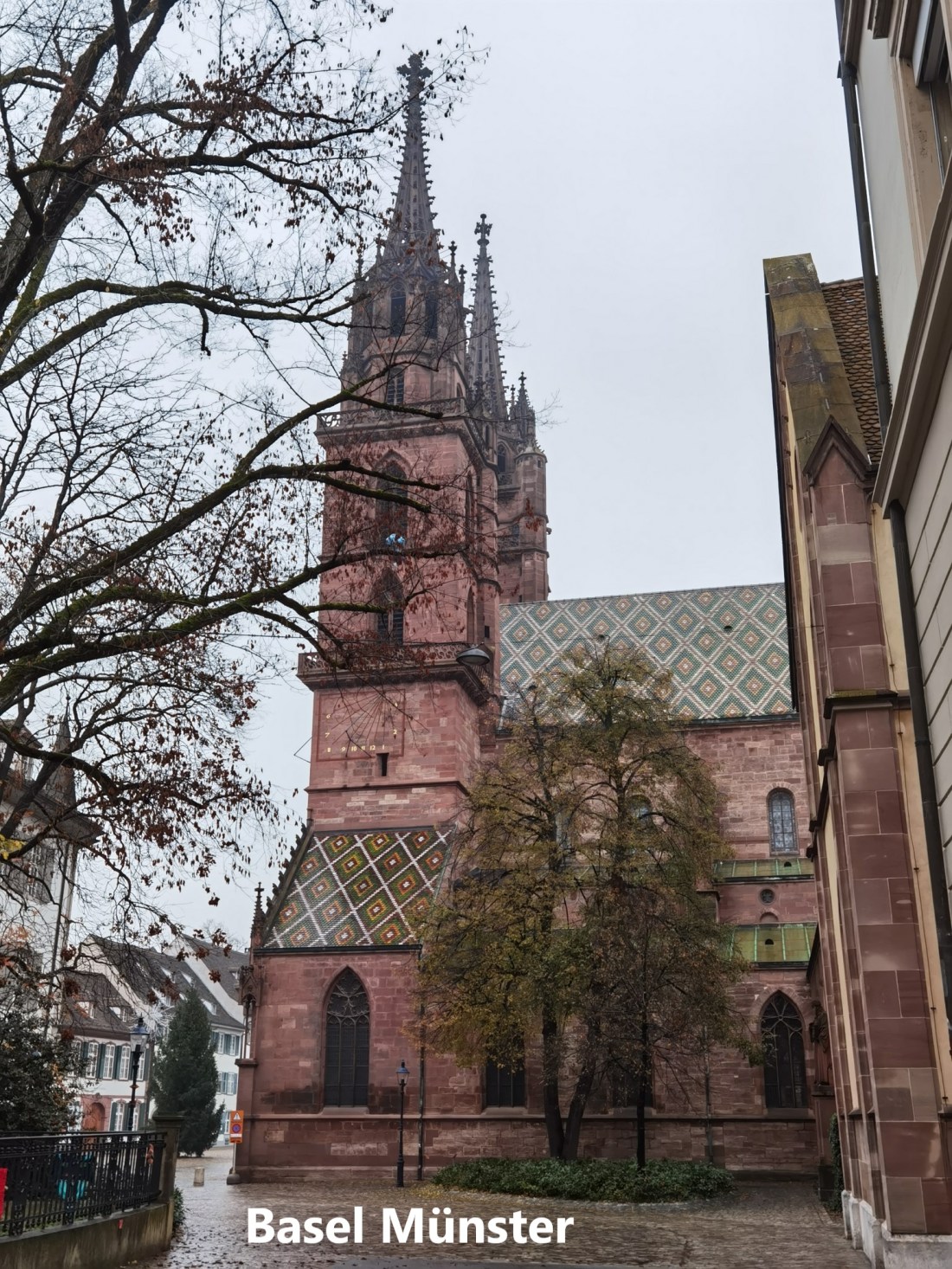
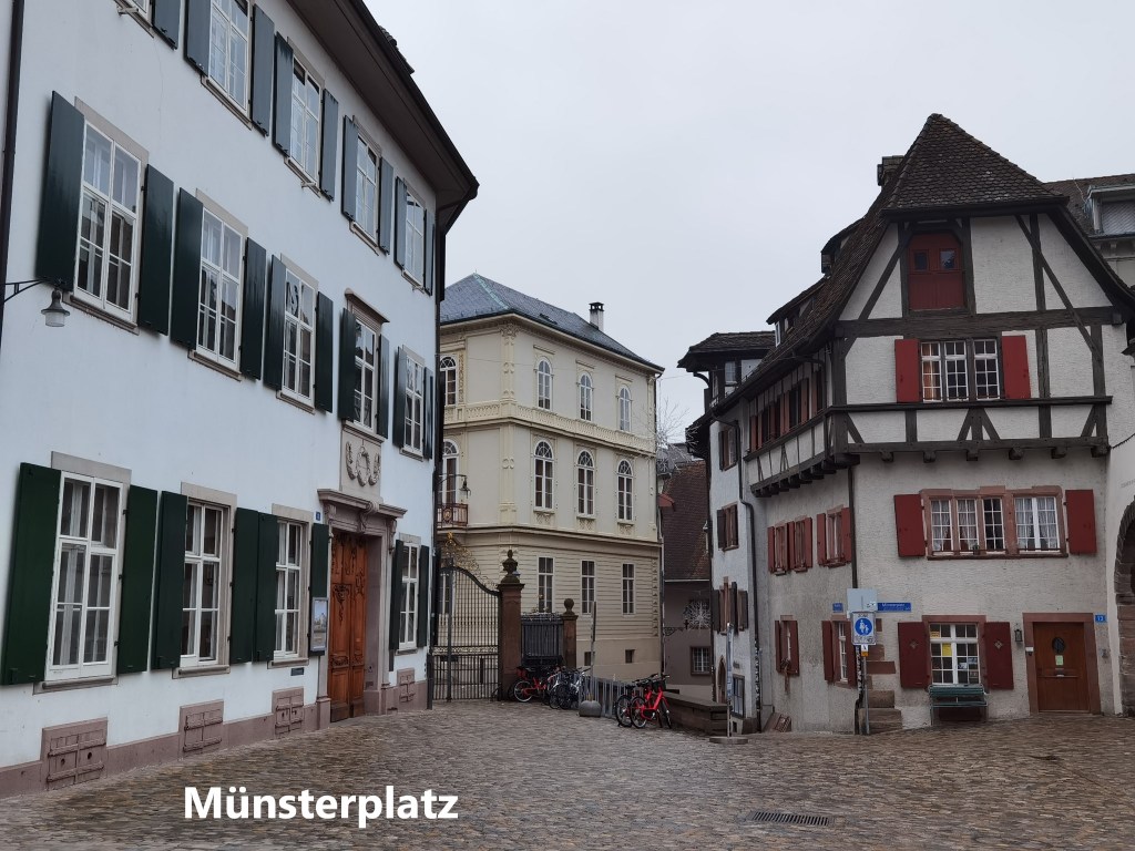
And so it was that last weekend, I set out on the first stage of the Via Gottardo. There were no trains or busses to the starting point. I simply walked out of my apartment building and down the street. The time was late enough for the sun to be up, but early enough for the streets to still be quiet. The proprietors of the coffee shops were readying their premises for the day. And it was a cloudy morning. As I approached the centre of the city, the Roche towers on the other side of the river had their tops obscured in the clouds. I treat the Basel Münster as the official start of the walk, so I paused there.
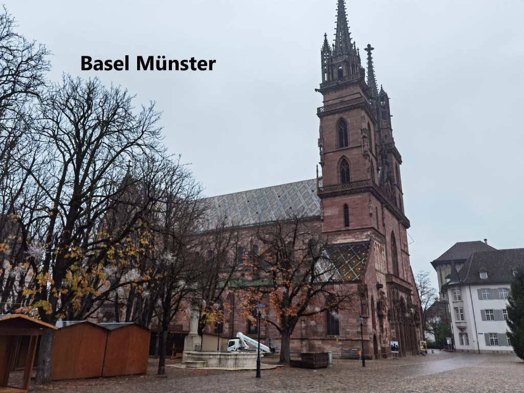
Basel does not have a cathedral, so the Münster, or minster in English, is the principal church in the city. It was built between the eleventh century and 1500, finished off in that year with the completion of the second tower. The building was disrupted by the earthquake of 1356, but the work continued for almost another 150 years to see the work completed. It was built from the distinctive red-brown stone, like many other prominent buildings in the city.
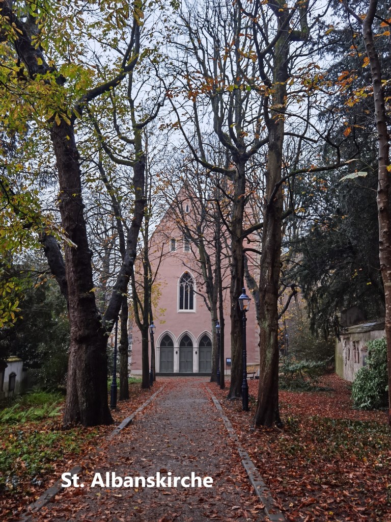
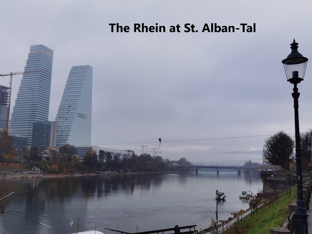
From the Münster, the route continues on, passing St. Albanskirche to reach the riverbank at the St. Albans-Tal landing stage. By now, the tops of the Roche towers were clear of the clous, though whether that is because I was nearer, or because the weather was clearing, I could not tell.
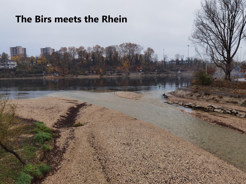
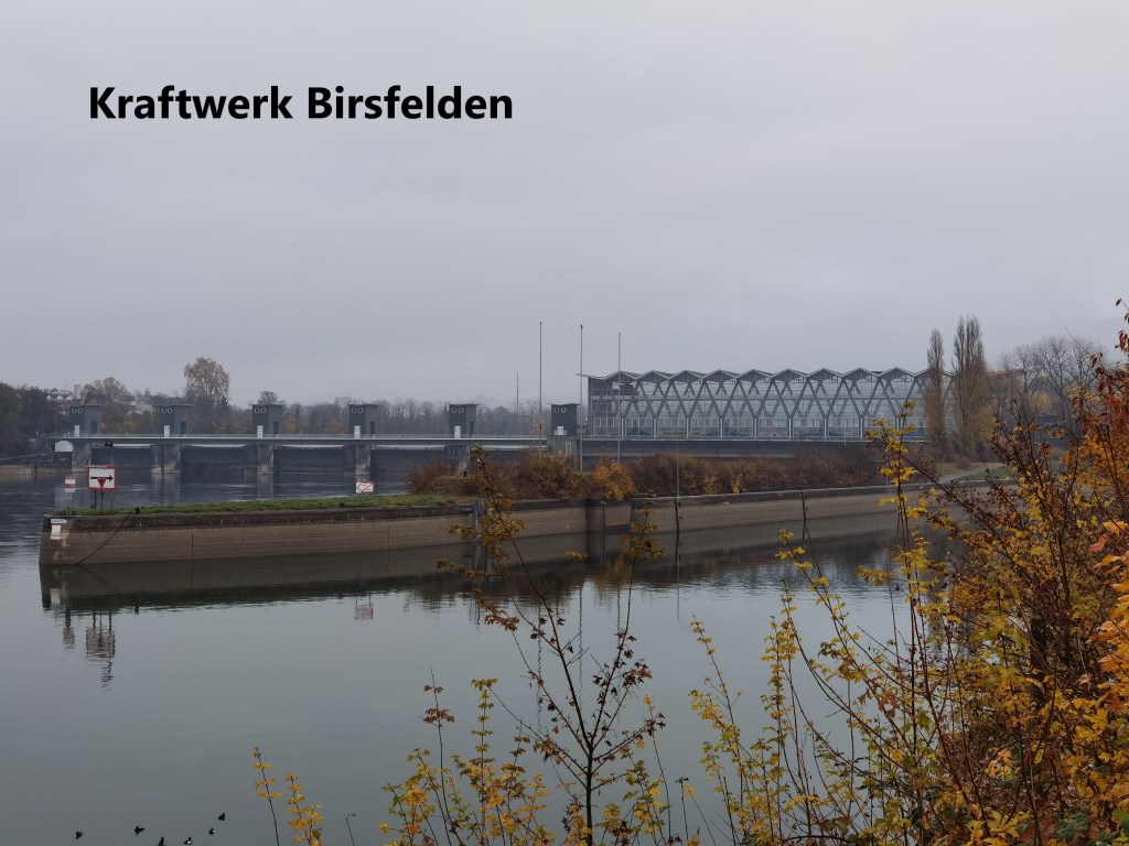
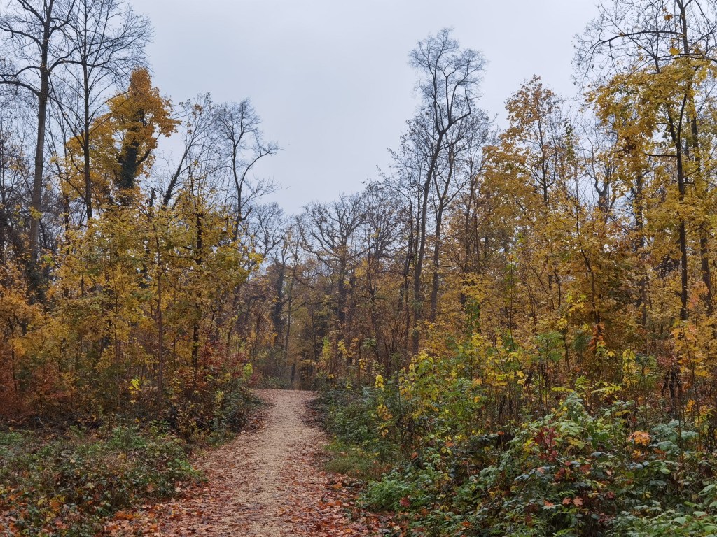
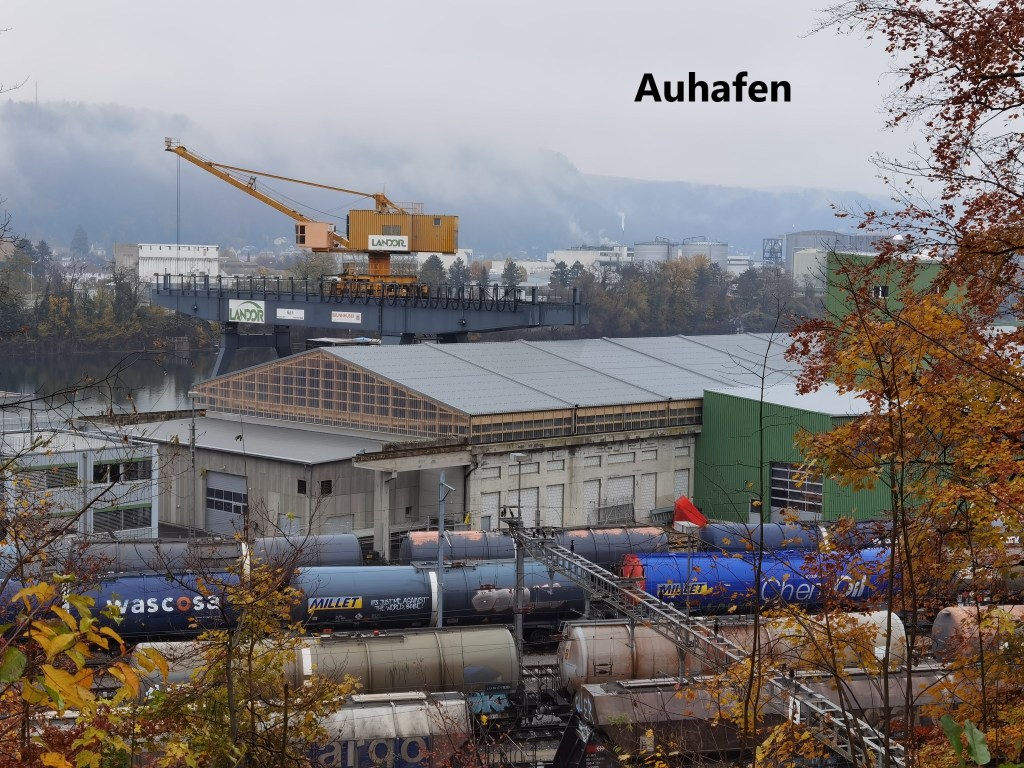
I continued on eastwards, crossing the Birs river near where it enters the Rhein. After passing the Birsfelden power station, the route moved inland a short distance. There is an industrial harbour on the river, and the route has to avoid the riverside at this stage. Instead, I had a pleasant park in its autumnal colours to go through. I passed the second part of Basel harbour at Auhafen, and then the route turned further inland again-

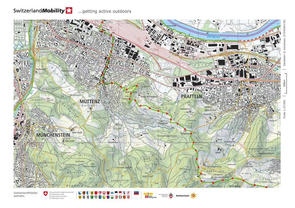
After leaving the park, I crossed over the motorway. This is the motorway from Basel to Zurich. Next came the Muttenz marshalling yards. These railway tracks are where goods trains are assembled for despatch to other parts of Switzerland and beyond. The Swiss, with their usual modesty, make no claim that this is the biggest marshalling yard in Europe, only that it is one of the largest.

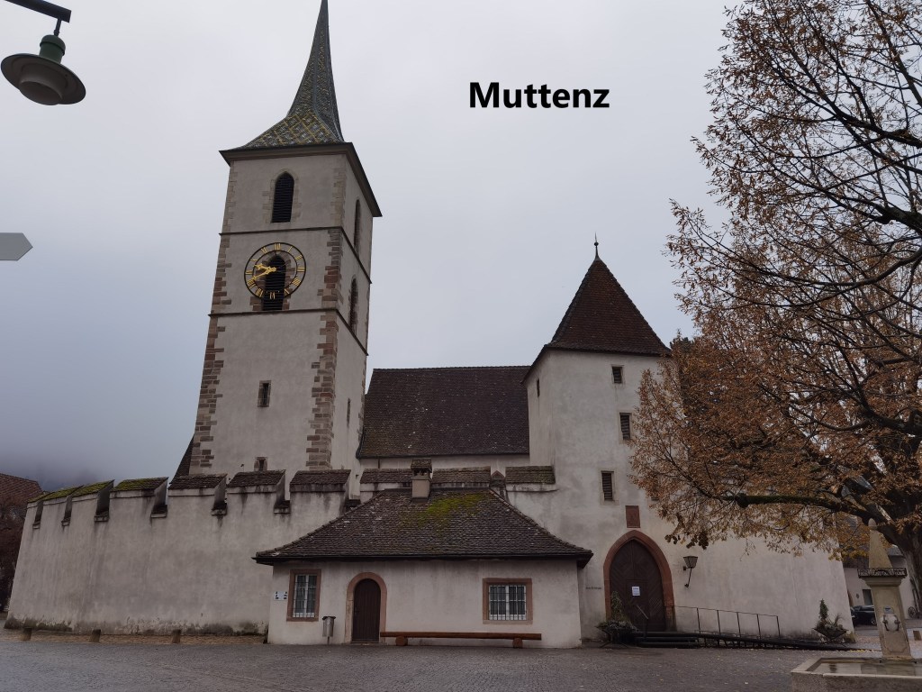
After crossing the marshalling yards, I entered Muttenz itself. Muttenz today is a dormitory town for Basel, but there is a small older centre to the town. There were settlements in the area as far back as Roman times, but the first mention of the name Muttenz is in the early thirteenth century. Early in the fourteenth century, the village became the property of the Münch family, who also owned the nearby Warteberg castle, something I will come to later. When the 1356 earthquake damaged the castle, Münch built a wall around Muttenz church, and it still stands. The ownership of the village transferred to the city of Basel after the Münch family fell on hard times in the sixteenth century. In the following century, the village was hit hard by the plague, losing one seventh of its population. After the Basle civil war of the 1830s, Muttenz went with the separatist Basel Landschaft, and no more a part of the city of Basel. It remained a rural agricultural village until the industrial growth of the entire Basel region in the twentieth century.
After Muttenz, my route began a sharp ascent on the nearby Warteberg. But it did not take long until I came to the ruins of the castle.

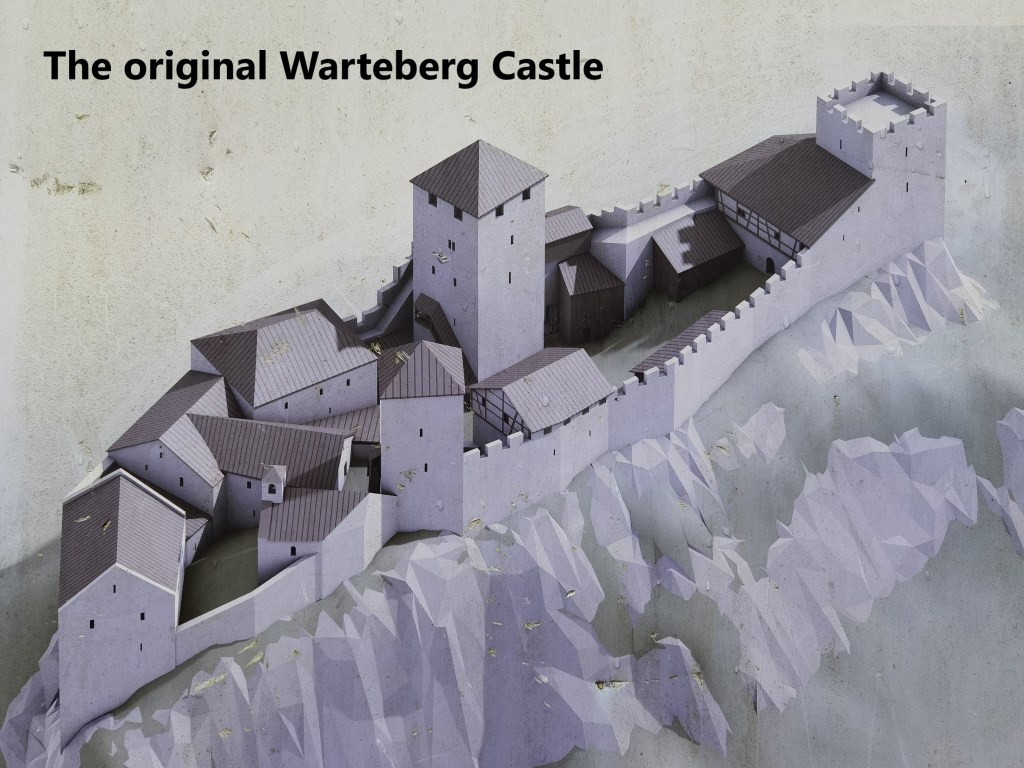
The complex of castles at Warteberg consists of three buildings: a castle, and two towers further up the hill. The oldest building is the castle. Its origins are not entirely clear, but it was owned by the diocese of Strasbourg in the eleventh century. It passed to the Habsburg empire and was occupied by imperial families from the thirteenth century. But the earthquake of 1356 damaged the castle very badly. Records from 1470 record that only 2 stables were occupied, with the rest in very bad condition. But the castle still had a value based on the lands it possessed and the rights it held in relation to villages around. And so the castle continued to change hands through the following centuries, but today it is just a total ruin.
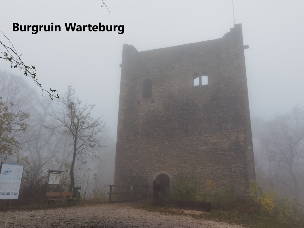
Further up the hill, I came to the second part of the complex, a square tower. Again, the exact details of the time and reasons for its construction are lost in the mists of time. The years have been a little kinder to this tower. Although it is a ruin, the walls seem reasonably intact, though it is completely hollowed out and open to the elements.
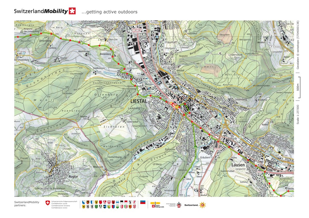
My route bypassed the third part of the complex, another tower. Instead of going to the tower, my route went downhill again. But it was only a short descent, and then there came an almost flat section of the route. I passed the farm at Eglisgraben, and then I was going upwards again. At first the ascent went through forestry, and then I came into open farmland at Schauenburg.
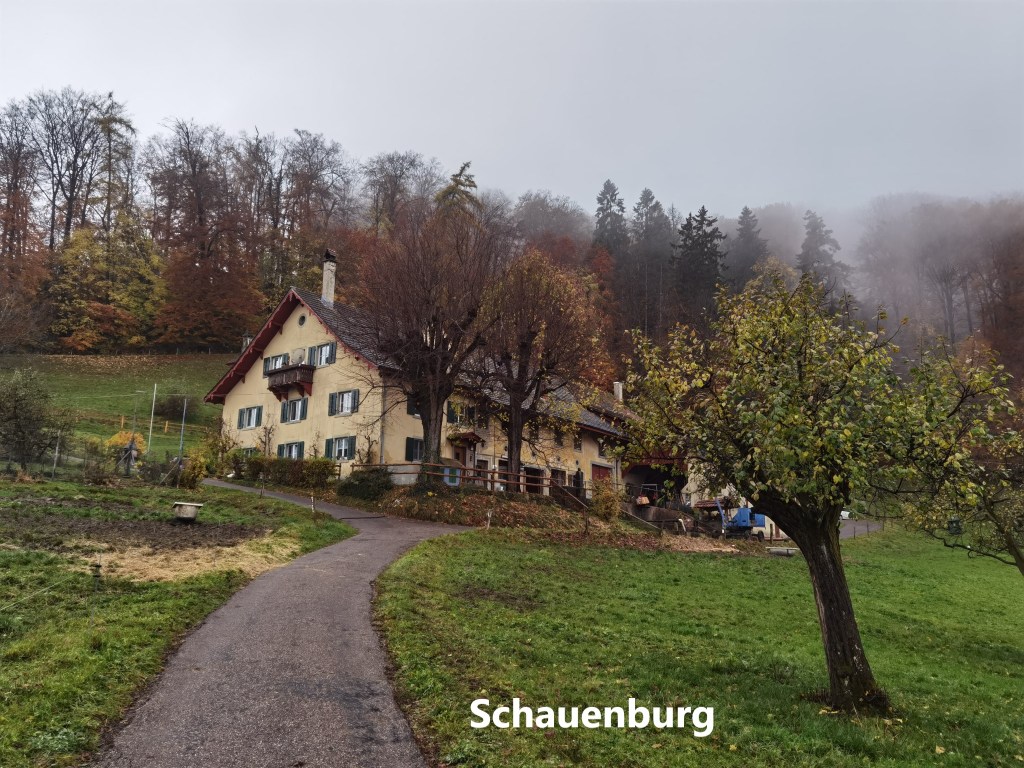
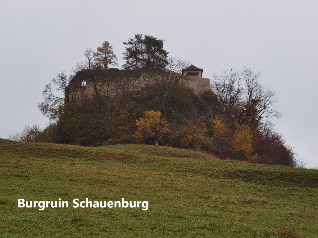
Close by is the castle of Schauenburg. Again, the origins of this castle are vague. It is mentioned in records from 1214, but the ownership is unclear. By 1300, because of legal disputes over ownership, the castle was largely abandoned. That earthquake of 1356 hit Schauenburg castle as well, and it was no longer habitable after the earthquake. But by 1400, the castle belonged to a local pharmacist, whose astute business and political dealings made him a powerful figure. But the legal disputes continued, and a few decades later the castle was lost again. But by the eighteenth century, all that had been resolved, and although only a ruin, ownership passed to various dignitaries from Liestal. Today, the castle is still a ruin, though a small dwelling is situated close to a high wall on the eastern side.
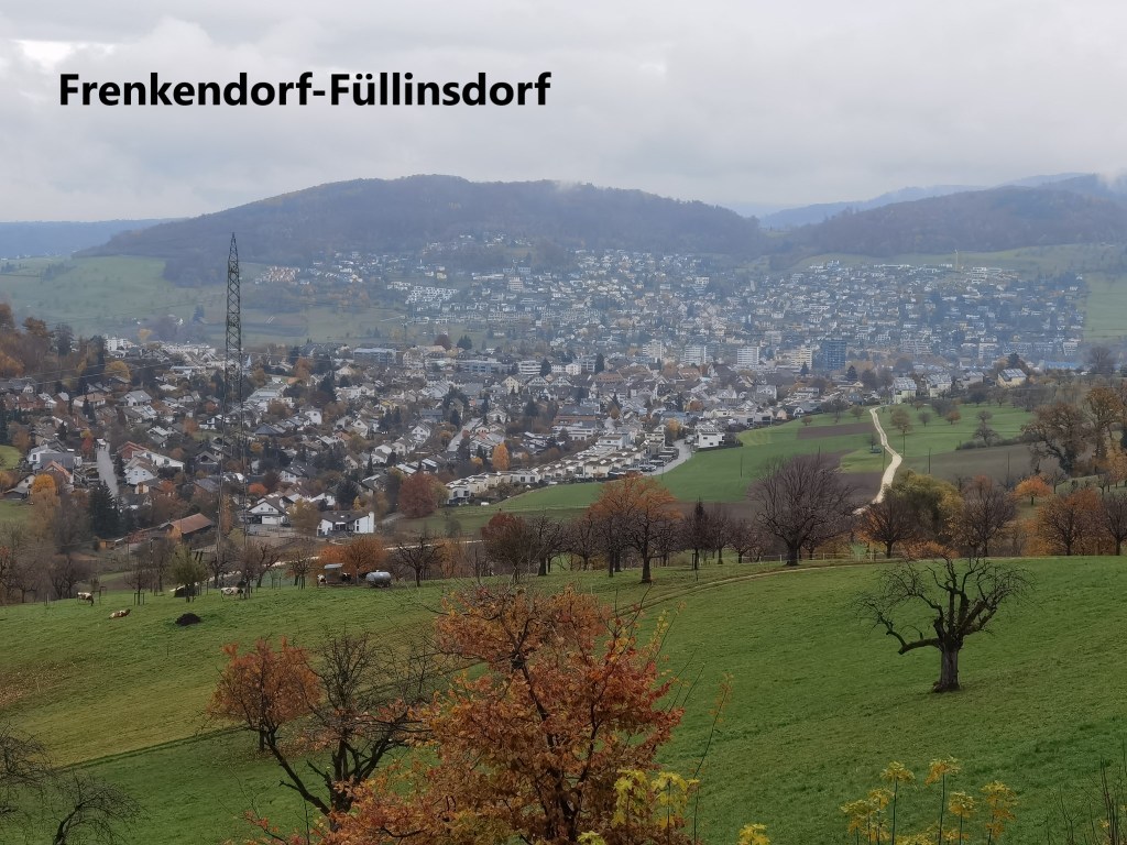
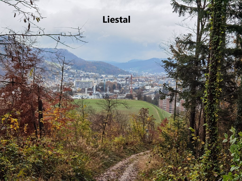
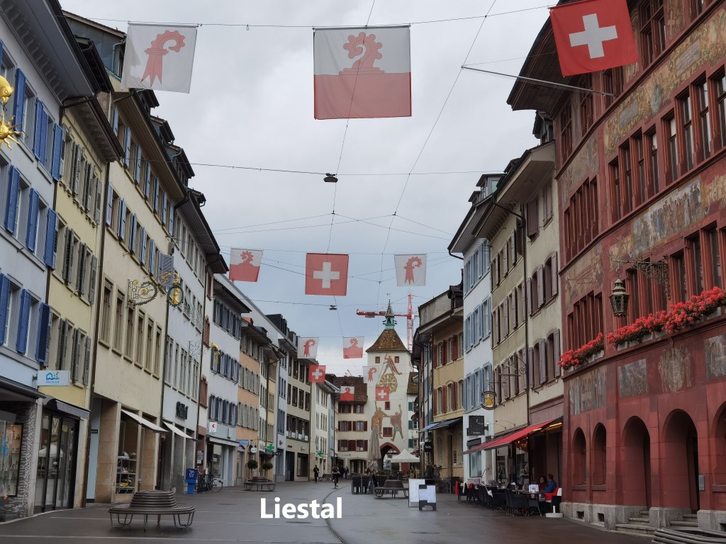
After passing the castle, I began to descend towards It is a lengthy descent for such a small hill. At first, the villages of Frenkendorf-Füllinsdorf came into view, and then I was heading into Liestal itself.
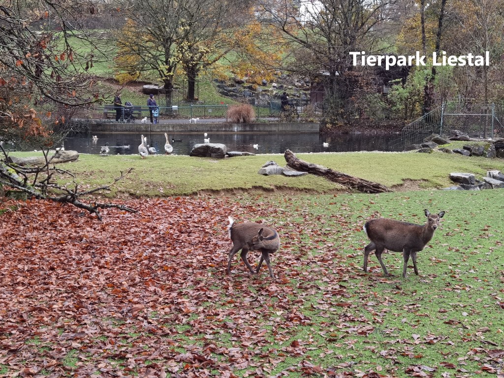
Liestal is an old town. It is mentioned in the twelfth century. The town sided with the Swiss confederation in the Burgundian wars of 1476 and 1477. In the seventeenth century, a peasants’ revolt against Basel was crushed with harsh punishment of the rebels. As a result, when Napoleon invaded, his troops were welcomed in Liestal, as people saw this as a way to end the cities influence. In the 1830s, the tension between Basel city and the surrounding countryside erupted into civil way. The single canton that was Basel became two half-cantons: Basel Stadt, and Basel Landschaft. And thus it remains today. Liestal became the capital of Basel Landschaft. Basel city has a zoo, and quite an impressive one at that, but Liestal, being much smaller, has only a Tierpark, whose inhabitants are mostly smaller and less exotic than those of the Basel Zoo.
I went straight through Liestal. There were slight detours compared to the official route because of construction work at the railway station. There used to be a narrow-gauge railway line linking Liestal station to the village of Waldenburg in the hills to the south. But recently, that line has closed, and is replaced by busses. The end of the line at Liestal has been completely removed as part of the construction work going on there, but when I came to what would be the first station out of Liestal, at Altmarkt, the line was still very much present. The tracks look in good condition, though I suspect that will soon change. I have memories of taking the Liestal to Waldenburg line. Those memories will remain, so I didn’t stop at Altmarkt, but kept on going. My route followed the railway line as far as Lausen, a village under the control of Basel since 1400.

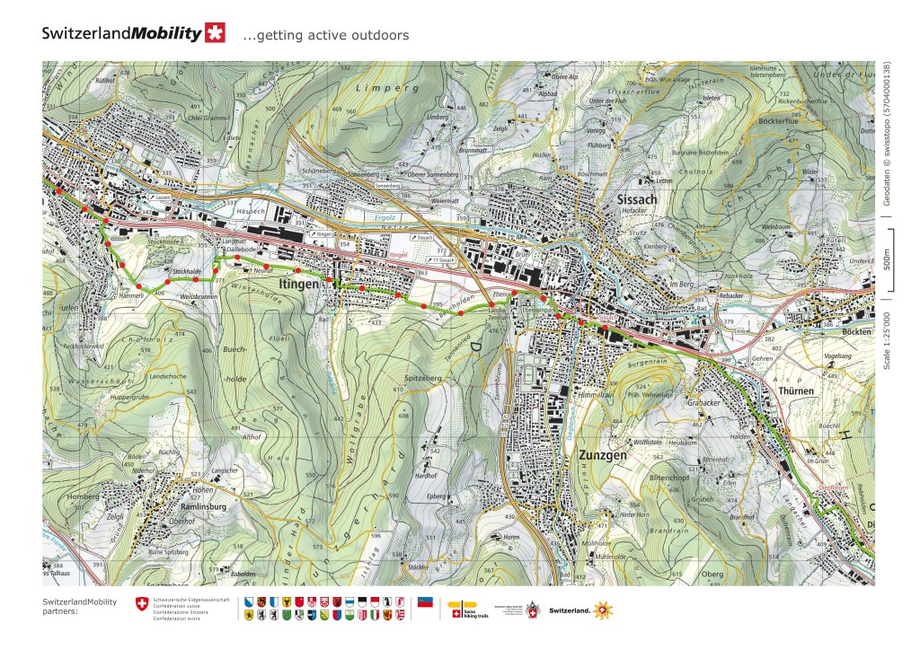
After Lausen, the route takes a circular route around the nearby hills to reach the village of Itingen. It was a short ascent, around the hill, and descent into Itingen. It is very much a residential village, a dormitory for people working elsewhere, so again, I did not stop, but went straight through on my way to Sissach. Sissach is and old town, mentioned in archives of 1275. But it is without significant sights for travellers, so I did not delay, but went straight to the railway station and my train back to Basel. When I return for the next stage, I will not have the luxury of starting from my own front door.
And the step count for the day was a total of 45,910.