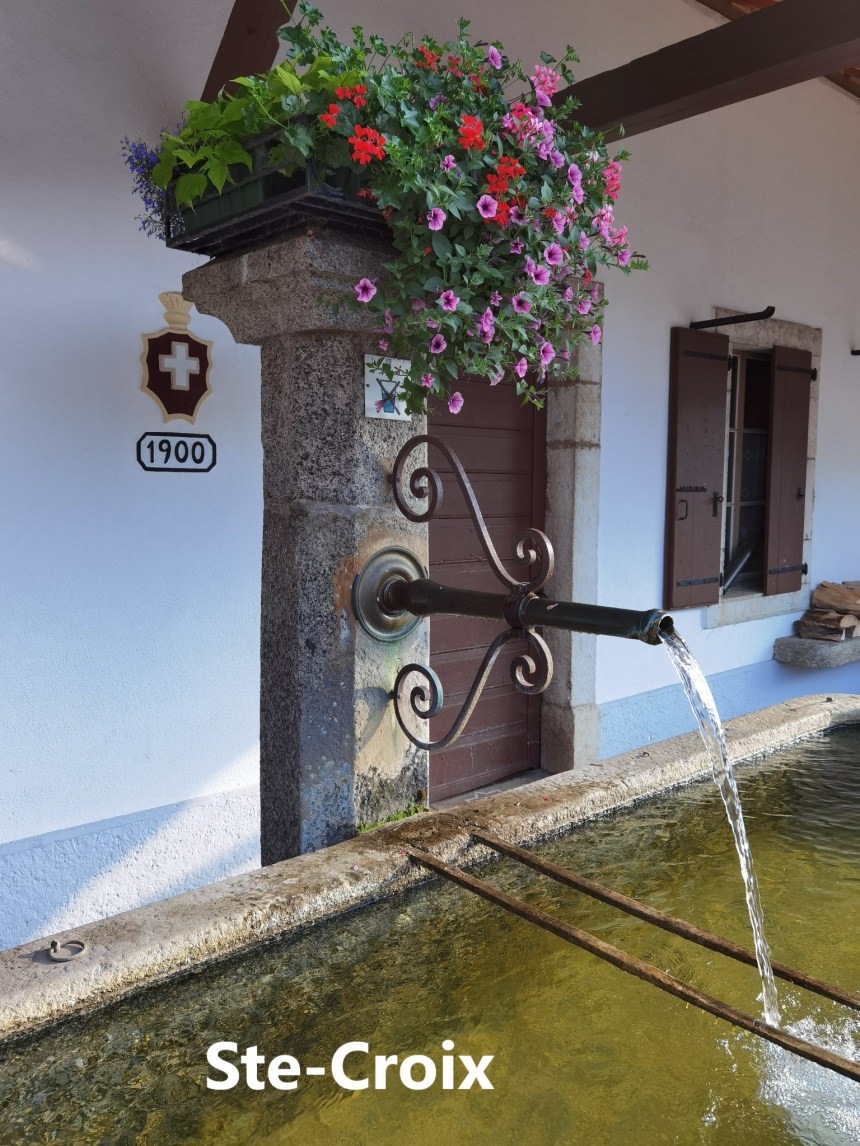
My last outing on the Jura Höhenweg brought me to the little town of Ste-Croix. The stages after that raised some questions however. The guidebook lists the next stage as going from Ste-Croix to Vallorbe, a distance of 23km, which would be a reasonable day’s walk. However, the following stage, from Vallorbe to Le Pont is only 13km, and it did not seem reasonable that I should schedule a day’s hiking for just 13km. So I decided to put the two together, and make one long day, going all the way from Ste-Croix to Le Pont.
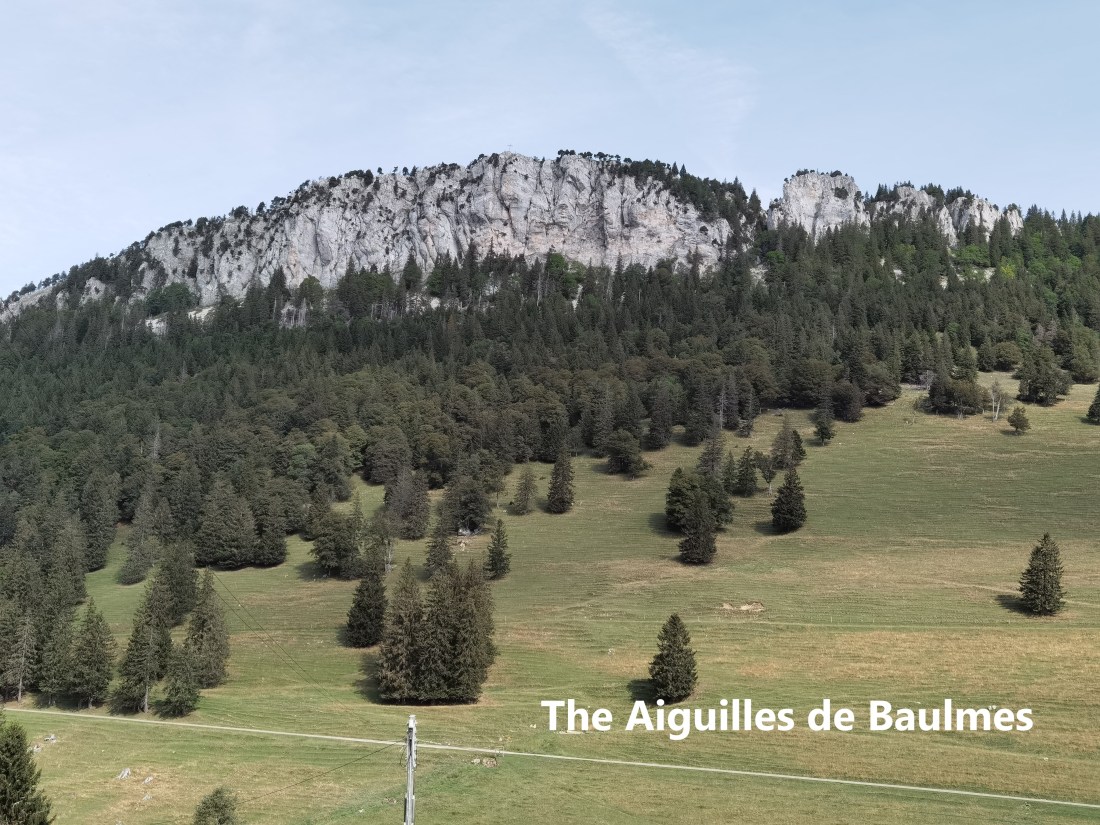
I was also not very enthusiastic about the route of the Jura Höhenweg from Ste-Croix. The official route heads north-west from Ste-Croix, before turning and heading south. It bypasses the Aiguilles de Beaulmes, which has some of the most spectacular cliffs in the Jura range. I decided, therefore, to make some adjustments, and go my own route, generally following the Jura Höhenweg, but with some variations.
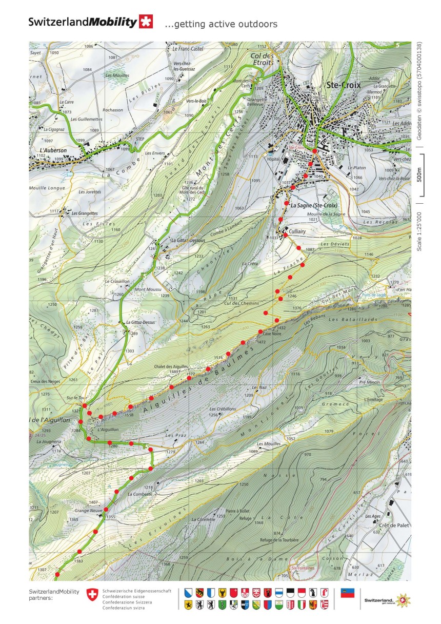
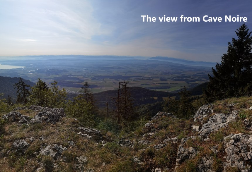
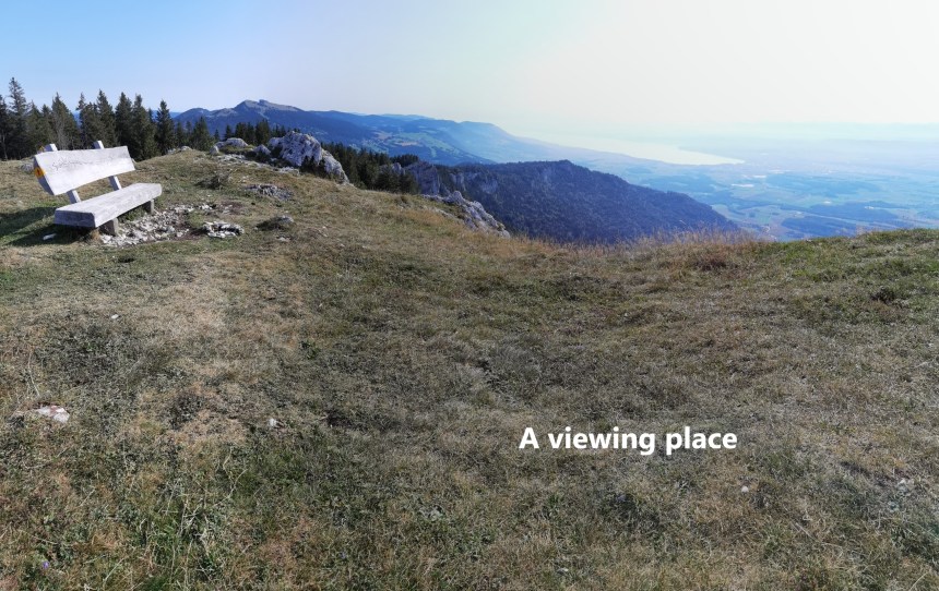
I left Ste-Croix in the early morning sunshine, and after a small descent to Culliairy, I was soon ascending through the forest. It is not a very long ascent, about 400m gain in height, and I soon came out of the forest onto the ridge of the Aiguilles de Beaulmes at the Cave Noire waymark point. Once on the ridge, my reward was a spectacular view to the south and east. Lakes Neuchatel and Geneva were clearly visible, with a haze over the Alps in the distance. I was also able to see the face of the cliffs on the southern side of the mountain.

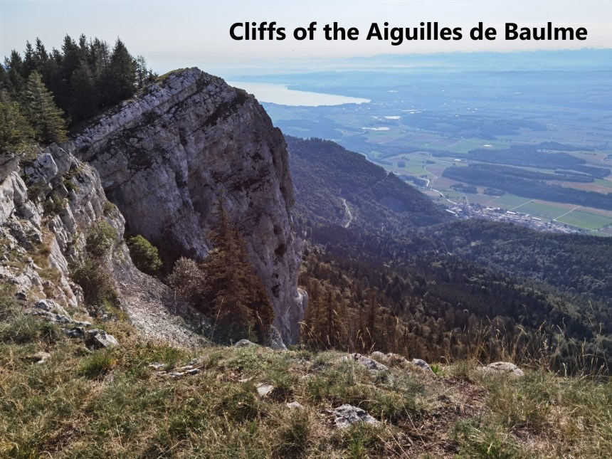
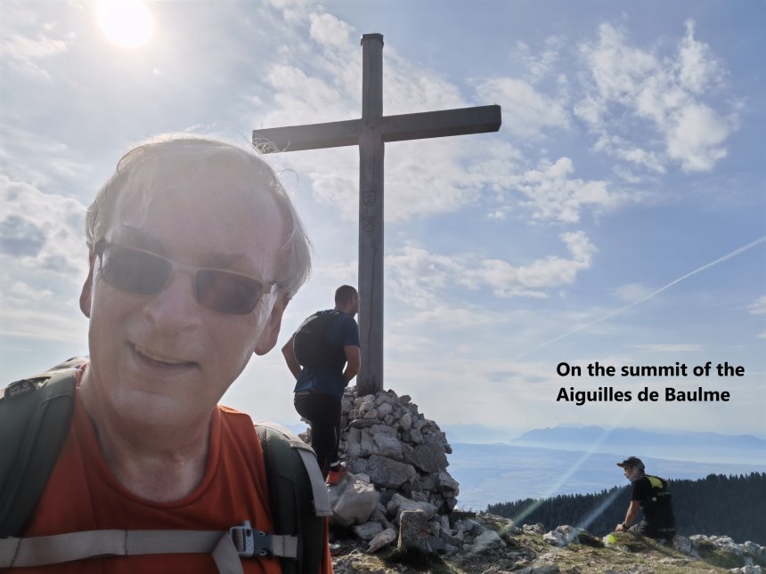
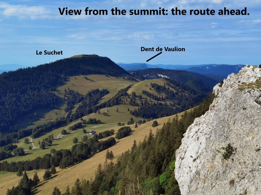
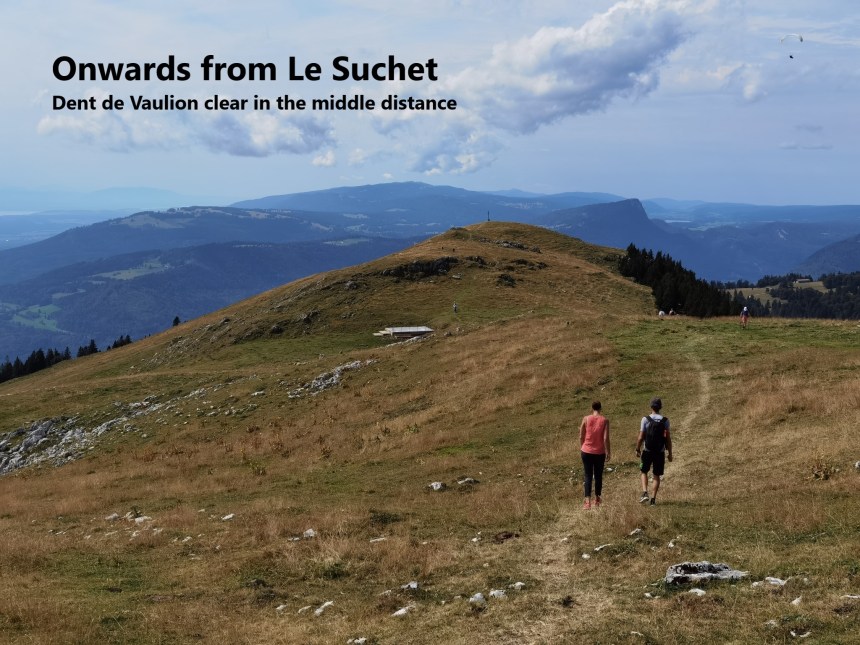
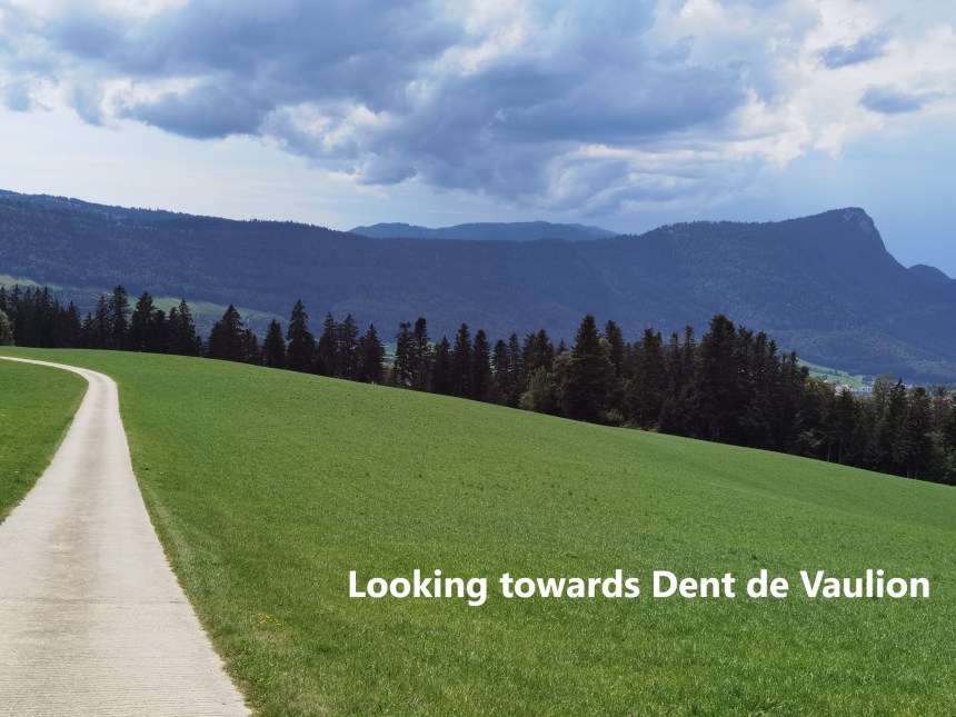
From the Cave Noire to the summit of the Aiguilles de Beaulmes looks like a smooth gradual ascent of just 100m over a distance of two kilometers, but it is in fact a hilly route, going up and down in small amounts, generally following close to the edge of the cliffs. The summit itself is marked with a cross. From there, I could see the other summits that were on my agenda for the day: Le Suchet and Dent de Vaulion.
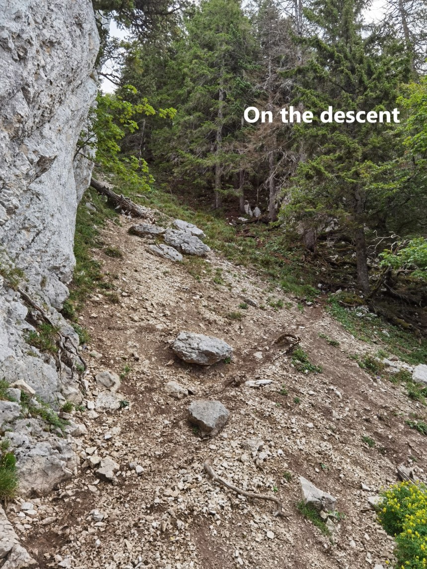
The standard trail from the summit of the Aiguilles goes northward to join the Jura Höhenweg, but my route was south, so I took the shorter, but less used trail directly west from the summit. At first, it was relatively easy. The slope was gentle, and though not well marked, the trail is not difficult to follow. But on the eastern end of the ridge, the route because much steeper, to the point that I was no longer walking, but scrambling down. This is not a route for the inexperienced.
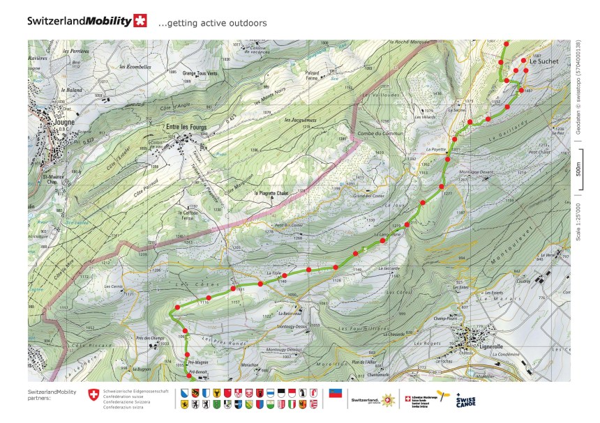
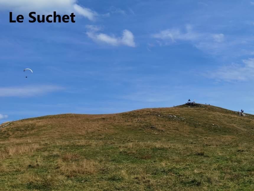
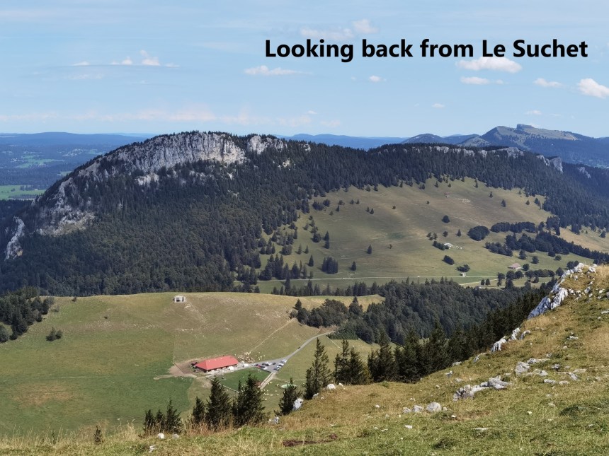
Nevertheless, I got down safely and back onto the official Jura Höhenweg. The trail swings eastwards then, bringing the face of the Aiguilles into view. Then it goes across the valley and onto Le Suchet. This mountain is a gradual ascent, at first through open country, then through the forest, and back into the open close to the summit. It requires a small detour of about ten minutes’ walk to reach the summit itself. It is a popular spot, with paragliders practicing and groups of walkers coming and going.

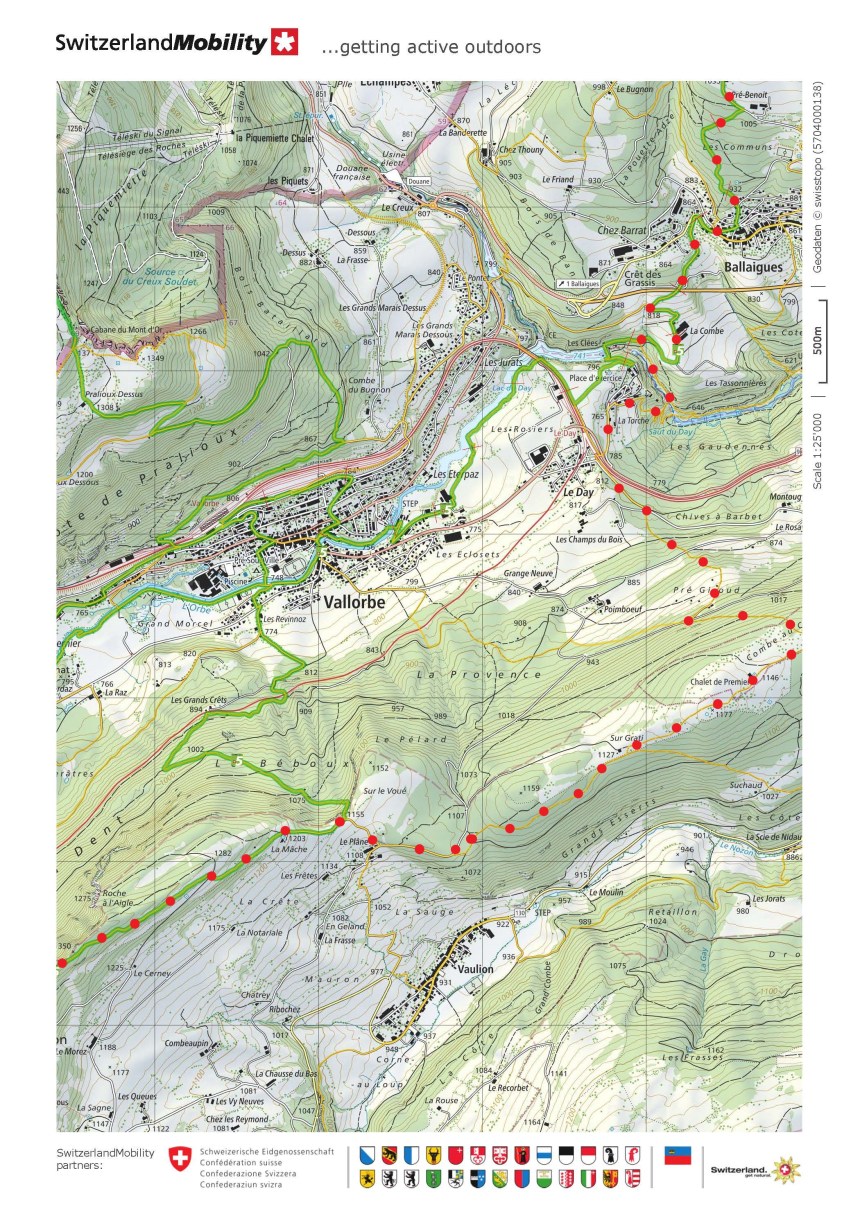
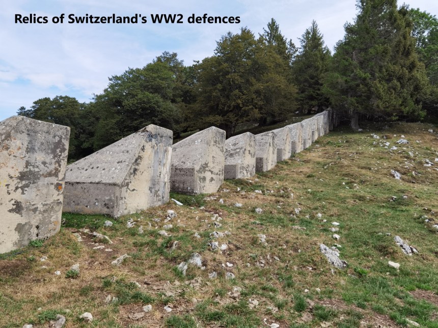
I did not delay, but quickly went on. For my plan to succeed, I would have to get to the Orbe valley by 2:30 in the afternoon, and I could not take too much time at the summits. From Le Suchet, the route descends quickly at first, but then is almost flat for several kilometers. By now, the clouds had come in, and there was even a spattering of rain, but not enough to justify taking out the rain gear from the rucksack. At places along this route, there are the remnants of Switzerland’s wartime defences from WW2: a pillbox bunker in one place, ant-tank obstacles in another
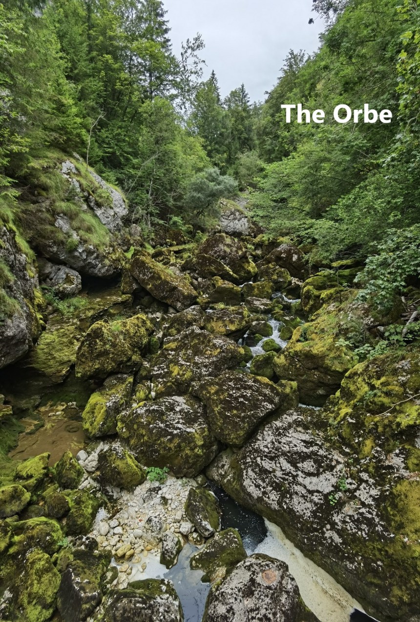
It was under grey skies that I reached the village of Ballaigues, with a clear view of the Dent de Vaulion as I came out of the forest. I made the decision not to go into Vallorbe itself, but to go through the village of Le Day and get back onto the higher ground as quickly as possible. With that in mind, I left the official route just after passing the farm at La Combe, and went down into the gorge of the Orbe River. I expect that in wet weather, this is a cascade of waterfalls, but in this dry summer of 2020, it was just a small stream.
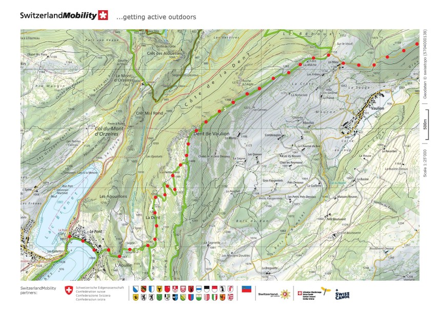
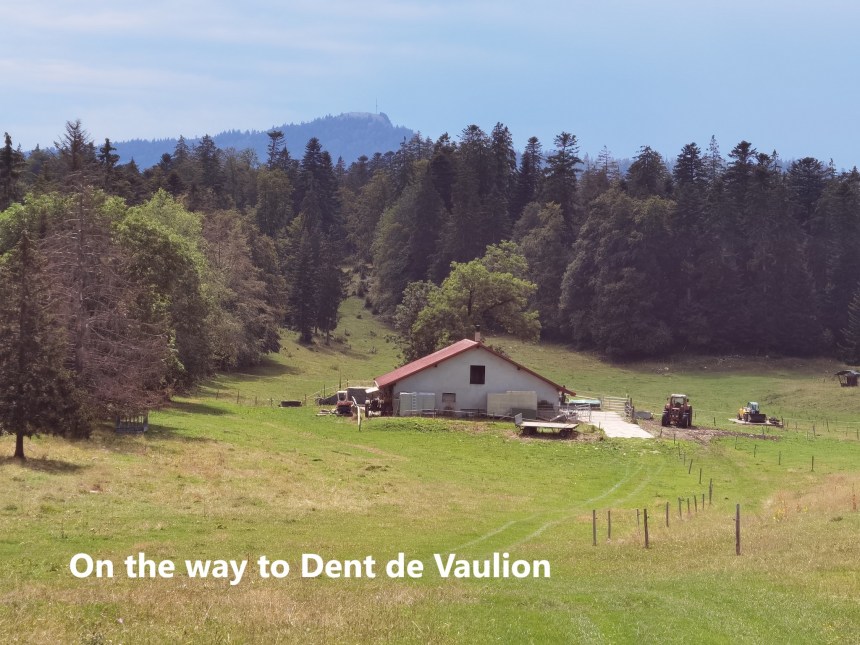
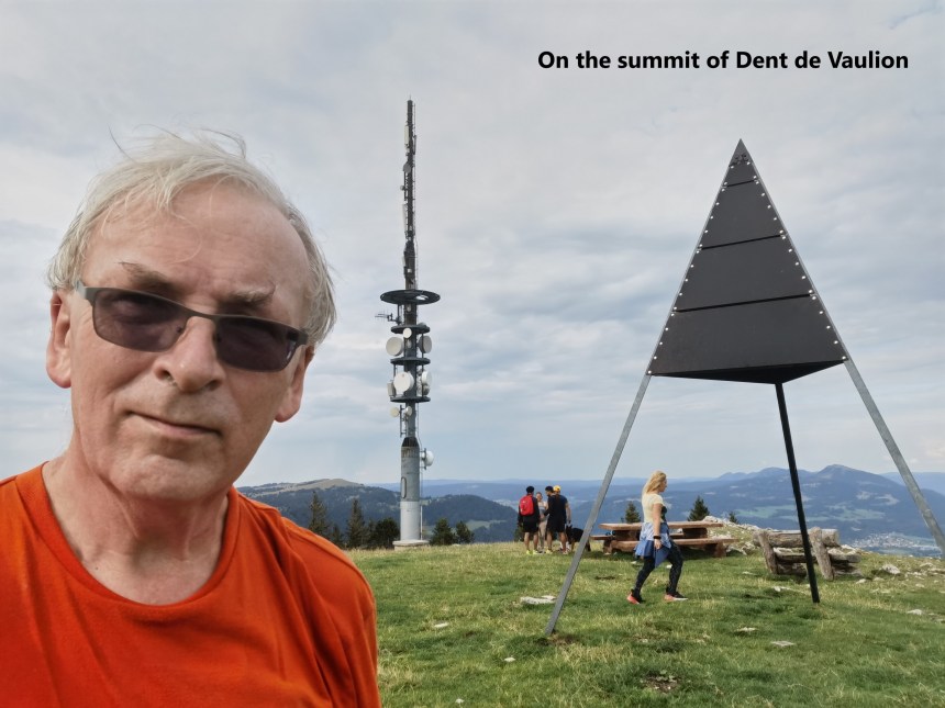
I kept going, just passing the edge of Le Day, and then beginning the ascent to the higher ground. The route goes through the forest, and I found a Bergrestaurant on the way, which allowed me a very welcome beer. Each time I came to a clearing, the Dent was getting nearer, and it was not long before I was on the final ascent. It was forest for most of the later stages of the ascent, and I came back out into the open just below the summit. The skies were still grey, but I was there at last. Thankfully, the clouds were high enough to allow views all around. To the south, I could see Lac de Joux and my final destination of Le Pont
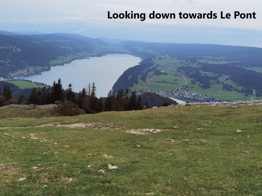
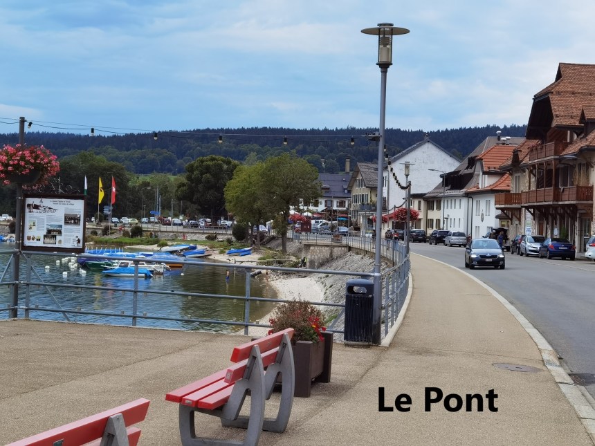
The descent was quick from the Dent de Vaulion, but relatively easy at the same time. I came into Le Pont at the eastern end of the village. Le Pont is as close to a beach resort as I have seen in Switzerland, with swimmers and pedal boats on the lake, floral decorations, and restaurants along the promenade.
From Le Pont, it was a combination of trains and a bus journey to get back to Basel. I was happy with my day, having walked about 35km and counted 60,728 steps.
In the maps below, the official route of the Jura Höhenweg is shown in green. The red dots show the route that I took.