
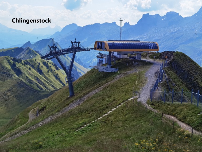
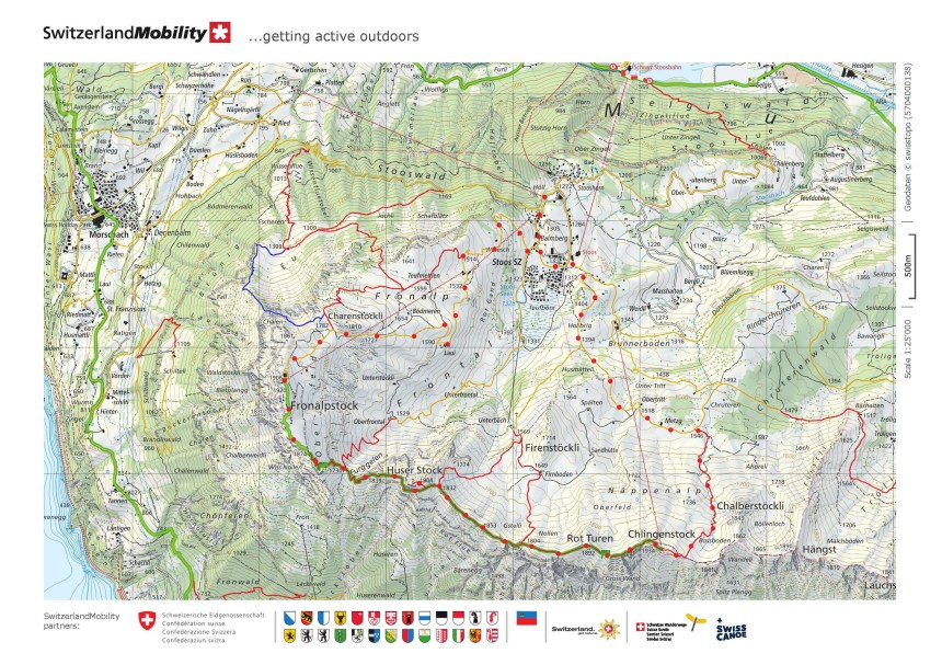
The village of Stoos is in the Swiss canton of Schwyz. It sits below a ridge, and that ridge is the route of a popular walk. The ridge takes in three summits: Chlingenstock, Huser Stock and Fronalpstock. There is a ski lift from Stoos to each of Chlingenstock and Fronalpstock. The walk from each of those to the other has become very popular among locals and tourists, so popular that the route itself has been upgraded and made safer, and the route has been given a reference number among the official routes of Switzerland: number 827. The tourists and day trippers mostly take the ski lift to Chlingenstock and walk from there to Fronalpstock, where there is a popular bar and restaurant before they take the second ski lift down again to Stoos.
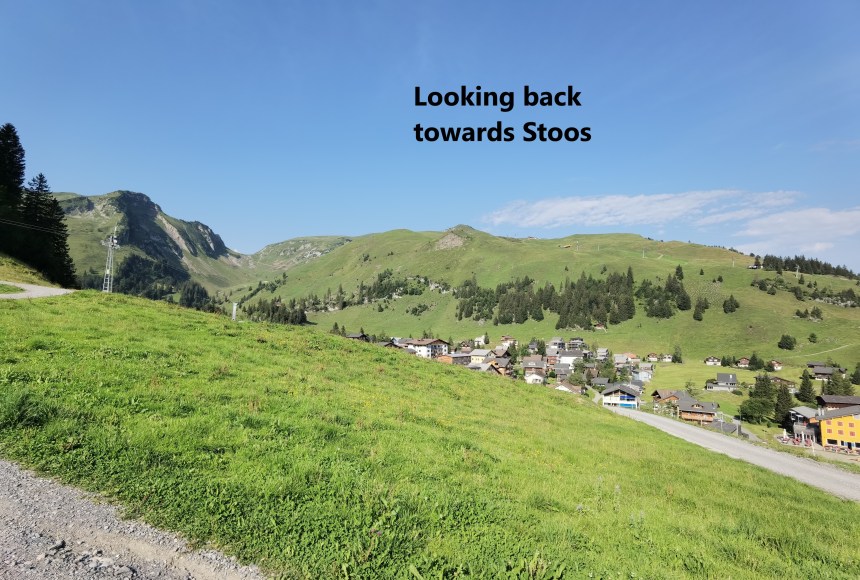
But as I have written in the heading to these pages, a walker walks. So my route did not involve any ski lifts. Instead, as the map at the end shows, I made my plan based on walking from Stoos to Chlingenstock. A train took me from Basel to Brunnen, a bus took me from there to Morschach, and a cablecar carried me up the hill to Stoos. Stoos itself is more of a holiday village than a place where people live all year round. Some of the chalets look like they were designed based on Swiss music boxes, or perhaps the other way around.

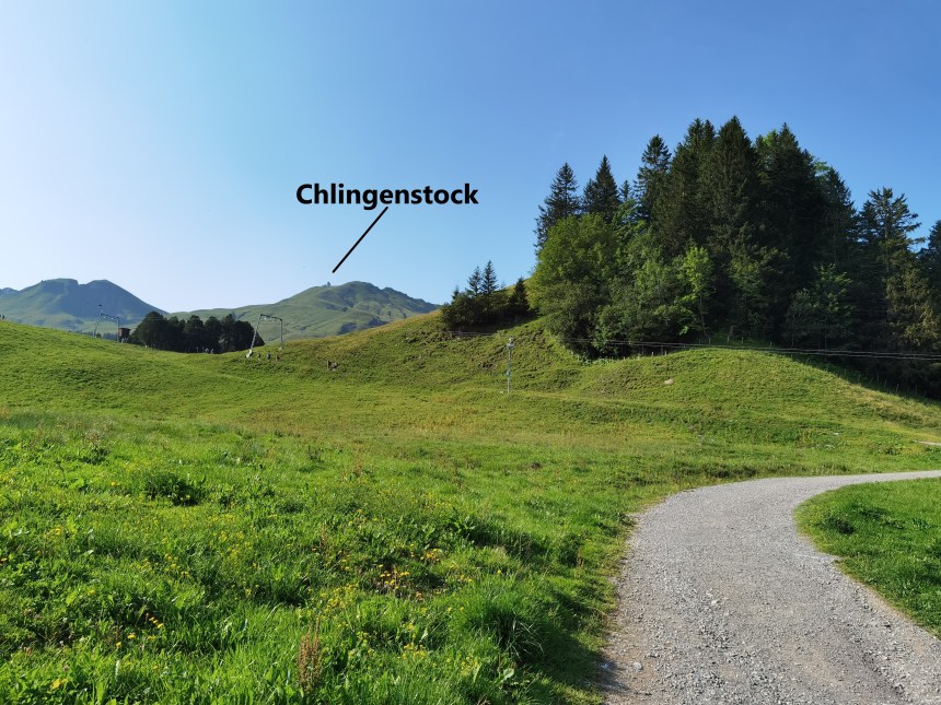
The route out of Stoos ascends quickly, and soon Chlingenstock came into view. The sun was fully out, and warm, and the uphill trek quite an exertion.
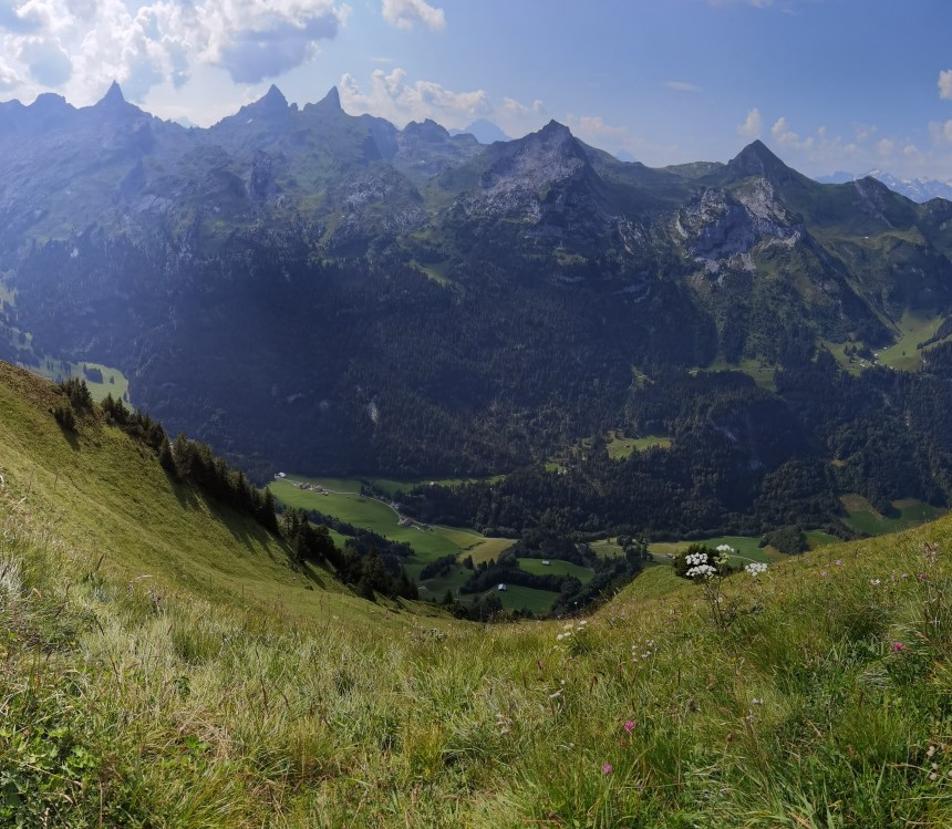
But I was rewarded with magnificent views when I reached the summit of Chlingenstock. Gross Mythen and Klein Mythen stood out prominently to the north, while a deep valley separated me from the more northerly of the alpine peaks to the south. Most people seem to take the ski lift to the summit, and there are picnic tables nearby, but this was not a place to stop. After the exertions of the walk to the top, I was sweating profusely, and I seemed to attract every flying insect in the vicinity. So, I was soon on my way along the ridge.

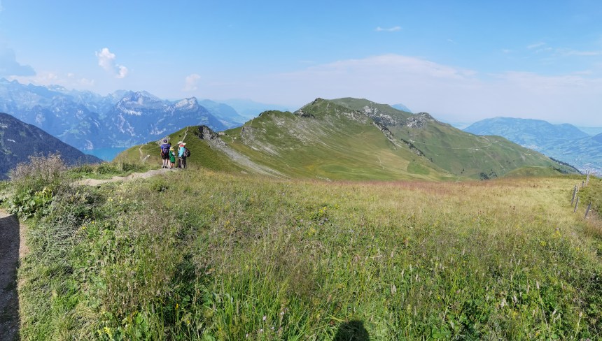
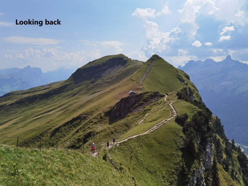
The ridge goes up and down and the track winds its way along close to the crest. Because the route is mostly used by tourists and day trippers, it has been made safer by improving the surface, putting in steps, and generally making it more suitable for less experienced walkers. It was easy in the sunshine, and occasionally a breeze provided welcome cooling effect.

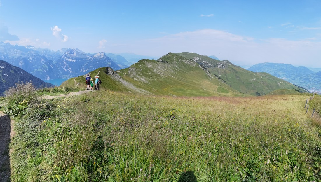
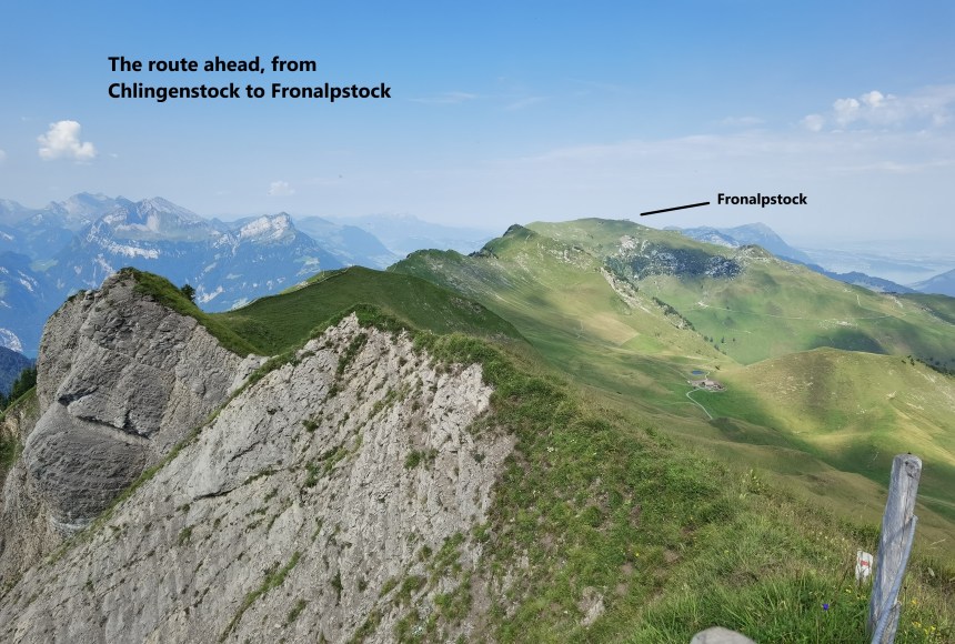
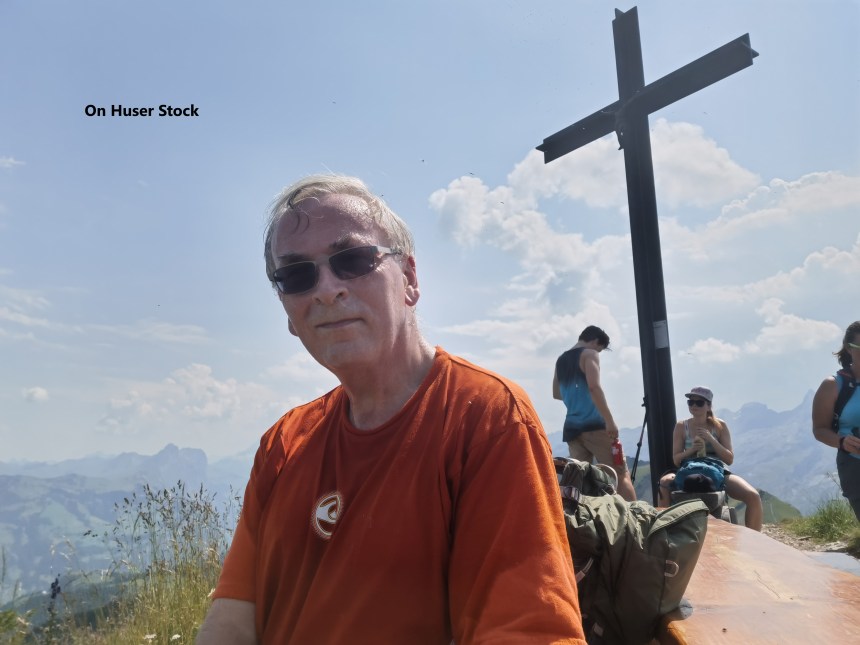
I took a detour to go to the summit of Huser Stock, where I had my first views of the lake. In English it is referred to as Lake Lucerne, but in Switzerland it is known as Vierwaldstatter See, the lake of four cantons. Huser Stock also provided a very clear view of the route to the final summit, Fronalpstock.

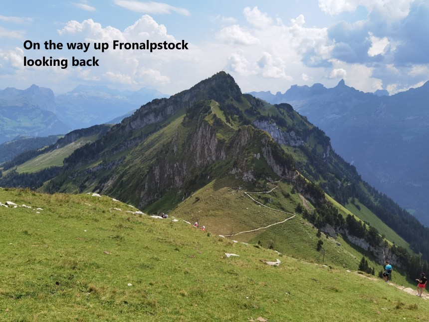
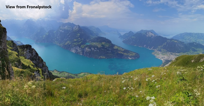
And then I went on. The route descends from Huser Stock, and then ascends to Fronalpstock. There is a viewing platform there, which allows for full appreciation of the lake scenery below.
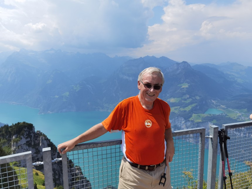
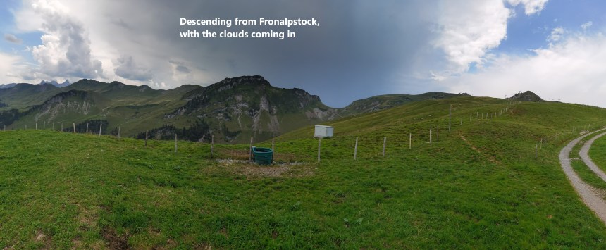
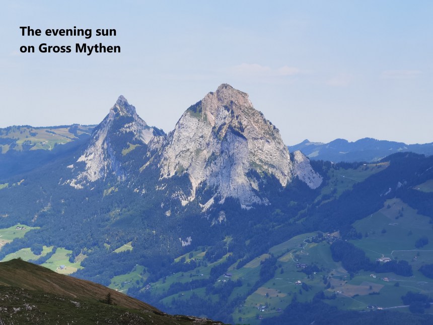
There is also a bar and restaurant on the summit of Fronalpstock. I enjoyed a beer before taking the route downhill from there. As I went, the clouds began to gather above the ridge. I had not gone far before the rumbles of distant thunder could be heard. At the same time, the afternoon sun cast a glow on the rocky face of Gross Mythen.
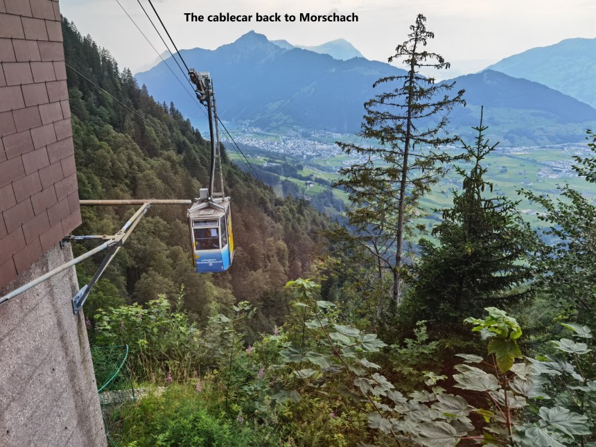
But I made it back to the village and the cablecar station. The cablecar was on its way down when the rain started, and by the time I reached the bus stop, it was raining heavily.
Altogether, this was a really good walk: not too demanding in the hot weather, and with great views of the local scenery. My step count for the day was 29300.

This is a very beautiful account of your journey. I thoroughly enjoyed reading it. Thank you for sharing!
LikeLiked by 1 person
Just beautiful and the weather looks like pretty good!
LikeLike