With good weather at the weekend, and bad weather in prospect during the week, I decided to head out once again on the Jura Höhenweg. However, I decided that rather than follow the route in the books, I would take a detour. A little to the south of the route is a summit called Mont Sujet, and I decided to incorporate this into my walk.
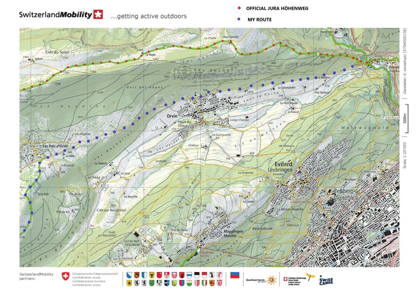
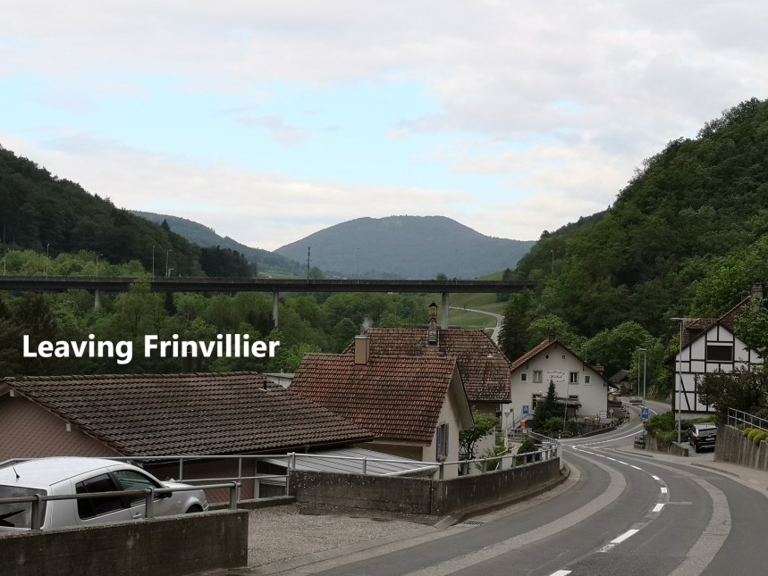
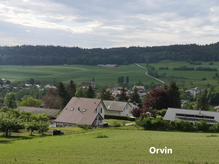
And so it was that I set out in the cool of the morning from Frinvillier. Mont Sujet was visible straight ahead. My route soon left the road and went into the forest. The ascent was gradual, and I made good progress, soon coming to the edge of the village of Orvin.
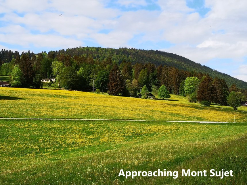
Not far beyond Orvin, the forest thinned out into a mixture of pasture and trees, and soon I came to the second village of Les Pres d’Orvin. Across the fields, Mont Sujet looked inviting. The fields themselves were a bright yellow sea of dandelions. It is indeed strange that a plant that seems such a week in suburban gardens can look so magnificent when seen massed in their thousands in the countryside.
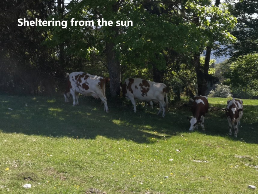
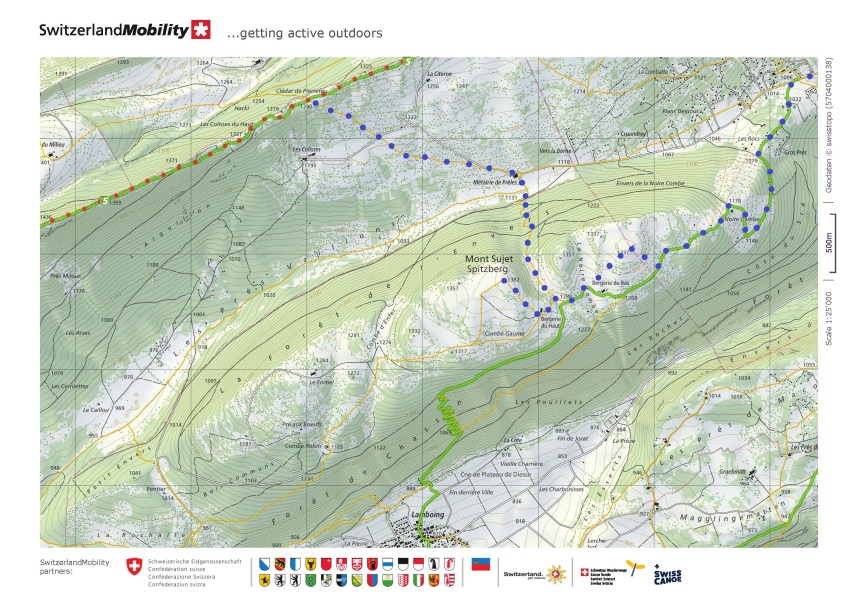
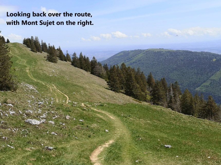
By now, the sun was out in full force, and as I ascended onwards from Les Pres d’Orvin, even the cattle were sheltering in the shade. But I continued on. Mont Sujet actually has more than one summit. The eastern summit has a cross on top. To get there, I had to leave the trail and take a short walk across country. It was worth it; the eastern summit offers the best views to the east, and I could see back over the way I had come, with Hasenmatt in the distance beyond.


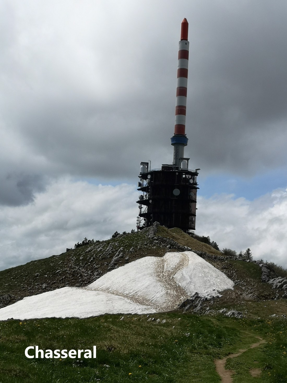
Then I got back on the trail and went on to the western summit. At 1382m this is the highest point on the mountain. It is marked by a simple waymark sign. This summit offered great views out to the west. Chasseral, with its monstrous signal tower was clearly visible.

")
From the eastern summit of Mont Sujet, I retraced my steps initially before heading north on a track descending into the forest. The descent is nearly 250m before coming back into the open just before the Metairie de Preles. From there, I took the trail going north-west to re-join the Jura Höhenweg just above Cledar de Pierrefeu. From there, the trail ascends steadily towards Chasseral. Along the way, there were good views back towards Mont Sujet.
There was a patch of snow just before the summit of Chasseral, and then I was at the summit itself. The summit allows magnificent views over the lakes of Biel, Neuchatel and Murten


According to the guidebooks, this was the end of this stage of the Jura Höhenweg, but I still had farther to go. I went on, first to the Chasseral Berghotel, now closed because of the coronavirus. That did not stop the place being a magnet for tourists. It was crowded, though not as crowded as when I came here in January in the snow. From there, I took the track downhill to the village of Nods. As I waited for the bus to start the journey back to Basel, the signal tower still dominated the skyline to the north.

And my total step count for the day was 43,531.
The maps below show the route that I took. The official Jura Höhenweg is marked with red dots, while my route is marked with blue.