
I walked to Pluto. And I even went far beyond Pluto. But I will come to that shortly.
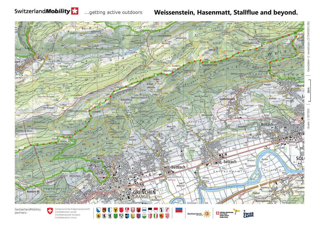
I was following on from my previous walks on the Jura Höhenweg. The last stage brought me as far as Weissenstein. And this next stage was to bring me from Weissenstein to Frinvillier. Unfortunately, I have had a camera problem, so I have only one photograph of my own for this posting. I could use library photos, but that would not be the same. So instead of photos, for this posting, I only have memories.
But first I had to get to Weissenstein. The train took me as far as Oberdorf, and from there it was a walk uphill to Weissenstein. This was the reverse of the way I had come down from the last stage, so it was a brisk walk uphill from 655m at Oberdorf to 1260m at Weissenstein. The mist was down, and Weissenstein itself was in mist when I got there.
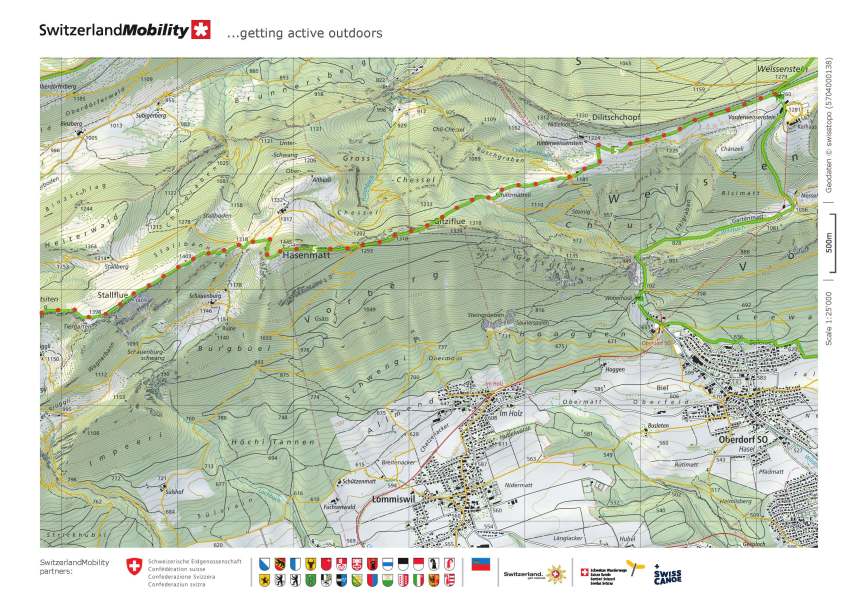
I have mentioned before in other postings that there is a Planetenweg starting from Weissenstein. These Planetenwegs seem to be very much an institution in Switzerland, and I have come across several in my walks. They are designed to show the scale of our solar system. On the Weissenstein Planetenweg, the distance from the sun to earth is about 60m, and that is where I joined it having come up from Oberdorf. From Weissenstein, my route took me westwards, and I soon passed Mars. It took a little while longer to reach Jupiter. Near Hinterweissenstein, I came to Saturn. I had come this way, but in the other direction back in January, so this far was familiar to me.
After Hinterweissenstein, the route ascends gradually through the forest. In spite of the mist, it was not cold, and I was going well as I took the upward slopes to Hasenmatt. At 1445m, this is the highest point in Solothurn canton. The summit is above the treeline and is marked with a large cross. And there is a nearby waymark point a little bit past and below the summit. On another day, with fine weather, I know that there are great views from Hasenmatt. I know this because I came this way a few years ago, before I started these postings. But today, in the mist, it was different. Visibility was down to about 200m, and it was not an inviting place to stop for long.

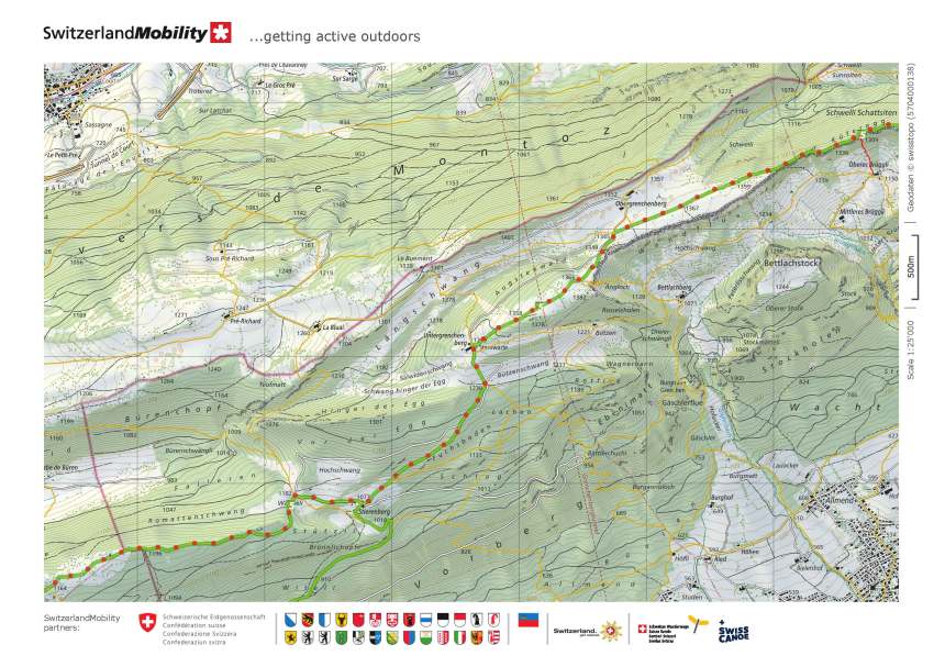
From Hasenmatt, the route continued westwards, curving around to get through the slopes on the descent. Then it gradually ascends to Stallflue at 1409m. Stallflue is a broad, open summit, reminiscent of some of the Irish mountains where I learned what mountaineering skills I have. In this wilderness, there are few signs, so the route is marked with posts, topped with yellow tape to show the way even in the snows of winter. And it was on Stallflue, that I came to Pluto. It had taken me two hours of walking, approximately 10km from Weissenstein, to reach this point. But the real edge of our solar system is not Pluto. Beyond that planet there is Ultima Thule and the Kuyper Belt. And so, on the way through the woods descending from Stallflue, the Planetenweg has a marker to tell walkers that they have now reached the end of the solar system. The marker also tells the walker that in this scale of things, they would have to walk for three days from there, at 40km per day, to reach the nearest star.
But for me, I had now just reached about halfway in my walk to Frinvillier. My route went on, passing the settlements at Stemwarte and Stierenberg. Mostly, it was downhill or flat. The descents were gradual, but occasionally the route went upwards to go over a small rise. The route goes through a mixture of forest and farmland. It passes from Solothurn canton into Bern. At that point, the signposting changes from Höhenweg to Chemin des Cretes, the path of the summits. I passed the bergrestaurant at Montagne de Romont. It was closed, like all others at the moment. In the village of Plagne, there was little activity. I took a wrong turn shortly before Frinvillier, but soon realised my mistake and got back on the right track. And so I arrived in Frinvillier in mid-afternoon.
Somewhere on the descent, the sun won its battle with the mist, and the day had become clear. But somehow, I am almost glad that the mist enveloped me on the higher slopes. When you can only see 200m, you appreciate your immediate surroundings without looking for distant vistas.
From Frinvillier, it was a short journey to Biel, and the train back to Basel. My walk was done. As I say, no great photos for this one, but lots of memories.
My total step count for the day was 48521.


Congratulation
Such determination
It was inspiring to follow your blog.
Keep walking
LikeLike