
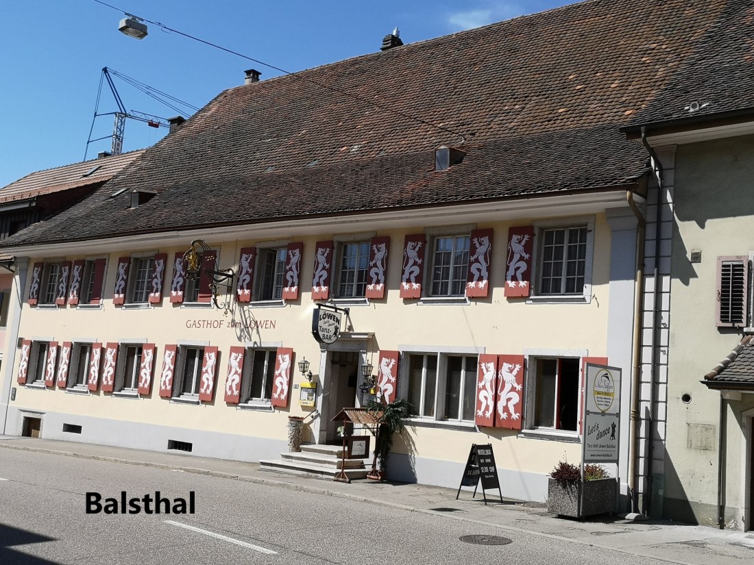
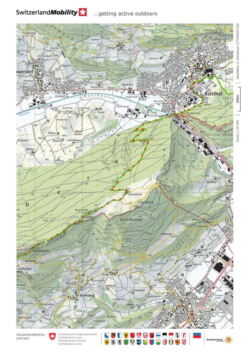
I started out early from Balsthal. The first kilometre or so of the route was flat, and I was soon coming towards Thalbrücke. As I walked, I could see a small castle on my left, and the map identified it as Alt Falkenstein. I took a short detour up the hill to check it out. After all, it was only a hundred metres or so off the route.
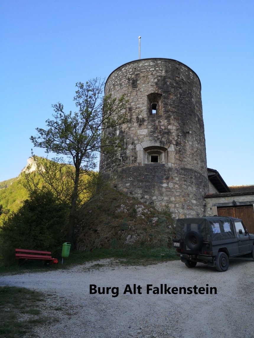
The castle was built in the middle of the thirteenth century by Count of Falkenstein. However, as the centuries passed, the family fell on hard times, and they sold the castle to the city of Solothurn. Today, it houses a small museum. Whether because it was early in the morning or because of social distancing, or both, the castle was closed, and I went on my way.
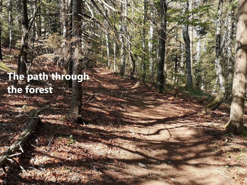
My route crossed the stream and the railway line, and soon headed up the slopes through the forest. After zig-zagging upwards along forest tracks at first, the route then plunged into the forest to take a direct ascent. Undeterred, I made good time and before long I arrived out into the open again at the farmhouse of Schwengimatt.
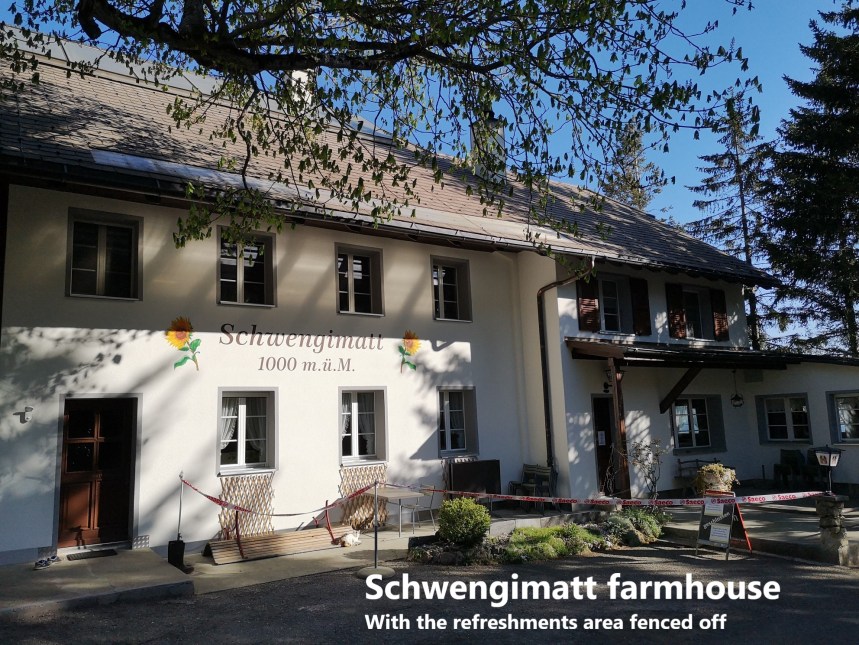
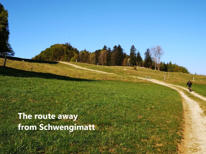
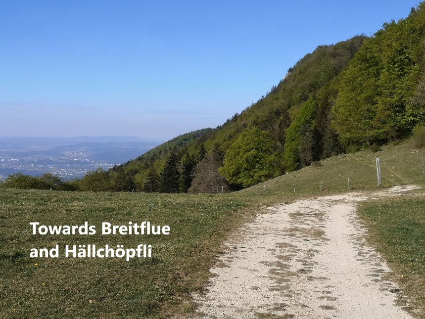
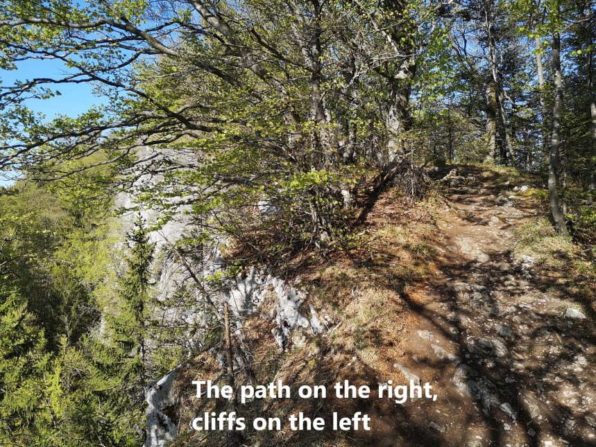
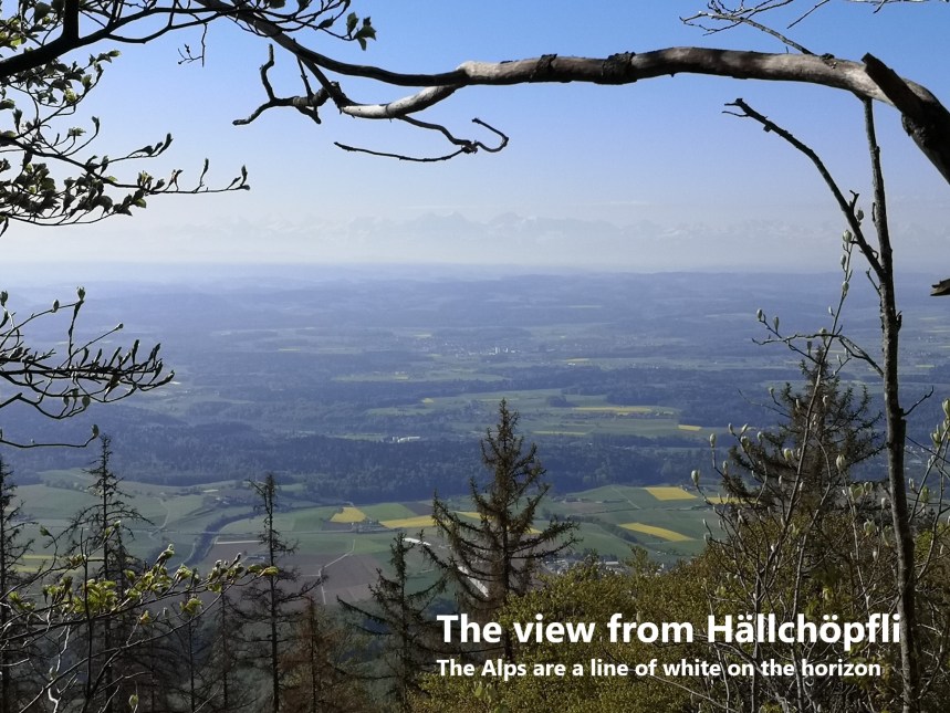
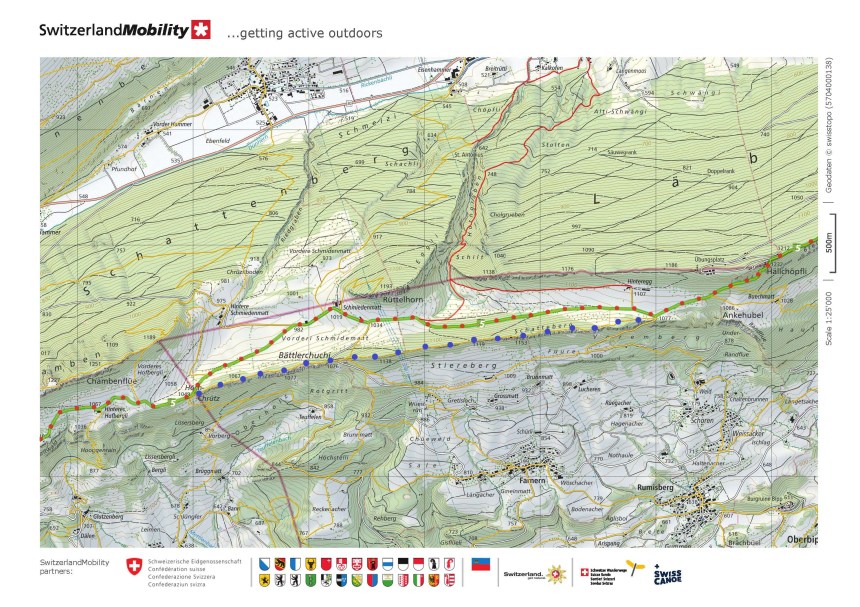
In normal times, this would be a place to stop for refreshment, but in these days of social distancing, the refreshments area was fenced off, so I went on. After Schwengimatt, the route curls around over a small rise to reach the ridge of Breitflue. The trail follows the crest of the ridge, with steep cliffs falling away on the left. But Breitflue is only the prelude for Hällchöpfli. The summit there affords magnificent views of the plain to the south, with the Alps as a hazy line of white on the horizon.
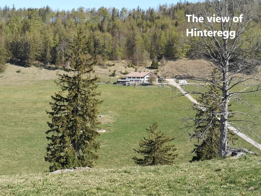
There is a steep descent from Hällchöpfli (1232m), so steep that it has fixed ropes for one stretch. But then it gets easier, and I soon reached the road junction. At that point, I was faced with a choice. The standard Jura Höhenweg takes a lower route and allows for a refreshment point at Hinteregg. But with everything closed, there was no point in going there, and I chose the higher route, staying on the ridge. I went over Schatteberg, where once again there were magnificent views to the south. It was more or less a straight route along the ridge, passing Bättlerchuchi and on to Hörn-Chrütz.
Video
From Hörn-Chrütz, the route is almost level as far as Hinteres Hofbergli. But after that is a stretch that was quite draining. It seems that there was an old route that kept to the high ground going on from Hinteres Hofbergli, but for some reason, that route is now closed. I think it is due to a rockfall, but for whatever the reason, the new route drops down into a valley, losing about 50 metres in altitude. There than follows an ascent of about 150 metres to Niederwiler Stierenberg. I had not stopped for refreshments at any stage up to then, and with the heat of mid-day bearing down, I was feeling the strain. But I decided to go on the short distance to Wanneflue. Again, this was a detour from the official Jura Höhenweg, but I reckoned on sticking to the higher ground.
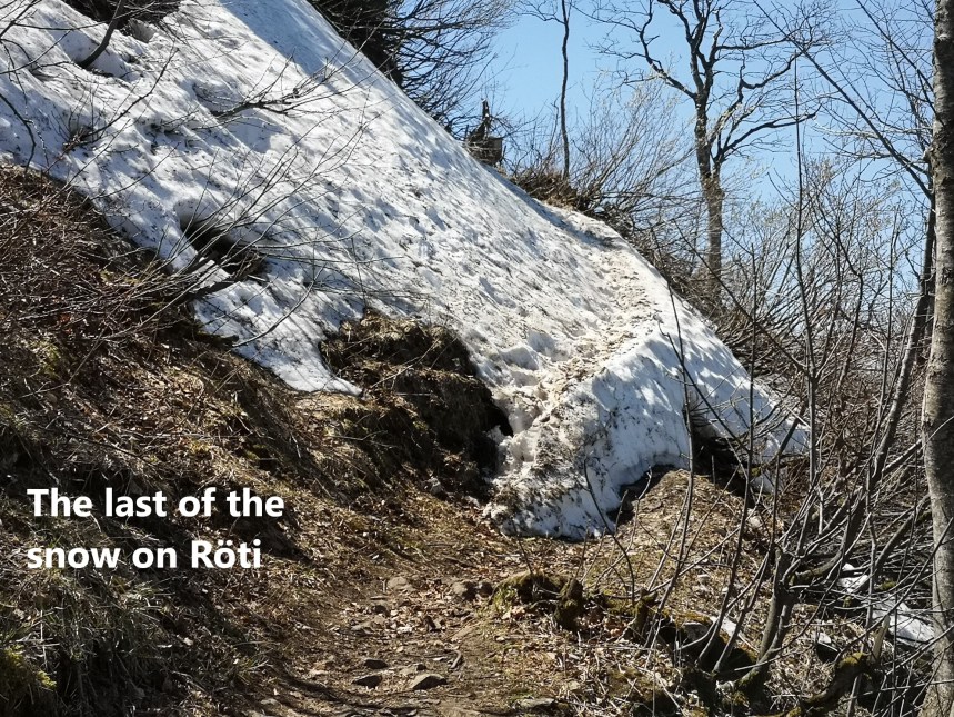
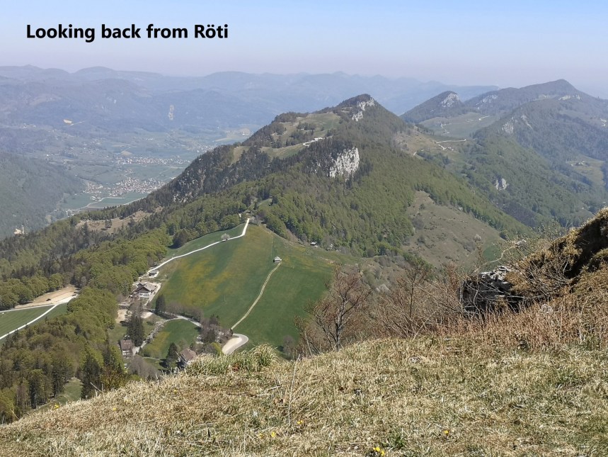
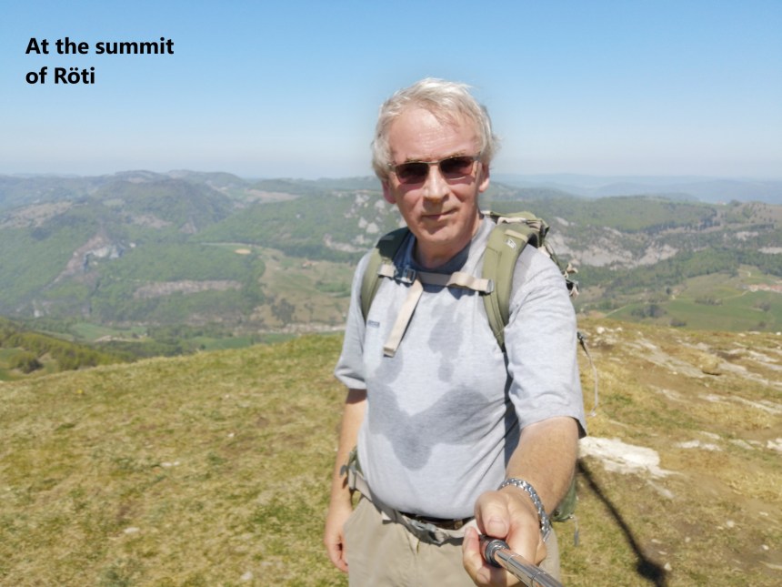
Wanneflue did not offer much in terms of views, but it did offer a place to pause in the shade for something to eat and drink before going on. From there it was just a short distance to the junction at Balmberg. Here again, I had a choice. The official Jura Höhenweg goes straight on, but I chose to take a detour towards the summit of Röti. The ascent begins gradually but then becomes steeper before emerging from the trees near the summit. Close to the summit, I came across a forlorn patch of snow, a last remnant of winter. And then I was there, at the summit. Where the ridge walking earlier had offered great views to the south, the summit of Röti, at 1395 metres, offered views all around, but especially to the north and east. I was able to look back over the way that I had come, and onward towards my destination of Weissenstein.

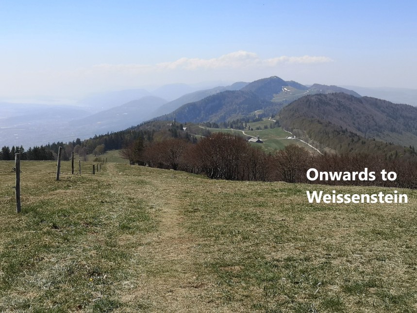
It is a gradual descent to Weissenstein. I was here earlier in the year, before the current social regimes took over. Back then, I was able to stop at the hotel for refreshment, but today the hotel was closed. However, the outside tables were still in place, and I could stop again for something to eat and drink. For entertainment, I had the sight of a hang glider close by.

There is no public transport at Weissenstein. The cable car is closed. I had reckoned it would be, and so I went on my way taking the trail down to Oberdorf and the train back to Basel. And so, finished a magnificent day’s walking, one that refreshed my spirit in these difficult times.
As on so many of my walks, on this one, there were many wild flowers to be seen. I wish i knew their names.


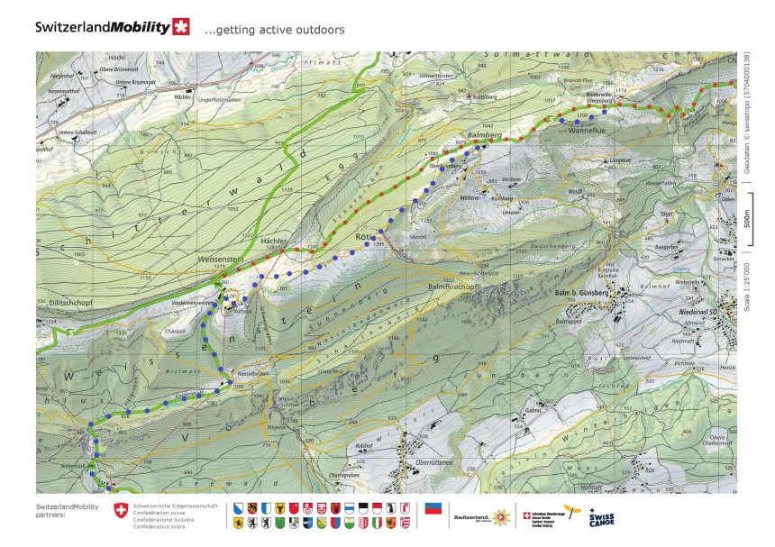
My total step count for the day was 45955. The maps below show the route. The red dots show the official Jura Höhenweg, and the blue dots show the route that I actually took.

“A walk in nature walks the soul back home,” a quote I read somewhere, which fit you to a T. You’re off to exploring good places and as usual, again this time you gained twice the benefit that it lifted your spirits soar higher. You made your day a new conquest…with sore but happy feet. Those are really fantastic photos.
LikeLike