
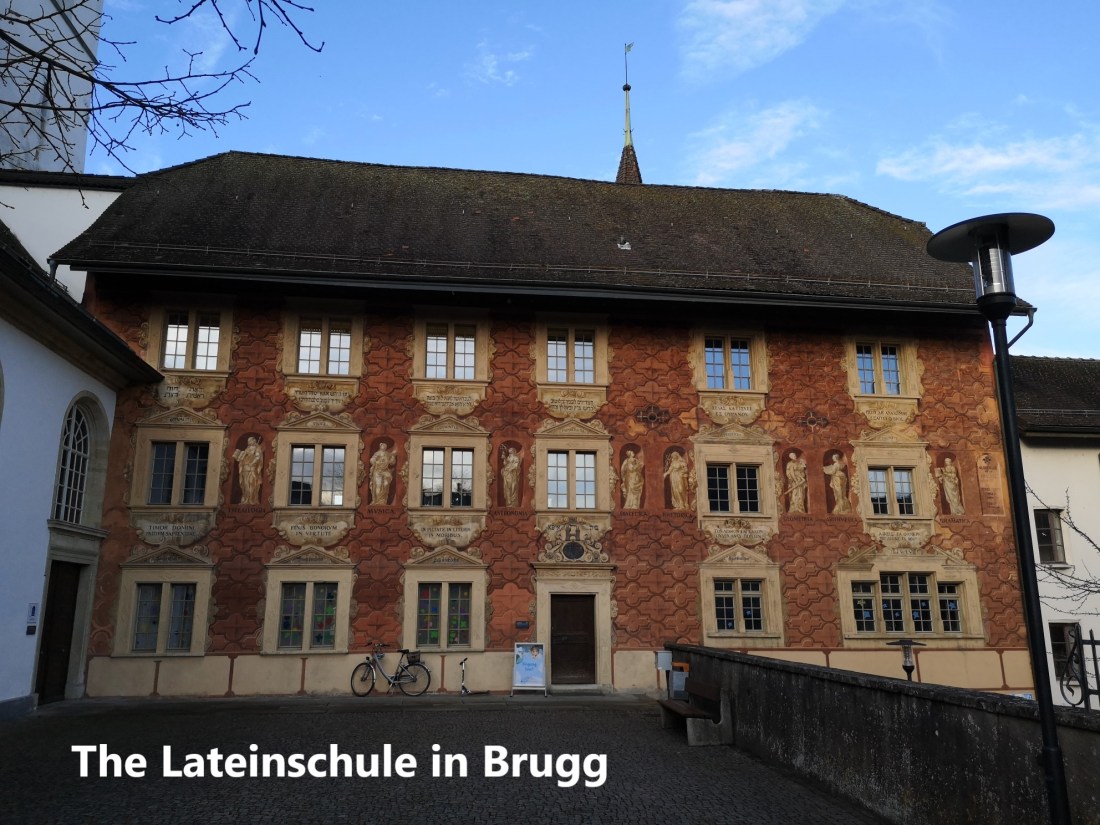
There are direct trains from Basel to Brugg, and so I arrived there early in the morning, just as businesses and schools were opening for the day. Because I was early, I took a little time to wander around. I found the Lateinschule, or Latin School. It was associated with the church and the learning provided by church institutions. The building goes back to the 17th century, though the façade is baroque in style. The building is listed as being of national importance for Switzerland, and from its external appearance rightly so.
The old town is not large, and it did not take long to wander around, finding some interesting corners in the process.


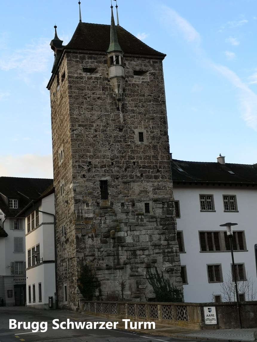
And then it was time to be on my way. I left Brugg going over the bridge to the north, passing the Schwarzer Turm or Black Tower. The tower was one of the old entrances to the town, dating from 1535.
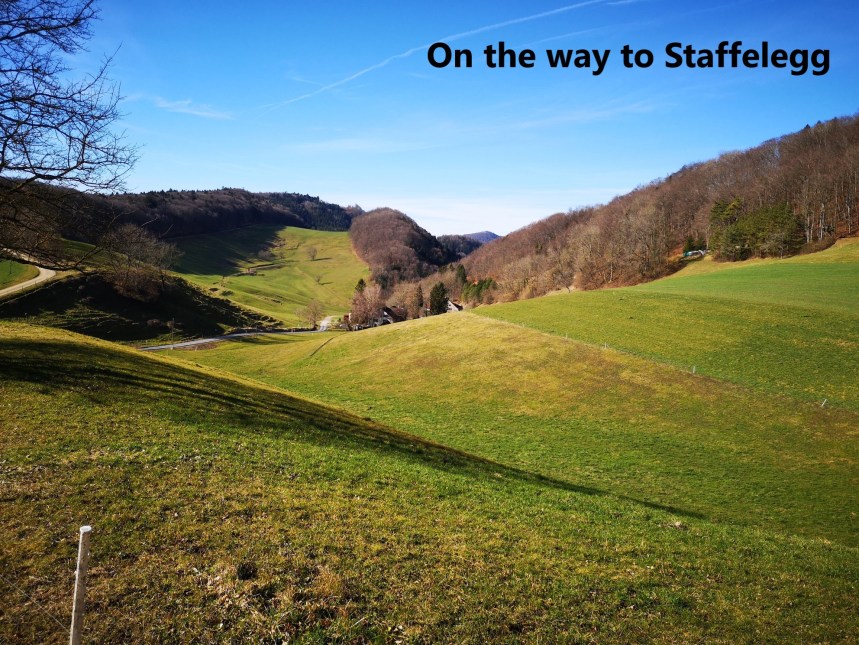
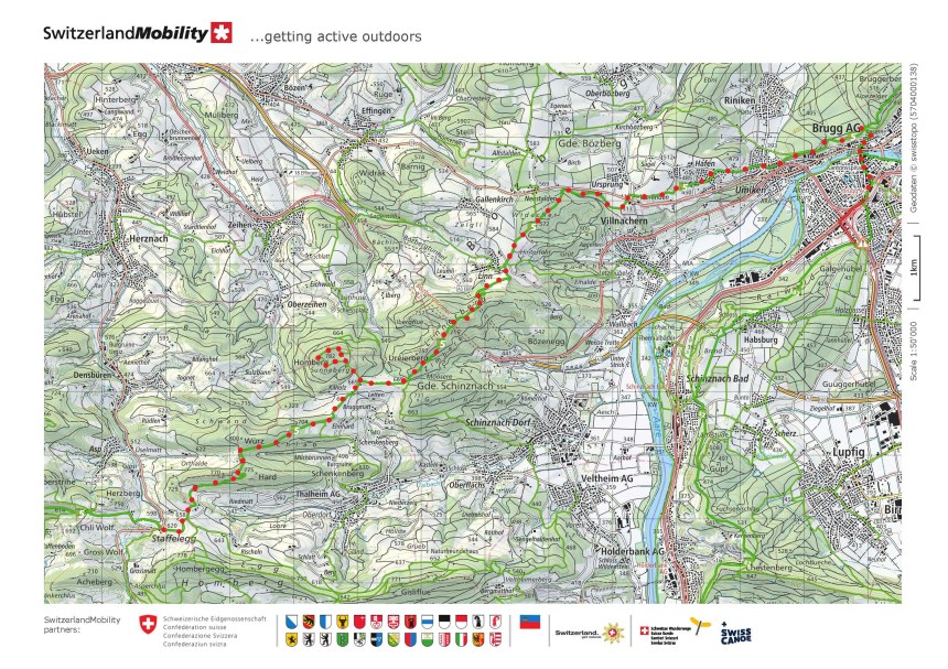
Then it was up the hill and into the forest. It seems that hikes in Switzerland, especially in the Jura Mountains, never go far without going through a forest. Coming out of the forest, I went through the residential area of Hafen, with the trail going higher all the time. Once past Hafen, the countryside opened up, and the road stretching ahead beckoned me onwards.


The next stretch continued to be a mixture of forests and fields. The trail had levelled out at this stage, and it was an easy route to reach the village of Linn. The trail does not actually go into the village, but skirts around the east and south of Linn. On the southern side, it goes upwards again, providing great views back over the way I had come. The route through the forest is adorned with forest sculptures. The say that many a rose is born to blush unseen, and I suspect that not many people get to see these sculptures either.


The route levelled out again as I passed Dreierberg and approached Homberg. I planned a small detour here to go to the top of Homberg, not for any particular reason, but simply because it was there. I did not know what I would find. While the southern side of Homberg is unimpressive, looking like just a mound in the landscape, the northern side is much steeper, and allows great views out to the north. The villages of Oberziehen and Ziehen aare clearly to be seen in the foreground, while the town of Frick is visible away to the northeast.


From Homberg, once back on the Höhenweg route, it was more forests and fields until I reached Staffelegg. From there it was a bus journey to Frick and the train back to Basel.
And my step count for the day? A modest 36,185

Another interesting walk with spectacular vistas of hilly terrains, history-rich villages, church and structures. The challenges and satisfaction derived from this hike, is I think another memorable feat for the walking man. Kudos.
LikeLike