
The Jura Höhenweg (Jura Crest Trail) is one of the Swiss national trails. It runs from one of the suburbs of Zürich in an arc all the way to Lake Geneva. Marking of the route began as far back as 1905, so the route is more than 100 years old. As the name suggests, the route takes in some of the highest peaks of the Swiss Jura range. There are a few higher peaks on the French side of the border, but the highest of the Swiss Jura peaks are on this route. I have walked part of this route before, and in recent walks, documented here, I have walked more parts of it again. I decided that I want to walk the whole thing again, and maybe take some detours to make it more interesting as I go along.
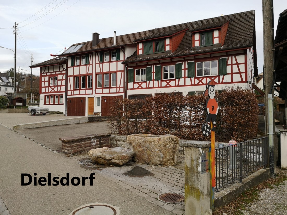
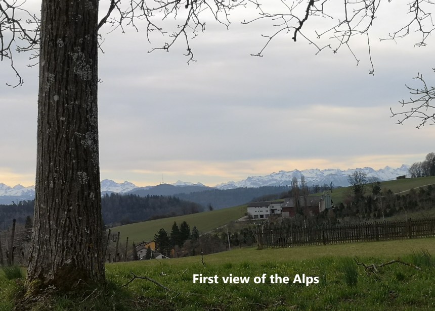
So, on a Sunday morning I started out at the beginning of the route in Dielsdorf. Dielsdorf is a suburb of Zürich, though somewhat distant from the city itself. The village was quiet when I set out. Dielsdorf is a residential rather than a business town, and there were few people moving at that time on that Sunday, or probably any Sunday. The route ascends fairly quickly from the village, and as I went up the hill, I was afforded a view of the Alps to my left and away to the south.
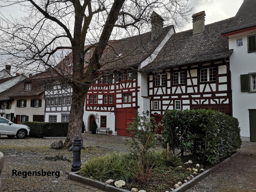
This soon brought me to the settlement of Regensberg. What is now a tiny village there was once a powerful barony. The baron of Regensberg build fortifications there in the 13th century. But the power struggles of the time were cruel. Switzerland did not exist at that time, and Zürich, together with the powerful Hapsburg empire crushed the independent minded barons, including Regensberg. The fortress changed hands over the following century, ending up as part of Zürich. The village prospered to become a market town, though it has gone back to being a quiet village today.
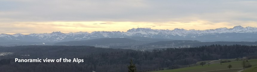
Going on from Regensberg, I was afforded an even better panoramic view of the Alps to the south, snow-covered in their winter glory.
The trail went on upwards from Regensberg, and into the forest. There is always a forest on a Swiss hike, or so it seems. Eventually, this brought me out onto the main trail where it joins a Planetenweg. I came across a Planetenweg on my last hike (see my posting for Weissenstein), and I joined that one at Saturn. I joined this one at Saturn too, but whereas on Weissenstein I was moving inwards towards the sun, on this one I was moving outwards towards Uranus, Neptune and Pluto.


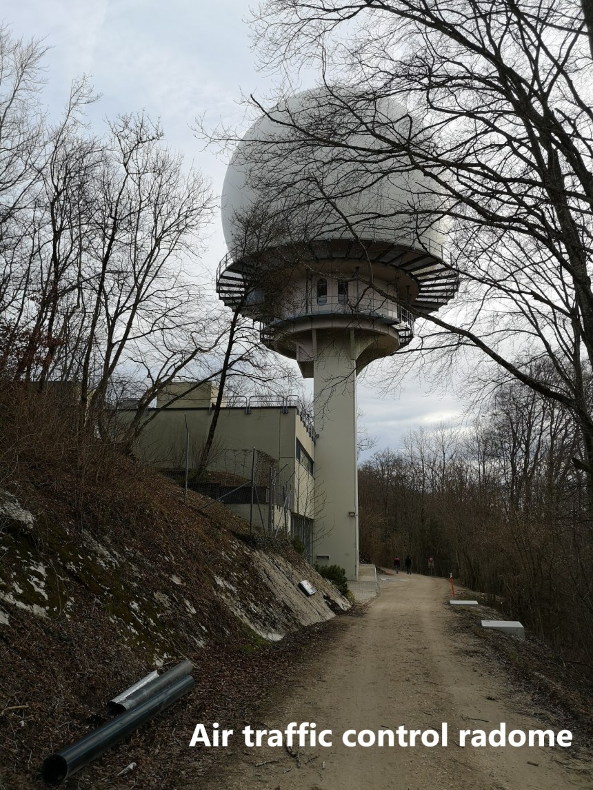
The trail kept going upwards but more gently now. As it levelled out, I came across the radar tower for air traffic control at Zürich Airport. The tower was built in 1959, and the radar system installed first in 1979, then replaced in 2006. It can see and helps manage aircraft within 280km. But somehow, the tower seems alien, perched above the forest as it is. As if it were some presence from another civilisation there to monitor our activities.
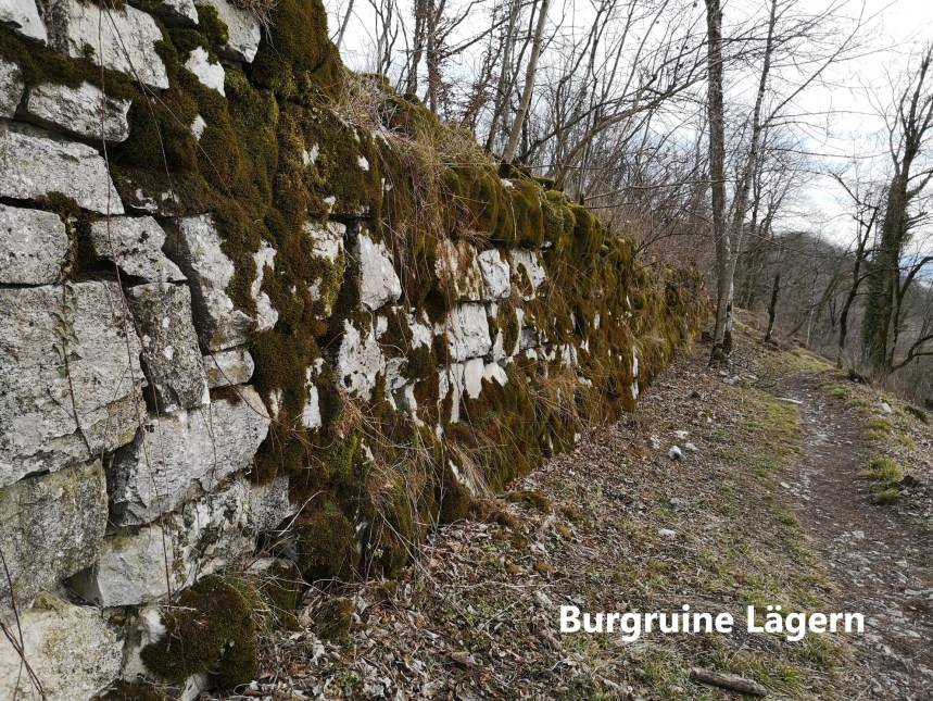
Further along the mountain, I came to the Burgruine Lägern. This is no more than the foundations for a castle that seems to have never got built. The Baron of Regensburg wanted to build a fortification here, but his power was snuffed out before it could be completed. Today, all that remains are the moss covered walls of the castle base.
Once past the Burgruine, the route becomes narrower, confined to the crest of a ridge, with steep slopes on either side. Some care is needed, but it is not really difficult. Along the way, I came across a cantonal marker post. I was crossing from Zürich canton into Aargau canton.


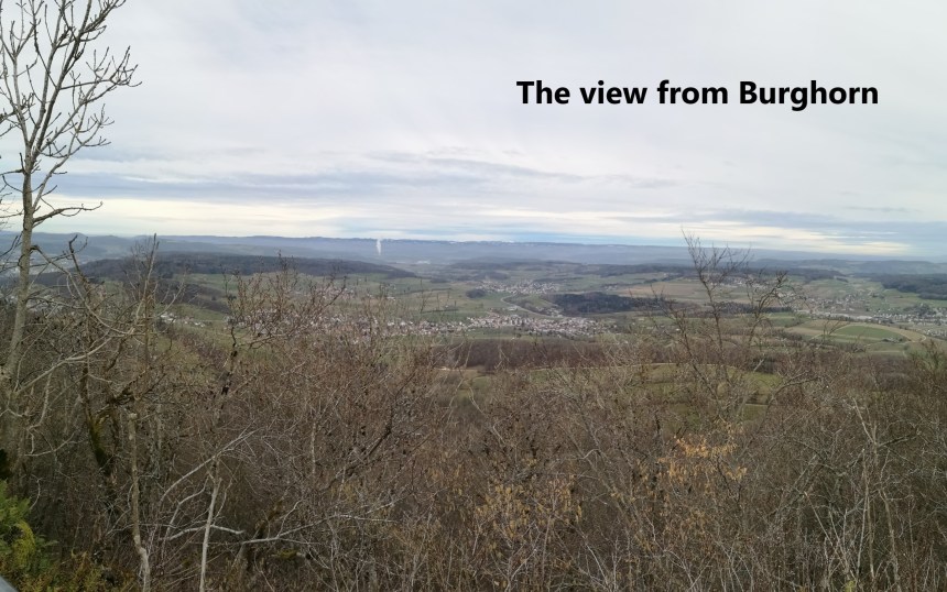
Further along, I came to Burghorn where there are magnificent views to the north. The Jura had been somewhat neglected until World War One, when Swiss army engineers built roadways into the mountains. The Jura was to be one of the main places of resistance if the country was invaded in that war, though thankfully it never happened. Today, places like Burghorn, opened up in that war 100 years ago, provide fantastic viewpoints.
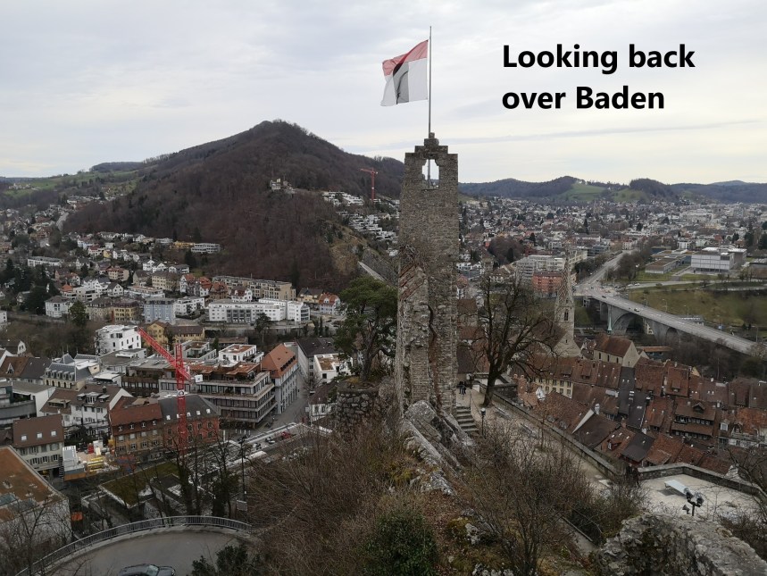
The trail descents from there through the forest towards the town of Baden. Just before Baden, I came to Schloss Schartenfels. For much of the year, the castle is open to the public. However, it was closed when I got there, so I just took a few photos and went on into Baden.


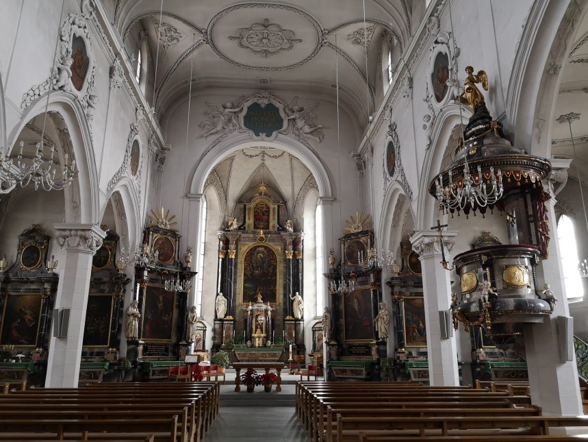
There are a few things of interest in the old town of Baden, but the most magnificent has to be the town church. I took just a very short rest there before going on. The route immediately ascends again, up to the Ruine Steine. At this point there are views across to the mountains I had just come from, including the Schloss Schartenfels directly below the summit.


 But once out of Baden and back on the high ground, the route was fairly flat and non-descript. I passed Baldegg and kept going. There was more forest, and then the route divides. I chose to follow the path down to the village of Tungi, and on from there towards Brugg. I passed the confluence of the Aare and Reuss rivers to come to the edge of Brugg.


Coming into Brugg, I took the shortest route directly to the train station and my journey back to Basel. The first stage of the Jura Höhenweg was complete,
And finally, my step count for the day was 41,795.

Very nice photos and vivid descriptions of amazing places you’ve passed along the way as you walked. Switzerland is indeed beautiful. Thanks for sharing.
LikeLike
I like this account of your journey. The Baden townchurch is really beautiful. I have heard so much about this place.
LikeLike