
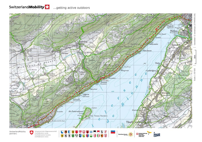
I set out again on Saturday, September 21st, heading south on the old pilgrims’ route that brought people from the city of Basel on their way to Santiago. My last stage had reached the town of Biel, and I decided to go on from there to the little town of Murten. However, while the route from Basel to Biel followed mostly well-defined major walking routes, the way south from Biel gets a bit more complicated. The route depends on local trails, and as long as you get to the end point, you can more or less pick your own
Before I go on, I must add a note about language. Switzerland is a country of three main languages. In most parts of the country, one language dominates. But between Biel and Murten, both French and German seem to have equal prominence. That means that on the maps, most place names are presented twice: once in each language. In writing this post, I have chosen whichever name is given first on the maps. That is not to disrespect anyone, but purely in the interests of simplicity.
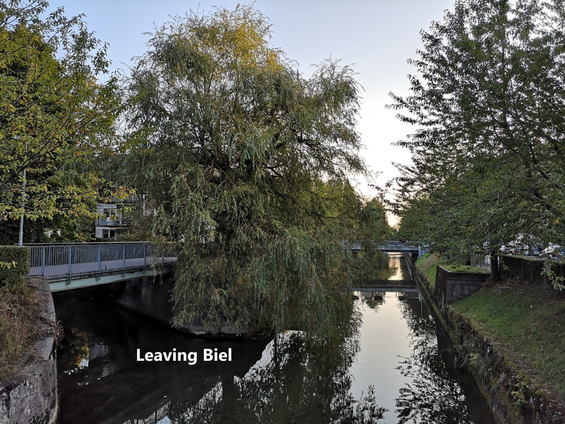
I left Biel in the early morning, going into the wooded hills to the southwest. It was a beautiful morning with the sun just coming over the hills to the east, and the cool clear air of morning giving great views back to Biel and beyond.
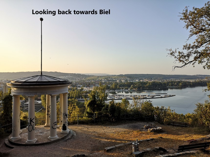
In that photo, you might just be able to see two small dots to the right of the flagpole. They are hot air balloons, rising up from the hills to the east of Biel. It seems that I was not the only person out early for adventure on a Saturday morning.
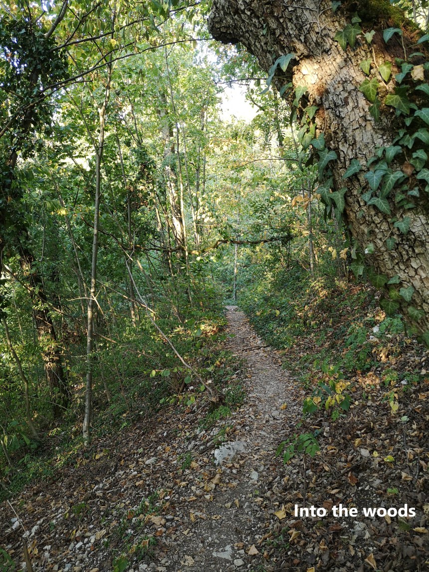
And then the route took me into the woods. Sometimes it seems impossible to do a walk of any distance in Switzerland without going through forestry, but I can live with that.
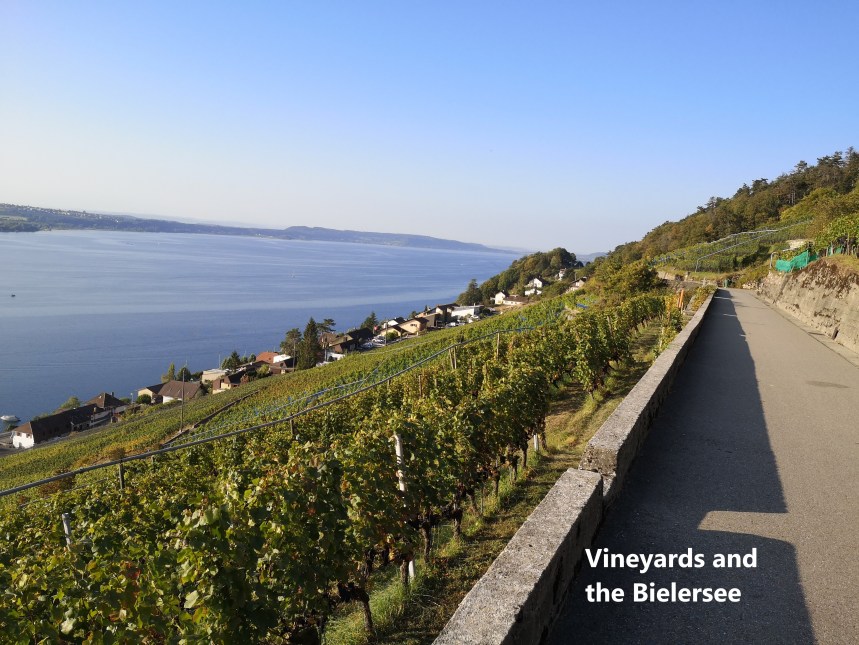
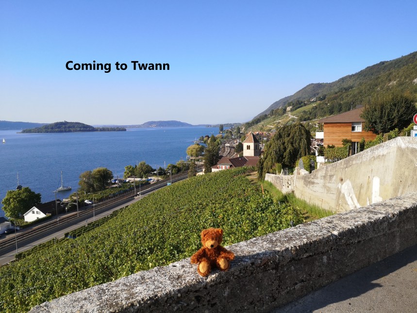
After a short distance of walking through the forest, I was back out into the sunshine. I had come at last to one of Switzerland’s main wine regions, and the vineyards stretched away in front of me to the south.
I passed an interesting little church near Tüscherz, but unfortunately it was closed. I kept going, and the landscape to the south became clearer. The St. Petersinsel is not quite an island, as it is joined to the southern shore of the lake by a causeway. Beyond that was the ridge of the Jolimont, a hill in the region between the lakes of the Bielersee and Lac Neuchatel. My route was going to take me over that ridge and beyond,


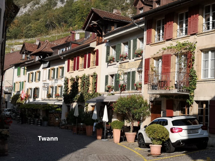
It was not long before I came to Twann, my first town of the day. Twann as a town goes back to the 12th century, but there is evidence of human settlement in that location back to stone age times. It is a quiet peaceful place, with cobbled streets and colourful shops and cafes.


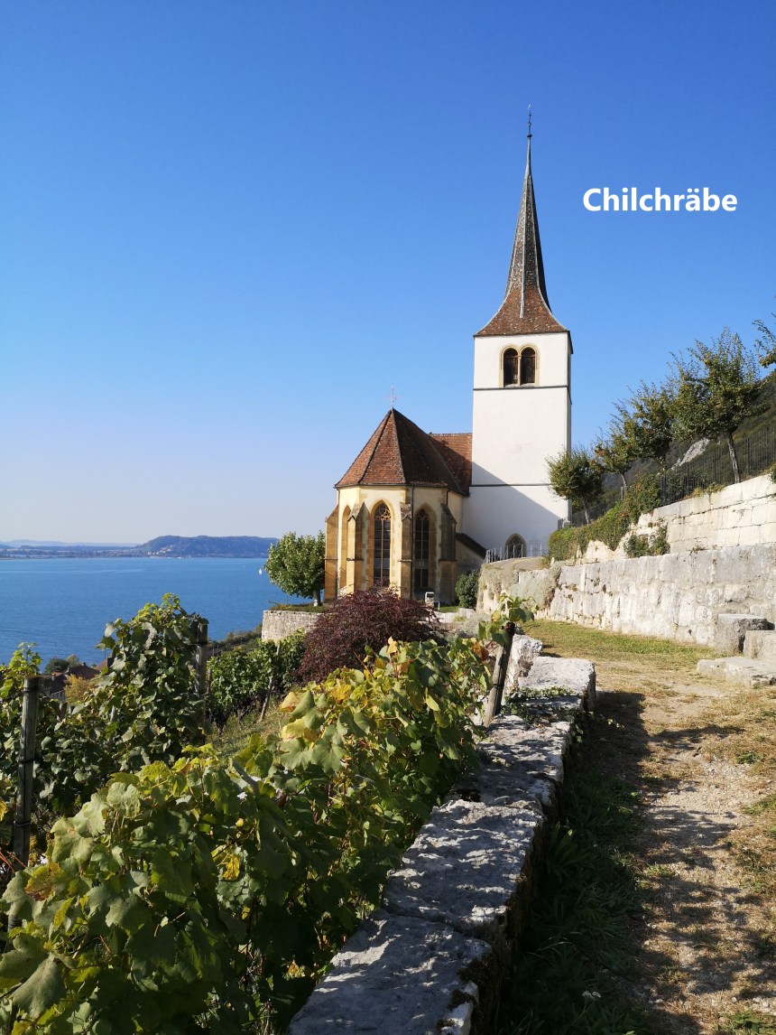
From Twann, the route continues on to the wayside church at Chilchräbe. Set as it is among the vineyards, this is a real pilgrims’ church. It stands out on the hillside, a waymarker to all.
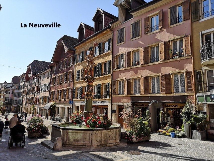
From there it was on to La Neuveville. Like its neighbour Twann to the north, human settlement in the area goes back to prehistory, but the town is younger than its neighbour. La Neuveville is a mere 700 years old, about 200 years younger than Twann. Nevertheless, it has a similar air to it, with old streets and colourful buildings.


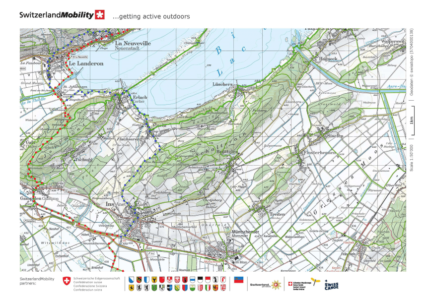
Leaving La Neuveville, I left the official route. In so far as there is an official route for this Jakobsweg or Chemin de Saint Jacques, the official route goes on south to Le Landeron, then turns east along the shores of the Bielersee to Erlach before turning south again. This seemed unduly long to me, so I planned a more direct route to Murten, crossing the Jolimont ridge. So I followed a trail from La Neuveville along the shores of the lake until I came to the Canal de la Thielle. There are three large lakes in this part of Switzerland, and they are linked by canals. The canal project was completed in the 19th century, partly to improve communications and partly for flood control. Sometimes it seems that the Swiss embark on a national project at regular intervals, This one was probably the first, followed by the St. Gotthard tunnel, and most recently by the Basistunnel, currently the longest rail tunnel in the world. The Canal de la Thielle links the Bielersee and Lac Neuchatel.


From there, I went directly east, and straightaway into the woods of the Jolimont.


Jolimont is not a particularly high ridge, and I did not take long to cross it, and came down into the village of Gampelen, where I could see the countryside stretching out flat to the south.


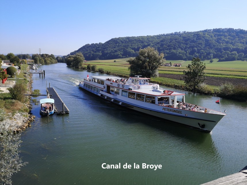
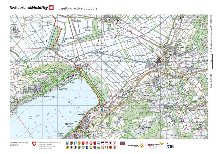
The trouble with flat countryside is that it is often boring, and that was the case in this instance. There were some fields of ripening corn, shallow brackish streams, and one forestry plantation before I came to the Canal de la Broye. This is the second of the canals that make one water system out of the three lakes, and this one links the Murtensee to Lac Neuchatel. Seeing it meant I was getting closer to my goal.
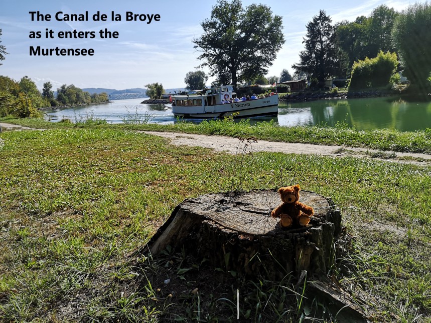
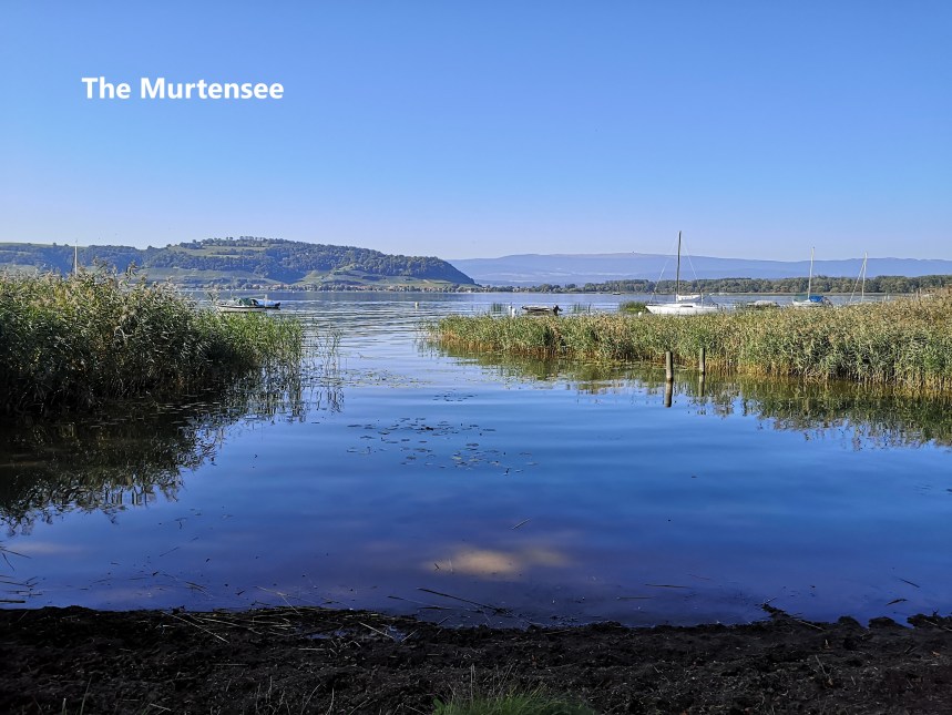
Where the canal enters the Murtensee, I left the waterside and was once again in the forests. Just before coming into the sunlight again, I saw a giant rabbit carved from wood. And then, there was the Murtensee. I followed the shoreline to come to Murten.


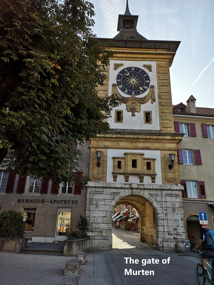
The little town of Murten holds a special place in Swiss history. The popular view of Switzerland is a country of permanent peace, but that is a false view. Over the course of written history, starting with Julius Caesar, it has been invaded many times. In the 15th century, the Duke of Burgundy, invaded twice. The first time, he was quickly sent packing, so he returned in 1476 with a larger army. The first significant Swiss garrison that he came to was at Murten, and he laid siege. But the Swiss cantons rallied their forces, and attacked. Charles’ army was routed. Burgundian power was never the same again, and the willingness of the Swiss to defend themselves was established. Today, Murten is a quiet peaceful town, with many parts of the old town still intact.


I made my way through the town to the railway station and the train home.
My step count for the day was 63279. It was a long walk, but worth the effort.
Here are the maps of the walk. The red dots show the route I actually took, while the blue dots show the “official” route.

Another feat for you, congrats Thur. It’s also a good read, Muren is a very interesting place, rich in history, unique structures, has a very awesome lake and magnificent views. Thanks for sharing 👍
LikeLike