
 I completed my second marathon on August 10th. This comes 2 months after my first one, which I wrote about in these pages. This one was the East Cork Harbour Marathon. Unlike the last one which went through Cork City, this one is out in the countryside. I guess that part of what attracted me was the fact that it has a special category for walkers, giving them an early start an hour ahead of the runners.
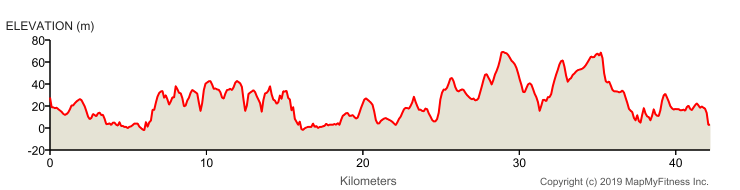
The downside to this marathon is the number of hills. That photo at the top shows the height profile for the route, and as you can see, it goes over a lot of small hills as it makes its way around the course. But undaunted, I had registered, with the aim of beating my time from the last one.
And so I lined up with sixteen other people at the start, and at 07;30 we were off.

My target time was to do better than 6 hours 30 minutes. While most elements of life in Ireland have changed from imperial measurements (inches and feet, pint and gallons, ounces and pounds), marathon running is still mostly measured in miles. The marathon is 26 miles, 385 yards, so I would have to do at least 4 miles per hour to reach my target time. And remember that I will only walk; I never run or jog on the marathon. In metric measurements, the total distance is 42 km 195m.
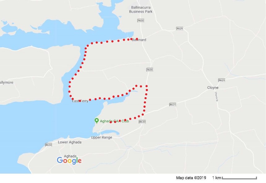
The route starts in the little village of Aghada on the eastern side of Cork harbour, with the start line just outside the local GAA sports club. It follows a narrow rural road before emerging onto a main road. It follows that main road briefly, before turning west towards East Ferry. There is then an almost semi-circular road around to Bawnward before turning back along the same route. But on reaching the main road the second time, instead of going back to the sports club in Aghada, the route goes into the little village of Rostellan.
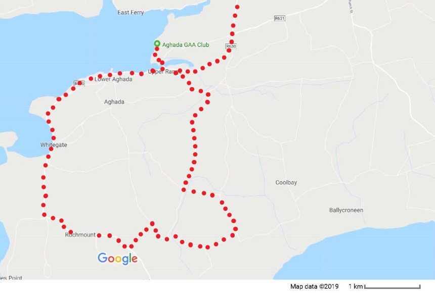
This is a route of two halves, and the 13-mile marker is in Rostellan. From there, the route follows a circle through the countryside south of Aghada before coming back into that village and finishing at the GAA sports club where it all began.
It was a pleasant morning, not too cold, not too warm. I started out at a fast walking pace, and I reached the 10-mile mark (16.1 km) after 2 hours 21 minutes, so I was averaging better than my 4 miles per hour target. This part of the route is very scenic, along the wooded shores of the bay. I would have liked to stop and take photographs that I could show here, but this was about speed and time, so I regret to say that I have no photos of the scenery here. My fast pace continued through miles 11, 12 and 13. But as you can see in the height profile, there are more hills in the second half of the route than in the first. Also, the distance was starting to take its toll. As a result, my pace dropped back to exactly 4 miles per hour; each mile was taking almost exactly 15 minutes. I maintained this pace through the roads and lanes reaching the 20-mile marker (32.2 km) in 4 hours 49 minutes. I went through the village of Whitegate, with all the people I passed wishing me well, and on to Aghada. At last the GAA club was in sight, and I crossed the bridge just before the 26-mile marker to reach the finish in the club itself.
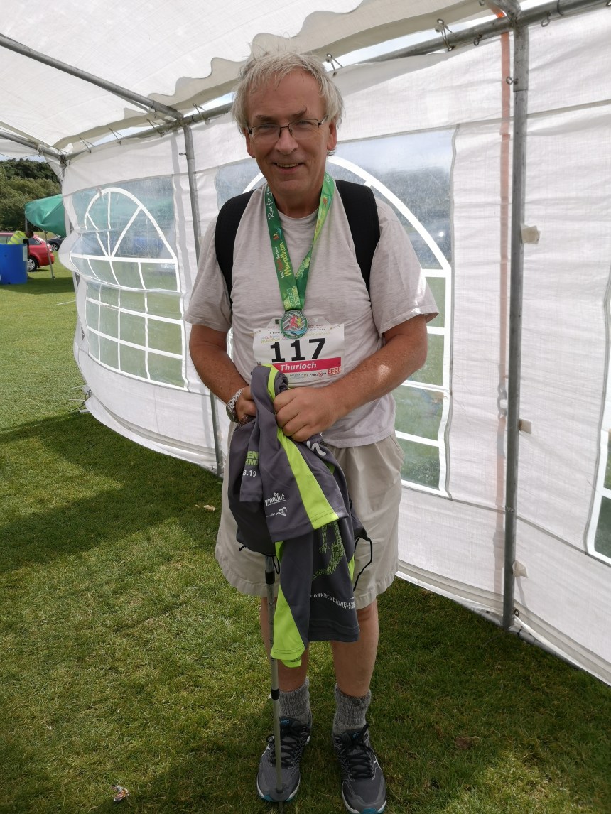
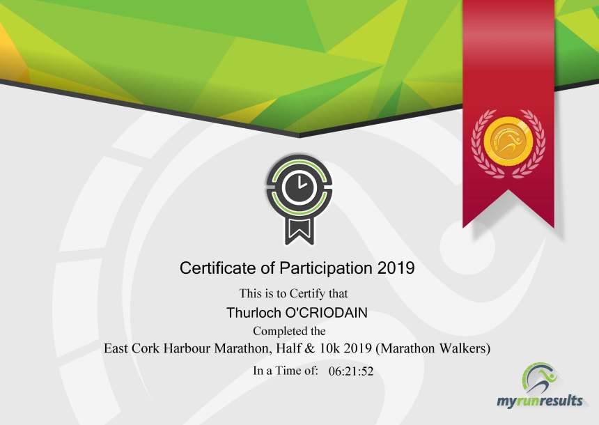
As I mentioned, I had set myself a target of better than 6 hours 30 minutes. My official time was 6 hours 21 minutes and 52 seconds.
And my step count for the day: 56,995 steps.

Congratulations Thurloch, this is an extraordinary accomplishment – you can be very, very proud!
LikeLike
good on you, Sir, for your determination to accomplish a difficult trek in good time and good humor every step of the way. your heart is certainly rejoicing today. . . j
LikeLike
Congratulations ! You made it !
LikeLike
Congratulations! Another feat conquered and won, it’s the footsteps that count…with the will and the fighting spirit that never wane…really a hard earned medal again this time. Kudos and good luck to more…
LikeLike