

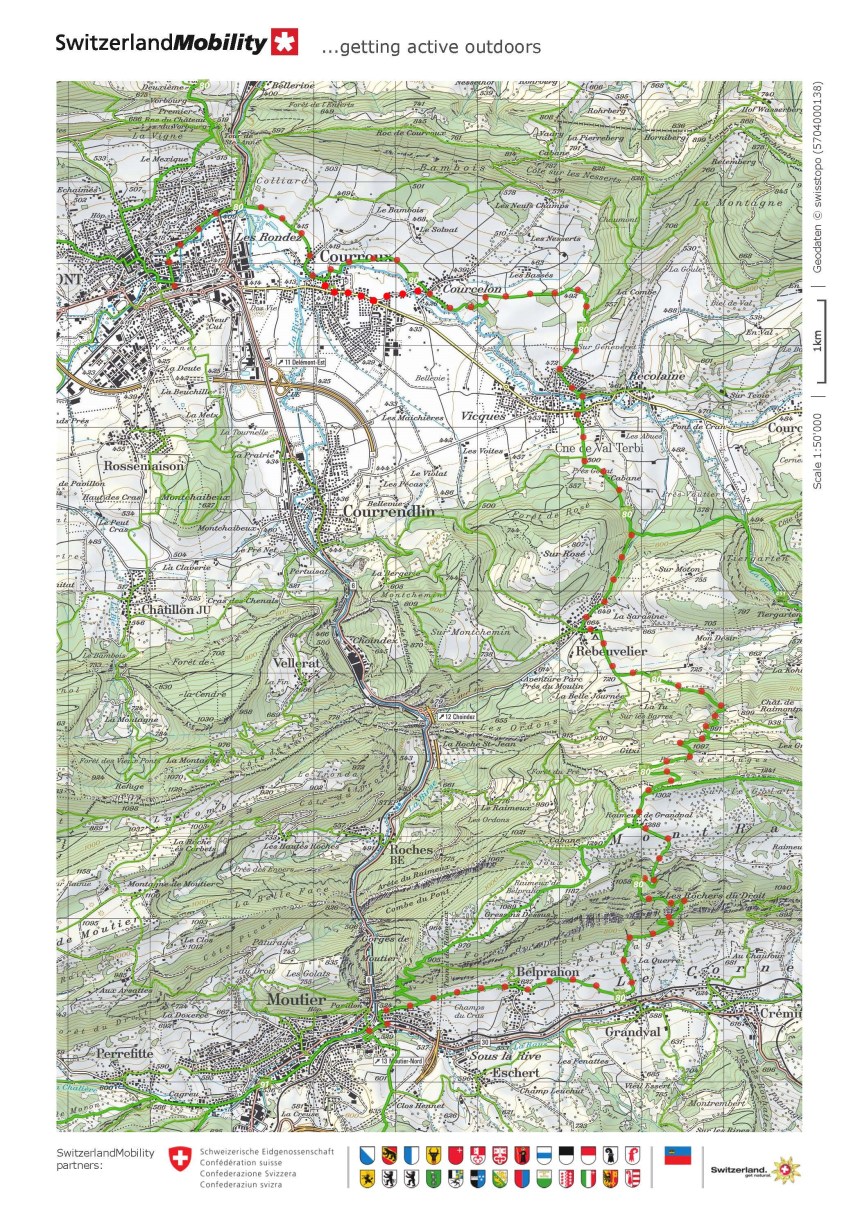
The route from Mariastein to Delemont involved an ascent to one of the ridges of the Jura, and approaching Delemont it seemed like there was flatter ground ahead. But it was not to be. The route from Delemont to Moutier involves a higher ridge, with almost 900m of ascent in total. And while there were small wayside churches to pause between Mariastein and Delemont, this next stage had none. At about 25km, it is shorted, but the emphasis is on getting through the mountains and down to Moutier.
The route starts off flat enough. From the train station at Delemont I went back through the streets to the Pont de Birse at just 409m above sea level. From there, it goes through fields of ripening grain, mostly wheat and barley, to the village of Courroux. At Courroux, the waymarked route is blocked. I wanted to cross to the right bank of the little river that flows through the village, but the bridge was under construction and it was impossible to cross. I was forced to take the road for a short distance to get to Courcelon. But as it says in the old proverb, it is an ill wind that does not blow some good, and taking this way allowed me to see the waterfall at Courcelon which I would have missed had I gone the other way.

After Courcelon, the route was rising gently, offering panoramic vistas of the fields around.


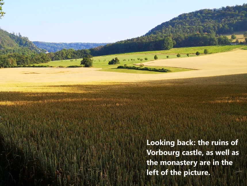
At Vicques, the total ascent was just 65m over a distance of 6km, so it had been gentle so far. It got a bit steeper then, as the route goes up through the woods to reach Rebeuvilier at 664m, a rise of almost 200m in just 3km. But that was in some ways just a taster, with a rise of over 600m in 5km to reach Raimeux de Grandval at 1288m above sea level. There is no wonderful scenery on the way, but close to the last stretch there is a panoramic view to the north, looking back towards Delemont.


Thankfully Raimeux de Grandval is one of those wonderful Swiss places where a farm has also become a bar. The tables outside are amazing, with a single piece of wood at least 4m long and about 10cm thick, has been used as the tabletop. So it was the perfect place to have a beer after the exertions of the ascent. There is also a “pet farm” where children can see the young goats, exotic pigs and other animals. But I just needed a beer to restore my energy and dampen my thirst before heading onwards.


And then it was descent, first circling around to come to the side of the Combe des Geais, and then on downwards towards the village of Grandval. The descent was just as steep and fast as the ascent. The route went down about 700m in just 4km.
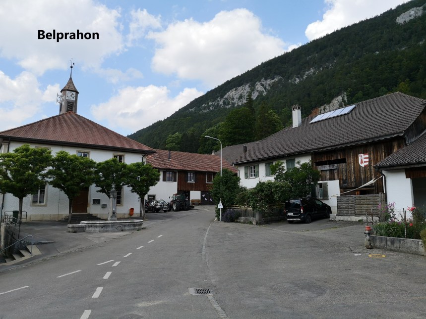
The route did not go right into the village but skirts the northern edge as it turns west towards Moutier. It is almost flat again after Grandval, passing through Belprahon and coming into Moutier just beside the train station.
There were no beautiful buildings or historic villages on this stretch of the route, just farming communities in the mountains, and I wonder how it must have been for the pilgrims of old. At a time when mountains were places to be avoided for many reasons ranging from the presence of brigands to plain bad weather, this stretch would have been something just to get done and have it over. I can’t say I felt like that; there were some wonderful natural vistas to see. For those medieval pilgrims, and indeed pilgrims of the modern era, perhaps places like this in the Jura were and are good preparation for crossing the Pyrenees later.
I will go back in a few weeks for the next stage. For this stage though, my step count stands at 43,781.

I like those lovely nature photos, the vivid greens and most of all the waterfalls. Thanks for giving justice, a great writer you are, for the sharp and real life accounts and descriptions of all the places you have been and traversed on foot. Good luck on your writings and more incoming adventurous hiking ahead. Your friend, Addie
LikeLike