
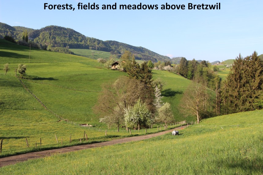
From Bretzwil, I headed north on the road towards Seewen. After a few hundred metres, I came to the settlement of Mühle on the right. Is it possible for a village like Bretzwil to have suburbs? If so, then Mühle is a suburb of Bretzwil. There is a footpath alongside the road all the way to Mühle, so at least I didn’t have to worry about dodging oncoming traffic.
Just after passing Mühle, my route turned right up a small road. It was early morning, but it says something about the sense of security in rural Switzerland that many children’s toys were still left out in gardens presumably from the previous evening. My small road became a track once it had passed the houses, and it wound on upwards towards the forest. Looking back, Bretzwil was hidden from view by the woods and hills in between. Once into the forest, the track leveled out and emerged to reach the cantonal border again

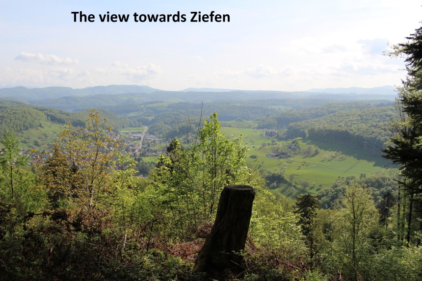
The route then took me across a combination of open pasture and woodland to reach the road. It’s a small rural road, and I turned left to go downhill to the main road. About 120 metres of walking brought me to the forest and the place of my map reading error for the day. I turned left into the forest, and very soon saw the left turn to follow regional walking route 32. I should have taken that left turn and a right turn very soon after, but instead I simply went straight on. It meant that I was going in the right direction, but parallel to the track that I should have been on. I should have been on Chösliweg, but I was on Chüeweg. I didn’t realise the error until I reached a signpost for Chöpfliweg. So I made a short detour, backtracking onto Chöpfliweg and taking the side track to the summit of Chöpfli itself at 756 metres. The summit is marked by a signpost, but being in forest, there are no great views. In fact the best view on this section was from Chüeweg looking northeast towards the small town of Ziefen.
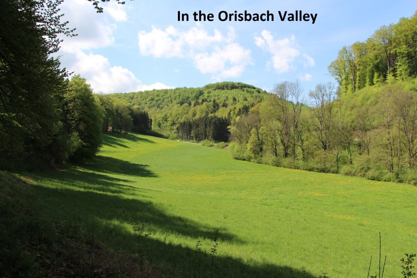
Once back at that signpost, I turned onto Laachweg, first going through the forest and then following the track along the forest edge to reach the junction with the road. A multitude of tracks and roads converge at this point, so care is needed to take the right one. This time I got it right, following the road northwest. At the next junction, I went straight ahead onto Baselweg, going on through fields to reach the woodland again. A right turn onto Hagenwaldweg and another kilometer of walking brought me to the road just west of Lupsingen. I almost made another error by taking the wrong entry to the forest from the main road, but caught myself in time. The correct turn onto Remisbergweg had me following the border again along the Orisbach valley until I came to Neunuglar.
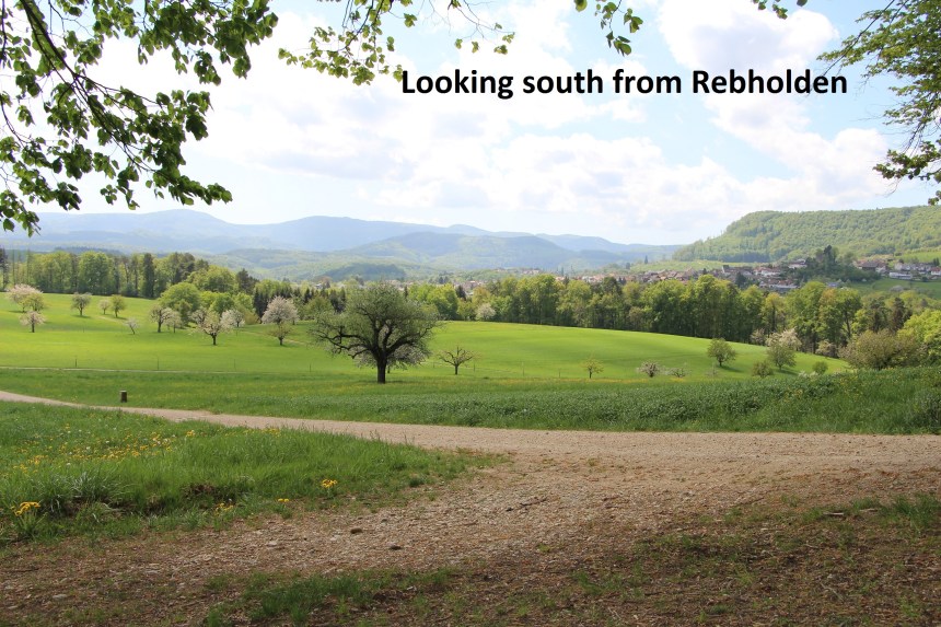
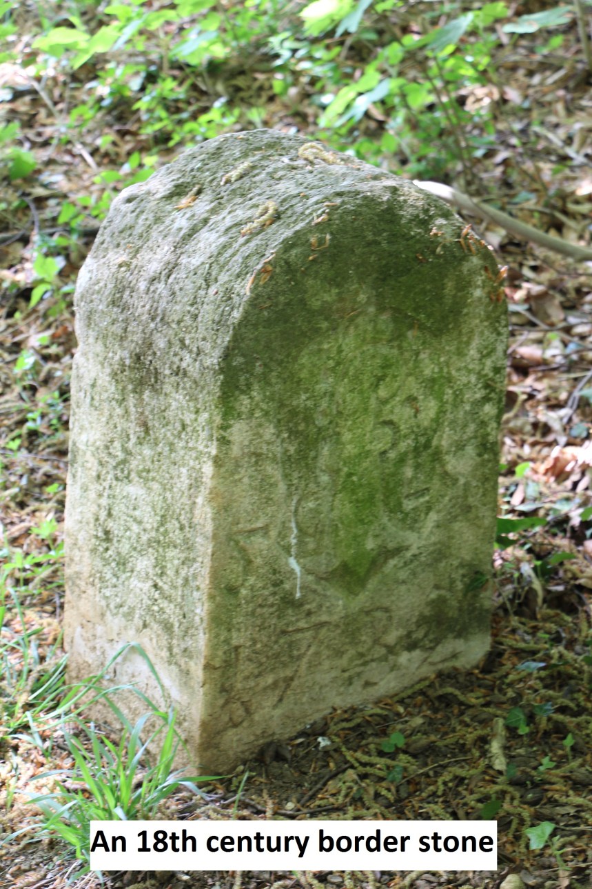
My route then followed the Brunnenbachrain valley on the Solothurn side of the border, followed by a right turn to reach the forest at Rebholden. I had seen no border stones on this section up to now, but in the forest of Rebholden there were several.
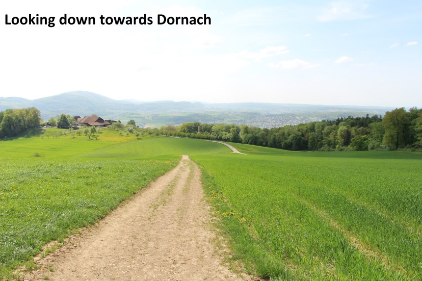
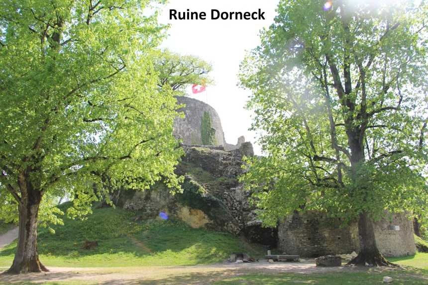
In these woods was one of the most difficult pieces of the day’s walk. A steep descent of about 100 metres from about 580 to 481 was followed by an equally steep ascent up the other side of the Röserental valley. But I made it and went on. The next several kilometers were in forest, but eventually descended again into pastureland above Dornach. And of course I just had to see the ruins of the castle at Ruine Dorneck before going down into Dornach itself and the train back to Basel.
I guess I can summarise today’s walk as saying that I have left the high country of the Jura Mountains. There will be some more hills, but nothing as high as what I have already walked. I am back into farmland and forestry. It is also worth noting that in the complex shape of Basel canton, I have completed more than half the way around. Let’s see what the remainder of the journey Shows.
