
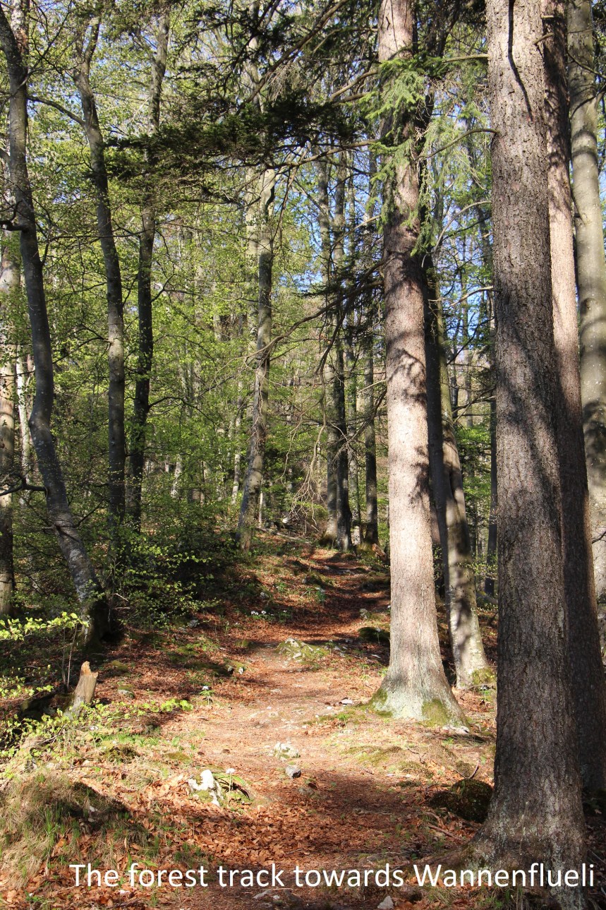
It took two trains and a bus to bring me from Basel to Langenbruck. At the Langenbruck Unterdorf stop, the trail begins right away. There are some steps behind the bus stop that led up to a meadow above the village. Then the trail took a Z shape onto a forest trail that led the way to the top of Wannenflueli.
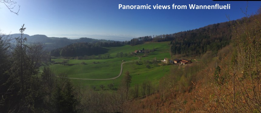
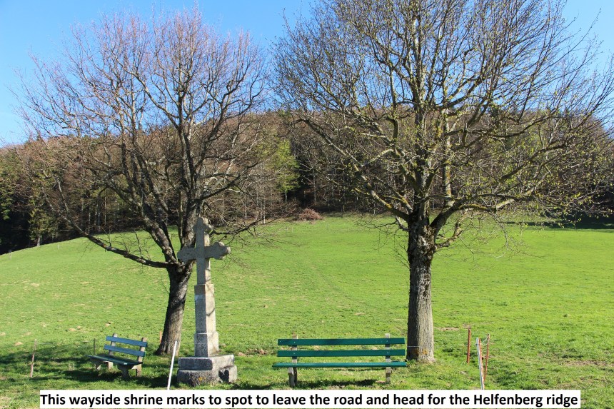
There are great views to the south from Wannenflueli, and it is worth taking a few moments to enjoy them, especially as the early morning sun lights up the Wanne valley below. From there it was a straight walk downhill, at first through the forest, and then through open fields to Bachtelen. At this point my route rejoined the small road that leads uphill. It is a public road with motorised traffic, but a quiet one, and only one car passed me during the ¾ km up to Breitehöchi. The point at which my trail left the road is marked by a wayside shrine, which makes it easy to find the right place. I went up through the field and into the trees. And there in the middle of the forest was one of the older border stones that I have found: this one from 1765. I almost went astray at this point. The rail turns to the right, but I missed the indicator and went straight on. However, the apparent trail that followed soon degenerated into impenetrable forest, so I went back to find the right route.

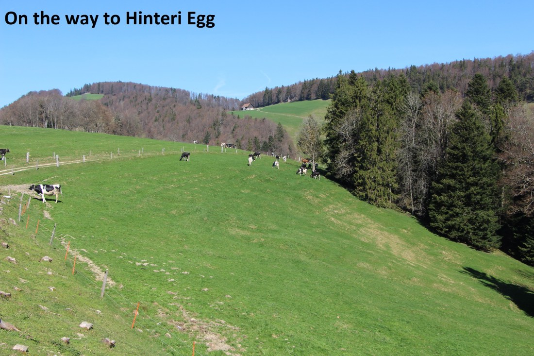
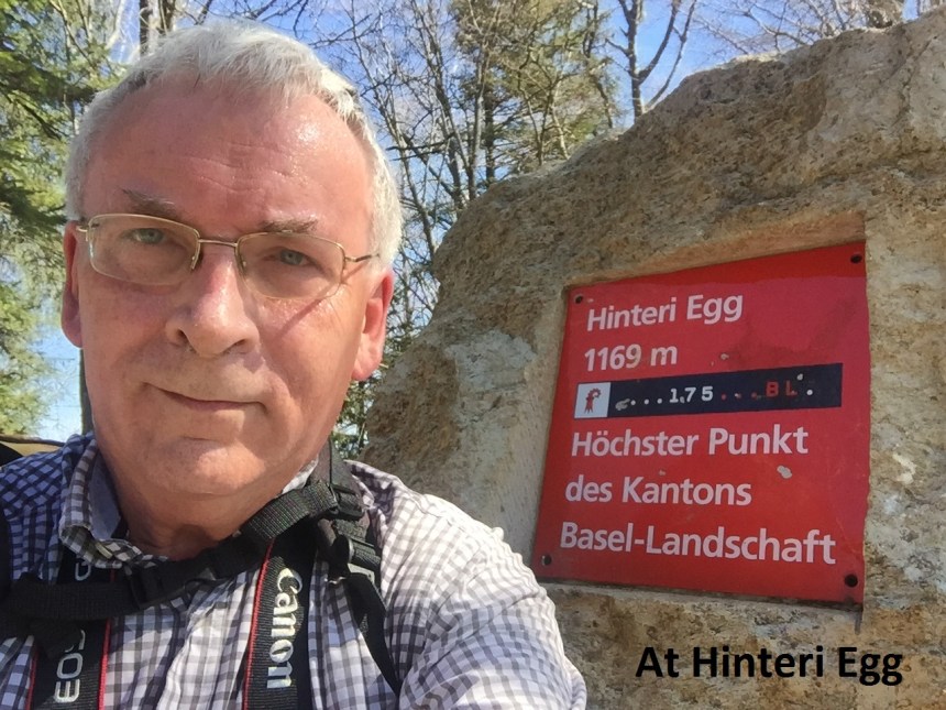
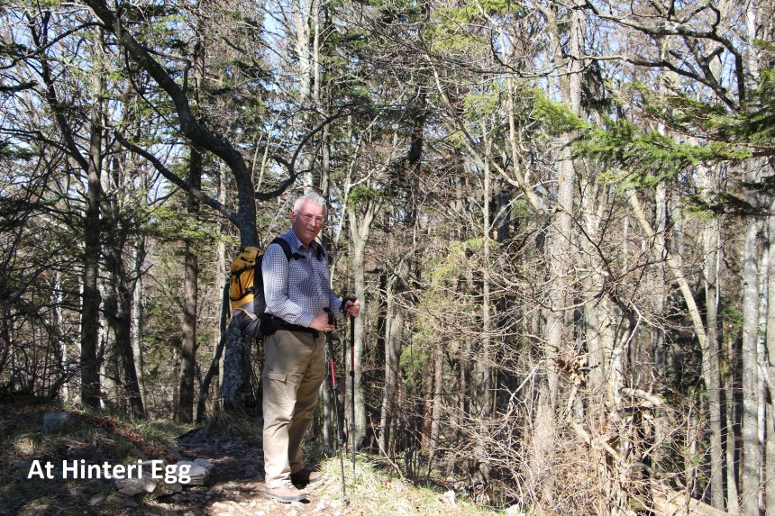
The mistake probably cost me 20 minutes, but time is not so important on a route like this. The trail goes on through the forest, over the Helfenberg ridge and on down through fields to reach the farm at Hinter Hauberg. And it is back on a road again. The road twists around to another farm at Sol, before it goes back to being a track again. It continues through open farmland and up onto the ridge. The trail follows the cantonal border along the ridge to reach Chellenchöpfli, but just before it does, it is worth taking a detour to Hinteri Egg. Hinteri Egg is just over 100 metres off the trail and is the highest point in Basel canton at 1169 metres above sea level. It is not as spectacular as some of the other peaks in the Jura, being completely in woodland, and with no views to speak of. But it is there, and being there, and being the highest point in the canton, it merits a visit. Also, the summit is marked with a stone pillar which just invites a selfie.
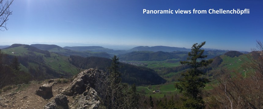
It is Chellenchöpfli that has the views, offering great panoramic vistas to the south. By now, the sun was high in the sky, and there was not a cloud to be seen, just a warm haze over the landscape. From Chellenchöpfli, my route took be downhill, following the signs towards Passwang. Soon I was going upward again, following the crest of the ridge above Wasserfallen. The ridge is narrow, but completely wooded and the path was not difficult. I eventually emerged into an upland meadow, and from there it was only a short distance to the mountain inn at Vogelberg, where I treated myself to an ice-cream and beer.
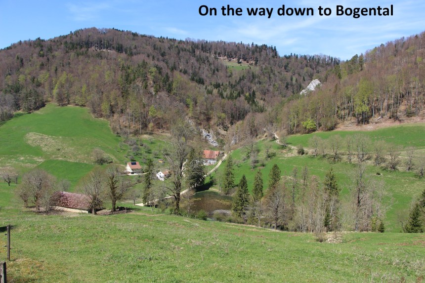
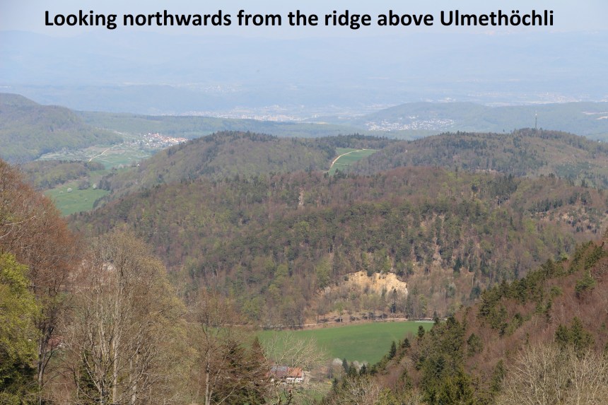
From Vogelberg, I followed the signs for Bogental. The first part of this section follows the cantonal border, and I was hoping to see some good border markers, but I found none. Whether I missed them, or whether they were there and were moved, or whether they were never there, I cannot tell; I can only say that I did not see any. So I continued downhill to Bogental. From Bogental my route went uphill again, following the contours of the hills at time, until I reached Ulmethöchli. The ridge above Ulmethöchli is the last point on this section above 1000 metres, and it offers spectacular views northward.
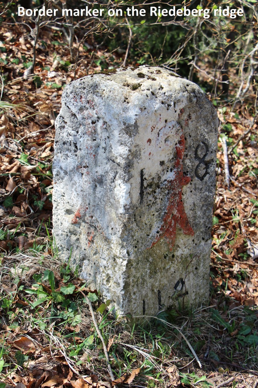
I passed another mountain inn at Stierenberg without stopping to reach the top of the Riedeberg ridge. From Bogental to Riedeberg is entirely inside Basel canton, up to a kilometer in places, so I was not looking for any markers, but at Riedeberg I was back on the border line, and there was a marker for me.
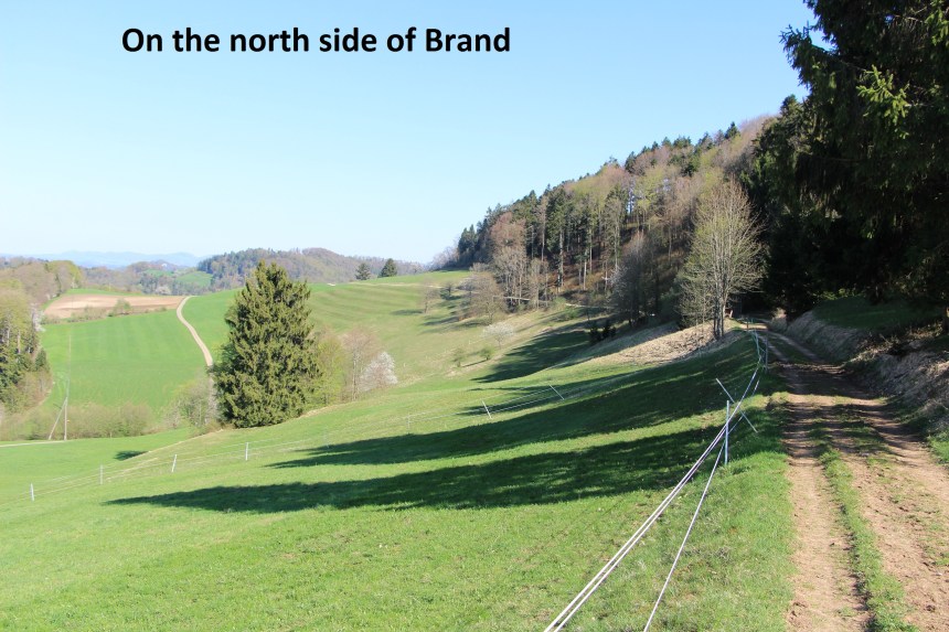
From Riedeberg, it was a steady descent to reach the road at the Bretzwil Sabelhöhe bus stop. I had decided to follow the border line as closely as possible so I was not yet ready to go into Bretzwil itself. The map showed a trail going up the hill at Sabel and contouring around to reach the forest at Brand. In practice though, the trail peters out, and I was left crossing open meadow on the north side of hill 747. But the forest at Brand offered a pleasant walk. The route around the forest is fairly level, following the contours.
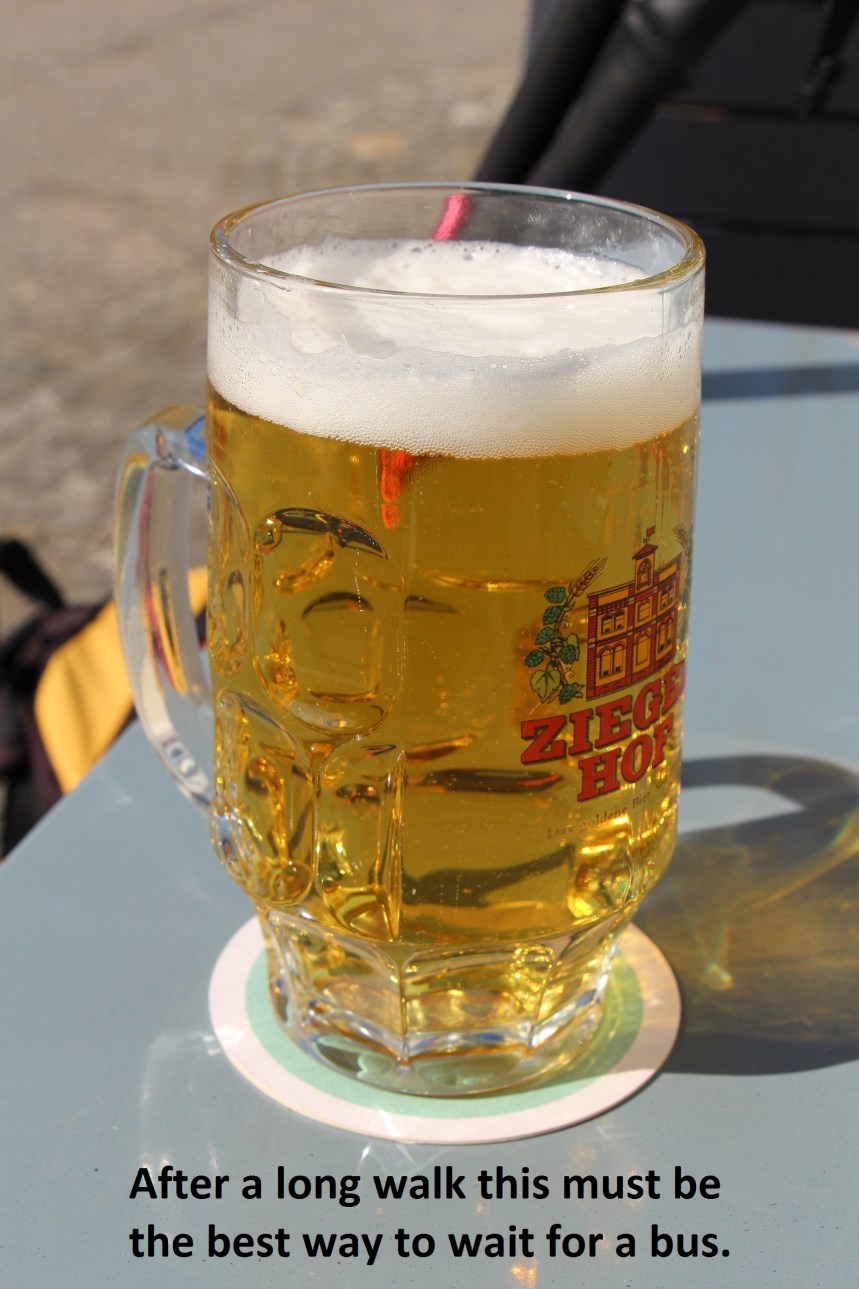
The trail emerges from the forest into meadow country before descending back to Bretzwil. There are regular busses from Bretzwil that would bring me back to Basel. They come once an hour, and with 50 minutes to wait, there was only one thing to do.

Thanks for sharing. We are doing this route soon! I especially loved the fact that you closed your post and your hike with a highly necessary beer! 🙂 Cin cin! Sam 🙂
LikeLike