
In these blog posts, I have described my previous ventures on the Aargauer Weg. The entire route is 105 kilometers long, divided into five sections. The first section is 31 kilometers, and both the second and third sections are 22 kilometers each, which makes up 75 kilometers when all three are put together. That only leaves 28 kilometers for the last two, and the designers of the walk have conveniently made each of those equal in length at fourteen kilometers each. Having already walked the first three sections as described in those other blog posts, I decided to combine the fourth and fifth sections together into one walk. After all, I have proven before that I can walk 28 kilometers in one day, and also, these two sections are relatively flat, so they shouldn’t be too strenuous.
The result of that approach was that on Sunday I arrived in the Swiss town of Mellingen to take up where I had left off at the end of the third section. The weather forecast was for a sunny day, but the weather gods had decided otherwise, and a heavy mist hung over everything. Mellingen is a small town, but dates back to medieval times. It was granted its town charter in 1230 when the Habsburg dynasty ruled this region. Even the dense mist could not hide the historic character of its town gates and old houses.


Leaving Mellingen the route follows the river Reuss upstream. The air was still; nothing moved, not the flags hanging limply on flagpoles, not a leaf or a branch on the trees. In the still air, the mist seemed to accentuate sound: the cars on the roads that I could not see, the ducks on the river, the crows in the trees on the other side, and a woodpecker nearby. I have often heard these birds, but never saw them, but I could tell this one was very close, so I stopped to look. I soon picked him out, drumming on a branch, a colourful little bird, making a sound completely disproportionate to his size.
The route goes through meadows with evening primrose flowers in bloom, and into the forest. With the warm summer and moist autumn, there are vast numbers of fungi anywhere that there is rotting wood. The route rises and falls with the land, never very high from the river, but steeply in places, and some care was needed in those places. At other times, the route went through meadow fields where the dew of the misty morning had transformed spiders’ webs into nets of silver.


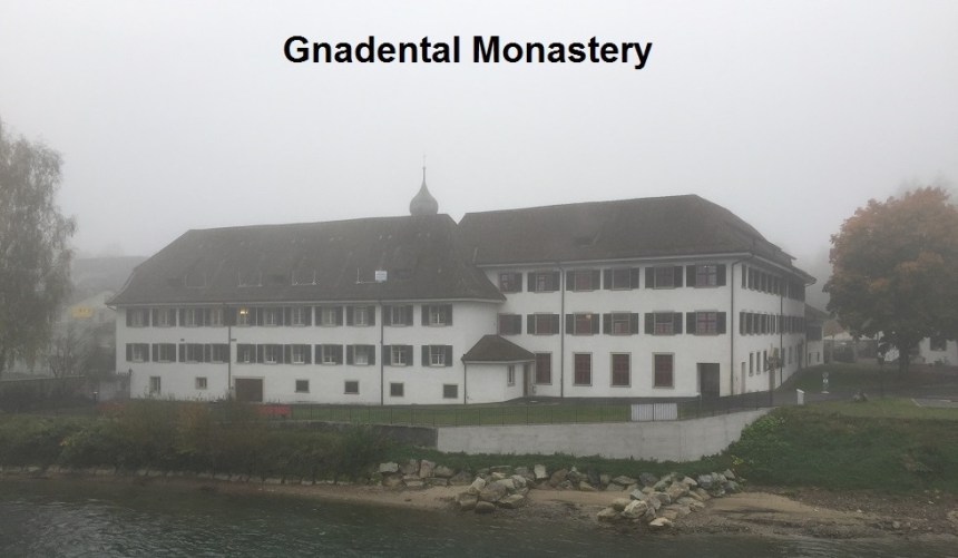
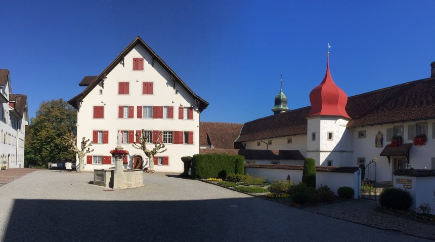
And so I came to the abbey of Gnadental. The abbey was owned by the Cistercian nuns, but is now dissolved and no longer functions as such. Nevertheless, it has a fine chapel with ornate altar decorations and a beautifully carved wooden pulpit. It was worth taking a few moments of rest and quiet in the chapel.


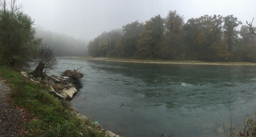
Leaving Gnadental, it is a long hike to Bremgarten. The route is not particularly special, but has the constant presence of the river Reuss on the right as you travel. The Reuss is the fourth largest river in Switzerland, coming all the way from the St. Gotthard pass. The river here is noisy. It is shallow, and runs over rocks and shoals, making it much loved by canoeists. There are islands close to the shore, and in these sections it is often quiet, with the islands forming little creeks where the water runs more slowly, sometimes almost not at all.


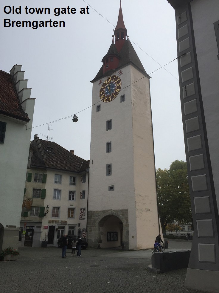
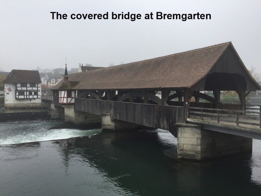
This brought me to Bremgarten. Although it is not well known, Bremgarten is another Habsburg town. It was granted its town charter in 1240, so it has a rich history of more than 700 years. And Bremgarten is a little gem. I came into the town past small houses with clinging vines and floral decorations. I took the time to walk its streets and admire some of the shop decorations. One of the things I like in these old Swiss towns is the way some traders have mounted their shop signs. There are no neon lights here. But there are very ornate metal signs that hang out into the street, as evidenced by the Kaffee Spatz and the Hotel Sonne. I walked down to the covered wooden bridge over the Reuss. In the middle of the bridge, on both the upstream and downstream side, are tiny chapels, presumably to ward off evil that might befall travelers of a bygone era. I stopped to have a snack at the Bijou Restaurant before going on my way again.


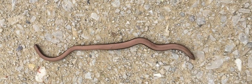
A short distance upstream from Bremgarten is a hydro-electric station. My route crossed over the river there. And when I did, two things changed. First of all, the river upstream is quieter, almost a flat calm. And the other change was that the sun started to come out and the mist started to dissolve away into blue skies. I was privileged to see a slow worm making his way across the path. Slow worms are actually a kind of legless lizard, and they move slowly. They are a protected species, so I did not interfere, but simply observed him (or her) for a few minutes and then went on. As the sun came out, the woodlands were visible in all their autumn glory, perfectly reflected in the still water.

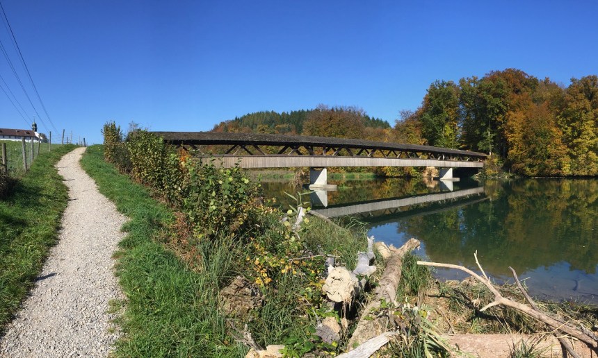
I soon came to the second abbey on the walk: the kloster at Hermetschwil. This community also has a beautifully decorated little chapel. It is worth taking time to examine the ceiling decorations here. Upstream form Hermetschwil was another covered bridge, again made of wood, but resting on concrete piers. These wooden bridges always remind me of the novel The Bridges of Madison County so I see them as a romantic feature of Switzerland.


Above Hermetschwil, the river is wider, forming a small lake known as the Flachsee. There are times when the landscapes in Switzerland are almost too good, almost unnatural as if they were part of a model railway scene instead of reality. And that is how it looks a Flachsee. After the Flachsee, the route leaves the river and goes inland, through the settlements of Gilzen, Althaeusern and Kapf. When I reached Kapf, I could just see the Alps in the distance to the south. Then there is the last piece of forest before emerging at Hasli and descending into the town of Muri. Once there I was able to enjoy a beer and sit in the sunshine looking back the way I had come, before boarding the train that would start my journey back to Basel.


I had put together the fourth and fifth sections of the Aargauer Weg to make one day of walking, but with hindsight, maybe that was not such a good idea. I should have taken more time to enjoy what the route has to offer. These sections of the Aargauer Weg overlap with another route: the Freiaemterweg. I must find out more about that route, and perhaps on a cold day in winter follow it slowly, and enjoy more of the sights of the Reuss valley.
And my step count for the day? 49,000 in total.
