
This post was written on October 1st an posted on October 2nd
After breakfast, it was wet as I was leaving Montfaucon. I could tell you that it was raining, but it wasn’t exactly like that. Rain falls. This was more like moisture condensing out of the air and settling onto the nearest available surface. It does not exactly fall, it just settles. And so within a short time, my jacket was glistening with droplets of water, but still not exactly wet.
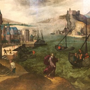
As I made my way through the town, I stopped briefly at the church in Montfaucon. The church is known throughout France for a set of 16th century paintings depicting scenes from the bible that it links to a certain time of the year in each case. I have included a couple of them here: Christ calling the first apostles to himself, and Christ’s entry into Jerusalem.


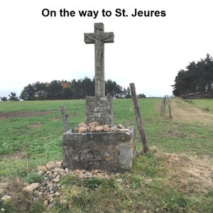
And then I was leaving town and on my way. At the edge of town, I came across my first stone cross of the day, together with an explanatory panel telling me that a cross is not just a cross. They serve a purpose. It was common to erect a cross on routes into a town or village to show the boundaries of that town or village. It was also common to erect a cross at the centre of a village to mark the centre of local activity. It was also common to erect a cross as a memorial to a person or event. And some crosses were for marking stopping points on ritual processions. This first one was a boundary cross. Once past it, I was formally out of Montfaucon and on my way to the next town. I would see many stone crosses through the day, each with their own function.

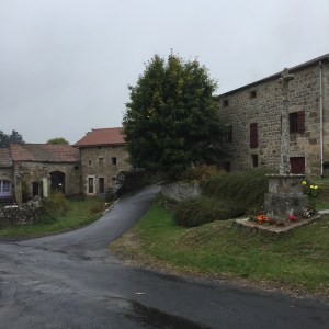
The route went on through several small settlements: Les Lardons, Les Barons, Le Fayyad, and La Grange. It went up hill and down dale, though nothing like as much as yesterday. Yesterday, the route would seem to climb to a ridge only to plunge into the next valley and then climb again. Today the ascents and descents seemed less severe. It was just as well, because at this stage, my feet and muscles are beginning to ache. I put a lot of that down to the ascents and descents of yesterday. They were hard on the muscles. But eventually I found myself on the road into Tence.

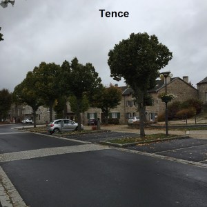

Over the last few days, I had begun to wonder about the man behind the “martins long way” stickers. There seemed less of them. I had begun to wonder had he either run out of stockers, or maybe been forced to give up the walk. But I saw one yesterday, which told me that he was still going. And today there was another as I was entering Tence.
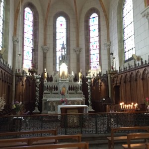
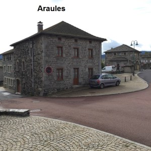
Tence is a small quiet town, but I did get a good pint of beer there. Finding the correct route out of town was a bit difficult, but I was soon on the right road. Once again, the route goes up and down among the hills, with Pouzols being the only significant village until I eventually reached the town of St. Jeures. I had just time to replenish my water before going on. The official route takes a track out of St. Jeures, but I decided to follow the road. By now, the sun was trying to put the clouds to flight, and when I reached Araules, it was time to get rid of the jacket. Araules has a neat church which was open, and it was nice to get a couple of minutes of quiet before going on.

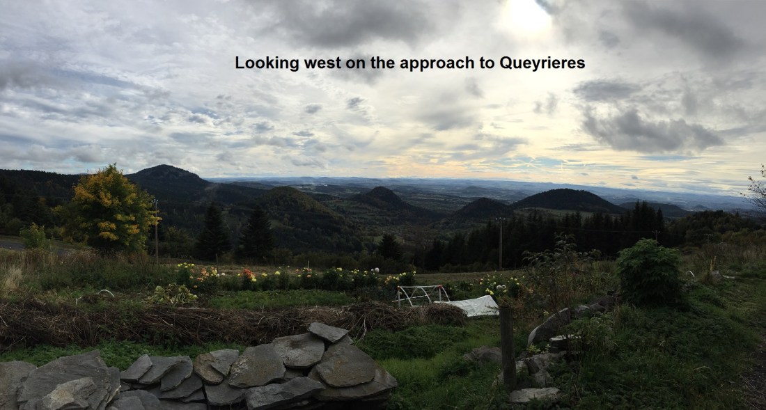
Once again, when leaving Araules, I had a bit of trouble to find the right route, but I got there in the end, and was on my way. My starting point for the day, Montfaucon, was at 925 meters above sea level. Tence was at 837 meters. St. Jeures and Araules were at 1024 meters and around 1000 meters. But after Araules, the route just seemed to ascend continuously. Gradually, but continuously. It reached a high point at Raffy with over 1200 meters above sea level, before dropping down again on the short distance from there to Queyrieres. On the way, I met two people also heading to Queyrieres. They were German, one from Leipzig and one from Oberbayern. We all arrived in the village together where they are saying at Fritz’s Gite, while I am staying at a house.
As I have gone through the region today, there has been a subtle change in the buildings. In the Rhone valley area, and part of the way into the Loire department, most of the houses were of light coloured local stone. It looks like sandstone. But here in the Haut-Loire, the rock comes from volcanoes, long since extinct. The rock is darker, and it gives a different ambience to many of the buildings.
My accommodation in Queyrieres is “Chambre d’Hote”, and it is very good. My host is an accountant, but looks more like a farmer. In fact I would go so far as to say that he looks most unlike an accountant, which probably means that he is very good at that profession. The vegetables at dinner come from his own garden. His wife cooked an excellent soup and pork with mushrooms in mustard sauce. The house seems ancient, but I am sure it is not. Over dinner, we talked about many things, including why the churches are locked up. They explained that it is mainly due to concern over vandalism. In the case of Queyrieres, there is a woman who opens up the church each day and closes it each evening. But she is in her eighties, and what will happen when she is gone is anyone’s guess. I think there is an issue to be resolved with this topic. I believe that a combination of keeping the churches open and a concession to sell refreshments would go a long way.
So tomorrow I hope to see the village a little, and then we will go to Le Puy. I have some aches and pains after 10 days on the road, but there is nothing that will stop me entering Le Puy in triumph tomorrow.
