
Having completed the stage 2 of the Aargauer Weg on Saturday, I was resolved to continue with stage 3 on Sunday. Stage 3 takes up exactly where stage 2 left off, at the railway station in Brugg.
I did not spend time in Brugg looking for interesting sights, but immediately followed the hiking route out of town. The route goes eastwards on a narrow strip of land between the Aare and Reuss rivers. It is a suburban area of houses and gardens with occasional agriculture. Close to where the two rivers meet, the route crosses the Reuss using the railway bridge to arrive in the village of Turgi. The trail goes straight through the village, across the railway and into the woods. The path through the woods is a steep ascent initially, but soon levels out. After that, the trail makes use of a Waldstrasse, one of those dirt-track roads used by foresters. It is easy going from there, and continues in this way almost all the way to the town of Baden. There were occasions when I emerged from the forest to a combination of cornfield and grassland, but mostly it was forest.


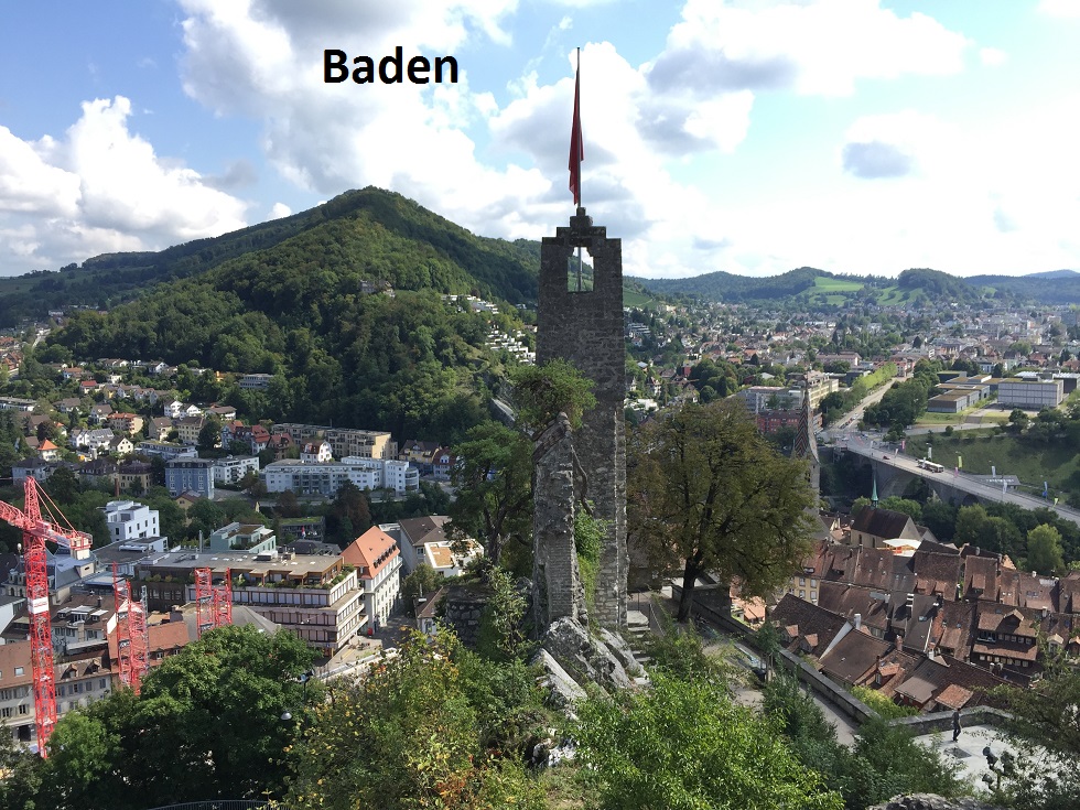
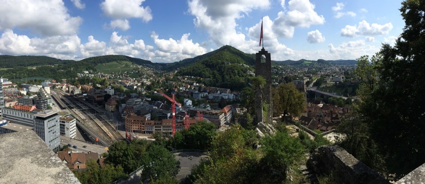
I entered Baden via the Ruine Stein, a ruined castle on a hill above the town. The castle was built over a thousand years ago. With the rise of the Swiss Confederation, it was destroyed, rebuilt and destroyed again. After that final destruction early in the 18th century it has remained a ruin. It must have been an impressive fortress in its day, but now it is almost completely destroyed, with just fragments of one tower standing. Nevertheless, it provides a magnificent view of the town.


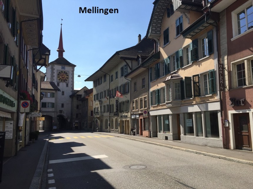
From there, the route descends rapidly into the town centre close to one of the old city gates, but I did not stay, and quickly followed the route out of town. Due to roadworks, I had to make a detour at one point, but son found the correct route again. After that, the route took me through the suburb of Oberstadt before going back into the woods. I continued through the woods to emerge into fields near the village of Fislisbach. Following the route, I skirted the edge of the village, and after going through more fields and woodland eventually reached Mellingen. The route comes down into Mellingen close to the Gasthof Krone. I went into the town briefly before getting the bus to the railway station, which is about 2 kilometers outside the town.
I have two stages of the Aargauer Weg still to complete, and I hope that I will get to them later in the year. And of course when I do, I will post it here.
Finally, the step count for the day was just under 38,000. This hike was part of my preparation for walking the Chemin de Saint Jacques in a few weeks. I am ready to go!
