
In my last posting, I wrote about my intentions to walk the next stages of the route to Santiago de Compostela. Having walked the stages from Luzern to Geneva, it is time to take time to walk a section of the route through France. The intention is to walk from Geneva to L-Puy-en-Velay.
Once I had firmed up the intention, it was time to work on the planning and logistics. The complete route is listed as being 346km long (about 215 miles). So the planning has to break that down into manageable daily stretches, organise overnight accommodation and so on.
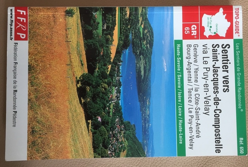
My reference for this is the excellent TOPO-GUIDE GR65. This book provides almost everything that the intending walker needs for planning: maps of the route, lists of places to stay, sights to see, and so on. In particular, it gives the distances and approximate times for each small piece of the walk, allowing detailed planning. The 340km suddenly becomes 78 small stages, the shortest being less than 1 km, the longest being 12km. So it was with this book that I worked on the details of the planning.
I reckon that I can walk at an average pace of 4km per hour, so walking about 7 hours each day, I can cover about 30km each day. Then, using the guide book, I broke the total route into stages of about 30km each. Of course it doesn’t work out at exactly 30km each day; that could leave me in the middle of a forest at the end of the day, so it is a case of looking at the nearest accommodation after walking 30km. The result is that some days will be slightly more than the nominal 30km, and some days a little less.
Thanks to the internet, I was able to check out the accommodation for the end of each day. Unfortunately, some of the places I wanted to stay were fully booked, but after a little bit of effort, overnight arrangements for each day started to fall into place.
One stage proved a problem. One part of the route came to 70km, which clearly had to be split in two. But how would I arrange the split? My survey of available accommodation initially looked like the first of those two stages would be 47km, and the second 23km. But 47km meant taking risks. Would I be able for something that long? I reckoned it better not to take chances. But by checking more closely, there was accommodation just a few kilometers off the route. So by making a small change to the route, I have two stages, one of 40km and one of 33km.
So with all of this, the planning is in place. The stages are decided and the route is planned for 12 days as follows:
Day 0 Arrive in the Geneva area
Day 1 Walk to Chaumont
Day 2 Walk from Chaumont to Motz
Day 3 Walk from Motz to Yenne
Day 4 Walk from Yenne to Pigneux
Day 5 Walk from Pigneux to Quetan
Day 6 Walk from Quetan to Beaurepaire
Day 7 Walk from Beaurepaire to Clonas-sur-Vareze
Day 8 Walk from Clonas-sur-Vareze to Bourg-Argental
Day 9 Walk from Bourg-Argental to Montfaucon-en-Velay
Day 10 Walk from Montfaucon-en-Velay to Raffy
Day 11 Walk from Raffy to Le-Puy-en-Velay
Day 12 Rest!!!
It is an aggressive schedule, but I think not beyond my capabilities.
The accommodation is booked. I continue to study the maps, but now it is to decide on the things to see each day. Some of them are natural and some are man-made, but I am already looking forward to seeing the sights on the route.
I will return to discussing the preparation for the walk in future postings. There is still plenty to do before heading off.
